About pictures/当ブログ内の写真について/당 블로그내의 사진에 대해서

Most of the pictures in this blog are taken by my camera, yet some of them were downloaded from the website of the hiking club. If you click any pictures, they become the original size.

当ブログ内の写真の大部分は筆者のカメラで撮影したものですが、一部、山岳会の共有写真からダウンロードしたものを含みます。すべて、各写真をクリックすれば、元のサイズに拡大します。

당 블로그내 사진의 대부분은 필자의 카메라로 촬영한 것입니다만 일부 산악회 공유 사진으로부터 다운한 것도 포함합니다. 모두 각 사진을 클릭하면, 원래 사이즈에 확대합니다.

2010年5月18日火曜日

100508 GyeRyongSan (鶏龍山), AhToSan Irregular Hike

May 8 (Saturaday) 2010, fine

Irregular hike by “AhToSan”
Destination: GyeRyongSan
Course: Cheonjanggol – Nammetap – SamBulBong – Jayong Seongreung – Eunseong Waterfall –Donghaksa Temple (12 km – 6 hour hike)

May 8th is “Parents’ Day.” Many Koreans visit their parents on May 8th every year. So AhToSan planned no regular hike. In stead, they planned irregular hiking to Mt. GyeRyong.

The course was exactly the same as my alone-hiking on April 30. So when people gathered at 9 a.m., I explained the course using the big map in front of the restaurant.

Total number of participants were 20 including 3 foreigners (Bernardo, the Mexcian, Brian, the Australian, and myself.)

[About 20 participants、約20名が参加、약20명이 참가]

We began climbing the mountain at 9:15. The trail at Chonjanggol is gentle and broad. It is easy to walk.

We arrived at “NanMeTap” at 10:40. We saw a “makgeoli막걸리” peddler at the fork before SamBulBong. The old lady was selling a bowl of Korean unrefined wine by 3000 won.

[The makgeol peddler and her customer, マッコリ売りのおばあさんと客、막걸리 판매 할머니와 손님]

It was only 2000 won when I saw at SamBulBong last time. So, I thought it was expensive. One of my AhToSan friends bought the bowl of wine for me. I shared it with him by half, and it tasted good.

We took group pictures on the peak of SamBulBong. The ridge between SamBulBong and GwanEumBong was called JayonSeongreun (Natural Castle Wall). This part of the trail is most exciting and beautiful. I saw many pain trees on the rocks, and Jindalle was in full bloom.

[Gruop picture at SamBulBong, 三佛峰でグループ写真、삼불봉에서 단체사진]

[Lunch on the ridge, 稜線の途中で昼食능선 도중에 점심]

The peak of GwanEumBong is too rocky to use tripod. So, it was difficult for me to take a self-portrait. With my hiking friends, it was easy for me to take one.

[Top of GwanEumBong、観音峰山頂、관음볼정산]

The trail from GwanEumBong to Donghaksa Temple via Eunseong Waterfall, it took another 2 hours.

We returned the entrance of the trail at 3 p.m. Then we had “Tippuri” or after-the-hike party at a restaurant called “PaekEunJang.”

We had “totorimuk” or acorn-starch jelly paste and “sea-food pajeon” and makgeoli and enjoyed eating, drinking and talking for one hour.

["Totorimuk" or acorn-starch jelly paste, トトリムク(ドングリの澱粉で作った寒天状の食べ物、도토리묵]

To my surprise, one of AhToSan members whose nice name is “Marin Boy” paid the whole price for all of us.

Actually this is not unusual for Korean people. I often experienced this kind of practice several times before. But it is impossible to follow suit for me, because my income is too small now.

Anyway, we all thanked Marin Boy for this treatment and finished the party at 4 p.m.

2010年5月8日(土)快晴 アトサンの不定期登山、目的地:鶏龍山
コース:チョンジャンゴル(천장골) – 男妹塔(ナンメタプ:남매탑) – 三佛峰(サンブルボン삼불봉) – 自然城稜(チャヨンソンルン자연성릉) - 観音峰(관음봉) – 隠仙瀑布(ウンソンポクポ은선폭포) - 東鶴寺(トンハクサ동학사) – 駐車場(12km、6時間)

5月8日は韓国では「オボイナル」。両親の日である。韓国では母の日と父の日が別々にあるのではなく、同じ日に「両親の日」として決められている。このため、定期登山はなく、都合のつく者だけが集まって大田近郊の鶏龍山を登山することになった。それも私が先月4月30日に登ったコースとまったく同じコースだ。

参加者は意外と多く、20名になった。このうち外国人はメキシコ人Bとその知人でオーストラリアのブライアン、そして私の3人だった。

登山を開始する前に、登山口にある大きな地図を利用して私がコースの説明をし、コンジャ氏が補足説明をした。


[I explained the course, 私がコースを説明、내가 코스를 설명]

9時集合で、9時15分には登山開始。広くてゆるやかなチョンジャンゴルの登山路は歩きやすくて快適だ。男妹塔には10時40分に到着した。

[Group picture at NamMeTap、男妹塔前でグループ写真、남매탑앞에서 단체사진]

男妹塔から三佛峰までの登山路は急だが、甲寺への別れ道で、地元のハルモニ(おばあさん)が自家製のマッコリ(どぶろく)を1杯3000ウォンで売っていた。

前回、三佛峰で売っていた無人の「頂上酒」は2000ウォンだったからかなり高い。一緒に歩いていたニックネーム「品質管理」氏が私に1杯おごってくれた。この一杯は非常に量が多く、「品質管理」氏と半分ずつ飲んだ。

今回、三佛峰には無人の「頂上酒」は置いてなかった。今回も快晴で、三佛峰で記念撮影をした。

[Gruop picture at SamBulBong, 三佛峰でグループ写真、삼불봉에서 단체사진]

三佛峰から観音峰までの尾根はチャヨンソンルン(自然城稜)と呼ばれ、城壁のようにそそり立っている。この部分は展望も良いし、岩の上に生えている松の木も立派で、チンダルレもちょうど見ごろだった。

[The view from the ridge、稜線からの風景、능선으로부터의 풍경]

我々は稜線の途中で少し早目の昼食をとった。

[Lunch on the ridge, 稜線の途中で昼食능선 도중에 점심 ]

観音峰では三脚が使えないため、単独登山の時は写真が撮れないが、このように大勢の時には他人に撮ってもらえるのがいい。

[Top of GwanEumBong、観音峰山頂、관음볼정산]

観音峰からの下りは石の階段で、いつ来てもかなりきつい。

東鶴寺は「お釈迦様の来られた日(5/21)」に向けての飾り付けが綺麗だ。また、庭に咲く花も美しい。

[Lantran decoration at the temple, 東鶴寺のぼんぼり、동학사의 등롱]

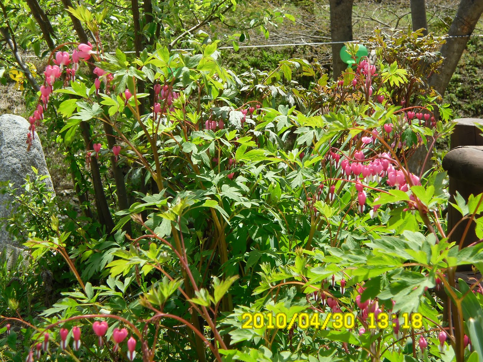
[Bleeding Heart, ケマンソウの花、금강화]

3時には出発点に戻ったが、今回は「白雲荘」という食堂に入って、トトリムク(도토리묵どんぐりの澱粉を寒天状にした食べ物)やヘムルパジョン(해물파전イカがはいったお好み焼き)を食べ、マッコリを飲んだ。

[Pajeon, イカ入りパジョン、해물파전]

このティップリに参加した全員が自己紹介をして1時間ほど歓談した。おどろいたことに、ここの費用は、ニックネーム「マリンボーイ」が一人でまとめて支払ってくれた。マリンボーイ様に感謝。

[After the hike party at PaekEunJang, 白雲荘にてティップリ、백은장에서 뒷풀이]

2010年5月16日日曜日

100505 YangSonSan(297m), ChungBuk 忠北・養性山

May 5 (Wed) 2010 Fine

Destination: YangSeongSan (297m), ChungBuk Province)

Course: Moonwi Culture Vellage Parking Lot – Youth Training Center – Eagle Rock - Two-story octagonal gazebo called “PalGakJeongJa” – Two-way Fork – ChungBong (YangSeongSan) – Parking Lot.

I joined the Teajeonhikers’ hiking planned by Alan. We met at the main gate of KAIST at 10 am.

On my way to KAIST main gate, I passed by the colony of herons on the campus. There must be more than a hundred herons make their nests here and hunt fish at Gapchon River nearby.

[A colony of herons at the campus of KAIST、KAISTキャンパス内のシラサギのコロニー、KAIST캠퍼스내 백로의 콜로니]

To my surprise, I saw Juli who established the Teajeonhikers 8 years ago and left Korea 6 years ago. I could not recognize her at first, but she remembered me.

Just like Gyeryongbong whom I met at AhToSan hiking 4 years ago, and I could not remember him at the hiking last week.

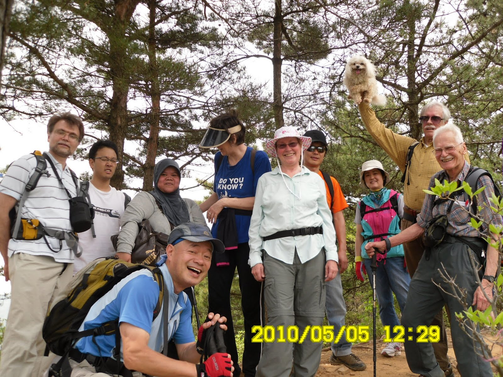
Other members beside July were; Alan, Ken the German, Bigor the Russian and his 3 small kids, GF the Ameridan and his pet, PiPi, T from Australia, Ai from Indonesia, Dr. Chen from China, Dr. Yoon the Korean and his elementary school kid, and one more Korea, total 12 adults and 4 kids and one dog.

[12 adults, 4 kids and a dog、大人12人、子供4人、犬一匹、어른 12명, 어린이 4명, 강아지 한마리]

We left KAIST at 10:15 by 4 cars. We arrived at the parking lot of Mooni Cultural Vellage at 11:05. We began hiking at 11:25.

The course is a bit different from last time when I came here with AhToSan last time. First, we walked to the Youth Training Center, then we climbed toward “Dok-suri-pwawi” or “Eagl Rock .”

[CheongWon Youth Traning Center、清原青少年修練院、청원청소년수련원]

To my surprise, Ken climbed the rock. I dare not try climbing, because it seemed difficult to get down from the rock.
[Ken climbed on the Eagle Rock、ケンが鷲岩に登る、켄이 독수리바위에 오른다]

The twin boys asked me to use my sticks, but I told them that they were not for kids. The sticks are inevitable for me to walk on the mountains to keep balance.

Hiking is a very popular past time for many Koreans. So it is well developed including the related businesses. One of such business is selling foods/drinks.

I saw ice-candy seller on one of the peaks at the mountain. The baby kid of Vigo, Sarsha, asked one of “adult hikers.” He got what he asked for, and enjoyed it happily.

There were beautiful flowers such as “San chol-chuk” or wild azalea and chindalle along the ridge.

We arrived at the top of 378 hights called “SangBong" where a two-story octagonal gazebo at around 12:30.

[The 2-story octagonal gazebo、二階建ての八角亭子、이층구조의 팔각정자]

There were many people at the gazebo, and we arrived there one by one, according to our hiking pace. So we had lunch there separatedly on the 1st floor and 2nd floor.

I had lunch with Dr. Chen, Ai from Indonesia, Alan, Vigor, and Dr. Yoon. Others had lunch upstairs.

It was really a good weather. We took nice pictures there with the scene of Lake DaeChongHo.

[You can see DaeChong Dam,後ろに大青ダムが見える、뒤에 대청댐이 보인다]

We walked down toward YangSongSan and arrived at the two-way fork. One leads to the top of YangSongSan (ChungBong 297m) and the other way to the parking lot.

[A "Tea-house" at the 2-way fork、分かれ道の「茶屋」、갈림길의 매점]

It was only I who climbed ChungBong. All others went down to the parking lot directly.

It took us nearly 4 hours for 4 km hiking. But it was an easy hike and we could enjoy talking and seeing the beautiful nature.

2010年5月5日(水)快晴、

目的地:忠北(충북チュンプク)・清原(청원チョンウォン)・養性山(양성산ヤンソンサン297m)

ハイキングコース:文義文化材団地(公園)駐車場문의문화재단지주차장~青少年修練館~鷲岩
(독수리바위トクスリパウィ)~八角亭子[378m高地/上峰(상봉)]~養性山(中峰)別れ道~中峰(상봉)~駐車場

久しぶりにテジョンハイカーのハイキングに参加。ワンルームからKAIST正門へ徒歩で行く。

KAIST構内にはシラサギのかなり大規模なコロニーがある。シラサギたちはここをねぐらにしてすぐ近くの一級河川の甲川(カプチョン)などから餌をとっているようだ。

[A colony of herons at the campus of KAIST、KAISTキャンパス内のシラサギのコロニー、KAIST캠퍼스내 백로의 콜로니]

おどろいたことにテジョンハイカー創設者のジュリと再会した。自分は人の顔の認識能力が落ちて来たのかもしれない。アトサンで4年前にあった「佳蓮峰(カリョンボン)」の場合と同様、ジュリもすっかり忘れていたが、彼女は私を覚えていた。

メンバーは、ジュリのほか、このハイキングの企画者のアラン、ドイツ人のケン、ロシア人ビゴーと息子たち3人、アメリカ人のGFとその愛犬「ピピ」、オーストラリア人のTとその友人で韓国人の「ミッシェル」、インドネシア人の留学生アイ、アランの同僚の中国人の陳(ジン)さん、同じくアランの同僚の尹(ユン)さんとその息子ユン・ドンヒョンともう一人の韓国人の同僚の大人12人、子ども4人、犬1匹だった。

KAIST出発は10:15。文義(ムニ)文化村の駐車場には11:05に到着。GFが下痢のためトイレからなかなか出てこず、登山開始は11:25になった。

コースは以前のアトサンと異なり、青少年修練館経由で稜線に登った。ビゴーの双子の息子が私の杖をねだったが、「これは子どものためのものではない」と断った。アイは最初から遅れがち。また、体調の悪いGFが常に最後尾だった。1時間ほどゆっくり登ると鷲岩(トクスリ・パウィ)に出た。驚いたことにケンがこの上に登った。

[The Eagle Rock & Pipi and Sasha、鷲岩とピピとサーシャ、독수리바위와 비비와 사샤]

鷲岩を過ぎた場所で記念撮影後、途中の高台では「アイスケーキ」屋が「キャンディ」を売っていて、ビゴーの3男サーシャがユン氏にねだって1本せしめた。

[A group picture on the ridge、尾根で記念撮影、산등성이에서 기념 촬영]

[An Ice-candy peddler on the peak, 山頂のアイスキャンデー屋、정상 아이스 캔디(ice candy)장수]

この付近から尾根伝いにはチンダルレやサンチョルチュクの花が見事だった。この後の急坂を登ると八閣亭子(gazebo)のある378m高地(上峰상봉)に到達した。ここでメンバーは1、2階に分散して昼食をとった。

私とアランとユン氏、陳氏、およびアイは1Fで、他は2Fで個別に食べた。アイが持参したインドネシア料理のおかずを味見した。辛みのきいた牛肉料理だった。

[A lunchbox of the Indonesian student, インドネシアの学生の弁当、인도네시아 학생의 도시락]

ここでは到着時間がバラバラなため小一時間ほど休憩することになった。天気が良く、大清ダムがよく見えた。378m高地からやや急な坂を下りると養性山(ヤンソンサン)の「チュンボン(中峰:297m)」へ行く道と駐車場へ下る道の別れ道になり、ここには茶店がある。

この店の主人のアジュンマがパクセ(シジュウガラ)に餌をやっていた。子どもたちがベンチの上に土足で上がるたびに彼女は韓国語で叱っていた。

ここから私を除く全員は駐車場へ下り、私は中峰経由で駐車場に下りた。ハイキングは午後3時に終了。ユン氏の車で、陳さんとアランと私は、KAISTへ急いだ。モリファ前の信号で降ろしてもらった。よいハイキングだった。

2010年5月10日月曜日

100501 Mt.Biseulsan (1083m), Daegu 大邱・琵瑟山


[At the Daegyon Sato, テギョンサトにて、대견사터에서]

May 1st, 2010 (Sat) fine.

Destination: Biseulsan (1083m) in Daegu. I climbed this mountain with AhToSan people in April 29, 2006. It was a foggy weather, but Jindalle (Korean azalea) was in full bloom, so it was really fantastic view. This time, it was a fine weather, but since we had cold weather in April, the flowers on Biseulsan were still in buds and not blooming at all. What a shame!


[AhToSan slogan, "Let's go hiking on Saturday!" 出発前の気合い、「ああ土曜日だ。山へ行こう!」출발전의 구호, "아!토요일은 산에 가자!"]

There were 38 hikers including 3 foreigners (1 Mexcian and 2 Japanese).


[In front of the Yugasa Temple, 瑜伽寺の山門前で、유가사 산문앞에서]

The couse was same as before. We arrived at Yugasa temple at 9:55. After taking a group picture at 10 am, we began hiking.


[Cherry blossoms near the temple, 瑜伽寺付近の山桜、유가사 부근의 산벚나무]

After walking toward ridges, we took “Suzuki-time” when I provide fruits such as grape tomato, Chinese orange called “Kinkan” and imported grapes from Chille.

We arrived at the ridge after walking upward for 70 minutes. The ridges are in the altitude of 1000 meters. There are many jindalle trees, but flowers were not blooming.


[The flowers were not blooming yet, チンダルレはまだつぼみのまま、진달래는 아직 봉오리인채로]

We arrived at the highest peak of Biseulsan (1083m) called “DaeGyonBong” at 11:45. We had lunch at a flat space on the ridge.


[At the peok of the mountain、琵瑟山山頂にて、비슬산 대경봉에서]

Korean people prepare a lot of vegitable for lunch. They wrap rice with vegitable and eat it. It tastes good.


[AhToSan lunch, アトサンの昼飯、아토산 점심]

After having lunch, we continued walking among the bush of jindalle toward 1034-Bong. I noticed a unique white building on the ridge. I had no idea what it was, but B and M told me it was a radio observatory since they are expert of astronomy. Both of them work at Korea Astronomy and Space Science Institute (KASI).


[The radio observatory, 電波天文台、전파천문대]

From “DaeGyonSaTo” to the last part of the hike, Sojaesa Temple was the most difficult part of this hike. It was almost “cliff” we had to go down carefully, but it was fun.


[The most difficult part of the cliff, 今日最大の難所の「崖」下り、오늘 최대의 험한 곳의 「벼랑」하행]

We could also see the block streams which were formed during the last part of ice age (10,000 to 100,000 years ago.) They say Biseulsan Block Streams are the largest ones in Korea.


[Biseulsan Block Stream, 琵瑟山岩塊流、비슬산암괴류]

When we landed on the paved road, it was a part of leisure park which non-hikers can enjoy. There was a big picture panel on which pictures of azalea are printed. It was a nice spot to take a picture, so many AhToSan hikers took pictures of themselves in front of the panel.


[In front of the panel, チンダルレの写真のパネルの前で、진달레 사진 패널 앞에서]

The menu of after-the-hike party were trotters and “pine-leave” wine which is one of my favorite wines in Korea. Unfortunately for B, the Mexcican, he does not like “trotters,” so he did not touch any of them and went back to the bus seat alone.


[A toast by the president, アトサン会長による乾杯、아토산 회장님에 의한 건배]

This is my 21st hike for this year and my 199th hike in total with AhToSan hikers.

2010年5月1日、土曜、快晴

目的地:大邱・琵瑟山(1083m)。この山は2006年4月29日にアトサンといっしょに登ったことがある。このときは霧が深くたちこめていたがチンダルレが満開で幻想的だった。今回は天候に恵まれたが、先月、低温の日が続いたため、高原のチンダルレの群落の花がまだ蕾のままで残念だった。

参加者は38名で、外国人は日本人のMとメキシコ人のBと私の3人。

コースは前回とまったく同じで、瑜伽寺(ユガサ)駐車場には9時55分到着。ちょうど10時に記念撮影をしてから出発。稜線にでるまではつらい登りが続くが、45分ほど進んだ後、ミニトマトとキンカンとブドウの3点セットによる「スズキタイム」の休憩。出発後約70分の登りで、岩の露出した稜線に出た。

稜線に出れば進む足も速まる。11:45に山頂の「テギョン峰(1083m)」に着いた。我々はテギョン峰を過ぎた開けた場所で昼食をとった。


[DaeGyongBoong, テギョン峰、대견봉]

いつも感じることだが、アトサンの仲間の昼食は野菜が豊富だ。特にこの時期は山菜を多く持参し、ご飯をくるんで食べる。


[After lunch, 昼食後、점심후]

昼食後、チンダルレの群落を歩いて1034峰を経由し、テギョンサトへ進んだが、チンダルレがみな蕾のままであったのが惜しかった。

テギョンサトへ進む道の尾根伝いの左側には特異な形の電波天文台がある。実は私にはなんの建物か分からなかったのだがMやBは天文研究院に勤める専門家なので、すぐそれと分かったようだ。


[The radio observatory, 電波天文台、전파천문대]

テギョンサトから最終点の「消災寺(ソジェサ)」駐車場へ至る道への下りは、前回とは異なるルートのようだった。ほとんど崖のような急こう配の道を注意深く下りた。途中には1万年から10万年前の氷河時代にできたという岩塊流が見えた。


[The block stream, 岩塊流、암괴류]


[Sojaesa Temple Gate, 消災寺(ソジェサ)山門、소재사의 문]

舗装された道路に出ると、そこは公園のようで、観光客が楽しめるような施設があった。

その中に、琵瑟山頂上付近のチンダルレが満開になっている写真が大型パネルに印刷され、その前で写真撮影ができる場所があった。我々もそのチンダルレの写真の前で記念撮影をした。


[The panel on which the flowers were in full bloom, 満開のチンダルレの花のパネル、만개한 진달래꽃 패널]


[The poem of "Jindalle Flowers" by Kim Sowol, the poet, 詩人・金素月の「チンダルレの花」の詩、시인,김소월의"진달래 꽃"]

今回のティップリはチョッパルとよばれるトンソクと私の好きな松葉酒だったが、Bはトンソクが苦手で、まったく手をつけなかった。


[Trotters, トンソク(豚足)、적발]

この登山は私にとって今年21回目の登山であり、アトサン通算199回目。次回はいよいよ200回目だ。

2010年5月5日水曜日

100430 Mt. GyeRyongSan ( 鶏龍山 계룡산 845m), Daejeon (大田)

Alone hike to Mt. Gyeryon on April 30, 2010

My 20th hike for this year. I climbed Mt. Gyeryong
(845m) alone. This is my 3rd hiking to climb Gyeryongsan, but the longest among three times (12 km, 6 hours).

I went to Donghaksa Temple Bus Stop from Shinsongdong via Yusong. I lfet home at 7:15, and at 8 a.m. I was already at the entrance of trail at ChonJangGol.


April 30, 2010 (Friday) Fine, temporalily cloudy.
[The bus arrived at the parking lot before 8 a.m. バスは駐車場へ8時前に到着、버스는 주차장에 8시전에 도착했다.]

Up to NanMeTap, it was the same route as my 6th hike for this year on Feb. 3rd. This trail is spacious and gentle slope, and I found the same kind of bird (the great tit) when I took the short rest. The bird seemed no fear against human being, and it looked like she was asking for some food to me.


[A great tit、シジュウガラ、박새、大山雀]

Nanmetap was decorated with colorful “bonbori” or paper lanterns as a part of preparation for Buddah’s birthday(April 8th on Lunar Calender = May 21st for this year). The slogan for the celebration in Korea is “The day when Buddah had come to this world.”


[NamMaeTap decorated with paper lantern、ぼんぼりで飾られた男妹塔、등롱으로 꾸며진 남매탑]

This time, I took a time to visit “SangWonAm.” I guess it is a part of “DongHakSa” temple. There was a simple notice showing the price of substitution service for prayers by the temple. The list of the prayers (wishes) includes business prosperous, heals of diseases, passing entrance examinations for universities, or promotion, etc. We can see similar list of wishes at shrines and temples in Japan, too.


[Prayer for one person: 10,000 Won、祈祷受付:1人10000ウォン、기도 접수:1명 10000원]

The trail from Nanmaetap to SanBulBong is steep and well facilitated with steel steps.

When I reached at the top of the peak, I found several containers of Korean liqure called “Makkori” or “crude rice wine.” There were even some side-dishes such as cucumbers and “saeukkang” or “shrimp crackers,” and the paper says, 2,000 won for “Jeongsanju” or “Wine on the mountain peak.” It did not say the unit, however. I cannot tell whether a cup of the wine costs 2000 won or a bottle of wine cost 2000 won. It might be a bottle of wine, because if you buy a bottle at a super market, it costs around 1000 won. There was no seller, and I saw several 1000 won bills put under a small stone.


[On the top of SamBulBong、三佛峰頂上にて、삼불봉정상]

There is a folk in the trail under SanBulBong; one is for elderies and children and the other is for regular hikers. I got a little shock to read “trail for senior and weak people and children.” Well, I might be a little old, but not “weak” I thought. Actually, I WAS weak when I walked this trail for the first time 7 years ago. My legs were cramped while walking the ridges and I stoped for a while until I was recovered at that time. There is no problem for me to walk on the harder trail by now.


[GwanEumBong、観音峰、관음봉]

It took 90 minutes from SanBulBong to GwanEeomBong along the steep ridges. I ate lunch at the gazebo there. Again, a great tit came to me, as if she is asking for some food.

After having lunch, I began decending the steep stone steps toward the waterfall named “EunSeonPokPo.”


[EunSeonPokPo、隠仙瀑布、은선폭포]

From the waterfall to Donghaksa Temple, the trail is much gentle along the river. Donghaksa is famous for its beautiful garden with various flowers. As I expected, I could see many beautiful flowers there.


[Bleeding Heart、ケマンソウ/鯛釣り草、금낭화[錦囊花]

When I arrived at the bus stop, it was 2 p.m. The course for today’s hike was: Donghaksa Bus Stop – Cheonjanggol Valley – Nammae Tap – Jayonseongreung (ridge) – GwanEumBong – Eunseon Waterfall – Deonghaksa Temple – Bus Stop, 12 km, 6 hours.


2010年4月30日(金) 晴れ、一時曇り

今年20回目の登山は地元ので単独ハイキング。ここは今年3回目だが、今回は最長コースで約12km、6時間歩いた。

登山コース:東鶴寺駐車場-チョンジャンコル(천장골) –男妹塔(남매탑) – 三佛峰(삼불봉) – 自然城陵(자연성릉) –観音峰(관음봉) – 隱仙瀑布(은선폭포)- 東鶴寺(동학사) – 東鶴寺駐車場

新城洞を7時15分に出ると、儒城でのバスの乗り換えも順調で8時前には現地到着、歩き始めた。駐車場から男妹塔までは今年1回目と同じコース。緩やかな登りで、登山路も広く快適。途中、前回も近づいてきたシジュウカラ(パクセ박새)に遭遇。どうも登山者から食べ物をねだっているようだ。


[A great tit、シジュウガラ、박새、大山雀]

男妹塔は、5月21日の釈迦誕生日に合わせてカラフルな雪洞(ぼんぼり)で囲まれていた。また、男妹塔のそばの「大韓仏教・曹溪宗・上元庵」と書かれた寺へ行ってみると「お釈迦さまがこられた日」と書かれた横断幕と、大学入試やら家業繁盛、無病息災祈願受付の張り紙があった。この辺は日本の神社や寺院同様だなと感じた。また、日本では絵馬がよくつかわれるが、韓国では瓦を使うようで、瓦には寄進者の住所と名前が書かれていた。


[The tile on which the address of the dedicator and the name were written、寄進者の住所・氏名が書かれた瓦、기부자의 주소·성명이 씌어진 기와]


[NamMaeTap decorated with paper lantern、ぼんぼりで飾られた男妹塔、등롱으로 꾸며진 남매탑]

登山コースは、男妹塔から三佛峰に上がる階段から本格化。東鶴寺側から登る反対のコースを取れば、ここが最後のピークになる。

今回は平日のため、人が少ないが、三佛峰の頂上にはマッコリ(どぶろく)の容器がごろごろしていて、つまみまで置いてあった。そこに掲げられた紙には「頂上酒・2000両(約200円弱)」と書いてある。1杯200円なのか、1本200円なのか分からないが、ずいぶんおおざっぱな商売だ。みると現金1000ウォンの上に石が置かれていた。


[On the top of SamBulBong、三佛峰頂上にて、삼불봉정상]

三佛峰を下ると道が分かれ、尾根伝いを避けた道には「老弱者・子ども用」とある。確かに尾根伝いは慣れていない者にはきつい。私もアトサンに入る前、ここで足が攣ったことがある。

もちろん今はなんでもない。尾根伝いに1時間ほど進むと、もう片方のピークである観音峰に至る。それまで晴れていた空が、ここでは一時曇り空になった。


[GwanEumBong、観音峰、관음봉]

観音峰に着いたのは11時半。ここで昼食をとり、急な石の階段の坂を下ると隱仙瀑布(ウンソンポクポ:은선폭포)という滝の展望台に出る。

ここからは下り坂も緩やかになり、尼寺の東鶴寺には約1時間で到着する。東鶴寺の庭園には四季に応じて様々な美しい草花が咲いている。なかでも今の時期はきっと最高であると思われる。期待にたがわず、きれいな花々を見ることができた。


[Bleeding Heart、ケマンソウ/鯛釣り草、금낭화[錦囊花]

バス停に着いたのは午後の2時で、ちょうど6時間のハイキングを終えた。


[Chipmunk、シマリス、다람쥐속、花栗鼠]