Place: MakJangBong (887m) and JangSeongBong (917m), in Gyongbuk & Chungbuk Province
Course: Jesuri – MakJangBong – JangSeongBong – Shimyosal Valley – Ssangguk Parking Lot (About 12 km, 6 hours.)
Partner: 40 AhToSan Members (Including 4 foreingers: Japan, Mexico, China and India.)
The weatherman predicted rain, but it began raining late at night. We could enjoy this hike without getting wet. Only complain was the strong wind. It blew so strongly that my tripot stand was almost falling down when I was taking a group picture.
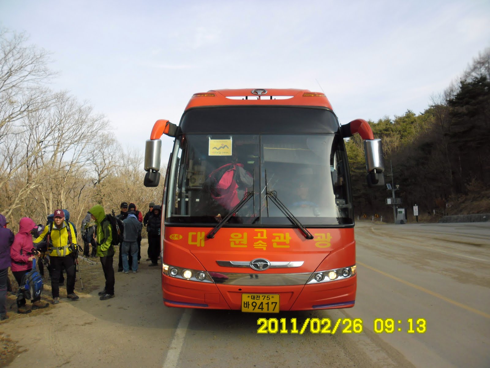
We left at South Gate at 7 a.m. and arrived at Jesuri at 9:15.
In spite of the cold weather, Soumen came with light wears. Someone recommended him to buy climbing irons. It was good for him to follow the advice. He needed the gear when he decended the mountain.
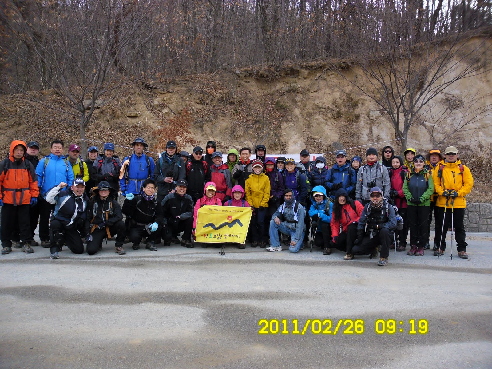 [A group picture at Jesuri, 出発前の集合写真、출발전의 단체사진]
 Also, some members lent him a scarf and a pair of gloves. So he could enjoy the hiking without freezing.
We had warming up exercise before hiking. During the whole hiking, we did not see any other hikers besides AhToSan members. So, it must be not so popular course. Yet the moutain was good, and the hiking course was really nice.
 [Warming up exercise, 出発前の準備体操、출발전의 준비 체조]
They were rather rocky mountains. We had to climb on the rocks, one after another. During the first one hour, I was in the last group.
 [On the ridge,稜線の岩場で、능선의 정망대에서]
We had a couple of rest time. They call it “Suzuki Time” because I bring fruits such a s grape tomatoes, kumquat or “kinkan” in Japanese. When we arrived on the ridge, we had the 1st Suzuki Time. When we came to the observation point, we ahd the 2nd Suzuki Time.
I arrived at MakJangBong at noon, together with SanSalang (president of AhToSan) and JeongDaUn (vice president).
 [At MakJangBone, 幕場峰にて、막장봉에서]
From MakJangBong to JangSeongBong, we had to make a round trip using the same trail. The last group of the people were too late to make this round trip. They decided to skip JangSeongBong. However, I did head for JangSeongBong.
It was 1:40 p.m. when I arrived at JangSeongBong. Most of the members were having lunch already. Since I arrived there rather late, I did not have much time for lunch.
 [At JangSeongBong, 長城峰にて、장성봉에서」
“JangSeong” means Great Wall in China. The view of the mountain looked like “Great Wall”that’s why they named the peak “JangSeongBong.” Anyway, the view from JangSeongBong was good.
We walked the same trail back to MakJangBong. Then we began decending the mountain. Since the slope was steep and frozen, it was absolutely necessary to wear climbing irons. I saw him wear the gears there.
After decending for a while we saw waterfalls beautifully frozen. The first frozen waterfall was just besides of the trail. The 2nd one was in the valley, a bit far from the trail. The three foreigners were strong enough to walk extra and they went close to the frozen waterfall.
 [In front of the frozen water fall, 凍った滝の前で、언 폭포 앞에서]
 [Three foreigners went close to the frozen waterfall in the valley, 渓谷の凍った滝の前で、계곡에 있는 언 폭포 앞에서]
When I came to the trail with few snow, I took off my climbing irons. Then I came to the river completely frozen. It was fun to walk on the ice, but I must walk very carefully.
 [Walked on the frozen river, 凍った川の氷の上を歩く。언 강 위를 걸었다]
 [Support Center which I saw before, 見覚えのある支援センター、본 기억이 있는 지원센터]
 Then we came to the open area which I remember that I came before. We came to the parking lot where our bus had been waiting for us at 3:30 p.m.
 [At the wrap-up party, スユクともち米マッコリでティップリ、수육과 찹쌀막걸리로 뒤풀이]
When all AhToSan members came to the bus, we moved to the suitable place for Tippuri (Wrap-up) Party. The menu of the party were: Suyuk (boilded pork), tofu, kimchi and “Chapsal Makgeolli.”It was my first time to drink “Chapsal Makgeolli” and it tasted really good. The color of regular makgeolli is while, but this makgeolli is brawn.
We ended the party at 4:15 p.m. and went back to Daejeon.
This was our last “winter-hike” in Korea, and it was my 13th hike for this year and my 230th AhToSan regular hike as total number.
登山月日:2011年2月26日(土) 晴れ、ただし、山では強烈な風。
登山地:慶北(キョンブク경북)、聞慶(ムンギョン문경)/忠北(チュンブク춘북)、槐山(クェサン과산)にまたがる幕場峰(マクチャンボン막장봉 887m)と長城峰(チャンソンボン장성봉 916m)
登山コース:
ジェスリ(제수리) – 幕場峰(막장봉) ←-→ 長城峰(장성봉) – シミョサリ渓谷(시묘살이계곡) - 双谷(쌍곡) 12 km (6時間)
同行者:40名以上、そのうち外国人は私の他、ベルナルド(メキシコ)、ソウメン(インド)、サニー(中国)で計4人
天気予報では夕方から雨。しかし、雨は夜遅くなってからで、ハイキングには影響なし。だが、到着地点から幕場峰までの上り3時間はものすごい強風で、団体写真を撮る時には三脚が危うく倒れるところだった。
南門を7時に出発し、出発地点のジェスリジェには9時13分に到着した。
 [We arrive at Jesuri at 9:15,ジェスリへ9時13分に到着、제수리에 9시13분에 도착]
ソウメンは相変わらずの軽装で、運動靴。しかし途中で誰かがアイゼンを購入することを勧めたらしく、アイゼンを持っていたのは幸いだった。スカーフと手袋は会員が貸してくれたと言っていた。
今回は到着後10分ほど準備体操をしてから出発した。今回のコースはめずらしく初めから最後まで他の山岳会とは出会わなかった。
 ["The Chair Rock" 椅子の岩、의자 바위]
登山開始後1時間ほどで急な岩を登ったり降りたりする難しいコースになった。登りはじめてすぐフミ(最後尾)グループとなった。主なメンバーは、新人数名のほかサンサラン、チョンダウン、アランドロン、ウポという主要メンバーたち。
最初の尾根で1回目のスズキタイム。ここで栗マッコリとキンカン/ミニトマト2箱を提供。1時間以上登った展望の良い地点でポラムが生人参を提供していて、ここで2回目のスズキタイム。残りのキンカンとトマトを提供。この後、凍った岩場の下りからアイゼンを装着した。
幕場峰にはサンサランやチョンダウンらとともにほぼ12時に到着した。アランドロンやウポらの最後尾グループはまだ到着しておらず、彼らは長城峰をあきらめたが、私は行くことにした。
 「At MakJangBone,幕長峰にて、막장봉에서]
先着組が食事中の長城峰に着いたのは1時40分。狭い林の中で、サンサランのポジャギに座って昼食にした。20分ほどの昼食だが、遅く到着したため余裕がない。弁当を少し残して片づけ、長城峰の石標撮影。
ここからみる峰々はなかなか見ごたえがあった。石標は地味なものだが漢字で峰の名前が彫ってあった。
ここから幕場峰の下の三叉路まで戻り、そこからやや急な雪道を下りはじめた。ここではソウメンも初めてアイゼンを装着。その後、元気に走り下りた。
しばらく下って渓谷に出たが、そこですばらしい氷結した滝を2つ見た。1つは道のすぐ脇で、滝に触れることができた。もう一つは「隠仙瀑布」で、こちらは崖を下らなければならない。わざわざ崖を下って近づいたのはベルナルドとサニーとソウメンの三人だけのようだ。
 [In front of the frozen water fall, 凍った滝の前で、언 폭포 앞에서]
彼らは実に元気だ。ここから下るにしたがって、渓谷も氷が解けている部分が増える。それでもアイゼンをはずしてから最後の大きな氷結部分を渡ることになり、滑らないよう気を付けて渡った。
 [Walked on the frozen river, 凍った川の氷の上を歩く。언 강 위를 걸었다]
七宝山へ続く登山路との三叉路からは見覚えのある道で、そこからバスの待つ双谷休憩所はさほど遠くない。ここに着いたのは3時30分だから、登山時間は6時間。ほぼ予定通りだ。
 [Support Center which I saw before, 見覚えのある支援センター、본 기억이 있는 지원센터]
 その後バスで10分ほど移動して「俗離山双谷地区案内図」という大きな看板のある場所でティップリ・パーティ。
メニューはスユクとキムチと豆腐をつまみに「チャプサルマッコリ」を飲んだ。「チャプサル」は「もち米」で色は茶色。味はなかなか良い。
 [At the wrap-up party, スユクともち米マッコリでティップリ、수육과 찹쌀막걸리로 뒤풀이]
ティップリは4時15分ごろ切り上げ、帰途に着いた。途中、チンハンサラムは槐山バス停で下車してソウルへ向かった。我々は南門に7時ごろ到着。写真は約100枚アップロードした。
今回はこの冬最後の冬山で今年13回目のハイキング。アトサンのトータルでは230回目だ。
0 件のコメント:
コメントを投稿