About pictures/当ブログ内の写真について/당 블로그내의 사진에 대해서

Most of the pictures in this blog are taken by my camera, yet some of them were downloaded from the website of the hiking club. If you click any pictures, they become the original size.

当ブログ内の写真の大部分は筆者のカメラで撮影したものですが、一部、山岳会の共有写真からダウンロードしたものを含みます。すべて、各写真をクリックすれば、元のサイズに拡大します。

당 블로그내 사진의 대부분은 필자의 카메라로 촬영한 것입니다만 일부 산악회 공유 사진으로부터 다운한 것도 포함합니다. 모두 각 사진을 클릭하면, 원래 사이즈에 확대합니다.

2019年12月26日木曜日

KR #6 Climbing Two Mountains in Iwaki City and Recovery from the Disasters in Fukushima.いわき市の「赤井岳(605m)」と「二ツ箭山(ふたつやさん710m)」登山と福島の震災復興

KR #6 Climbing Two Mountains in Iwaki City and Recovery from the Disasters in Fukushima.

My wife and I have two sons; the elder son, Hajime with his family, living in Sydney, and the younger son, Ryo, now living in Tomioka-machi, Fukushima Prefecture, Japan.

Ryo studied environment science in NZ, and he has been working at NPOs supporting the recovery of the area of Tsunami and Nuclear Plant Accident since 2011.

He got married 3 years ago, and they got a baby this March.

He determined to work at the NPOs in Fukushima and moved in Tomioka-machi with his family this September.

So, before going back to Sydney, I visited Ryo, our younger son, and his family in Tomioka-machi, Fukushima Prehecture.

[JR Special Limited Train "Iwaki" at Shinagawa Station, 品川駅にて「JR特急いわき」시나가와 역에서 JR 특급 "이와키"]

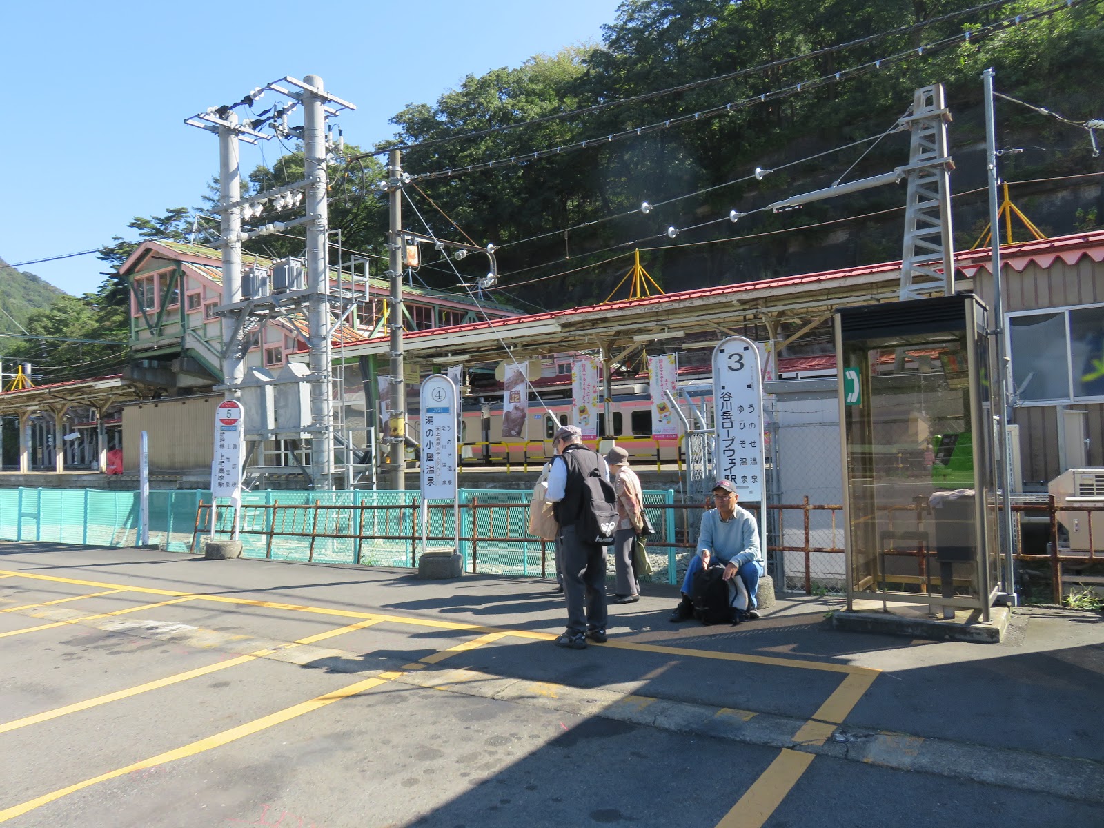
I met them in front of JR Iwaki Station and Ryo drove us to “Akaidake-Yakushi” temple on Mt. Akai in Iwaki city.

The temple was founded in 806, after an earthquake and famine in 734, so the people in Tohoku area have history of having earthquakes for many years.

[A view from "Akaidake Yakushi", 閼伽井嶽薬師からみたいわき市方面、아카이다케 약사에서 본 이와키시 방면]

Ryo drove his car near the peak of the road, then he parked beside the road and we walked a gentle ridge to the top of the mountain.

It was only 30 minute walk, yet I was a little bit surprised that he carried the 8 month old daughter, Kyo, by his hand, and walked the trail rather easily.

[Ryo's family on the ridge trail, 閼伽井嶽山頂への登山路にて、아카이다케 정상에 등산로에서]

So this was a three-generation hike, for the first time for me. We had snack near the peak of Mt. Akai.

[My son and granddaughter at the top of Mt. Akai, 閼伽井嶽山頂にて、아카이다케 정상에서]

After the light hike, we went to a fresh market called “Yattchaba” in Iwaki city.  They sell fish and vegetables.

[At the market called "Yacchaba" ,「やっちゃ場」市場にて、"얏챠바"시장에서]

I was surprised to find “Kamakura Vegetable” corner there. We had lunch at a restaurant there. I had “Kaisendon” and it was delicious.

[The sign board of "Kamakura Vegetable,「鎌倉野菜」の看板、"가마쿠라 야채"의 간판]

[A set menu called "Kaisen-don", 海鮮丼定食、해물 덮밥 정식]

Ryo has two jobs now. He works at an NPO called “Futasuke” and his new job at a hotel called “Hojinkan.”

He works night shift at the hotel, so he went to the hotel to work that day (Dec. 5.)

Next day (Dec. 6) after coming back from work, he drove to Iwaki city again, and we went to Mt. Futatsuya (710m).

Mt. Futatsuya is one of 30 famous mountains in Fukushima. He drove his car to the foot of this mountain.

He parked at a shrine called “Kirigaoka Ohyama Shrine” and we walked “Kirigaoka Forest Road” for about 2 km, close to the peak.

[“Kirigaoka Ohyama Shrine”, 桐ヶ岡大山祗神社、키리가오카 오오야마 신사]

The forest road was closed because of land slide near the shrine. So there was no automobile traffic at all. We enjoyed the gentle hike until the entrance of the trail which leads to the peak.

[We walked the forest road, 我々は林道を歩いた。우리는 임도를 걸었다.]

It was past noon when we reached at the entrance of the trail, so we had a light snack, then we started the mountain hike.

[Autumn colors along the forest road, 林道から見た紅葉、임도에서 본 단풍]

It was a ridge trail, and it took only 30 minutes to reach the peak.

[The Peak of Mt. Futatsuya、二ツ箭山山頂、후타쯔야 산 정상]

After taking pictures, we went down to the rocky part of the mountain. There is an area where chains are facilitated. (I read an article reporting a deadly accident recently.)

So we returned to the fork point and chose a safer trail called “Gassan Trail."

“Gassan” means “Moon Mountain” and there is a big mountain called Gassan (1,984m) in Yamagata Prefecture. It is one of One Hundred Famaus Mountains in Japan. (I climbed this montain several times.)

[Gassan Shrine at Mt. Futatsuya, 二ツ箭山の月山神社、후타쯔야 산 의 갓산 신사]

The views from the shrine were wonderful. We could see “Male Rock” and “Female Rock” where chains were facilitated. But it blew a bit hard and I felt chilly there.

[A view of Male Rock and Female Rock, 「男岩」と「女岩」、"남자 바위" 과 "여자 바위"]

I felt like challenging to climb these rocky area, but not this time. We went down to the forest road, and then to the car.

Ryo drove back to Tomioka-machi and on the way back he showed me the facilities related to the recovery from the disasters.

On the third day of my visit (Dec. 7,) I was to leave Tomioka before noon. My son, guided the tsunami and nuclear plant accident affected area by car.

[Abolished elementary school named "Ukedo", 廃校となった「請戸小学校」、폐교가 된 "우게도 초등학교 "]

He drove through the area where the whole village was disappeared. They are putting nuclear contaminated materials and they built factories where they burn low-level radioactive waste in many of such areas.

[Memorial Plate for Tsunami Victims of Namie-machi,浪江町震災被害者のための慰霊碑、해일 피해자를위한 위령비]

As of December 2019, there are still 3 local towns are designated as “living prohibited areas” next to Tomioka-machi: Ohkuma-machi, Futama-machi and Namie-machi.

[Villages were disappeared after the tsunami attached, 津波襲来後消滅した地域、 해일 내습 후 소멸 한 지역]

Joban Line which connects between Nippori in Tokyo and Iwanuma in Miyagi Prefecture via Ibaraki and Fukushima Prefectures is still being disconnected between Tomioka Station and Namie Station.

[TEPCO Decommissioning Archive Center, 東電廃炉資料館、도쿄 전력 폐로 자료관]

There are three stations; “Yorunomori Station,” “Ohno Station” and “Futaba Statiion” which are under construction now.

They plan to complete this work in 2020, and Joban Line will be reconnected next year.

I pray that God bless Ryo and his colleagues' endeavor and protect them and their families and local citizens from all harms especially for their health.

---------------------------------------------------------------------------------------

KR#6 いわき市の「赤井岳(605m)」と「二ツ箭山(ふたつやさん710m)」登山と福島の震災復興

私には息子が二人いる。長男はオーストラリアで教育を受け現地で就職し結婚し子供が4人いる。

次男はNZで環境学を学び、卒業後は環境保護のNPO活動に携わり、2011年の大震災以降は福島の復興にかかわってきた。

次男は2016年2月に結婚し、今年3月14日に待望の第1子が生まれた。

[My second son, Ryo's family at Akaidake Yakushi Temple, 伽井嶽薬師境内にて次男一家、아카이다게 약사 경내에서 차남 일가]

次男一家は今年9月、福島県双葉郡富岡町の町営住宅に移住した。

次男はこれまでの復興にかかわるNPOを継続する一方、地元の企業に職を得た。

今月第1週、シドニーへ戻る前に、2泊3日で富岡町の次男一家を訪ねた。

初日は富岡へ行く手前の「いわき」で合流し、いわきの閼伽井嶽薬師(あかいだけやくし)およびその裏山である赤井岳(605m)に登頂した。

閼伽井嶽薬師は大同元年(806年)開基。その契機となったのは天平6年(734年)に東北地方で起こった大地震や飢饉というのでこの地の災害の歴史は実に長い。

閼伽井嶽薬師は赤井岳の山頂近くにあり、境内からいわき市の街並みが展望できる。山の紅葉も残っていてよかった。

[Autumn colors at Akaidake-yakusi, 閼伽井嶽薬師の紅葉、아카이 다케 약사의 단풍]

寺の坊さんに登山口を訪ね、峠の分岐点に車を止め、片道30分の尾根歩きで山頂に到着した。次男は、8カ月になる娘を軽々と抱いて、私の先を歩いた。

私にとって3世代登山は初めてである。山頂でブルーシートを敷いてスナックを食べて満足である。

[At the top of Mt. Akai, 閼伽井嶽山頂にて、아카이다케 정상에서]

下山していわき市の台所と言われる鮮場「やっちゃば」という市場を訪れた。ここは新鮮な野菜多魚介類をかなり安価に販売している。

[The Shiome Restaurant in the market, 市場の中の「潮目食堂」、시장에서 "시오메 식당"]

野菜市場では「鎌倉野菜」のコーナーを見つけ驚いた。私は市場内の食堂で海鮮丼をごちそうになった。食材が新鮮でとてもおいしかった。

[A set menu called "Kaisen-don", 海鮮丼定食、해물 덮밥 정식]

現在息子はこれまでのNPO以外にもホテルで働いており、この日は夜勤で、夕方、職場のホテルへ出勤した。

翌日、夜勤明けにも関わらず、ふたたびいわき市まで車を運転し、より本格的な、「二ツ箭山(ふたつやさん710m)」に案内してくれた。

二ツ箭山はコースによっては山岳事故も起こるほどの山で、中級向けとされている。

https://yamayama.jp/futatsuya/futatsuya.htm

次男もこの山に登るのは初めてなので、まず、登山口をさがした。

登山口は「根本登山口」を探し、桐ヶ岡林道の起点近くの桐ヶ岡大山祗神社の前に車を止めた。

[At the starting point of the forest road, 林道の起点にて、임도의 기점에서]

我々は桐ヶ岡林道を2kmほど上った峠から山頂に向かった。この林道は起点からすぐ50mくらいのところで土砂崩れがあり、車は通れない。我々はみごろの紅葉を愛でながらのんびりと歩いた。

[We walked the forest road, 我々は林道を歩いた。우리는 임도를 걸었다.]

峠の登山口で軽いランチを食べ、この登山口から山頂までの尾根をゆっくり歩いて30分ほどで山頂についた。

[Lunch at the entrance of "Pass Track", 桐ヶ岡林道峠登山口にて昼食、키리가오카 임도 고개 등산로 입구에서 점심]

[At the top of Mt. Futatsuya,二ツ箭山山頂にて、후타쯔야 산 정상에서]

山頂から鎖場まで下り坂を歩いた。さらに直進すると死亡事故のあった鎖場に出るが、今回はこれを避け、分岐まで戻ってから比較的安全は月山尾根を選んだ。

「月山神社」とは日本百名山の1つである山形県の月山(1,984m)にある月山神社と関係があるようで、同じ名称の小さな神社が月山尾根コースにあった。

[Gassan Shrine at Mt. Futatsuya, 二ツ箭山の月山神社、후타쯔야 산 의 갓산 신사]

ここならの展望はすばらしく、鎖場がある「男岩」「女岩」が見える。しかし、ここは風が強く、かなり肌寒く感じた。

[A view of Male Rock and Female Rock, 「男岩」と「女岩」、"남자 바위" 과 "여자 바위"]

鎖場のあるコースを上るのは次回のお楽しみということで、今回は桐ヶ岡林道へ出て、車で富岡へ戻った。ほぼ3時間の無理のない登山だった。

次男は富岡町にもどる道すがら、復興に関連した施設を案内してくれたのも自分にとっては彼の今後の生活を知るうえで有益だった。

さて、彼らのアパートに2泊して、3日目(12月7日)は電車で鎌倉へ戻ったが、その前に次男は震災関連個所を車で案内してくれた。

[Abolished elementary school named "Ukedo", 廃校となった「請戸小学校」、폐교가 된 "우게도 초등학교 "]

津波で町が消滅した地域は現在核廃棄物の焼却炉や一時貯蔵場所になっていてその処理がまだ延々と続いている。

[Memorial Plate for Tsunami Victims of Namie-machi,浪江町震災被害者のための慰霊碑、해일 피해자를위한 위령비]

現在(2019年12月)なおも帰還困難区域に指定されているのは富岡町に隣接した大熊町、双葉町、浪江町の3町で、常磐線では富岡駅と浪江駅間が不通である。

[Joban line diagram showing disconnected section,不通区間を示す常磐線路線図、불통 구간을 나타내는 조반 선 노선도]

この間の夜の森駅、大野駅、双葉駅の3駅は復興工事が進行中で2020年には全線が復活するという。

[TEPCO Decommissioning Archive Center, 東電廃炉資料館、도쿄 전력 폐로 자료관]

息子はこれらの関連地域を車で案内してくれた。このような働きも彼のNPO関連の仕事の一環らしい。

息子の働きが主に祝され、息子一家、同僚たちおよび地域の方々の健康が守られるよう祈ってやまない。

2019年11月19日火曜日

KR (Kamakura Report) # 5 “Climbing Mt. Tanigawa Twice, after 10 Years” 10年ぶりの谷川岳登山10 년만의 타니가와 다케 등산

KR (Kamakura Report) # 5 “Climbing Mt. Tanigawa Twice, after 10 Years”

Since I came back to Japan, I climbed mountains over 1000 meters 9 times. The first 4 times [Mt. Ooyama(大山1252m) twice, Mt. Okudainichi(奥大日岳2611m) and Mt. Hiuchi(燧ヶ岳2356m)] the weather was not good, either cloudy or rain. But after Mt. Hiuchi, I enjoyed every hike with good weather.

In October, and November, I climbed the same mountain; Mt. Tanigawa(谷川岳1977m). I climbed this mountain twice about a decade ago.

At that time, I was living in Korea, and during vacation, I visited this area with my wife’s circle “Suzu-ei kai(.鈴英会)” My wife was teaching English and social dance a senior group. They had an overnight trip to a hot-spring resort “Minakami Onsen(水上温泉)” and I just accompanied them.

While they were enjoying social dance and playing “majang” I climbed Mt. Tanigawa twice.

Now I came back alone and God blessed me with fine weather.

When I went to North Yatsugatake(北八ヶ岳), I used a special limited express “Azusa” with 30% discount, using a member privilege of “Otonano-Kyujitu – Jipang(大人の休日:ジパング倶楽部.”

This time I took advantage of the same “Otonano-Kyujitu大人の休日” membership, but not using any fast-trains like special limited express train, neither “Shinkansen,” but just local train which connects Tokaido Line and Joetsu Line. I traveled over 400 km distance (round trip,) but it cost less than 6,000 yen! But it took me nearly 4 hours for one way.

For the 1st challenge this year, Oct. 10, I made it a day trip. I took the earliest train from Ofuna to Takasaki, then changed trains at Takasaki to Minakami.

[I got off at Minakami Station, 水上駅前で下車した。미나카미 역에서 하차했다.]

I took a bus from Minakami to Tanigawadake Ropeway Station, then I took a lift to the top of the mountain of Tenjindaira.

[I took a bus for the Rope-Way Station, ロープウェイ麓駅行のバスに乗車。로프웨이 산기슭 역 행 버스에 승차.]

[Gondola of Tanigawadake Rope-Way, 谷川岳ロープウェイのゴンドラ、타니가와 다케 로프웨이의 곤돌라]

Then I walked along the ridge to the top of Mt. Tanigawa, “Tomano-mimi.”

[At Tomano-mimi (top of Mt.Tanigawa),谷川岳山頂・トマノ耳にて、타니가와 다케 정상 토마노 귀에서]

Mt. Tanigawa is just like Mt. Hiuchi, it has “Twin Peaks: Tomano-mimi and Okuno-mimi.” I made the first peak “Tomano-mimi” on Oct. 10 and returned to the rope-way station.

For my second challenge on November 8th, I took the same train up to Minakami via Takasaki. But this time, I changed train at Minakami and went to “Doai Station (土合駅),” a.k.a. “Mole Station.” The platform bound for Niigata at Doai Station is located one of the longest tunnels in Japan “Shimizu Tunnel (新清水トンネル13,500m).”

[The platform of Doai Station (bound for Niigata), 土合駅の下りプラットフォーム、도아이 역의 하행 플랫폼]

It takes more than 10 minutes from the platform to the entrance of the station. You also have to climb more than 500 stairs. There is no elevator nor escalator that discourages people like my wife to get off this station.

[Looking up from the platform, プラットフォームから改札口を見上げる、플랫폼에서 개찰구를 올려다 보았다.]

It takes another 20 to 30 minutes from Doai Station to Rope-way station on foot. There is a bus stop in front of the station but I preferred to walk.

[The autumn colors near the rope-way station, ロープウェイ駅付近の紅葉、로프웨이 역 부근의 단풍]

Thus you can enjoy the scenery more and at the same time you can save money, but time.

I could walk all the way from the bottom to the top if I reserve a lodge called “Katanokoya(肩の小屋)”near “Tomano-mimi ” but I reserved a luxurious hotel instead.

Since I am a member of former-NTT Employees Club,(退職者の会) I could use the “Ryokan (旅館)” like quality hotel with discount rate. So, I reserved “Shimeikan (紫明館)” hotel at local hot-spring area called “Yubiso Hot-spring Resort (湯檜曽温泉街).”

That means I have to catch the last bus a day, at 5:05 pm bus at the rope-way station.

Anyway, I used the rope-way round trip costing 2100 yen. A couple of foreigners in the same gandora were talking about what they saw in Kyoto, dried persimmons (干し柿). They admired the beauty of the scene. So I talked to them. “There are bitter persimmon (渋柿) in Japan and whey you peeled and dried, they turned to sweet persimmon.”

They are from California and they asked me if I ever visited California, I said “yes, maybe over 5 times, and last time was about 24 or 29 yeas ago when we celebrate our 20 or silver anniversary.” [I checked my record. Yes, as my private trip, it was August 1990, our 20th anniversary. As for my business trip, I visited SF several times, and my last visit to SF was March 2000.]

Anyhow, I did not use lift this time, and I straightly went to the ridge trail from Tenjindaira this time.

[Scenery from the trail to the top,尾根道から見た風景、능선 길에서 본 풍경]

When I got off at the Tenjindaira Station, it was fine around there. I could see blue sky but the top of the mountain was covered with snow cloud.

When I came across the hikers, they all said I was lucky because the could not see any scenery but all white-out, and it was snowing hard. I saw trees covered with ice, and they were beautiful.

[At the ridge trail to the top, 頂上への稜線にて、정상으로가는 능선에서]

I arrived at “Kuma-anazawa Shelter (熊穴沢避難小屋) at around noon. I decided to take a lunch break in side of the shelter.

After having lunch, I tried to reach at the peak, but the trail was also frozen and slippery. Since I had no company, if I slipped and fell off to the cliff, nobody would report for rescue for me. So I walked carefully, sometimes using chains on the rocks.

["Tengu-iwa" along the ridge trail, 稜線の登山道の「天狗岩」、능선 등산로의 "텐구이와"]

If I reserved the lodge near the first peak, “Tomano-mimi”  I could walk slowly,

Since I reserved “Ryokan” level hotel at Yubiso Hot-spring Resort, I needed to catch the last bus at the rope-way station (it was 17:05), I had to give up reaching the top (only 100 meter left), at 14:00 and began walking down.

[Ice-cover trees along the trail, 稜線の樹氷、능선의 수빙]

The peak was covered with snow cloud anyway and I made the bus before 5 pm.

“Shimeikan” was in front of Yubiso Post Office, easy to find out. I checked in at around 5 pm. The hot-spring was near the natural stream and autumnal color was just right.
[At "Shimeikan" Hotel at Yubiso Hot-spring Resort, 湯檜曽温泉の「紫明館」にて、유비소 온천 "시매이관"에서]

The dinner was from 6:30 pm. Dinner was served by waiters. It was like “Kaiseki Ryori(懐石料理) served one after another. While I was enjoying the dinner, other stuff people made “futon” in my room. I stayed a big room for 5 people single use. Later I found out that they charged 2000 yen extra for this service. If I used this service with my wife, then each cost 2000 yen less.

[Breakfast table of Shimeikan, 紫明館の朝食、호텔의 아침 식사]

I wish I could come to this hotel with my wife next year, as our 50th year anniversary event.

----------------------------------------------------------------------------------------------------

KR#5 10年ぶりの谷川岳登山

7月1日に帰国してから最初の4回の登山(大山2回と奥大日岳と燧ヶ岳)では天候に恵まれず、雨天山行が続いたが、5回目の至仏山からは北横岳、縞枯山、大山と好天に恵まれた。

10月は10年ぶりに群馬県と新潟県の境にそびえる谷川岳に日帰り登山を試みた。そして11月には麓の温泉に宿をとり、同じ山を再挑戦した。(2回目はバスを使わず、「もぐら駅」と呼ばれる土合駅のプラットホームからロープウェイ駅まで徒歩でアクセスした。)

北八ヶ岳の場合、JRが30%割引になる「ジパング」の会員割引を利用して特急を使ったが、今回は大船から高崎まで直通列車を利用し、高崎から上越本線に乗り換えて水上で下車し、バスとロープウェイに乗り継ぐ方法で、往復日帰り登山をした。

10年前は妻の主催するダンスと英会話のサークル「鈴英会」に同行し、宿所から天神平~谷川岳頂上をピストンした。この時はずいぶん軽いハイキングだと感じ、2日連続で登山した。ただしこの時は二日とも天候は悪く、頂上は雲の中で展望が悪かった。

今回は快晴にめぐまれ、すばらしい展望が楽しめた。谷川岳は尾瀬の燧ヶ岳同様双峰山で山頂が2つある。天神平からみて手前がトマノ耳、奥がオキノ耳である。

10月10日の登山では大船駅から前橋行きの始発の直通電車に乗り、高崎で上越本線に乗り換え、水上駅で下車した。

[In front of JR Minakami Station, JR水上駅前にて、JR 미나카미 역앞에서`]

水上駅前の観光案内所で谷川岳・天神平行きのバスとロープウェイの割引切符を買って、まず水上駅から谷川岳ロープウェイの麓駅へ行き、ロープウェイに乗り換え、天神平駅へ向かった。

[At the rope-way station, 谷川岳ロープウェイ麓駅にて、타니가와 다케 로프웨이 산기슭 역에서]

さらに天神平から天神平山頂までのリフトに乗り、リフトの山頂駅から尾根道を歩いて谷川岳の山頂をめざした。

[At Tenjindaira Life Station, 天神平リフト麓駅にて、天神平リフト麓駅にて]

この時は、谷川岳の双子峰の手前のトマノ耳まで登って、下山した。

[At Tomano-mimi (top of Mt.Tanigawa),谷川岳山頂・トマノ耳にて、타니가와 다케 정상 토마노 귀에서]

二回目は11月8日の登山ではあえて水上では下車せず、上越本線の清水トンネルの中のいわゆる「もぐら駅」とよばれるプラットホームが地下にある「土合駅」で下車し、プラットホームから地上の改札口まで約500段の階段を上らなければならなかった。

この駅にはエレベーターもエスカレーターもないので、足の不自由な人はこの駅には下車せず、2つ手前の水上駅で下車してバスに乗り換えればよい。

[At the platform of Doai Station, 土合駅の下りプラットフォームにて、도아이 역의 하행 플랫폼에서]

[Welcoming sign of Doai Station, 土合駅歓迎看板、도아이 역 환영 간판]

JRの「土合駅」は上りのプラットホームが地上10mにあり、下りのプラットホームが地下70mにある非常に変わった駅である。

土合駅の駅前にはロープウェイ駅行きのバス停があるが、徒歩20分ほどの距離であるから私はそのまま歩いてロープウェイ駅に向かった。

[Bus schedule in front of Doai Station, 土合駅前バス停の時刻表、역앞 버스 정류소 시간표]

ロープウェイを使わずに歩いて登山する方法があるがその場合頂上で一泊することになる。

私は地元の湯檜曽温泉にある格安のNTTの保養所「紫明館」を予約してこの日は今年2回目の谷川岳に挑んだ。

[The autumn colors near the rope-way station, ロープウェイ駅付近の紅葉、로프웨이 역 부근의 단풍]

今年2回目のロープウェイのゴンドラの中の同乗者は外国人のカップルだった。

彼らは京都を観光した後らしく、そこで目撃者た干し柿がすだれのようにかかった風景の話をしていた。

そこで私は声をかけ、日本では渋柿の皮をむいて干して甘柿にする風習があるという話をした。

彼らは米国・カリフォルニアからきた旅行者で、私にサンフランシスコへ行ったことがあるかと尋ねた。

私は24年前、あるいは29年前に妻と結婚20周年あるいは銀婚式記念で行ったのが最後だと答えた。(記録を調べるとプライベートで行ったのは1990年で、結婚20周年記念旅行だが、その後、出張で何度も行っており、最後は2000年の出張だった。)

今回はロープウェイ駅からリフトは使わずに天神平駅からすぐに尾根道に入った。

この日、頂上は雪雲に覆われ、下山してきた人々はみな雪に降られて、展望はまったくなかったという。

[Scenery from the trail to the top,尾根道から見た風景、능선 길에서 본 풍경]

幸い、私が歩き始めたころ雲は頂上だけにかかり、尾根道の雪はやんでいた。

紅葉はすっかり終わり、枯れ木は雪が凍り付き、美しい樹氷になっていた。

歩き始めて小一時間ほどで「熊穴沢避難小屋」に到着した。ちょうど昼食時間だったので避難小屋で弁当を食べた。

[Kumaanazawa Shelter on the ridge, 稜線の「熊穴沢避難小屋」、능선의 "그마아나자와" 피난처]

昼食後頂上をめざしたが、尾根道は凍っていて、アイゼンなしでは滑って危ない。

[At the trail to the top, 稜線の登山路にて、능선 등산로에서]

慎重に歩かざるを得なく、速度はにぶる。この日予約した湯檜曽へはロープウェイ駅からバスに乗る。

最終バスは午後5時5分発でこれに乗れないと湯檜曽町まで歩くことになる。

前回登頂したトマノ耳まであと100メートルという地点で午後2時になった。

[At the trail to the top, 稜線の登山路にて、능선 등산로에서]

この時の状況は頂上付近は雪雲に覆われ、また風も強く体感温度はマイナスという感じだった。

したがって無理をせずUターンすることにした。最終バスの1本前に乗車し、湯檜曽温泉街で下車して紫明館に向かった。

ここは保養所とはいえ、食事はシェフが懐石料理を出してくれ、専門の給仕さんが給仕してくれる。

食事の間に部屋は布団を敷いてくれるのでまったく伝統的な旅館のようだった。

[At "Shimeikan" Hotel at Yubiso Hot-spring Resort, 湯檜曽温泉の「紫明館」にて、유비소 온천 "시매이관"에서]

温泉は渓谷沿いで紅葉が美しかった。ただし、部屋の料金は5人部屋の一人ユースということで通常より2000円アップだった。

[A part of dinner at the hotel, ホテルの夕食の一部、호텔의 저녁 식사의 일부]

翌朝はやはり私にとっては豪華すぎる朝食で、そのあと湯檜曽駅から登りの列車にのり、鈍行を高崎で乗り継いで、大船には昼過ぎに戻った。

来年は妻と二人で紅葉と登山を楽しみに再度来たいものだ。[我々は1970年に結婚したから結婚50周年でもある。]