About pictures/当ブログ内の写真について/당 블로그내의 사진에 대해서

Most of the pictures in this blog are taken by my camera, yet some of them were downloaded from the website of the hiking club. If you click any pictures, they become the original size.

当ブログ内の写真の大部分は筆者のカメラで撮影したものですが、一部、山岳会の共有写真からダウンロードしたものを含みます。すべて、各写真をクリックすれば、元のサイズに拡大します。

당 블로그내 사진의 대부분은 필자의 카메라로 촬영한 것입니다만 일부 산악회 공유 사진으로부터 다운한 것도 포함합니다. 모두 각 사진을 클릭하면, 원래 사이즈에 확대합니다.
ラベル Hiking、USA の投稿を表示しています。 すべての投稿を表示

2013年3月20日水曜日

130208-2 “Frozen Head State Park” in Morgan County, Tennessee(フローズンヘッド州立公園、テネシー州、米国)

Hiking Date: In the afternoon of Feb. 8 (Fri) 2013, cloudy

Hiking Course: Visitors’ Center – Entrance of the Trail – Deboard Fall – Emory Gap Falls (Round trip)

Partners: Alan and Mark

After visiting “Peace Bell” and AMSE, we had lunch at Alan’s home. Then Alan and I visited Mark Cristy, Alan’s neighbor, and three of us headed for “Frozen Head State Park.”


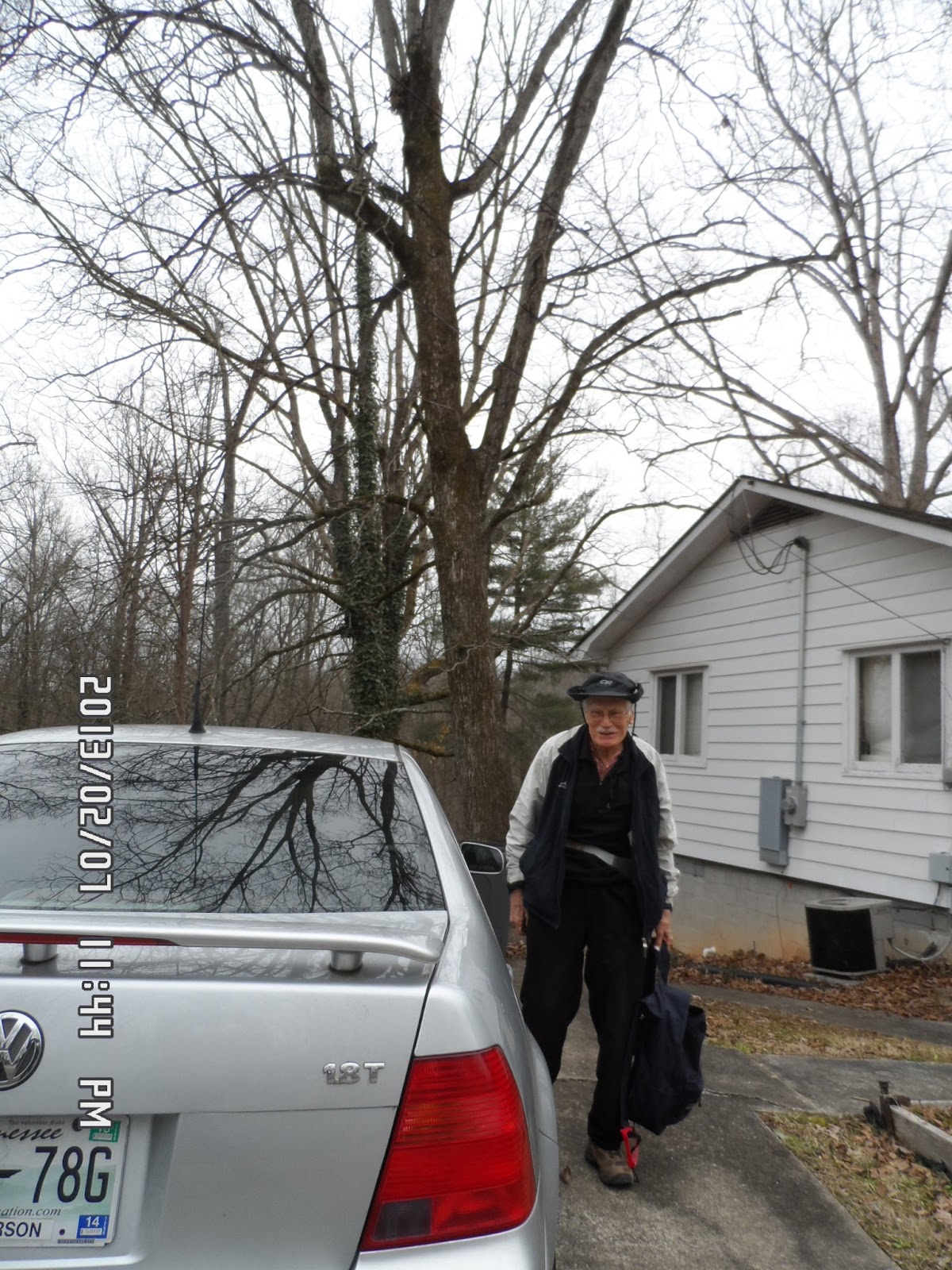
[Alan and Mark in front of Mark's house, マークの家の前で、마크 집 앞에서]

I found the website describing the state park as follows:

http://en.wikipedia.org/wiki/Frozen_Head_State_Park

[Quote] Frozen Head State Park and Natural Area is a state park in Morgan County, Tennessee, in the southeastern United States. The park, situated in the Crab Orchard Mountains between the city of Wartburg and the community of Petros, contains some of the highest mountains in Tennessee west of the Blue Ridge.

Frozen Head State Park consists of approximately 24,000 acres (97 km2), all but 330 acres (1.3 km2) of which is classified as a state natural area. The terrain varies between 1,300 ft (400 m) to over 3,000 ft (910 m). with 14 peaks at or over 3,000 feet (910 m).

Frozen Head, the park's namesake, is the highest peak at 3,324 feet (1,013 m). The mountain's name comes from its snow-capped appearance in colder months. The park's highest elevations allow for unobstructed views of East Tennessee's three main physiographic features: the Cumberland Plateau, the Tennessee Valley, and across the valley, the Great Smoky Mountains.[Unquote]

We visited Visitors’ Center first. There was a staff member at the counter and he gave much information about the park.


[We visited Visitors' Center, first, 我々は先ず情報センターを訪れた、우리는 먼저 정보 센터를 방문했다.]


[A staff member explained the trails, 職員が登山路を説明した。직원이 등산로를 설명했다.]

While he was explaining the trail, I noticed a stuffed specimen of a rattle snake. It was a nice figure, but its tail was not perfect.


[A stuffed specimen of a rattle snake, ガラガラヘビの剥製、방울뱀의 박제]

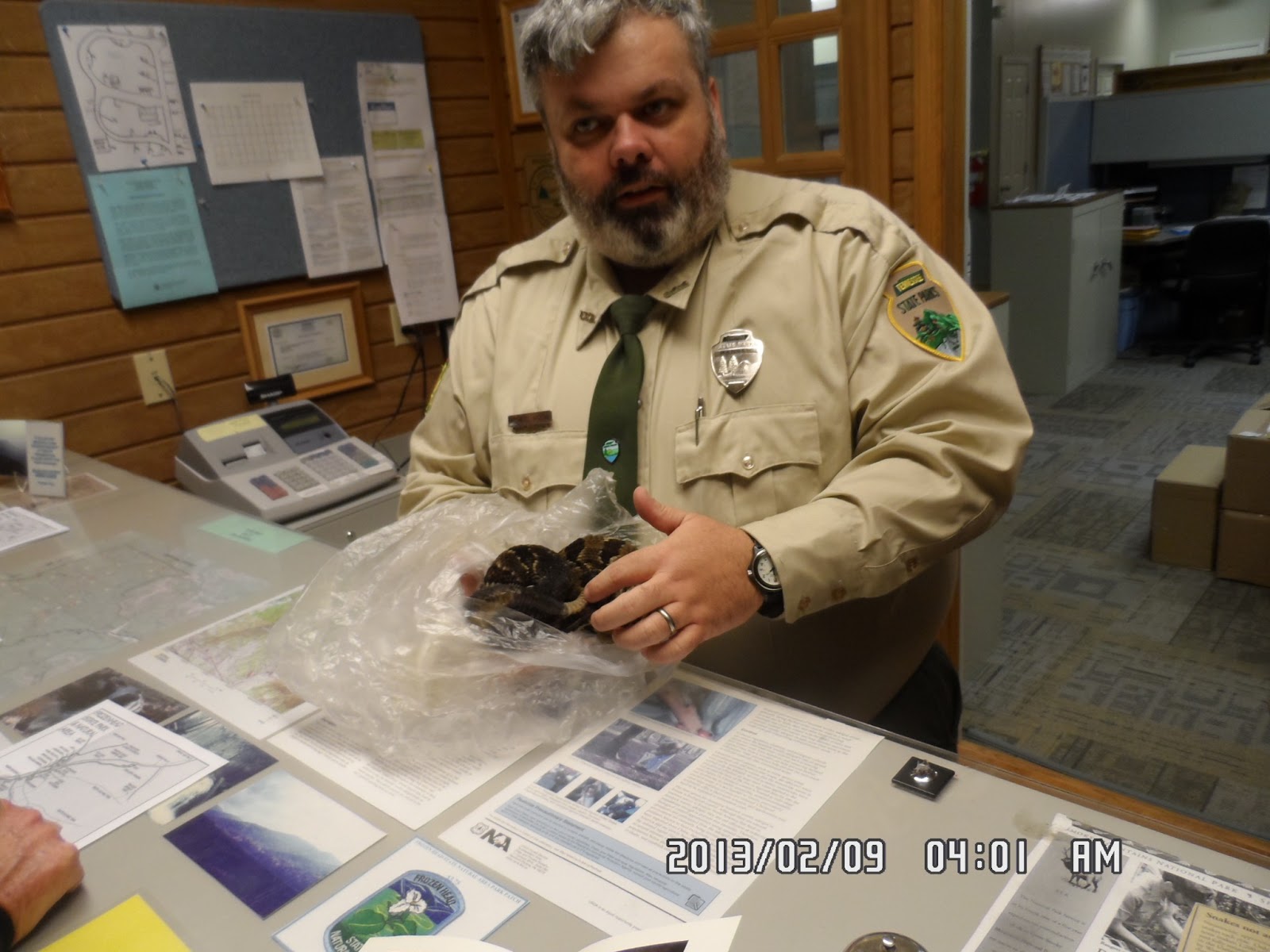
When I told about it to the staff person, he went back to his office and brought another specimen with perfect tail. When I shook the tail, it made a sound!


[A tail of a rattle snake, ガラガラヘビの尻尾、방울뱀의 꼬리]

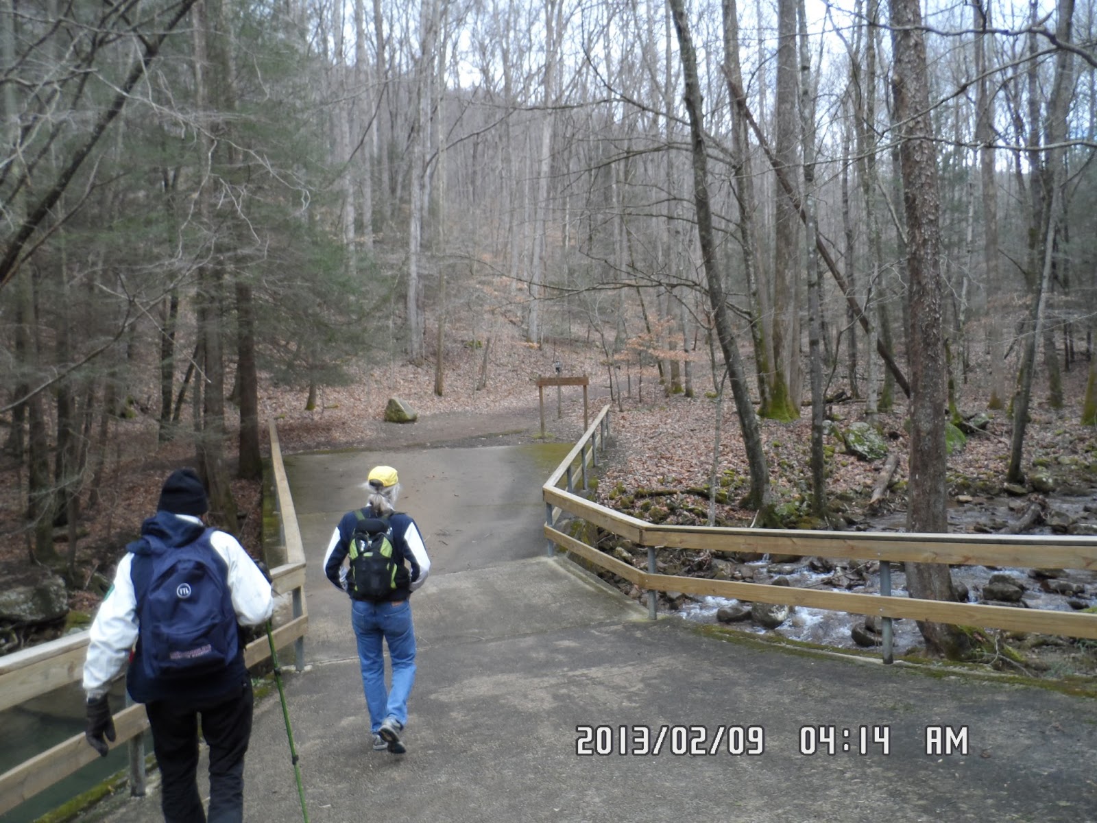
After visiting the center, we went on to the dead end of the paved road. We began walking along the river.

[After visiting Visitors' Center, we began walking, 情報センター訪問後、我々は歩き始めた。정보 센터 방문 후, 우리는 걷기 시작했다.]


[The post-guide near the entrance, 入口近くの標識、입구 근처의 표지판]

It was a gentle wide trail to Deboard Fall for about 15 minute walk. There was an observation deck between the main trail and the river. First we took pictures there, then we went down to the bottom of the fall.


[With Alan at the observation deck, 展望台にてアランと、전망대에서 앨런과 함께.]


[Deboard Fall, デボード滝、데보도 폭포]


[Alan and Mark at the bottom of the waterfall, 滝のそばで、폭포에서]

After taking the pictures at the bottom of the fall, we went back to the main traila and kept going up to Emory Gap Falls.


[Alan at the guide-post, 里程標のそばに立つアラン、이정표 옆에 서있는 알란]

It took us for about 40 minutes from Deboard Fall to Emory Gap Falls. And that was the final destination of today’s hike.


[Alan and I near Emory Gap Falls, エモリーギャップ滝の近くにて、에모리갭 폭포 근처에서]

I went up to the falls, but Mark stayed at the bottom of the falls and took rather long rest. Alan joined him, and eventually, I went down to join them.


[Emory Gap Falls, エモリーギャップ滝、에모리갭 폭포]


[Alan in front of Emory Gap Falls, エモリーギャップ滝の前に立つアラン、에모리갭 폭포 앞에 서있는 알란]

We went back to the car, and drove back to Oak Ridge. While we were in the park, it was cloudy and cool, but when we left the park, the sunshine came back. I guess that there might be more cloud in the area where maintains are.

After saying good-bye to Mark, we went back to Alan’s home, first. Then we went out for dinner.

Alan took me to an oriental restaurant named “WOK’N’ROLL” where we had oriental dishes with reasonable price. Thanks to Alan, he bought me the dinner.


[“WOK’N’ROLL”near Food City, フードシティ近所の『ワークンロール』、푸드시티 근처의 "워큰럴"식당]

It was my 2nd trekking in the States and my 7th hike for this year.

------------------------------------------------------------------------------------------------------------------------

「フローズンヘッド州立公園」テネシー州、モーガン郡

登山月日:2013年2月8日(金)午後曇り

登山場所:テネシー州、モーガン郡「フローズンヘッド州立公園」

登山コース:情報センター(Visitors’ Center)~デボード滝(Deboard Fall)~エモリー・ギャップ滝(Emory Gap Falls)[往復約3マイル]

同行者:アラン、マーク

午前中「平和の鐘」と「AMSE博物館」を見学して昼食後、アランは近所に住むマーク・クリスティを訪ね、彼も含め3人でモーガン郡の「フローズンヘッド州立公園」へ向かった。

州内を1時間あまり車を飛ばし、主幹道路から右にの谷間にはいる道路をはしると、さらに右側にやや大規模な刑務所があり、Lazerwireに二重に囲まれた塀に沿って走ると公園の入り口があり、Visitor’s Centerがあった。

ここでは陽気な職員が親切に対応してくれた。カウンターに展示されていたガラガラヘビの剥製に注目すると、この蛇の音を出す尾の部分がとれていると言って、尾の部分がしっかりついている別の多分剥製前の単体を奥から持ってきて見せてくれた。


[A staff member explained the trails, 職員が登山路を説明した。직원이 등산로를 설명했다.]


[The staff showed a stuffed rattlesnake, 職員がガラガラヘビの剥製を見せた。직원이 방울뱀의 박제를 보여줬다.]

[The staff showed another rattlesnake, 職員は別のガラガラヘビを持ってきた。직원은 다른 방울뱀을 가져왔다.]

また、展示してあった野生の花の図鑑の表紙が尾瀬でみたものと同じだったので名前を訊いたらIndian Pipeだと教えてくれた。


[The covers of pictorial books, 図鑑の表紙、도감의 표지]


[The explanation of "Indian Pipe", ギンリュウソウモドキの説明、수정난풀(水晶蘭-, Monotropa uniflora)의 설명]

尾瀬の花は日本語では「ギンリョウソウ(銀竜草、学名:Monotropastrum humile)」と言い、別名「ユウレイタケ」だが、図鑑の英語の説明ではIndian Pipe (Monotropa uniflora)となっていて、学名が異なり、日本語では「ギンリョウソウモドキ(銀竜草擬 学名:Monotropa uniflora)と言うらしい。ウィキペディアによると開花時期が異なり、こちらは「アキノギンリョウソウ」とも言うらしい。また別名をGhost Planというのはその雰囲気からだろうか。


[We left Visitors' Center, 情報センターを後にした。정보 센터를 출발했다.]

ビジターズセンターからさらに1キロ以上川に沿って走ったところがデットエンドで、そこがトレイルの入り口だった。


[The creek near the entrance, 入口近くの渓谷、입구 근처의 계곡]

広いが少しぬかるんだ緩やかなトレイルと少し進むとすぐ右側にDebord Fallsのサインがあり、まず展望台で写真を撮り、その後で滝の下まで行ってさらに写真を撮った。


[With Mark at the observation deck, マークと展望台にて、전망대에서 마크와 함께.]

ここの滝はなかなかのものでマークはキャノンのカメラで写真を撮った。


[Deboard Fall, デボード滝、데보도 폭포]


[Alan and George at the bottom of the waterfall, 滝のそばで、폭포에서]

その後、元のトレイルに戻ってさらに進むとやや急なトレイルになって、構わず進むと水量はやや少ないが棚のように突き出た岩から水が流れ落ちるEmory Gap Fallが見えてきた。

この滝に近づくには2本の大木が道を塞いでいて、その倒木に沿って川を渡らなければならない。


[Alan crossing the creek, 小川を渡るアラン、알란이 시내를 통과하고있다.]

この滝つぼからさらに上がろうとしたが、マークは腰を下ろして進もうとしない。


[In front of Emory Gap Falls, エモリーギャップ滝の前で、에모리갭 폭포 앞에서]

アランが戻り、私も戻ってみるとマークは食べ物を出してどっかりと休憩していた。ここが今回の目的地と言うわけだ。

片道1マイルほどで急な場所もない、実に適切なハイキングコースだった。

オークリッジでは日が差して暑いかと思ったが、公園に着く頃にはすっかり曇って、ハイキング中は寒いくらいで上着を着てちょうど良かった。

ハイキングを終え、刑務所を過ぎるころから陽射しが戻ってきたのは、地理的に山に近い部分は雲がかかっていたのかもしれない。

オークリッジに戻ったのは4時半ごろだった。1時間ほど休んでから、アランと最後の夕食に出かけた。

場所はフードシティのショッピングモールでワークンロール(WOK’N’ROLL)という東洋系のビュッフェスタイルの店で夕食時だったせいもあるのか客がひっきりなしに訪れてテイクアウトあるいは中で食事をしていた。


[We had dinner at a buffet style restaurant, ブッフェ式レストランで夕食、 뷔페식 레스토랑에서 저녁 식사]

ライスは基本でほかにおかずを3つとスープかエッグロールを合わせて5ドル台というのはおてごろだ。今回もアランの世話になった。

家に戻ってみるとマークが既にフェイスブックに写真を上げていた。

今回は「悪魔の競技場」に続く2回目の米国でのトレッキングだった。

2013年3月12日火曜日

130207-1 “House Moving” and “Devil’s Racetrack”「ハウス・ムービング」と「悪魔の競技場」in Knoxiville, Tennessee

Date: In the morning of Feb. 7 (Thu) 2013, fine

Place: Oak Ridge and Knoxiville in Tennessee

[The Devil's Racetrack (578m) is part of Walden's Ridge, which is the eastern edge of the Cumberland Plateau.]

Trekking Course: The entrance of the trail by Bruce Creek - Bruce Creek Fall - Bruce Creek Bridge – The Davil’s Racetrack (A round trip)

Partner: Alan

“House Moving”

We had breakfast at 8:15. Alan told me that we should leave the house before 10 am because there would be “House Moving” coming close to his area.


[Alan and his new car, アランと彼の新車、앨런과 그의 신차]


[The mark of "Caving",「洞窟探査」の象徴「こうもり」"동굴 탐사"의 상징 "박쥐"]


[Checking the map before going, 出発前に地図をチェックするアラン、알란이 출발 전에 지도를 확인하고있다.]

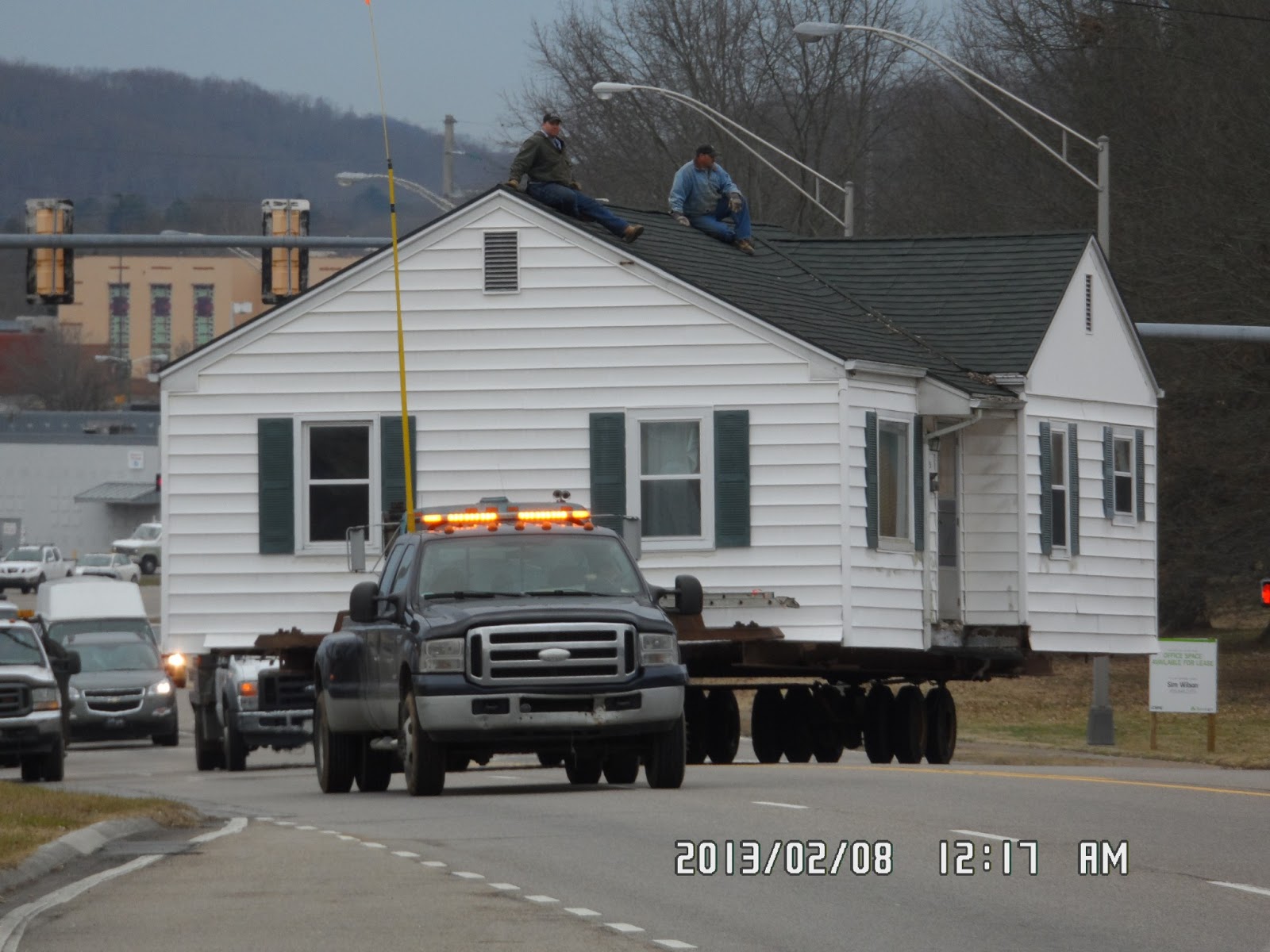
When I heard about “House Moving” I did not understand what it meant. When we went out to the big street, I saw this “house moving” and I understood.

[Pictures of "House Moving" 『ハウス・ムービング』の連続写真、"하우스 무빙"의 연속 사진]


They were carrying the house by the huge trailer!!!. The trailer with the house on its back was moving slowly, and two men on the roof.


There were other vehicles with heavy machines on their backs, too. And the other vecles could not pass around the trailer!b


[A trailer with a heavy machine, 重機を載せたトレーラー、무거운 기계를 실은 트레일러]

When I saw the “house moving,” it was moving on the wide street, but it would come in front of Alan’s home. No wonder why we should leave the house before it would come!

The next day, Alan took me to the place where this house was settled down.


[Next day I saw the house settled in the new place, 新しい場所に移動した家、새로운 장소로 이동 된 집]

“Devil’s Racetrack” hiking

The location was described as “Just north of the Caryville – Jacksboro exit of Interstate 75. It is a part of Walden's Ridge, which is the eastern edge of the Cumberland Plateau.

There is a formal entrance of the trail near the the exit of Interstate 75 (I-75), but Alan took me close to the mountain near the Bruce Creek.


[Alan parked his car near the creek, アランは小川のほとりに駐車した、앨런은 시냇가에 주차 했다.]

He parked the car along the raod which the sign said “Dead End.”


[We began walking along the creek, 渓谷に沿ってハイキング開始、계곡을 따라 하이킹 시작]


We walked along the river (between the river and the side of I-75) for about 15 minutes. Then there was a small waterfall (about a couple of meters). Then we came to the three-level waterfall (Bruce Creek Fall).


[At Bruce Creek Fall, ブルース・クリーク滝にて、브루스 크릭 폭포에서]


I took several pictures of the waterfall, then we climbed on the left side of the waterfall. When we came to the upper part of the creek, there was a small bridge called Bruce Creek Bridge.


[There was a small bridge over the creek, 渓谷に木の橋が掛かっていた。계곡에 나무 다리가 걸려 있었다.]


After crossing the bridge, the trail became a bit steep and we went on this zigzag trail, then we heard the noise of big vecles passing through T-75.

> I could see I-75 and cars passing through the woods. We climbed the zigzag trail for about 30 minutes, then we came to the ridge.


[Alan near the ridge, 稜線に近い登山路に立つアラン、알란이 능선에 가까운 등산로에 서있다.]

There were beautiful mosses along the trail which reminded me of Mt. Ishizuchi in Shikoku, Japan which I climbed with Bernardo and Mr. Matsumoto two years ago.


[Mushrooms and mosses along the trail, 登山路のコケとキノコ、등산로의 이끼와 버섯들]

The ridge must be “Walden's Ridge” and the end of the ridge was “Devil’s Racetrack.”According to Alan, the rocks were sandstone and conglomerate from the Pennsylvanian era.


[The sandstone and conglomerate, 3億年前の古代に生成されたという砂岩と礫岩、3억년전 고대에 생성되었다는 사암 및 역암]


[Alan stands on the ridge, 尾根に立つアラン、능선에 서있는 아란]


[Alan is walking on the Devil's Racetrack, 『悪魔の競技場』上を歩くアラン、알란이 "악마의 경기장"을 걷고있다.]

It was a rocky formation, and we could see the views very well, including I-75.


[Looking down I-75 from Devil's Racetrack, 『悪魔の競技場』から州際道路75号を見下ろす、"악마의 경기장"에서 주제도로 75호를 내려다보다.]

We started the trekking at 11 am, and we reached at the Devil’s Racetrack at noon. So it was an hour hike.

We had lunch on the rock and came down the same trail.


[Alan on the Devil's Racetrack、『悪魔の競技場』にて、"악마의 경기장"에서]


From the ridge, we could see the state park and some trailer houses. When I saw the trailer houses, they reminded me of my first trip to USA when I was 28 years old. I saw the trailer house of Lois and Craig in Portland, Oregon for the first time.


[The trailer houses from the ridge, 稜線から見たトレーラー・ハウス群、능선에서 본 트레일러 하우스들]


[Alan is walking down from the ridge, 下山路を行くアラン、하산길을 가는 앨런]

On the way back, we dropped in the formal entrance of the trail.


[The formal entrance of the trail, 公式な登山路入口、공식적인 등산로 입구]

It was a light trekking and I count this as my 6th hike for the year of 2013, thanks Alan for taking me to this mountain.

-----------------------------------------------------------------------------------------------------------------------------

分類:米国旅行第2日目-1 「ハウス・ムービング」と「悪魔の競技場」

旅行月日:2013年2月7日午前

登山地:カンバーランド高原(Cumberland Plateau)の東端に位置するWalden's RidgeのThe Devil's Racetrack(悪魔の競技場)と呼ばれる岩山(578m)

登山コース:川のほとりの登山口~I-75の下~見事な3段の滝(Bruce Creek Fall)~急こう配の登山路~稜線~頂上(往復)

同行者:アラン

この日は8時15分から前日購入した牛乳やパン、果物などで朝食。ゆったりと準備して9時45分に出発した。途中、前夜立ち寄った巨大な食料品売り場の「フードシティ」に寄って食料や水を調達した。


[Alan in front of his house,家を出発するアラン、집을 출발하는 앨런]


[At "Food City",『フードシティ』にて、"푸드 시티"에서]

「ハウス・ムービング」

登山地、Devil’s Race Track(DRT:578m)に向かう途中、家を持ち上げ、巨大なトラックに載せそのまま移動するHouse Movingを見学した。

前日、アランがHouse Movingがあるから10時前に出発しなければならないと言っていた意味がその実物をみて納得した。


[Information about "House Moving" 『ハウス・ムービング』のお知らせ、"하우스 무빙"안내]

なんとかなり大きな家1軒をそのまま巨大なトラックに載せ、そのままゆっくりと移動するわけだ。このトラックの前後にはまるで護衛をするかのように重機を乗せた業者の車などが前後し、前後は交通渋滞になるわけだ。

[Pictures of "House Moving" 『ハウス・ムービング』の連続写真、"하우스 무빙"의 연속 사진]

広大な大通りはともかく、アランの家の前などは対抗1車線の道路で、駐車場に車を停めておいてはこの家を乗せたトラックは通過できない。


[A trailer with a heavy machine, 重機を載せたトレーラー、무거운 기계를 실은 트레일러]

それであらかじめ、通過する通りに面した家々には「ハウスムービング」をお知らせを配って協力を要請するわけだ。

この家の引っ越し先はアランの家の近所で、翌日、この家が新しい場所に収まっているのを見学した。


[Next day I saw the house settled in the new place, 新しい場所に移動した家、새로운 장소로 이동 된 집]


「悪魔の競技場」ハイキング

登山場所はテネシー州中央部分に近いカンバーランド高原(Cumberland Plateau)の東端に位置するウェルデン尾根(Walden's Ridge)の一部で『悪魔の競技場』(Devil’s Race Track、DRT:578m)と呼ばれる岩山である。

州際道路(Interstate) 75号線の近くで、礫岩(conglomerate)のフォーメイションがむき出しになっている部分だ。

正規の登山道の入り口は州際道路を降りたすぐそばだが、今回はDRTの近くから始まる近道の登山道を使った。


[We began walking along the creek, 渓谷に沿ってハイキング開始、계곡을 따라 하이킹 시작]

Dead Endのサインのある小道が小川にぶつかる部分に車を停めてハイキングを開始したのは11時前。

小川(Bruce Creek)に沿って15分ほど上るとまず数メートルの小さい滝、少し上流に上ると川の向こう岸には大きな岩の壁があり、小川は立派な3段の滝(Bruce Creek Fall)になっていた。


[At Bruce Creek Fall, ブルース・クリーク滝にて、브루스 크릭 폭포에서]


登山路は滝を右にみながらやや急になっていて登り切ると平坦な林の中の道が続き、小さな橋(Bruce Creek Bridge)を渡るとすぐに本格的なジグザグの登山道となる。このあたりから登山道左上のI-75を走る大型トラックの騒音が大きくなる。


[George on Bruce Creek Bridge, ブルース・クリーク橋の上にて、나무 다리에서]


[Alan on Bruce Creek Bridge, ブルース・クリーク橋の上にて、나무 다리에서]

30分のほど登りで登り切った尾根を右へ進めばすぐにDRTのフォーメイションに出る。途中、頂上付近の登山路の山側にみごとな苔の絨毯のようになっていてベルナルドや松本さんと登った四国の石鎚山の登山路を思い出した。


[Beautiful mosses along the trail, 登山路の脇の綺麗な苔、등산로 옆의 아름다운 이끼]

稜線にでると礫岩の岩がむき出しになっていて、そのままDRTの先端に到達した。アランによるとここの岩は古生代石炭紀後期の3億1800万年±130万年前から2億9900±80万年前までに該当するペンシルバニア期に造成された砂岩と礫岩だという。この時点でちょうど12時で昼食にした。


[Alan near the ridge, 稜線に近い登山路に立つアラン、알란이 능선에 가까운 등산로에 서있다.]


[The sandstone and conglomerate, 3億年前の古代に生成されたという砂岩と礫岩、3억년전 고대에 생성되었다는 사암 및 역암]


[Alan on the Devil's Racetrack、『悪魔の競技場』にて、"악마의 경기장"에서]

昼食は前夜、パンと牛乳を購入したFood Cityでブルーベリーとバナナと小さなパン6個とミネラルウォーター1本で7ドルだった。アランは自分で作ったサンドイッチを食べ、私はブルーベリーとバナナを食べた。


[Looking down I-75 from Devil's Racetrack, 『悪魔の競技場』から州際道路75号を見下ろす、"악마의 경기장"에서 주제도로 75호를 내려다보다.]

リッジから見下ろすと湖や州立公園が見下ろせた。州立公園の近くには長方形の箱のようなものが並んでいるのが見えた。


[The trailer houses from the ridge, 稜線から見たトレーラー・ハウス群、능선에서 본 트레일러 하우스들]

これはトレーラーハウスだという。そういえば初めて米国を旅行した28歳の夏、ロイスたちがトレーラーハウスに住んでいたことを思い出した。

昼食後、リッジ歩きをするか聞かれたが、とくにエキサイティングなものはないと言うのでやめて、ただちに往路をそのまま戻った。2時間弱の軽いハイキングだった。


[Alan is walking down from the ridge, 下山路を行くアラン、하산길을 가는 앨런]

家へ戻る帰路、「悪魔の競技場」ハイキングの正式な入り口に寄って、写真を撮った。


[The formal entrance of the trail, 公式な登山路入口、공식적인 등산로 입구]


[Alan in front of the formal entrance of the trail, 公式な登山路入口にて、공식적인 등산로 입구에서]

今回のトレッキングを私の年間登山目標に含めれば、今年6回目の登山/トレッキングである。