About pictures/当ブログ内の写真について/당 블로그내의 사진에 대해서

Most of the pictures in this blog are taken by my camera, yet some of them were downloaded from the website of the hiking club. If you click any pictures, they become the original size.

当ブログ内の写真の大部分は筆者のカメラで撮影したものですが、一部、山岳会の共有写真からダウンロードしたものを含みます。すべて、各写真をクリックすれば、元のサイズに拡大します。

당 블로그내 사진의 대부분은 필자의 카메라로 촬영한 것입니다만 일부 산악회 공유 사진으로부터 다운한 것도 포함합니다. 모두 각 사진을 클릭하면, 원래 사이즈에 확대합니다.

2011年3月29日火曜日

110301 GappaSan (469m), Daejeon 甲下山(カッパサン)・大田

Date: March 1, 2011 (Tuesday)

Place: GappaSan (469m), Daejeon

Course: Gyeryong Service Area – Gapdong Daesagol – 380.6bong – Mt. GappaSan – Return to Gyeryong Service Area (About 4 km, 3 hours)

Partners: Alan and 8 Taejeonhikers members

March 1 is a national holiday in Korea. They commemorate March 1st for the first day of Korean resistance during the Japanese occupation in 1919.

It happened to be Alan’s birthday. I still remember the day when we celebrated his birthday at an inn at foot of Mt. Jiri, in 2004.

Anyway, he planned an easy hike to Mt. GappaSan in the suburbs of Daejeon on March 1, 2011.

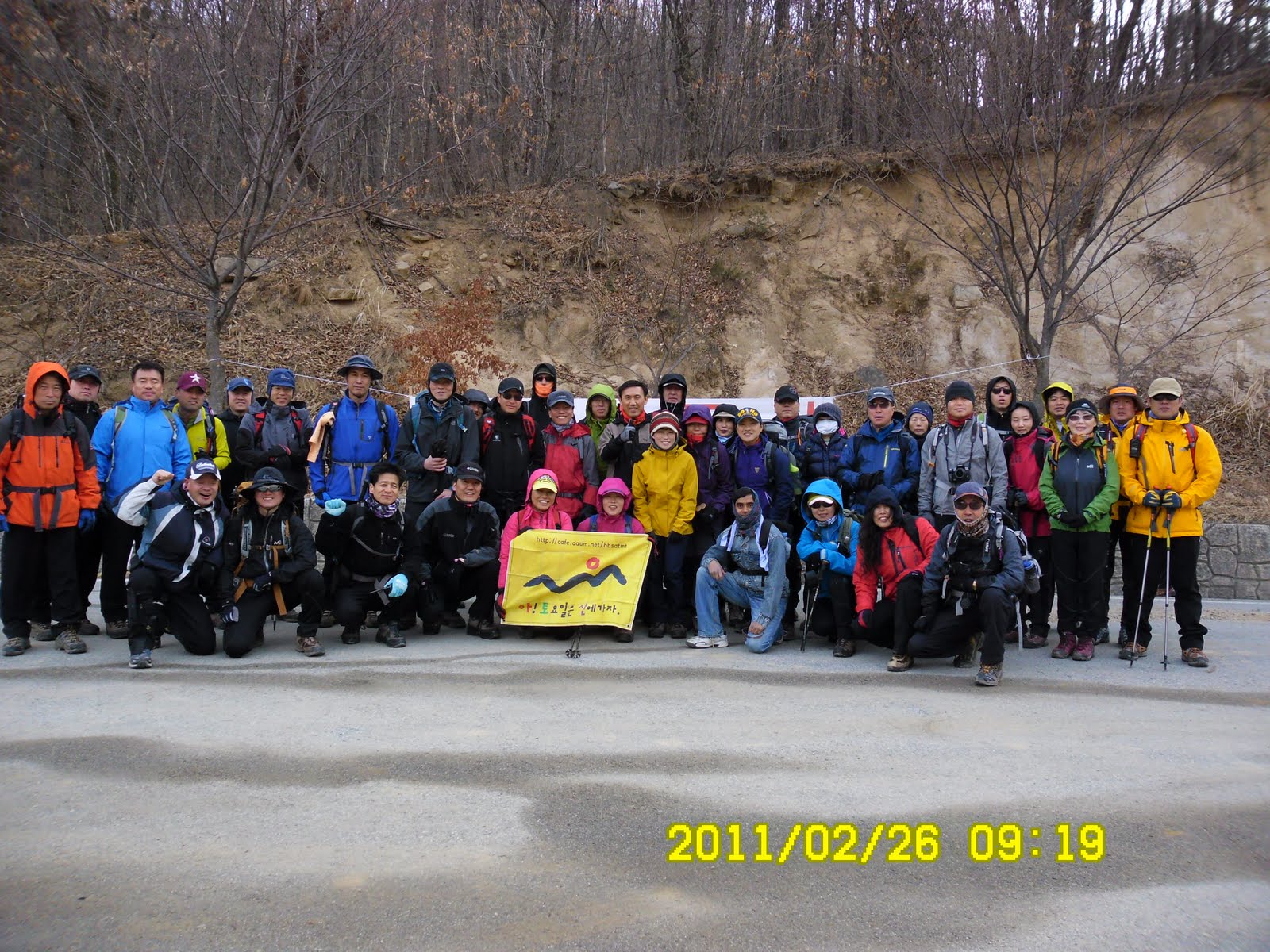
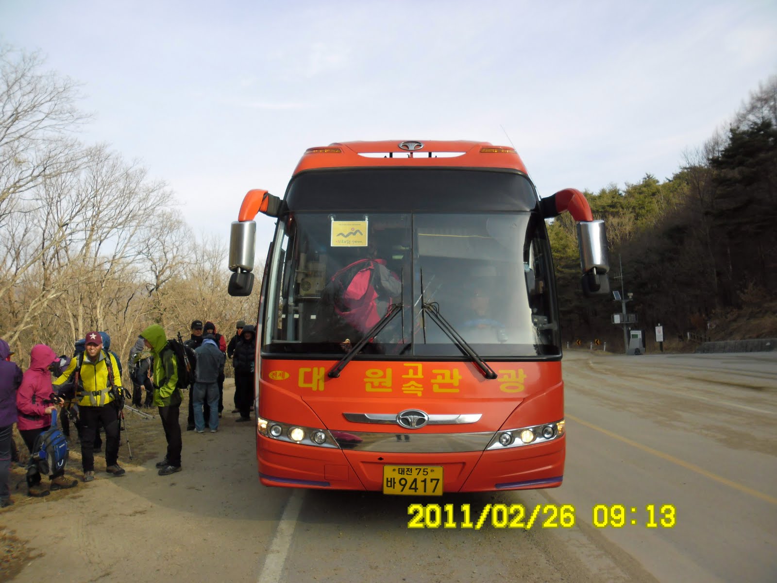
10 of Taejeonhikers got together at the main gate of KAIST in the afternoon. We headed for Gyeryong Service Area by 3 cars.

Participants were: 3 Americans including Alan, 3 Japaneses including myself, 2 Koreans (mother and her daughter), 1 Rumanian and 1 Canadian.

[At Gyeryong Service Area, 鶏龍休憩所にて、계룡휴계소에서]

We parked our cars at the service area and began walking toward Gapdong, at the foot of the mountain. I climbed this mountain 3 times before, but the last time was about 5 years ago and I was not sure the exact location of the trail.

[Alan explained the hike, 地図でコースを説明するアラン、지도로 코스를 설명하는 앨런]

We asked some local people and found out that the entrance of the trail was along the highway between Daejeon and Gongju.

[The small brook at the entrance of the trail, 登山路入口の小川、등산로 입구의 시냇물]

It was well facilitated with new ropes for handlines. All hikers except Alan and I went fast climbing the mountain.

Alan and I needed to rest while climbing on the steep slope, so we went on rather slowly.

[Walking along the ridge,尾根伝いに頂上へ、산등성이를 따라서 정상에]

When we reached at 308.6-bong, it began snowing a little bit. We could see snow remained along the trail and tree leaves.

[Looking at GyeryongSan from the ridge, 尾根から鶏龍山を望む、산등성이로에서 계룡산을 본다]

Alan and I arrived at the top of Gappasan at 3:30 p.m. The rest of the hikers were waiting for us.

[甲下山頂上のヘリポート、갑하산 정상의 헬기장]
[At the top of Mt. GappaSan, 甲下山頂上にて、갑하산 정상에서]

We just returned from Gappasan simply taking the same trail to the service area. Then we decided to have dinner together.

[Coming down from the top, 同じ道を下る、같은 등산로를 내려간다]

The Korean lady (or her daughter) suggested to go to a unique restaurant near Mt. GyeryongSan. The name of the restaurant is “Geureume Dal Gadeusi” or “Just like a moon with clouds.”

They have a big furnace in which they burn firewoods. There were many lanterns hanging from the ceiling. We ordered Korean dishes such as “pajong”“bibingpap”etc.


We all enjoyed having nice food and casual conversation. After the dinner, the Japanese couple took me to Shinseong-dong, where we live.

It was my 14th hike for this year, and the lightest hike so far.

登山月日:2011年3月1日(火)午後1時~午後4時

登山場所:大田市内甲下山(カッパサン갑하산469m)

コース:鶏龍休憩所~甲洞テサコル(대사골)~380.6峰~甲下山~原点復帰(約4キロ3時間)

同行者:大田に住む外国人および英語を話す韓国人計9人

3月1日は韓国では「三一節(サミルチョル)」と呼び1919年3月1日の三・一独立運動を記念する祝日である。それでテジョンハイカーズを企画するアランが半日の軽いハイキングを計画した。彼はメールで午後1時にKAIST正門に集まるよう参加希望者に前日配信した。

しかし、私はアランからのメールに気付かず、自宅にいた。午後1時10分になってアランから電話が来た。急いでタクシーでKAIST正門へ向かった。

すでにアランを含め9人が待っていた。国別参加者数は、米国人が3人、日本人が3人(天文研究所に勤めるMさんとその奥さんと私)、韓国人の母と娘の2人、ルーマニア人とカナダ人が一人づつの計10人。

我々は3台の車に分乗して鶏龍休憩所へ向かった。車はこの休憩所に駐車して、コンビニで買い物をしたり、トイレを利用したりしてから出発した。

[At Gyeryong Service Area, 鶏龍休憩所にて、계룡휴계소에서]

甲下山は久しぶりで登山路の入り口がわからない。結局現地の人に聞いて、以前登った丘からではなく、山の裾を左側に迂回して小川を渡ってからやや急な尾根道を登った。

登山路は真新しい白いロープが設置されていてハイカーに親切だ。見晴らしのよいあたりからアランと私がみんなから遅れた。

アランは登りがしんどくて、時々休まなければならない。私も登りはどうしても遅れる。そこで、アランのペースにつきあった。

[Taking a short rest while climbing up to the top, 頂上への途中で一休み、정상에의 도중에 휴식]

1時間半ほどの上りで、甲下山の頂上に到着した。他の7人はすべて先に到着していて我々を待っていた。

[At the top of Mt. GappaSan, 甲下山頂上にて、갑하산 정상에서]

ここから、もう1つのピークの雨傘峰(ウサンボン)までは3.6kmあり、往復すると3時間以上かかりそうなので、今日はここまでにして下りることにした。

下りは他のメンバーから遅れることもなく、4時過ぎに休憩所へ戻った。

わずか468mの低い山だが380.6峰から上の尾根には雪が残り、けっこう寒かった。

その後鶏龍山の近くの「그름에 달 가듯이(雲が月にかかるように)」という変わった名前のレストランへ行った。

[At the restaurant near GyeRyongSan, 鶏龍山近くのユニークなレストラン、계룡산 가까운 식당 "구름에 달 가듯이" 에서

このレストランは大きな囲炉裏のような槇を燃す場所があり、天井から多くの提燈のような照明具がさがっていてやさしい雰囲気がある。


ここは鴨の肉がうまいそうだが、鴨を注文するものはおらず、ビビンパやチャンコル、パジョンなどを食べた。

レストランを出たのは6時近くで、同じ新城洞に住むMさんの車で新城洞まで送ってもらった。

今年14回目のハイキングは、今年もっとも軽い登山だった。

2011年3月24日木曜日

110226 Mt, MakJangBong (887m) and Mt. JangSeongBong (917m), Gyongbuk and Chungbuk (幕場山と長城山、慶北・忠北)

Date: Feb. 26 (Sat) Fine, but strong wind at the mountain

Place: MakJangBong (887m) and JangSeongBong (917m), in Gyongbuk & Chungbuk Province

Course: Jesuri – MakJangBong – JangSeongBong – Shimyosal Valley – Ssangguk Parking Lot (About 12 km, 6 hours.)

Partner: 40 AhToSan Members (Including 4 foreingers: Japan, Mexico, China and India.)

The weatherman predicted rain, but it began raining late at night. We could enjoy this hike without getting wet. Only complain was the strong wind. It blew so strongly that my tripot stand was almost falling down when I was taking a group picture.

We left at South Gate at 7 a.m. and arrived at Jesuri at 9:15.

In spite of the cold weather, Soumen came with light wears. Someone recommended him to buy climbing irons. It was good for him to follow the advice. He needed the gear when he decended the mountain.

[A group picture at Jesuri, 出発前の集合写真、출발전의 단체사진]

Also, some members lent him a scarf and a pair of gloves. So he could enjoy the hiking without freezing.

We had warming up exercise before hiking. During the whole hiking, we did not see any other hikers besides AhToSan members. So, it must be not so popular course. Yet the moutain was good, and the hiking course was really nice.

[Warming up exercise, 出発前の準備体操、출발전의 준비 체조]

They were rather rocky mountains. We had to climb on the rocks, one after another. During the first one hour, I was in the last group.

[On the ridge,稜線の岩場で、능선의 정망대에서]

We had a couple of rest time. They call it “Suzuki Time” because I bring fruits such a s grape tomatoes, kumquat or “kinkan” in Japanese. When we arrived on the ridge, we had the 1st Suzuki Time. When we came to the observation point, we ahd the 2nd Suzuki Time.

I arrived at MakJangBong at noon, together with SanSalang (president of AhToSan) and JeongDaUn (vice president).

[At MakJangBone, 幕場峰にて、막장봉에서]

From MakJangBong to JangSeongBong, we had to make a round trip using the same trail. The last group of the people were too late to make this round trip. They decided to skip JangSeongBong. However, I did head for JangSeongBong.

It was 1:40 p.m. when I arrived at JangSeongBong. Most of the members were having lunch already. Since I arrived there rather late, I did not have much time for lunch.

[At JangSeongBong, 長城峰にて、장성봉에서」


“JangSeong” means Great Wall in China. The view of the mountain looked like “Great Wall”that’s why they named the peak “JangSeongBong.” Anyway, the view from JangSeongBong was good.

We walked the same trail back to MakJangBong. Then we began decending the mountain. Since the slope was steep and frozen, it was absolutely necessary to wear climbing irons. I saw him wear the gears there.

After decending for a while we saw waterfalls beautifully frozen. The first frozen waterfall was just besides of the trail. The 2nd one was in the valley, a bit far from the trail. The three foreigners were strong enough to walk extra and they went close to the frozen waterfall.

[In front of the frozen water fall, 凍った滝の前で、언 폭포 앞에서][Three foreigners went close to the frozen waterfall in the valley, 渓谷の凍った滝の前で、계곡에 있는 언 폭포 앞에서]


When I came to the trail with few snow, I took off my climbing irons. Then I came to the river completely frozen. It was fun to walk on the ice, but I must walk very carefully.

[Walked on the frozen river, 凍った川の氷の上を歩く。언 강 위를 걸었다][Support Center which I saw before, 見覚えのある支援センター、본 기억이 있는 지원센터]

Then we came to the open area which I remember that I came before. We came to the parking lot where our bus had been waiting for us at 3:30 p.m.

[At the wrap-up party, スユクともち米マッコリでティップリ、수육과 찹쌀막걸리로 뒤풀이]

When all AhToSan members came to the bus, we moved to the suitable place for Tippuri (Wrap-up) Party. The menu of the party were: Suyuk (boilded pork), tofu, kimchi and “Chapsal Makgeolli.”It was my first time to drink “Chapsal Makgeolli” and it tasted really good. The color of regular makgeolli is while, but this makgeolli is brawn.

We ended the party at 4:15 p.m. and went back to Daejeon.

This was our last “winter-hike” in Korea, and it was my 13th hike for this year and my 230th AhToSan regular hike as total number.

登山月日:2011年2月26日(土) 晴れ、ただし、山では強烈な風。

登山地:慶北(キョンブク경북)、聞慶(ムンギョン문경)/忠北(チュンブク춘북)、槐山(クェサン과산)にまたがる幕場峰(マクチャンボン막장봉 887m)と長城峰(チャンソンボン장성봉 916m)

登山コース:
ジェスリ(제수리) – 幕場峰(막장봉) ←-→ 長城峰(장성봉) – シミョサリ渓谷(시묘살이계곡) - 双谷(쌍곡) 12 km (6時間)

同行者:40名以上、そのうち外国人は私の他、ベルナルド(メキシコ)、ソウメン(インド)、サニー(中国)で計4人

天気予報では夕方から雨。しかし、雨は夜遅くなってからで、ハイキングには影響なし。だが、到着地点から幕場峰までの上り3時間はものすごい強風で、団体写真を撮る時には三脚が危うく倒れるところだった。

南門を7時に出発し、出発地点のジェスリジェには9時13分に到着した。

[We arrive at Jesuri at 9:15,ジェスリへ9時13分に到着、제수리에 9시13분에 도착]

ソウメンは相変わらずの軽装で、運動靴。しかし途中で誰かがアイゼンを購入することを勧めたらしく、アイゼンを持っていたのは幸いだった。スカーフと手袋は会員が貸してくれたと言っていた。

今回は到着後10分ほど準備体操をしてから出発した。今回のコースはめずらしく初めから最後まで他の山岳会とは出会わなかった。

["The Chair Rock" 椅子の岩、의자 바위]

登山開始後1時間ほどで急な岩を登ったり降りたりする難しいコースになった。登りはじめてすぐフミ(最後尾)グループとなった。主なメンバーは、新人数名のほかサンサラン、チョンダウン、アランドロン、ウポという主要メンバーたち。

最初の尾根で1回目のスズキタイム。ここで栗マッコリとキンカン/ミニトマト2箱を提供。1時間以上登った展望の良い地点でポラムが生人参を提供していて、ここで2回目のスズキタイム。残りのキンカンとトマトを提供。この後、凍った岩場の下りからアイゼンを装着した。

幕場峰にはサンサランやチョンダウンらとともにほぼ12時に到着した。アランドロンやウポらの最後尾グループはまだ到着しておらず、彼らは長城峰をあきらめたが、私は行くことにした。

「At MakJangBone,幕長峰にて、막장봉에서]

先着組が食事中の長城峰に着いたのは1時40分。狭い林の中で、サンサランのポジャギに座って昼食にした。20分ほどの昼食だが、遅く到着したため余裕がない。弁当を少し残して片づけ、長城峰の石標撮影。

ここからみる峰々はなかなか見ごたえがあった。石標は地味なものだが漢字で峰の名前が彫ってあった。

ここから幕場峰の下の三叉路まで戻り、そこからやや急な雪道を下りはじめた。ここではソウメンも初めてアイゼンを装着。その後、元気に走り下りた。

しばらく下って渓谷に出たが、そこですばらしい氷結した滝を2つ見た。1つは道のすぐ脇で、滝に触れることができた。もう一つは「隠仙瀑布」で、こちらは崖を下らなければならない。わざわざ崖を下って近づいたのはベルナルドとサニーとソウメンの三人だけのようだ。

[In front of the frozen water fall, 凍った滝の前で、언 폭포 앞에서]

彼らは実に元気だ。ここから下るにしたがって、渓谷も氷が解けている部分が増える。それでもアイゼンをはずしてから最後の大きな氷結部分を渡ることになり、滑らないよう気を付けて渡った。

[Walked on the frozen river, 凍った川の氷の上を歩く。언 강 위를 걸었다]

七宝山へ続く登山路との三叉路からは見覚えのある道で、そこからバスの待つ双谷休憩所はさほど遠くない。ここに着いたのは3時30分だから、登山時間は6時間。ほぼ予定通りだ。

[Support Center which I saw before, 見覚えのある支援センター、본 기억이 있는 지원센터]

その後バスで10分ほど移動して「俗離山双谷地区案内図」という大きな看板のある場所でティップリ・パーティ。

メニューはスユクとキムチと豆腐をつまみに「チャプサルマッコリ」を飲んだ。「チャプサル」は「もち米」で色は茶色。味はなかなか良い。

[At the wrap-up party, スユクともち米マッコリでティップリ、수육과 찹쌀막걸리로 뒤풀이]

ティップリは4時15分ごろ切り上げ、帰途に着いた。途中、チンハンサラムは槐山バス停で下車してソウルへ向かった。我々は南門に7時ごろ到着。写真は約100枚アップロードした。

今回はこの冬最後の冬山で今年13回目のハイキング。アトサンのトータルでは230回目だ。

2011年3月22日火曜日

110219 Mt. BangJangSan, JeonBuk & JeonNam 方丈山(743m)、全北の高敞郡と井邑市、および全南の長城郡

Date: Feb. 19 (Sat) Fine

Place: Mt. BangJangSan, JeonBuk & JeonNam

Event: Shisanje (To-begin-hiking Ceremony)

Course: JangSeongGalJae – Mt. Sseuri (734m) – Mt. SeoDaeBong – Mt. BangJangSan (743m) - GoChangGoGe – Mt. ByongOBong (640m) – YangGoSalJae (About 10 km, 5 hours.)

Partner: 40 AhToSan Members (No foreigners except myself.)

A lot of snow still remins in the moutains, yet I felt much warmer than before. We left the Expo South Gate at 7 as usual and arrived at JangSeongGalJae before 9:30 a.m. We began walking snow-covered trail after taking group pictures.

[A group picture at JangSeongGalJae, 『長城峠』にて団体写真、장성갈재에서 단체사진]

These days, it seems that I am always left behind most of members. This day, too, I was one of the last hikers until the first peak called “Peak 515.” I caught up with other people while “Chinan-Saram” was providing “Jangsu Makgeolli” from Seoul.
I followed suit of “Chinan-Saram” that is to offer “Chestnut Maggeolli” and “Chon-ha”(warm sake) to other people. But the thermo was not good enough to keep sake warm. It was a bit lukewarm or cold.

We arrived at “Sseuri-bong” a bit before 11 a.m. They we walked along the ridge. We passed two more peaks and had lunch at helicopter pad. It was wide enough to have lunch with all members together.

[The snowcovered trail,雪に覆われた登山路、눈이 쌓인 등산로]

“Yoreji” brought “Ogok-pup” or “Five grain dishes” and “Namul” or seasoned vegitables for other members, while Chinan-Saram cooked “Samgyopsal” or “pork belly” which most of Koreas liked very much.

To my surprise, a newcomer named “Gakchi” brought 40 cups of Chinese wine named “回春神酒”in Chinese characters (special wine to regain man’s power.) It tasted very good. The visce president,“Jeongdaun,”also provided “ume” liqueur. So we enjoyed various kind of wine during the lunch time.


After the lunch, I tried to keep up with the top group, and before we arrived at “Gochang Pass” I shared my jinsen candies and small chocolates with other members.
We repeated climbing up and down, one peak after another. The last peak was called “Byogobong” then we began decinding the mountain.

[On the ridge, snow began melting,稜線では雪が解け始めていた。능선에서는 눈이 녹가 시작하고 있었다.][On the way down,下山途中にて、하산 도중에서]

We finally arrived at “Yanggo Salje” at 3 p.m. So it took 2 hours to climb and 3 hours to decend, totally 5 hour-hike.

We moved from the parking lot of “Yanggo Salije” to another parking lot of “Gochang Upseong” for Tippuri Party. Gochang Upseong was build during the Japanese invation to the penisula duing the 16th century. The fortress was rebuilt recent days and some members (including me) sneaked into the sightseeing spot without paying fee. (I did not notice the ticket selling both.)

[In front of "Gochang Upseong, 高敞邑城(コチャンウプソン)の前で、고창읍성앞에서][At "Gochang Upseong,高敞邑城内にて、고창읍성내에서]

The menu of Tippuri was Tubu-chige soup and soju. Again, “Yoreji” provided home-made wine called “SulSunJu” which also tasted good.

[At Tippuri (Wrap-up) Party, ティップリパーティにて、뒤풀이에서]

It was my 12 hike this year and my 229th hike with AhToSan as total.

登山月日:2011年2月19日(土) 晴れ

登山地:全北・高敞郡(コチャングン)と井邑市(チョンウプシ)、全南(チョンナム)、長城郡(チャンソングン)の境界に位置する『方丈山(743m)』

登山コース:
長城峠(장성갈재)~スリ峰(쓰리봉734m) ~西大峰(서대봉)~方丈山(방장산743m)~高敞峠(고창고개)~ビョゴ峰(벽오봉640m)-ヤンゴ峠(양고살재)(約10km, 5時間)

同行者:アトサン40名(外国人は私だけ)

雪はまだ残っているがだいぶ暖かくなった。出発地点の全羅南道、長城峠(장성갈재)には9時半に到着。集合写真撮影後、雪の残る登山道をスリ峰に向かって上った。

[A stone monument for reunification of Korea,祖国統一を願う記念碑、조국통일 기원 비][A group picture before the hike, 出発前の団体写真、출발전, 단체사진][On the trail to the first peak, 最初の峰へ登る途中で、첫 번째 봉우리에 오르는 도중에서]

最初の峰の515峰までで先頭にはだいぶ離された。チンハンサラムが例によって長寿マッコリを振る舞っている場面に辛うじて間に合い、私も栗マッコリと清河を出した。清河を入れたポットは不良のようで、熱燗がほとんど冷めていた。

[The snow-covered trail, 雪に覆われた登山路、눈이 쌓인 등산로]

734mのスリ峰には11時少し前に到着した。スリ峰から尾根伝いに675m、695mへと進み、ヘリ機場で昼食。今回は40名がほぼ一堂にそろっての昼食となった。

ヨレジニムが五穀飯とナムルを大量に準備し、チンハンサラムは例によってサムギョクサル→チャーハンを料理してふるまった。また、今回初参加のカクチニムが中国で購入した回春神酒というミニチュアワンカップの容器に入った中国の酒を20個も用意して振る舞った。私も洋酒コニャックのVSOPを小さい容器いっぱいのみ振る舞った。このほかにもチョンダウンが梅酒を振る舞い、多様な酒を楽しめた。

[Lunch at the heli-pad, 山頂のヘリポートにて昼食、정상의 헬리기장에서]


昼食後は一時先頭グループに入っていったん高敞峠(コッチャンコゲ)まで下った。途中、後続を待って、持参した紅参キャンデーとチョコレートを振る舞い、そこから再び624m、625mの峰を越え、640mのピョゴ峰を最後に下りコースに入った。下りコースでも572mのビョル峰、および545mの小さな峰があったが、全体として楽なコースで、ヤンゴサルジェへ下りるとすぐアトサンを含め山岳会のバスが数台待機していた。

[On the ridge, snow began melting,稜線では雪が解け始めていた。능선에서는 눈이 녹아 시작하고 있었다.]

今回はほぼ予定通りの上り2時間、下り3時間の5時間コースで、全員そろったところで前回同様場所を変えてのティップリとなった。ティップリ場所は壬辰倭乱のときに作られた城を発掘・再現した「高敞邑城」の駐車場で行った。我々は料理をしている間に、簡単に高敞邑城を見学した。

[At "Gochang Upseong,高敞邑城内にて、고창읍성내에서]

メニューは豆腐がたっぷり入ったチゲと焼酎で、ここでもヨレジニムが自作の松葉酒(솔순[솔筍]、ケポクスンア、竹筍などを原料)を振る舞った。

[At Tippuri (Wrap-up) Party, ティップリパーティにて、뒤풀이에서]

これは今年12回目のハイキングで、アトサンのトータルでは229回目だ。