About pictures/当ブログ内の写真について/당 블로그내의 사진에 대해서

Most of the pictures in this blog are taken by my camera, yet some of them were downloaded from the website of the hiking club. If you click any pictures, they become the original size.

当ブログ内の写真の大部分は筆者のカメラで撮影したものですが、一部、山岳会の共有写真からダウンロードしたものを含みます。すべて、各写真をクリックすれば、元のサイズに拡大します。

당 블로그내 사진의 대부분은 필자의 카메라로 촬영한 것입니다만 일부 산악회 공유 사진으로부터 다운한 것도 포함합니다. 모두 각 사진을 클릭하면, 원래 사이즈에 확대합니다.

2010年3月30日火曜日

DR #179 “Kkosaem-Chuwi” vs. “Hanabie” 「コッセムチュイ(花を妬む寒さ)」と「花冷え」

DR #179 “Kkosaem-Chuwi” vs. “Hanabie”

In Korea, people call the sudden cold weather at the time when flowers bloom, “Kkosaem-Chuwi.”

“KKosaem” means to be jealous of flowers and “Chuwi” means coldness, or cold weather. So it means “Cold weather which is jealous of flowers.”

I saw yellow flowers began blooming on March 3, for the first time this year.


[The first flowers this year, この春最初の花、올해봄 처음으로 본 꽃]

The flowers are like “rengyo” in Japanese, or forsythia in English(a bush that has small bright yellow flowers in the early spring).

Just one week later (3/10), it snowed much so that the snow remained for a couple of days in Daejeon.


[Then it snowed a week later, 一週間後に雪が降った、일주일후에 눈이 내렸다]

That day, I went to ETRI to attend the Bible Class, so I carried my camera, and took several beautiful pictures with snow.


[Inside of ETRI、ETRI内の雪景色、ETRI내의 설경]

The next day (3/11) when I went to the college where I work, I also brought my camera and took pictures with the flowers and snow.

I thought it was the last snow this year, but alas, just one week later(3/17), it snowed again!


[The view from the college window, 大学の窓から見た大徳テクノバリーの雪景色 대학 창문으로부터 본 대덕 테크노 밸리의 설경]

I went to Mt. Gyeryong on March 19, the 3 days later, and I found the trail all covered with snow! (I wrote about his story on my hiking blog before.)

Now it will soon be in April. Every year about this season, I remember “Ohanami” party I enjoyed with KEC (Kamakura English Club).

Before coming to Korea, I kept attending this “Ohanami” party early April every year (maybe 30 times from 1974 to 2003.) We used to go to Genjiyama Park in Kamakura where you can enjoy viewing a lot of cherry blossoms at this time.

Sometime, we felt very cold even we could see cherry blossoms. We call such cold weather as “Hanabie” or “Flower-coldness.”

According to the Korean web dictionary, “KKosaem-Chuwi꽃샘추위” is “Hanabie 花冷え” in Japanese, and “the last cold snap” in English.

I like Korean expression because it impersonate the weather. Japanese expression simply explains the situation, and English expression sounds like it happens only once.

I feel nostalgic for “Ohanami” party with KEC members.

DR#179 「コッセムチュイ(꽃샘추위)」と「花冷え」

韓国では、早春、花が咲く頃の寒さを「コッセムチュイ(꽃샘추위)」」と呼ぶ。直訳すると「花を妬む寒さ」だ。

今年、私の住むテジョンで最初の花が咲いたのをみたのは3月3日だった。


[The first flowers this year, この春最初の花、올해봄 처음으로 본 꽃]

この花は、私が勤める大学へ行く道の片側の土手に上から垂れ下がっている枝に咲く黄色い花で、レンギョウに似ている。いわば『しだれレンギョウ』とでも言おうか。

ところが、この花が咲いてから1週間後、1日では融けないほどの雪が降った。


[Then it snowed a week later, 一週間後に雪が降った、일주일후에 눈이 내렸다]

この日はETRIで開催される聖書研究に参加する日だったので、カメラを持って出かけた。思いがけない冬景色をカメラに収めることができた。


[Inside of ETRI、ETRI内の雪景色、ETRI내의 설경]

その翌日は、学校へ出勤する日で、この『しだれレンギョウ』の上に積もった雪と、花のコントラストを写真に収めた。

もう雪は降るまいと思っていたら、さらに1週間後(3/17)、またしても雪が降った。


[Snow covered statue of the college-founder, 大学創始者の像にも雪、대학창시자의 동상에도 눈]

この週の金曜日、一人で鶏龍山へ登ったら、アイゼンが必要なほど雪が残っていておどろいた。

もうすでに3月も末で、あと二日すれば4月である。

私は日本で住んでいた時、毎年、この時期、英語会のお花見に参加した。その回数はおそらく30回。いつも鎌倉の源氏山公園へ行った。

年によっては雨が降って、会員の家の中でのお花見になった記憶もある。

日本では花見のころの寒さを「花冷え」という。

韓国語の辞書を引くと「コッセムチュイ」は日本語では「花冷え」英語では「the last cold snap」とある(Daum総合ウェブ辞書)。

韓国語では寒さを擬人化した表現だが、日本語では状況を説明している語感がある。また、英語では突然襲われたような不意打ちされたような感じ、そして最後の一回きりという感じがする。

日本のお花見がなつかしいこのごろである。

2010年3月29日月曜日

100327 Black Stone Mountain, HaeNam, JeonNam 黒石山、海南、全南

March 27 (Sat) 2010. Cloudy. AhToSan’s 260th Hiking. Destination: HeukSeokSan(650m) in HaeNam, JeonNam Province. “HeukSeokSan” means “Black Stone Mountain.” It is said that when the rocks contain water (after rain), the color of rocks becomes black.

The hiking course: Bamjae – ByolMoeSan(Star Mountain: 465m) – GaHakSan (577m) – HeukSoekSan (Black Stone Mountain 650m) – Baramjae – EunGol (Silver Cave) – Parking Lot. Hiking distance was about 10 km, It took 5.5 hours.

Since we went southern tips of peninsula, we left 6 a.m., one hour earlier than usual, again. My good hiking pal, “B” from Mexico, brought his friend from San Diego, “M” this time. They talked each other in Spanish.

“Black Stone Mountain” locates in the south-west part of the peninsula, so it took nearly 4 hours from Daejeon by bus. On the way to the mountain, B was awarded as the 319th “Best Member of AhToSan.” (If you attend 10 times of AhToSan hiking, you are qualified to be “Best Member.”)

We arrived at Bamjae at 9:50 a.m., and after taking the group picture, we began climbing the mountain. The first part of the hike was hard, climbing steep slope and it seemed especially hard for M, since she ware not proper shoes for such hiking.


[The first part of the hiking, 登り始めの急坂、처음의 가파른 언덕길]

When we came to the ridge, she looked exhausted. She walked well along the ridge, however, and she even climbed rocky part well.

We could see pink flowers of “jindalle” and yellow flower of “sengangnamu” along the trail.

The 2nd peak of the mountain is called “GaHakSan” which means the shape of a crane with its wing spread. It looked like a big rocket to me, though. We had lunch before reaching GaHakSan.


["GaHakSan" カハク山 가학산]

One of side dishes which Korea members enjoyed was “Minari” or dropwort salad with “Cho-kochujang” “Kochujang” is explained as thick soypaste mixed with red pepper, and “Cho” means vinegar. It is simple and delicious side dish.

B usually eats sandwiches, but he brought cup-noodle rebelled “JJangpong” which is spicy noodle. As a Mexican, he likes spicy foods, so he generally enjoys Korean foods.

After lunch, we enjoyed ridge walking, climbing up and down, sometimes rather steep rocks, and reached at the peak of Black Stone Mountain (650m) at 2:50 p.m.

Then it was 2 km download to the final goal of the parking lot. Along the trail, I found a small entrance of the cave. The big sign says it is called “Eun-Gul” which means “Silver Cave.”


[The entrance of "Silver Cave" 「ウングル(銀窟)」の入口 은굴 입구]

During Japanese colonial period (1910-1945), about 80 people worked as minors to dig “silver” from this mountain.


[Explanation of Silver Cave, ウングルの説明、은골의 설명]

There was a small zoo near the parking lot. There were monkeys and peacocks in the cages there. We had spicy meals after the hike. B and M enjoyed having the meals with Korean hikers.


[There were Japanese monkeys in the zoo.ニホンザルの母子 일본 원숭이 모자 ]

This was my 15th hike of this year, and 195th hike with AhToSan since November 2004.

3月27日(土)、曇り。アトサンは260回目の企画で目的地は全南・海南の「黒石山(650m)」コースはパムジェ(밤재) – ピョルメ山(별뫼산星山:465m) – カハク山(가학산:577m) -黒石山(흑석산)キッテ峰(깃대봉)650m) – パラムジェ(바람재) - 銀窟(은굴)- 休養林駐車場で約10キロ、所要時間:5時間半。登録者は34名。

3月に入ってから毎週、春を訪ねて韓半島の南端へ行くため、大田出発が1時間早い6時。

今回は1ヶ月前にサンディエゴから英語教師として来たMが初めて参加。メキシコから来たBとスペイン語で会話をしていた。

今回の目的地の黒石山は半島の南西端の木浦の近所で、大田からはバスで4時間近くかかる。途中、バスの中ではBの「優秀会員」証の授与が行われた。Bはメキシコから昨年の夏、韓国へ来てからアトサンのハイキングによく参加し、定期登山だけでも10回を越えるようになった。


[A Mexican hiker got "Best Member" メキシコ青年B、ベストメンバーとなる。멕시코 청년 우수회원이 됬다.]

さて、出発地の国道2号線沿いの「パムジェ(밤재)」には9時50分に到着した。団体記念撮影をして「さあ、土曜日には山へ行こう!」と掛け声をかけてから登山開始。


["Let's go mountains!"「土曜日は山へ行こう!」아! 토요일은 산에 가자!] 

最初の山のピョルメ山までは正規の登山路ではない崖のような道を約500メートルほど直登。この登りでMは息が上がり、苦しそう。しかし、展望は良好。黒岩山は岩山で、鶏龍山や雪岳山を思わせる。


ピョルメ山からは尾根伝いになり、Mも快調に進んだ。登山路の両脇にはピンクのチンダルレやサンスユに似たセンガンナムの黄色い花が見えた。

鶴が飛び立とうとしている姿に見えるところから名づけられたと言うカハク山は、私には空にそびえたロケットのように見えたが、この手前で12時になり昼食をとった。


["GaHakSan" カハク山 가학산]

会員たちの食事のメニューで気がついたおかずにミナリ(미나리:芹)をチョ・コッチュジャン(酢とカラシ味噌を混ぜた調味料)で和えたものだ。これは簡単でおいしい。

メキシコ人のBはいつものサンドイッチのほか、初めてチャンポンのカップヌードルを持参した。これはとても辛そうだった。

食後はすばらしい岩山の景観を楽しみながら進み、また、場所によってはロープを伝って岩を登ったり降りたりし、黒石山最高峰のキッテ峰(깃대봉:650m)には午後3時近くに到達した。

キッテ峰からは約2kmのなだらかな下り坂で、麓へ行くほど、チンダルレの花があちこちに咲いていた。


[Jindalle flowers チンダルレの花 진달래 꽅]

また、パラムチェから400メートルほど下ったところにはウムグル(銀窟)と呼ばれる洞窟があり、説明によると日帝強占時代(1910年~1945年)に朝鮮人労働者が80人ほど、この穴の中で銀を発掘したとある。


[Explanation about Silver Cave, ウングルの説明、은골의 설명]

本日のゴール、休養林駐車場付近には小さな動物園があり、日本猿やクジャクやインコなどがいた。この猿の檻の説明には「カハク山の野生サル展示中」とあり、次のような説明があった。「数年間カハク山で生活して野生が強くなった『ヘナミ』は、高陽市のテーマ動物園で同じ種類の日本猿『チル』と愛の関係の中で訓練を受け、故郷へ錦を飾った。」大人の猿のそばには子猿がいたが、大人の猿が『ヘナミ』で、この子猿は『チル』との間の子どもなのだろうか。


[Explanation of "Japanese monkeys" カハク山野生猿展示中の看板 가학산 야생 원숭이 전시중의 간판]

また、後で知ったことだが、黒石山は野生の蘭が自生することでも有名らしい。そういえば、野生の蘭も数か所で見た。


[Wild orchid, 野生の蘭、야생 난꽃]

ティップリは豆腐とポークが豊富に入ったキムチチゲ。BもMも辛い料理は大好物で、料理を楽しんだ。

今年15回目、アトサン通算195回目のハイキング。

2010年3月28日日曜日

100323 "Jukkumi" Party under the bridge, 橋のたもとの「ツクミ」パーティ

March 23, 2010 (Tuesday)

Last week, I got a cell-phone message from a AhToSan stuff member. It says they were going to have “Jukkumi” party under Dusan Bridge along Gapchon River.

Gapchon originates at Mt. Daedun and Mt. Gyeryong and interflows into Geum River.


[Rainbow Bridge accross Gapchon River, 甲川にかかる虹橋(レインボー・ブリッジ)갑천에 걸려있는 무지개다리]

The riverbed of Gapchon is well facilitated with walking trails and roads for bicycles. Some part of the riverbed are used as free parking-lots. The space under the bridge is also a parking lot. So we had a party at the parking lot.

“Jukkumi” is a small type of octopus. It is called “iidako” in Japanese. Fishermen catch “jukkumi” along seashores near the peninsula.


["Jukkumi” is a small type of octopus、「ツクミ」はイイダコ、주꾸미는 일본어로 "이이다코"]

Korea people eat “jukkumi” as a kind of “sashimi” called “san-nachi” and also cook with soup. We enjoyed “jukkumi” soup with lots of vegetable cooked together.

It happened to be a birthday of a member. They bought a birthday cake, and we sang “Happy Birthday” in Korean version. I left the party at 9 p.m. But the party went on until 10 p.m.


[Also, Birthday Party for A member, 会員の一人の誕生日パーティを兼ねる 한 회원의 생일 파티를 겸]

2010年3月23日(火)

先週、携帯電話にアトサンの総務からケータイメールが入った。火曜日の夜に甲川(カプチョン)にかかる屯山大橋の下で「ツクミ」パーティをやるから出席するようにというメールだった。


[Under the Dunsan Bridge, 屯山大橋の下で、둔산대교 아래에서]

大田広域市の大徳テクノバリーを流れる甲川は、大屯山や鶏龍山に源を発し、いくつかの河川と合流しながら大徳区の文坪洞で大河「錦江」に合流する一級河川だ。

私の住む儒城区からエキスポ公園付近までは広大な河川敷がきれいに整備され、遊歩道と自転車専用道路がえんえんと続く。また、大きな橋の下などは無料駐車場になっている。

この駐車場にゴザを引き、こんろを持ち込んで料理を楽しむ催しだ。当日はアトサン会長や総務、山行大将など15~16人が集まった。


チュクミは韓国沿岸で早春に獲れ、4月になると痩せてしまうので味が落ちると言われる。それで、いまが旬である。

この夜は風もなく、このような催しには適した気候だった。空気は寒いものの、アツアツのチュクミナベは美味であった。また、会員の一人の誕生日でもあり、主人公は三角帽子をかぶり、大きなケーキにキャンドルを立ててハッピバースディの韓国語バージョンを皆で歌った。


パーティは7時に始まり、私は9時に辞したが、後で参加者に聞くと10時過ぎまで続いたそうだ。

2010年3月23日火曜日

DR #178 “English Head” and “Think in English”「ヨンオモリ(英語の頭)」と「Think in Englsih(英語で考える)」

DR #178 “English Head” and “Think in English” 

I got a feedback about my previous DR #177 “Program change for EBS
for new academic year” from one of my Russian friends from Russia. He
commented as below. (I uploaded his comments on my blog archive
below.) http://georgesuzuki.blogspot.com/

“It is craze that they extend the broadcasting time to 24:40 or even 25:20.
But I can understand why Koreans are so enthusiastic to study English.

If you can speak Japanese, you can talk with Japanese people (both
educated and non-educated.) But if you can speak English you can
communicated with people from which English is their mother tongue,
such as UK, USA, Canada, Australia, New Zealand, etc. Not only that,
but also you can talk with educated people from all over the world.

On the other hand, if you can speak Russian, you can talk with
Russians (both educated and non-educated) and those who were once
under Soviet Union but not with other people.

If you can speak Korean, you can talk with both North and South
Koreans (both educated and non-educated) but not with other people.

In the future, such status of English might be replace by Chinese, as
China is increasing its influence, but “international” language should
have cultural influence which many people feel attractive. For this
point, the dominance of English seems not to be changed or replaced by
any other languages for some more decades.”

(My summary might not be so accurate. Hope you can check his original comment.)

I guess he is right.

President Lee Myung-bak proposed a drastic change on English
education. He proposed to develop “English Head” for every student by
so-called “English immersion” classes, esp. at high school when he was
elected as 17th President of Korea 2 years ago.

He proposed all subjects, except Korean, should be taught in English.
Most of all, English should be taught in English, and the government
should train English teachers who can do so, or hire such capable
teachers.

According to the newspaper, about 60% of the teachers opposed his idea
when he proposed this, so, once he withdrew this proposal.
http://japandev.joins.com/article/article.php?aid=95431&servcode=400§code=400

But recently, I heard from the radio news that his government proposed
more use of EBS so that people can learn and acquire practical English
ability more economically.

As I have been watching Korean society in the past two decades, high
class people try to send their kids to study abroad where English is
spoken. Those who cannot send their kids abroad, send their kids to
private English schools. Therefore, those who do not have enough
money, cannot provide proper English education to their kids.

I think this is why my beloved Japanese and Chinese programs of EBS
have been pushed away in the frame of 24 hours of broadcasting
schedule.

In my 20s, when I began learning English through NHK #2 radio, I was
deeply charmed by Dr. Toru Matsumoto’s English and his program. I
listened to his lectures and read his books. He proposed to “think in
English” and to immerse you with English.

Sometimes I feel that President Lee is realizing the ideal which Dr.
Matsumoto proposed 40 years ago. Unfortunately there was no such
politician has appeared in Japan in the past forty years.

President Lee and his education policy
http://en.wikipedia.org/wiki/Lee_Myung-bak

George's hiking blog including past DR: http://georgesuzuki.blogspot.com/

DR #178 「英語の頭」教育と「Think in English」

前回のDRで触れた「EBSの番組改編」について、韓国からロシアへ帰った友人から以下のようなコメントをもらった。(原文はブログhttp://georgesuzuki.blogspot.com/のアーカイブDR"177 に掲載)

「1日を24時以降25時40分まで数えるのは狂気じみているが、彼らが英語に力を入れる理由は理解できる。

日本語だけできれば話せる相手は(教育を受けた及び受けていない)日本人だけだが、英語ができれば、英語を母国語とする人々(英国、米国、オーストラリア、ニュージーランド,
etc)だけでなく、教育を受けた世界中の人とコミュニケーションができる。

これに対してロシア語ができれば、話せる相手は(教育を受けた及び受けていない)ロシア人及び旧ソ連の国々の人々としか話ができない。

韓国語ができれば、話せる相手は(教育を受けた及び受けていない)韓国人及び北朝鮮の人々と話ができるだけだ。

将来、中国語を学ぶ人口が増えて、英語にとって代わるかも知れないが、人々が外国語を学ぶのは、学びたくなるような魅力的な文化が伴わなければならない。中国語はこの点でまだ困難がある。」

そのとおりであろう。

現李明博大統領は2年前に大統領に当選したとき、英語教育の改善に並々ならぬ熱意を示し、「ヨンオ・モリ(英語の頭)」教育を提唱した。

一般の韓国人にとって実用に役立つ英語というのは日本人同様困難であり、学んでいる英語が実際に役立つためにはいちいち英語を韓国語に訳さず、英語のまま理解できなければいけない。それには英語を含めた高校の主な科目を英語で教えるようにしなければいけないと主張した。(最低限度、英語は英語で教えるべきだ。)

しかし、この時は教師の6割が反対したため、いったん提案を取り下げた。
http://japandev.joins.com/article/article.php?aid=95431&servcode=400§code=400

だが、今年になって、国民のだれもが英語学校へ通ったり、留学したりしなくても、実用英語が身に着くようにEBSを利用しやすくすべきだと主張いているようだ。

確かに韓国では、私が知っている限りの昔(20年前)から、上流層は子息を英語圏へ留学させることが普通に行われている。また、就学前から子どもたちをネィティブのいる英語塾に通わせている。これでは金持ちだけが特別に英語教育を受けられることになる。

(スタムティッシュで会う非韓国人の人々のうち英語を母国語とする人々は、留学中の学生でなければ、大部分、大学及び私教育機関の英語教師である。)

このような理由で、EBSの改編が行われ、残念ながら、私の愛する日本語と中国語の語学番組は24時以降という現実離れした深夜の時間帯に押しやられたわけだ。

李明博大統領の「英語の頭」を養う教育とEBSを利用した低コスト英語教育は、私が(勝手に)師と仰ぐ松本亨先生が1970年代に提唱した考えと大いに通じる思想だと思う。

すなわち、英語は英語のまま覚え、いちいち訳さない。また、留学しなくともEBSを利用して、英語をシャワーのように浴び、国語(韓国では当然韓国語)を除くすべての科目を英語で学ぶと言うものだ。

韓国の英語教育は、現政権のもとで、さらに進化するのではないかと思う一方、日本では松本先生の思想を国民の英語教育に取り入れようとする政治家は過去40年間現れなかったのだなとさびしい思いもする。

2010年3月22日月曜日

100320 SaRayngDo (BulMoSan and OkNyoBong)蛇梁島(仏母山・玉女峰)

March 20 (Sat), Cloudy, occasionally small rain, very strong wind around noon. This is my 14th hike for this year, and my 194th hike with AhToSan.


[Before boarding the ferry、フェリー乗船前に페리 승선전에]

The destination is SaRangDo. SaRangDo consists of 8 islands; 3 habited islands and 5 uninhabited islets. SaRangDo locates in the middle of Hallyo Maritime National Park, in the south east part of Korea Peninsula.


[Map of SaRangDo, 蛇梁島の地図、사량도 지도]

Among these islands, there are a set of two big islands, each called Sangdo (Upper island) and Hado (Lower island.) I climbed ChilHongBong with AhToSan people just 2 years ago (08/3/15). This time, we headed for JiriMangSan – BulMoSan – OkNyoBong in Sangdo.

The weather was not favorable for us since a powerful low pressure was passing the peninsula from west to east. The rain all day, and strong wind/high turf were predicted in the previous day.

So AhToSan prepared an alternative hiking to MiReukSan (461m) in Tongyeong city in case of no ferry service.


[AhToSan stuff members prepared two maps, just in case、アトサンは万一に備え2枚の地図を用意した。아토산은 만일에 대비하여 지도 2장을 준비했다.]

Fortunately the real weather was not so bad as predicted. It was not raining when we left Daejeon and when we arrived at a part near Tongyeong, the wind was not too strong.

The ferry boat company decided to operate the boats, but just in case, AhToSan decided to make the whole trip short by abandoning JiriMangSan.

“Mang” means “view” and JiriMangSan means a mountain from where you can view the famous Mt. Jiri (1915m) in Jeollado Province. It was cloudy and foggy day, so there is no use to climb that mountain.

BulMoSan (400m) and OkNyoBong (261m) are rocky mountains, and it must be fun, just for climbing rocks and cliffs.


[A rocky ridge to OkNyoBong、玉女峰への稜線、옥녀붕의 능선]

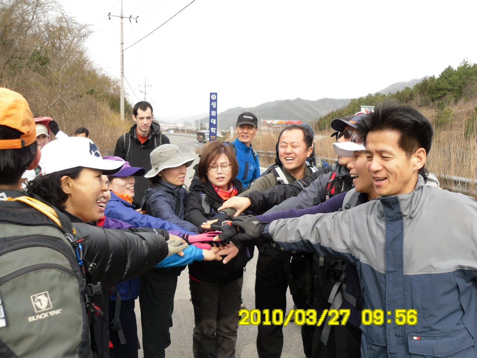
This time, two of my Stammtisch* friends joined this hiking; H is the owner of the restaurant where Stammtisch people meet. T is an English teacher who comes from Australia. There are not necessary strong hikers. Therefore it was a bit hard hike for them.

(Stammtisch is a casual English meeting place where anyone who want to speak English and exchange ideas in English can join. They regularly meet at a restaurant called "Pasta House" near KAIST every Wednesday evening.)

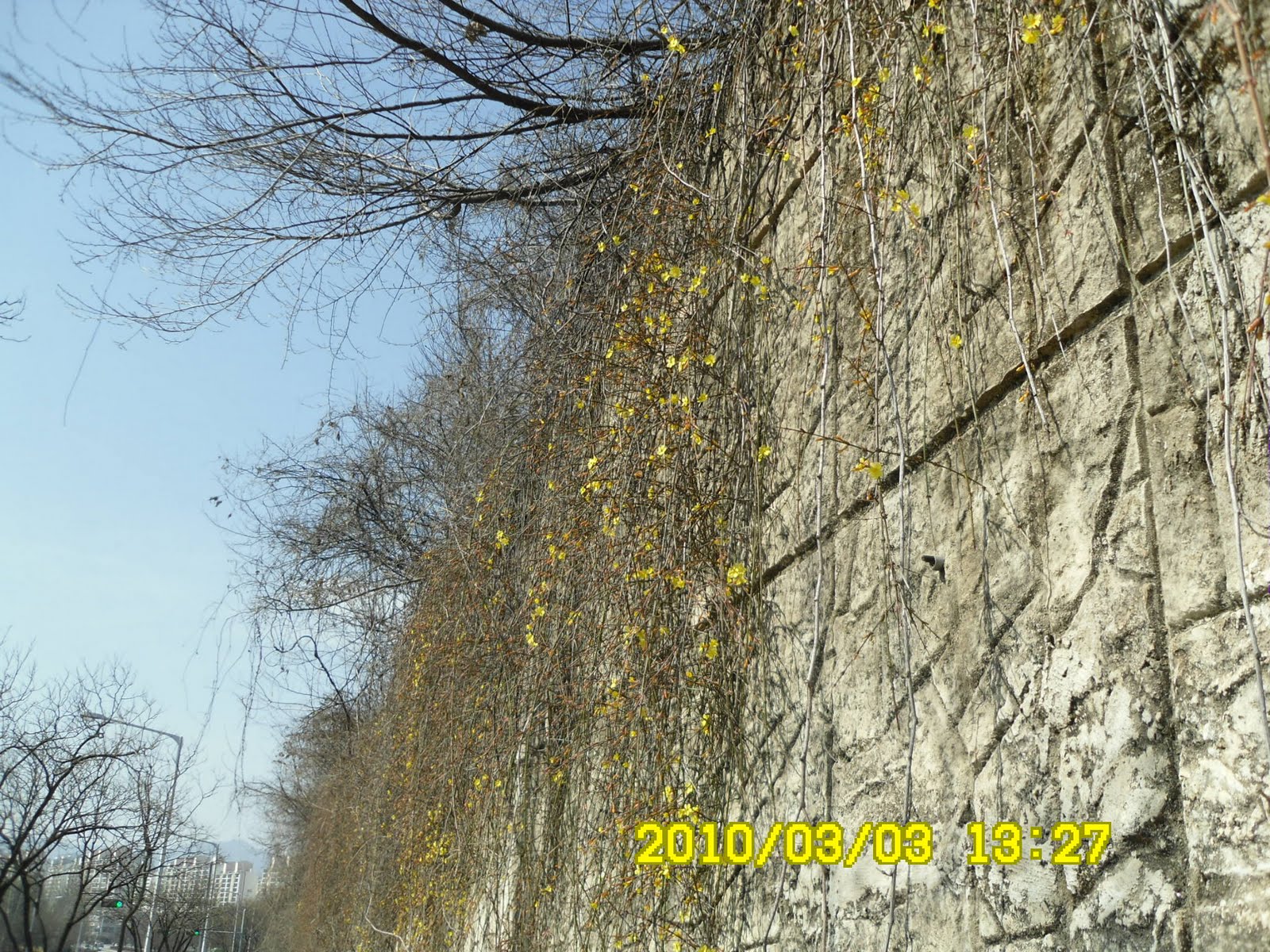
When we arrived at Naeji Port in Upper Island, it was still 10 a.m. We went through Naeji Village to the entrance of the steep trail. Naeji Village however is very unique and beautiful village. Wall of each house and concrete fences are all painted with colorful pictures and poems. They are fantastic!


[Pictures and poems on the wall in the village, 村の家々の壁には童話のような絵と詩が描かれていた。마을 집집의 벽에는 동화와 같은 그림과 시가 그려져 있었다.]

But we hurried to BulMoSan because we were informed that the ferry shall leave the port at 2 p.m. The first part of this hiking was difficult for my friends, because it was steep, and only up and up slope. They were the last two among 40 hikers.

We had early lunch on the ride of BulMoSan at 11: a.m. Then the wind was really strong and even a little rain began to fall. The mountain was covered with deep fog, and I was afraid of any accident. Be had lunch in the woods, so we could avoid the strong wind.


[Early lunch in the woods, 林の中で早い昼食、 숲 속에서 이른 점심]

When we began walking along the ridge, the strong wind stopped, and we could relatively easy to walk forward.

There are several steep parts of the trail, but such cases, there is an alternative trail for beginners. So 3 of us chose easier course, and arrived the fork of trails; one leads to GaMaBong (303m) and OkNyoBong (with another rock climbing) and the other leads to descend to the port.


[AhToSam members climbing up using the ropes, ロープを使って崖を登るアトサン会員、로프를 사용해서 벼랑을 오르는 아토회원들]

I recommended H and T to go down, not going to GaMaBong/OkNyoBong and they followed my advice. There was another guy who also chose this easy course.
So, four of us went down from the fork to the port.

When we looked up to the mountain, we could see AhToSan people climbing up to the steep ridge. We enjoyed talking and the nature while going down to the beach.


[AhToSan members climbing up the mountain, 濃霧の中、登山を続けるアトサン会員たち、농무 속 등산을 계속하는 아토 회원들]

We saw several groups of Jindalle flowers and blossoms of plum trees and etc., the sign of springs.


["Jindalle" or Korean azalea were in full bloom, 麓ではチンダルレが咲いていた。기슭에서는 진달래가 피어 있었다.]

We arrived at the port at 12:30 and had to kill time for one and half hours. The rest of hikers arrived at the port just in time at 2 p.m.

By this time, there was almost no wind, and weather became much better. There was a beautiful cruise ship in the harbor and a maritime police ship. When hikers arrived at the port, they enjoyed taking photos with such scenes.


[A cruiser ship at anchor, クルーザーが停泊していた。 크루즈가 정박하고 있었다.]

We returned to the port in Tongyeong, and had “after the hike” party with spicy soup called “Bude Jige” and some special wine called “Gugija” wine. We enjoyed the food and drinks very much. We came back to Daejeon at 7 p.m.

2010年3月20日(土)曇り、一時強風と小雨、今年14回目、アトサン194回目の登山。

今月に入って連続して島登山シリーズの第3弾として慶南・統営市の「蛇梁島(サリャンド)」を目指した。蛇梁島は韓国南部の閑麗(ハルリョ)海上国立公園中心部に位置し、3つの有人島と5つの無人島からなる島嶼群を言う。

このうち大きな島は上島と下島といい、向かい合っている。アトサンは2年前の2008年3月15日に、下島の七賢山(348m)に登っている。

今回は当初、上島の智異望山~仏母山~カマ峰~玉女峰の縦走コースを登る予定だったが、前夜からこの日の午後にかけて低気圧が半島を横断し、そのため全国的に雨と、強風が予想された。

最悪の場合、フェリーが欠航することも予想され、アトサン運営チームはその場合に備えて代替登山として統営の「弥勒山(461m)」も準備していた。


[In side of the ferry boat, フェリーの内部、페리 내부]

しかし、幸いなことに、暴風波浪注意報は発令されず、フェリーは運航した。ただし、曇天の濃霧で、目玉の智異望山へ登っても智異山は望めないことが明らかで、全体の登山を短縮し、仏母山(400m)~カマ峰(303m)~玉女峰(261m)だけを登山することにした。

今回は水曜日の英語サロン「スタムティッシュ」からパストハウスの女主人であるHとオーストラリア人のTが参加した。

また、大田印刷人山岳会の中年男性9名がまとまって参加したこともあり、全体ではほぼ満員の40人の参加となった。

バスはエキスポ南門駐車場を3週間連続で6時に出発。途中2回ほど休憩して統営のサンジョクアム(상족암)遊覧船乗り場に9時20分に到着した。当初10時出発の予定だったが、予定を早め9時40分には出港し、10時には上島の内地港(내지항)に着いた。船は小型でアトサン40名借り切りだった。

内地港の漁村は家や塀の壁にきれいな童話のような絵と詩が描かれている。どうも内地マウル(村)は童詩マウルとして有名らしい。登山時間が限られていて、この村の写真をゆくり撮れなかったが、それでも後で見てもきれいだ。


[Pictures and poems on the wall in the village, 村の家々の壁には童話のような絵と詩が描かれていた。마을 집집의 벽에는 동화와 같은 그림과 시가 그려져 있었다.]

この村を過ぎるとすぐにガレ沢の直登で、山登りに慣れた会員とそうでない会員との差がすぐに出た。スタムティッシュのHとTは当然最後尾で、それもかなり離されてしまった。この登りは勾配もきつくて足場も悪く、湿度と温度が高かったためすぐ汗だくになった。

それでも1時間ほど登りきると尾根にでた。尾根に出ると強風注意報の予報がぴったりのものすごい強風でしかも小雨まじり。これから岩場が大変と思った頃、尾根の林の中で早くも昼食をとった。


[Strong wind on the ridge, 尾根は強風、능선이는 강풍이 불고 있었다.]

昼食後、幸いなことに小雨と風は止み、岩場はなんとか切り抜けた。仏母山は石標がわからず通過し、尾根伝いに1時間ほど進むと、カマ峰/玉女峰へ至る道と、テハン(대항)船着き場へ下る道との分かれ目に来た。


[At the fork, 分かれ道にて 갈림길에서]

私は、HとTには岩登りが続くカマ峰/玉女峰は無理と判断し、テハン方面へ下る方を選んだ。同行したのはニックネームが「ハハ」という50代の男性だけで、他は全員がロープや80度近い階段のあるカマ峰/玉女峰方面を選んだ。


[OkNyoBong appears as the fog getting cleared、霧が晴れて玉女峰が姿を現してきた。안개가 개서 옥여봉이 모습을 나타내 왔다.]

下りの道を慎重に下って行くと天気は次第に回復し、港に出た時はもう風はほとんどなく、凪のような状態だった。

港近くの丘にはチンダルレの群落がいっせいに咲き誇り、梅の花も満開だった。


帰りの船は2時に出港のはずだったが、結局2時半ごろにずれ、それでも3時前には半島側の港に着いた。


[Return ferry was larger than going ferry, 帰りのフェリーは大型だった。귀로의 페리는 대형이었다.]

駐車したバスの横で恒例のティップリのメニューは「部隊チゲ」と呼ばれるチゲ料理と薬酒とされる「枸杞子(クギジャ)」酒のごちそうだった。


[Tipurri Menu: Bude Soup & GuGiJa(Chinese matrimony vine) wine, ティップリは部隊チゲと枸杞子酒]、됫풀이는 부대찌개와 구기자주]

2010年3月21日日曜日

100319 GeRyongSan/JangGunBong (500m) 鶏龍山・将軍峰

March 20 (Friday), 2010. Fine. Alone-hiking.

Since it was not a group, but “alone” hiking, I took a bus (#107) from Yuseong Hotspring Station. The course: HakBongGyo – ByongSaGol Entrance – JangGunBong (500m) – GatBawui – SinSongBong – KeunPeJe – DongHakSa Bus Stop.


[The map which shows the course, 今回の登山コースを示す地図、이번 등산 코스를 나타내는 지도]

I started walking at HakBongGyo (Gyo means bridge) before 8 a.m. Walked along YongSuCheon (Cheon means river) after turning right at the 2nd HakBongGyo for 400m until the entrance of GeRyongSan National Park called ByongSaGol.


[JangGunBong which I looked up from the bank of YongSuCheon), 龍水川(ヨンスチョン)の川岸から見上げた将軍峰,용수천 강가로부터 우러러 본 장군봉]

The trail leads to a steep rocky part with several ropes for the sake of hikers. It is so steep that you can earn altitude easily. I could see good view of lower mountains such as “SuTongGol” while climbing the mountain.


[A view from the steep slope near JangGunBong、将軍峰付近からの展望、장군봉부근에서의 전망]

This time, I felt like I came to the winter-mountain again because the trail had been covered with snow and ice. Actually the whole trails on the ridge were covered with snow. I should have brought climbing irons because I slipped once at the ridge. Fortunately I did not fall from the ridge, but I was a little bit scared, and thanked God for not falling from the cliff.


[The peaks of GeRyongSan,鶏龍山の峰々、계룡산 봉우리들]

I reached at JangGunBong (500m) at 9:20 and had a hot coffee there. While walking the ridge from JangGunBong to SinSongBong, it became noon and I had lunch between GatBaWui and SinSongBong.


[At the tope of JangGunBong, 将軍峰頂上にて、장군봉 정상에서]

Down walk from SinSongBong to DongHakSa parking lot was pleasant and easy “promenade.” It was a gentle descend with wide trail. I saw a couple of beautiful little birds with black wings and orange and while skin feathers. They seem not afraid me so I could take pictures of them.


[A bird which came close to me, 私に近づいてきた小鳥 나에게 근접해 온 작은 새]

When I arrived at the bus stop at DongHakSa Parking Lot, it was 2 p.m., so it was about 10 km-6 hour hike. It was my 13th hike for this year.

2010年3月20日(金)快晴

今回は、単独ハイキングのため、儒城から108番のバスを利用。コース:鶴峰橋バス停~ビョンサコル公園入り口~将軍峰(500m)~カッパウィ~神仙峰~クンペジェ~東鶴寺駐車場。所要時間約6時間。

8時前に鶴峰橋前で下車、歩き始めた。第2鶴峰橋を渡ってから右折、ヨンス川(용수천)にそって400m下ったところから左折してビョンサコル(병사골)の公園入り口から登山開始。


[I got a good view soon after the start of rock climbing.岩登りを始めるとすぐに展望が開ける。바위오름을 시작하면 곧 전망이 열린다.]

登り始めてすぐ急こう配のロッククライミングで、展望がみるみる開ける。天気も良いので最高だ。500mも登ると稜線に出る。この日、稜線は、最初から最後まで雪道で、部分的に凍ってアイゼンなしではやや危険。実際、1回滑って尻もちをついた。

[The trails were covered with snow.登山路は雪に覆われていた。등산로는 눈에 덮혀져 있었다.]

将軍峰には9時20分に到着した。ここまで雲ひとつないいい天気で、鶏龍山・ストンコル(수통골)の峰々を越えた遠い先の山々まで見えた。12時前に男妹塔へ着けば、三仏峰から観音峰までの主脈縦走をするかとも思ったが、将軍峰から男妹塔の手前の神仙峰までの尾根歩きはけっこうきつい。

アップダウンに鉄棒の手すりやロープがあるが、それでも気合いが入る。たぶんカッパウィ(갓바위)を過ぎた男妹塔手前1.6キロ付近で12時になり昼食にした。


[The first part of the rock climbing with rope, 将軍峰への最初の難所、장군봉에의 최초의 험한 곳]

昼食を食べてから神仙峰を過ぎてクンペジェ(큰배재)まで約1時間。クンペジェからは広い下山路で雪はなく、1時間弱でバス停に着いた。


[You can see the peaks of GeRyongSan on my bak, 鶏龍山の峰々をバックに 계룡산(鷄龍山)의 봉우리들을 배경으로]

途中、きれいな小鳥が近づいてきたので林檎の皮をやったがあまりよいマナーではない。前回、甲寺への登山路の脇に林檎の皮は農薬が残っているから鳥には毒だと書いてあったことを思い出したが、それをかじっている自分はどうなんだと思った。


[A bird which came close to me, 私に近づいてきた小鳥 나에게 근접해 온 작은 새]

午後2時にはバス停に到着した。最後まで快晴だったが、午後になって風が強まった。これは私にとって、今年13回目のハイキングである。