Destination (mountain): Mt. Jiri (Nogodan – Piagol)
Hiking course (B course) : Samseongjae – Nogodan – Imgeolryong – Piagol – Jikjeon (12.9 km, 6 hours9
Partner: About 30 AhToSan members (including Eric)
We left Expo South Gate at 5 am. I had to get up at 3:45 and left my apartment at 4:15 am. I arrived at the bus stop at 4:45. Eric came at 5 am.

[A picture of "BaemSaGol", ペムサコルの写真(Aコース)、뱀사골 사진 (A 코스)]
We sat together and enjoyed our conversation. He brought a comic book this time and asked me the meaning of the conversations written in the book.
I thought comic books might be a good textbook for teaching Japanese.
I hope my explanations about those difficult Japanese conversations would be some help for Eric’s understanding Japanese and its culture.
We arrived at Banseon where A course people (5) started at 7:30 am. These five members are the strongest hikers among AhToSan.
The rest of us arrived at SeongSamJae a little before 8 am. The altitude of SeongSamJae is 1202m, so it was easy hike to Nogodan (1507m).

[A group picture of B course at SeongSamJae, ソンサムジェにてBコースの集合写真、성삼재에서 B 코스의 단체 사진,]
Yet, I could not keep up with the majority of other hikers. I walked last and Eric kindly kept accompany with me.

[George in front of Nogodan Lodge, 老姑壇待避所の前で、노고단 대피소 앞에서]
Eric and I arrived at Nogodan Lodge at 8:45 and Mt. Nogodan at 9:22.

[At Nogodan, 老姑壇にて、노고단에서]

On the way down from Nogodan to Nogodan Pass, we could catch up with the group of AhToSan, and we had a short break at Nogodan Pass, just like I did last year.

[With Eric on the way down from NoGoDan, 老姑壇から老姑壇峠へ下る道で、노고단에서 노고단 고개로 내리는 길에서]
While having the short break with my fruits sharing with other members, I noticed that they introduced “Limiting the number of hikers to Nogodan” system.
Some forest rangers adjust the number of hikers to go on at a time at the gate of Nogodan.


[Short break at Nogodan Pass, 老姑壇峠にて『スズキタイム』、노고단 고개에서 "스즈키 타임"]
After having the short break, we began ridge walking toward Imgolryong. The trail to Imgolryong was a bit narrow, but there were many hikers.
We arrived at Daejiryong where we had lunch last time, at 10:23. We had the 2nd short break here.

[The 2nd short break at "Dwaejiryong", 『テジリョン』にて二回目の小休止、"돼지령"에서 두 번째 짧은 휴식]
We kept ridge walking toward Piagol and we arrived at “Imgeolryong” at 10:45. There is a “yaksuto” or a spring and many hikers taking rest here. We also took the 3rd rest under a big rock.

[The 3rd short break at "Imgeolryong", 『イムゴルリョン』にて3回目の小休止、"임걸령"에서 3 번째 짧은 휴식]

[Jirisan Map at Imgeolryong, イムゴルリョンの智異山の地図、임걸령의 지리산지도]
I brought pettitoes and other members offered “soju” and some other homemade wine.
Some faster hikers of AhToSan went farther until Banyabong (般若峰), but we went back to the Piagol Junction (Imgolryong Samgori) and began descending toward Piagol.

[AhTo Members who went to Banyabong at the top of BanYaBong (1732m), 般若峰(1732m)へ登ったメンバーの集合写真、반야봉을 오른 멤버 단체 사진]
It was a bit steep down slope and I noticed the colorful autumnal leaves along the trail. We stopped at the place where there were most beautiful leaves of maples. We had lunch under the beautiful leaves.

[On the way down to Piagol, ピアコルへ下る途中で、피아골에 내려가는 도중에서]


[Lunch on the way down to Piagol, ピアコルへ下る途中で昼食、피아골에 내려가는 도중에 점심]
Eric did not bring his own lunch. So we shared our lunch with him.
We began “after the lunch” trekking at 12:10. We soon came to the river in the valley.

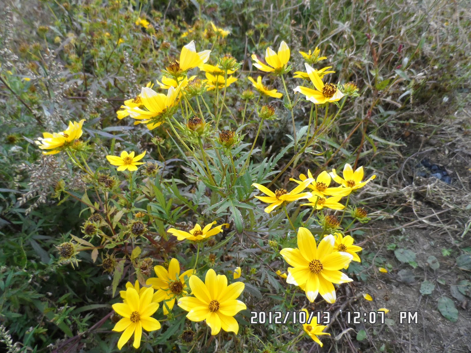
[Elsholtzia splendens Nakai near Piagol, ピアコルに咲いていた「コチャンユ(花香油)」、피아골에 피어있는 꽃향유]
We arrived at Piagol Lodge before 13:00. Just like last year, the autumnal colores there were the most beautiful.

[The autumnal color at Piagol, ピアコルの紅葉、피아골 단풍]


[With the President at Piagol, ピアコルにてアトサン会長と、피아골에서 아토산 회장님과 함께]
To my surpise, I found some members of A course there. It was really amazing. They walked so fast!
They uploaded the pictures of Bemsagol. They were really beautiful.

[Eric on the bridge in the valley, 渓谷の橋の上のエリック、피아골 다리 위에 서있는 에릭]
Eric and I always walked together, and we arrived at the parking lot of Piagol at 2:40 pm.
There were several hikers who arrived there at around noon! Wow, they were really fast hikers.
Those who went extra to Banyabong came to the parking lot after 3 pm. We had wrap-up party while waiting for them.
While they were preparing for the wrap-up party, I noticed that some of AhToSan members had been collecting some seeds of plants.
I asked them what they were. They said they were the seeds of “Tokomari (도코마리).” They said they were good for healing atopic skin conditions, rheumatic pains.

[An AhToSan member collecting the seeds of cockleburs, 「オナモミ(葈耳、巻耳)」を採集するアトサン会員、도꼬마리를 채집하고있는 아토산 회원]
When I checked by Net, it was originally from North America and it has variety of names such as Xanthium strumarium (syn. X. canadense, X. chinense, X. glabratum, Rough Cocklebur, Clotbur, Common Cocklebur, Large Cocklebur, Woolgarie Bur).
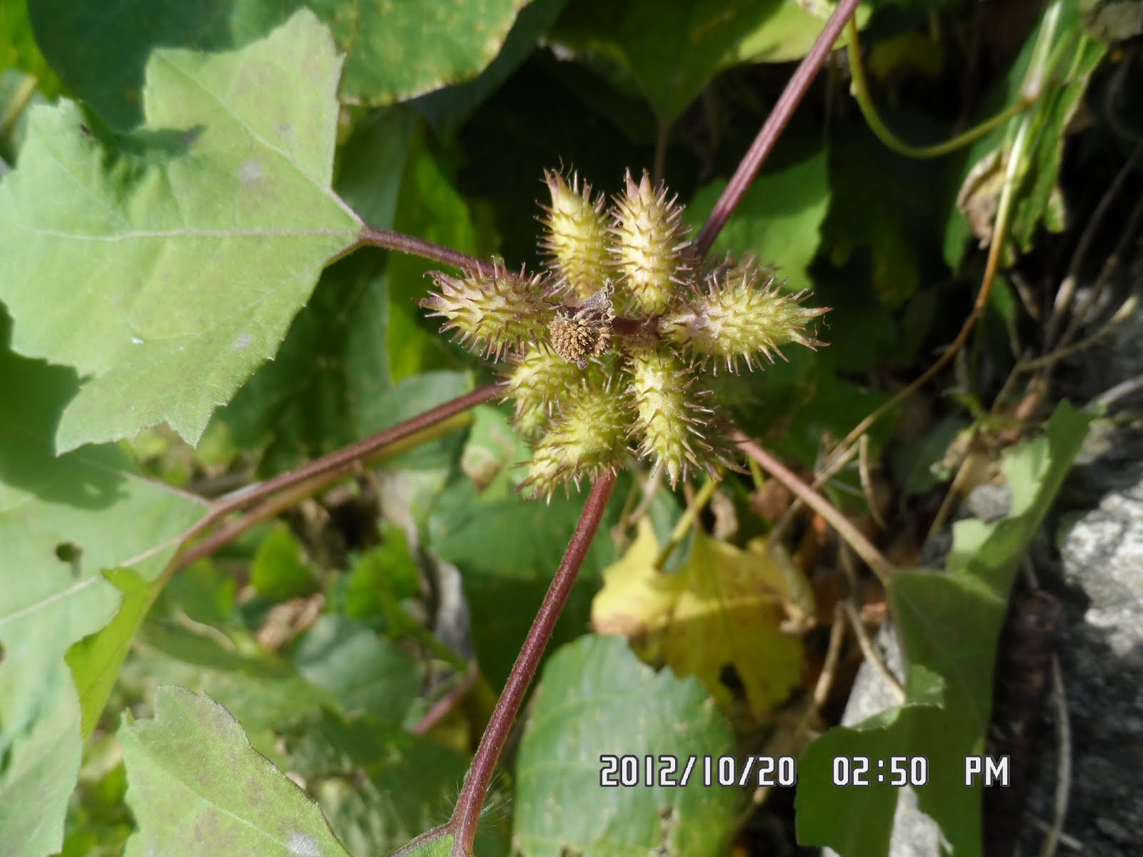
[“Xanthium strumarium” (syn. X. canadense, X. chinense, X. glabratum, Rough Cocklebur, Clotbur, Common Cocklebur, Large Cocklebur, Woolgarie Bur), オナモミ(葈耳、巻耳)、도꼬마리]
When I checked this plant, I found that there were Japanese names [オナモミ(葈耳、巻耳、学名:Xanthium strumarium)] as well, but there were no explanations about medical use in Japanese site of Wikipedia.
But for the same plant, if you check in English and Korean, there are explanations for medical use.
http://en.wikipedia.org/wiki/Xanthium_strumarium
I was amazed at their practical knowledge about plants.

[At the wrap-up party after the hike, ハイキングの後の打ち上げパーティにて、하이킹 후 뒤풀이 파티에서,]
We rounded up the party at around 4 pm and went back to Daejeon at 7:15.
It was my 53rd hike for this year and 292nd hike of AhToSan regular hike which I attended.
--------------------------------------------------------------------------------------------
登山月日:2012年10月20日(土)晴れ
登山地:智異山(老姑壇~ピアコル)
登山コース:
Aコース:バンソン( : 반선) ~ ペムサコル(뱀사골) ~ ファゲジェ(화개재) ~ ノルモク(노루목) ~ イムゴルリョン三叉路(임걸령삼거리) ~ピアコル(피아골) ~ ジクジョン(직전) / (18.7km, 9時間)]
Bコース:ソンサムジェ(성삼재1102m)~老姑壇(ノコダン노고단1507m)~老姑壇峠~イムゴルリョン三叉路(임걸령삼거리)~ピアコル(피아골)待避所~ジクジョン(직전) 12.9km, 6時間
参加者:Aコース5名、Bコース:26名
今回はペムサコルから延々と登るAコースの山行予定時間が9時間と長いので、出発が普段より2時間早い5時だった。

[A picture of "BaemSaGol", ペムサコルの写真(Aコース)、뱀사골 사진 (A 코스)]
これでは4時に起きてもそれからご飯を炊いていたのでは間に合わないため、前夜のうちに準備した。
3時45分に起床し、4時15分にはワンルームを出た。エリックは出発ぎりぎりの5時に南門に到着した。
出発地のソンサムジェに到着するまで、隣に座ったエリックと話しをした。今回はコミックを持参し、日本語の会話の難しい部分を質問した。
少女雑誌のような気もしたが、コミックの会話の内容は結構難しく、漢字も振り仮名がないものが多く、独学では大変だろう。私の説明が役立つとよいが。
さて、ペンサコルから延々と登るAコースに挑戦した猛者は流水や百里香ら5人だけ。残りの26人はBコース及びBコース+般若峰(반야봉)コースをとった。
ソンサムジェの入り口で集合写真を撮ってから、老姑壇退避所までのゆるやかな登りを進むうち、みなに遅れを取ったが、エリックだけは終始同行してくれた。

[A group picture of B course at SeongSamJae, ソンサムジェにてBコースの集合写真、성삼재에서 B 코스의 단체 사진,]
老姑壇退避所から老姑壇峠までの道は直進すれば近道のところを右折してしまい、よけいに皆と遅れた。

[Eric in front of Nogodan Lodge, 老姑壇待避所の前で、노고단 대피소 앞에서]
老姑壇峠では老姑壇へ入る人数を調節するため登り口で人数制限をしていたが、緩やかな統制だったため、勝手に入ってしまって後で気が付いた。
老姑壇ではアトサンへ初めて参加した新人が数人いたきりで、エリックと二人で写真を撮っただけ。ただ、峠へ下る道で、サンサランやチョンダウンたちに追いついた。

[Eric and I at Nogodan, 老姑壇にて、노고단에서]
昨年同様、ここで果物を食べる「スズキタイム」とした。

[Short break at Nogodan Pass, 老姑壇峠にて『スズキタイム』、노고단 고개에서 "스즈키 타임"]

老姑壇峠から尾根伝いの道は2008年以降で3回目だが、この時期は紅葉も半端であまり見どころはない。野生花もほとんど見かけない。それでもハイカーは多く、少し遅いハイカーがいれば渋滞になるし、気の早いハイカーは次々と追い抜く。
ただ、1時間ほど進んだ頃から展望が開け、山々に雲がかかる智異山らしい風景が楽しめた。

昨年昼食をとった『テジリョン(되지령)』には10:23に到着。

[The 2nd short break at "Dwaejiryong", 『テジリョン』にて二回目の小休止、"돼지령"에서 두 번째 짧은 휴식]
このあと10分後に天王峰とピアコルとの分岐点[イムゴルリョン三叉路(임걸령삼거리)]に到着したが、今回は天皇峰方面に約20分ほど進み、『イムゴルリョン(임걸령)』まで進んで休憩して引き返すことにした。

[A map of Mt. Jiri at the junction of three trails,イムゴルリョン三叉路の地図、임걸령 삼거리에서 지도]
イムゴルリョンには飲み水が出るヤクスト(薬水場)があり、岩場がある。その岩場の陰で私が前日購入した「チョッパル」を提供し、他の会員が持参した焼酎を一杯ずつごちそうになった。

[The AhToSan President at Imgeolryong, イムゴルリョンにてアトサン会長、임걸령에서 아토산 회장님]
ここでは11:00まで休憩し、ピアコルへの分岐点(三叉路)まで引き返してピアコルへと進んだ。
この尾根からピアコルまでの下りはかなり急こう配で、どんどん高度を下げる。それと同時に紅葉が目に着き始めた。

[On the way down to Piagol, ピアコルへ下る途中で、피아골에 내려가는 도중에서]
紅葉が一番見事な場所にちょうどちょっとした空き地があり、そこでチョンダウンやサンサランたちといっしょに昼食にした。

[Lunch on the way down to Piagol, ピアコルへ下る途中で昼食、피아골에 내려가는 도중에 점심]
エリックは昼食を用意していなかったため、私の弁当のみそ汁容器にご飯をいれて箸と共に渡した。すると他の会員もごはんを加えたので1回分の食事となった。
食事休憩は20分ほどで、また紅葉を愛でながら、下り続けた。

[The autumnal color at Piagol, ピアコルの紅葉、피아골 단풍]

[The autumnal color at Piagol, ピアコルの紅葉、피아골 단풍]
途中、台風で倒されたと思われる大木が目につき、道にかかっている場所ではその大木がスパッとみごとに切断されていた。
そのような大木の切断された場所を過ぎるとピアコル待避所で12:47にに到着した。

[The president and Eric at Piagol Lodge, ピアコル山荘付近にてアトサン会長とエリック、피아골 산장 부근에서 아토산 회장님과 에릭]
昨年同様、この待避所のそばの渓谷が紅葉がもっとも見事な場所だった。
おどろいたことに9時間コースを歩いたはずの流水たちがすでに到着していた。かれらの健脚はじつにおどろくべきものだ。
ピアコル待避所から続く渓谷沿いのコースは意外と岩がごろごろとしている悪路であまり好きではない。また、紅葉も待避所を過ぎるとあまり見事なものは見られなかった。
私はどうしても他のメンバーのスピードにはついていけないようだが、エリックが常に一緒に歩いてくれるのはありがたい。
待避所を一足先に出発したものの、結局チョンダウンと流水たちのグループに追い越された。
しかし彼らは吊橋の下の渓谷に降りて足を洗って休憩していた。彼らをこの時点で追い抜きはしたが、結局また追い越された。
昨年イベントをしていた場所は今年はなにもなく、最後は渓谷を右にみながら、ピアコルを抜けた。
ピアコルの食堂街を抜けた大型バス駐車場に到着したのは2時半ごろだった。
今回初めて参加した男女が熱心に草の実を集めているので聞いたら「トコマリ(도코마리)」という草の実でアトピー性皮膚病に効果があると言う。

[AhToSan members collecting the seeds of cockleburs, 「オナモミ(葈耳、巻耳)」を採集するアトサン会員、도꼬마리를 채집하고있는 아토산 회원]
[“Xanthium strumarium” (syn. X. canadense, X. chinense, X. glabratum, Rough Cocklebur, Clotbur, Common Cocklebur, Large Cocklebur, Woolgarie Bur), オナモミ(葈耳、巻耳)、도꼬마리]
ネットで調べると、この草は日本名は「オナモミ」で「ひっつき虫」で知られていて英語名はXanthium strumarium (syn. X. canadense, X. chinense, X. glabratum, Rough Cocklebur, Clotbur, Common Cocklebur, Large Cocklebur, Woolgarie Bur)といろいろあるが、「Cocklebur」と言われるようだ。原産地は北米らしい。
この植物は日本でもみかけるが、薬草として採集している人をみたことはない。常々感じることだが、どうも韓国の人々の方が薬草に対する知識が多く、また実際に実用化しているようだ。
さて、打ち上げパーティはトンソクとウォンマッコリで3時過ぎに始まり、我々が最も早くゴールインしたグループで最後は般若峰(パンヤボン)まで登ったテンピ、フリージア、秋の日記たちだった。

[At the wrap-up party after the hike, ハイキングの後の打ち上げパーティにて、하이킹 후 뒤풀이 파티에서,]
打ち上げパーティは4時過ぎに切り上げ、南門に戻った時間は7時15分ごろだった。今回は今年53回目の登山でありアトサン定期のトータルでは292回目。