About pictures/当ブログ内の写真について/당 블로그내의 사진에 대해서

Most of the pictures in this blog are taken by my camera, yet some of them were downloaded from the website of the hiking club. If you click any pictures, they become the original size.

当ブログ内の写真の大部分は筆者のカメラで撮影したものですが、一部、山岳会の共有写真からダウンロードしたものを含みます。すべて、各写真をクリックすれば、元のサイズに拡大します。

당 블로그내 사진의 대부분은 필자의 카메라로 촬영한 것입니다만 일부 산악회 공유 사진으로부터 다운한 것도 포함합니다. 모두 각 사진을 클릭하면, 원래 사이즈에 확대합니다.

2010年9月30日木曜日

100911, Mt. BiRyongSan, HweRongPo, Yechon, GyeongBuk, 慶北・醴泉・飛龍山/回龍浦

Date: Sep. 11 (Sat) 2010 Rain all over Korea, but no rain where we were hiking.

Place: BiRyongSan/HweRyongPo, Yechon, Gyeongsangbuk-do

Course: Parking Lot – JangAnSa Temple – Beacon Stand – No. 2 Observation Stage – Mt. Three River Front – Mt. Chair - Mt. JeokSeokBong – YongPo Village – Parking Lot (about 4.5 hours)

Partners: 25 AhToSan members

It was raing all over Korea in the morning. Yet 25 members came to the bus. We originally planned to climb Mt. WolAkSan in ChungBuk, but all mountains in Korean National Park were closed that day. We had to go alternative mountains.

Staff members of AhToSan asked the members for accessible mountains. One of experienced hikers, “DulMujige” suggested “Mt. BiRyongSan” in Yechon, GyongBuk province. The mountain is located near his hometown, Andong, so he knew the area quite well.


We arrived at the entrance of Mt. BiRyongSan at 10 a.m. It was a low mountain, yet well facilitated and we can hike safely even in the bad weather.


However, it was not raining that area. We started walking after taking the group picuture.

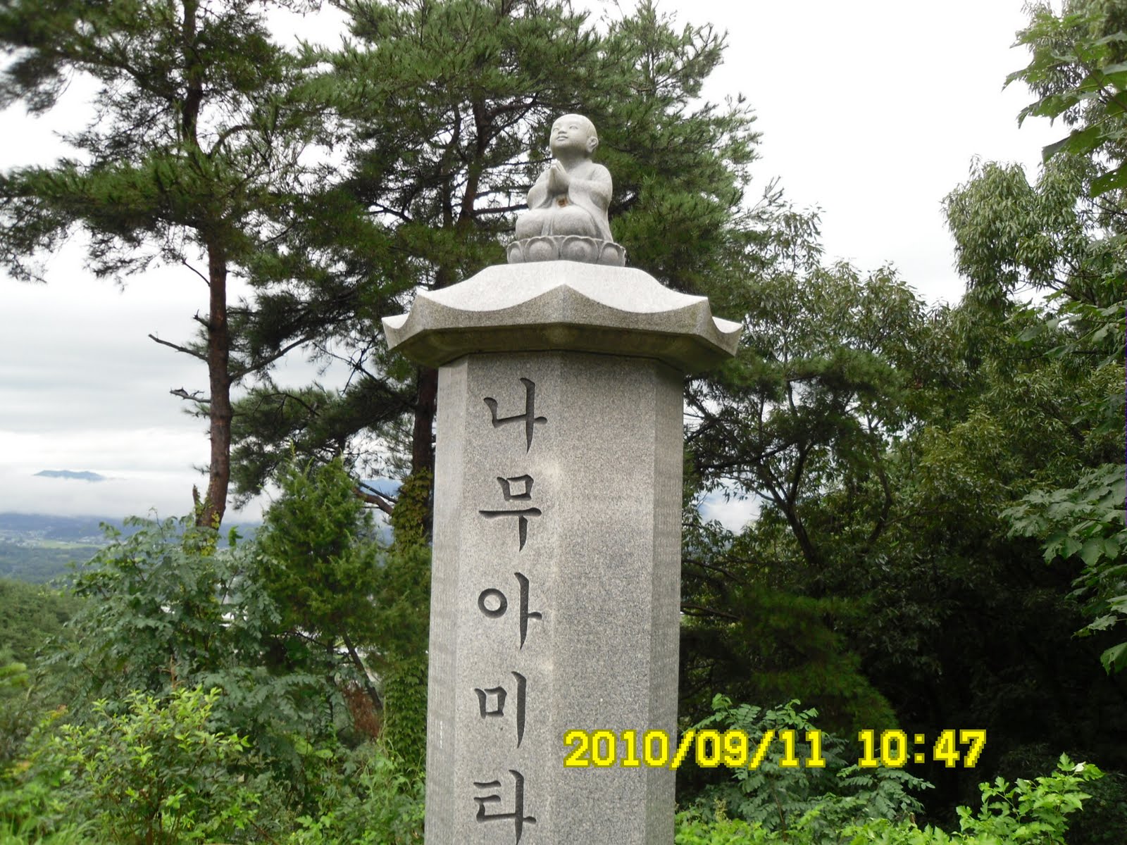
We walked on the gentle slope and soon arrived at a temple named JangAnSa Temple where there are several stone statues.


Then we came to the 2nd observation plateform from where we had good command of The NakDongGan River. The river makes beautiful S shape curve and we could see it well.


We had lunch there. There was a two story gazebo. In case of rain, we could use of the facility to shelter ourselves. But no rain. I joined the couple named “NulBo” and shared our lunch dishes. They liked my “duck meat” and I liked their pork dish.


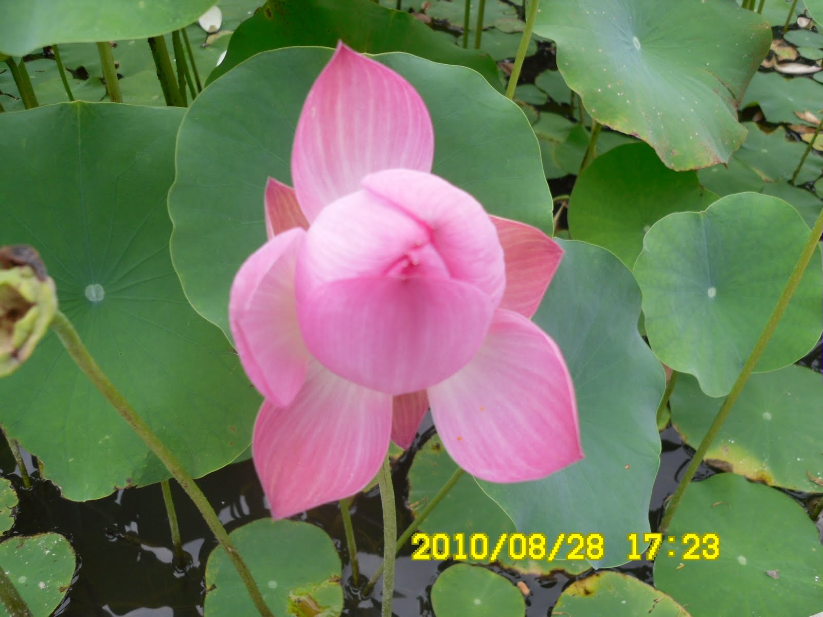
We had another group picture here and stared trekking again. After walking up and down, we came to the river side. The water in the river was plenty due to the rain in the previous days. There was an interesting small and long bridge named “PyongPyongDari.” The plants along the trail were also plenty and beautiful


We came back to the place were we started the hike at 2:30 p.m. It was a 4 hour and half trekking and we had no rain at all.


It was not only our hiking club, AhToSan, to change the destination. There were 2 other buses near our bus. They began “tippuri” party just like us. But we had the longest party from 3 p.m. to 4:15 p.m. We enjoyed our “tippuri” party with plenty of food such as “도토리묵” or “acorn-starch jelly paste” and “더덕 막골리” or “Makgolli” wine with “deodeok mountain herb”etc.

We came back to Expo South Gate Parking Lot before 7 p.m. and I came back to my room by taxi, because it was still raining in Daejeon.

I am really happy that AhToSan never give up hiking no matter the weather is.

日時:2010年9月11日(土)全国的に雨(ただし、山行地は曇り)

登山場所:慶北・醴泉(예천イェチョン)の飛龍山(ピリョンサン비룡산)・回龍浦(フェリョンポ회룡포)

コース: 駐車場~長安寺(장안사)~狼煙台~第2展望台~三江前峰(삼강앞봉)~椅子峰(의자봉)~チョクソク峰(적석봉)~龍浦村(용포마을)~駐車場(4時間30分)

同行者:アトサン会員25名

この日は全国的に雨。大田も朝から雨で、タクシーでエキスポ南門駐車場へ。このような天候でもアトサンは登山を中止しない。しかし、予定していた忠北・月岳山(ウォルアクサン)国立公園は入山規制がかかって登山できない。

やむなく、アトサンスタッフは会員と相談して、雨天でも安全に登山できるということで、慶北・醴泉(예천イェチョン)の飛龍山(ピリョンサン비룡산)に登ることにした。提案したのは安東出身のトルムジゲ(野の虹)氏である。


駐車場に着いたのは10時。山行概念図のある登山口で記念撮影をしてから出発。


たしかに登山道は広く、よく整備されていた。真新しい石の仏像のある長安寺を経由して、第1展望台を過ぎ、第2展望台で11時半になった。


ここは展望台も広く二重構造なので雨が降り出せば雨宿りが容易だ。しかし、いまにも降り出しそうな空模様ではあったが雨は降らず、広いテラスで弁当を広げることができた。

この展望台からは洛東江が回流する部分がよく見えた。私は比較的小さな「トッチャリ(敷物)」でヌルボ夫妻と「七甲山」とともに弁当を食べた。


今回も持参した「オリゴギ(カモ肉)」は好評。しかしヌルボ夫人が料理した豚のふくらはぎを使った辛い煮物がうまかった。

ここでも団体写真を撮影後、低い峰を2,3上り下りした後、洛東江のほとりに出た。


「ピョンピョンタリ」という細い橋を横目に見て川沿いの細い道を30分ほど進むと、最後の上りがあり、そこを登ると登山開始した地点に戻った。


4時間半ほどのトレッキングで実に適切なチョイスだった。他の山岳会もバス2台別々に駐車していて、それぞれティップリをしていたが、我々のティップリが一番長く、ティップリ開始が3時で終了は4時15分だった。


まず、ウポが用意したトトリムックとトドク・マッコリ、次にメインディッシュの野菜が豊富に入ったプッチム、最後にサリキノコ・豚汁が出た。マッコリの味が良くてかなり飲んだ。

南門には7時前に着きタクシーで戻った。こんな天気でも登山ができるアトサンに感謝。

2010年9月26日日曜日

100904, Mt. SangHakBong and Mt. MyoBong at SongNiSan, ChungBuk 忠北、俗離山国立公園内、上鶴峰と妙峰

Date: Date: Sep. 4 (Sat) 2010

Place: Mt. SangHakBong (834m) and Mt. MyoBong (879m) in SongNiSan National Park, BoEun, ChungBuk Province.

Partners: 45 AhToSan members including Bernardo and his 6 colleagues at KASI (Korea Astronomy and Space Science Institute).

Course: Yonghwa Hotspring – MaeBong – SangHakBong – MyoBong – YoJeokAm – SaNaeRi Parking Lot (About 12 km, 6-7 hour hike)


It was the first hike in September. The mountains are in the famous SongNiSan National Park, yet the couse was not very popular, so we could enjoy less crowded, yet, interesting rocky hiking.

The seats of AhToSan chartered bus were full with reservation again. I am especialy happy that my Mexcan friend, Bernardo brought 6 young fellow workers from his institute, KASI, including Masashi, a Japanese, and Po from Thailand.


Since the hiking location is close from Daejeon, we began walking even before 9 a.m.

We began walking from the village center near Yonghwa Hotspring. The trail was a gentle slope, and there were peper field on both sides.

There were “commelina communis,” commonly known as the Asiatic dayflower. The name of this flower in Japanese is “Tsuyukusa” or “dew flower,”similar idea of English common name. But its Korean name is “Tak-wi-chang-pul” which means “chicken’ long grass.” It may look like the head of rooster, and they grow very long. I saw a banch of this flowers on the middle of steep cliff.


After walking about 30 minutes, we came up to the ridge, and we had “Suzuki Time” for rest and eating “grapes.” I offer fruits while other members provide “makgeolli” Korean traditional rice wine. I always enjoy this “rest time” and makgeolli.


After walking about one hour, we came to the ridge of good view. I could not see MaeBong, but I found SangHakBong easily because of the wooden marker.


The youngest member was “Po” from Thiland. She is in the middle of 20s. She is rather tall, active and lovely. She wore jersey pants, and they looked too warm for this kind of weather.


However, it became noon when we passed SangHakBong, so I called my fellow hikers to have lunch there. I ate lunch with several new-comers. We share lunch among hikers. I brought duck meat again and it was popular among those who shared the lunch.


After having lunch, we soon started walking, and we arrived at Mt. MyoBong at 1:25 p.m. Up till then, I was with the top group hikers.


From MyoBong to the down slope, we mistook the trail and had to return for about 15 minutes. Then I was behind the top group, yet, ahead of the 2nd group. As the result I was walking alone.


When I came down to the foot of the mountain, I noticed that there were many big pine trees which were hurt on the trunks with the sape of “heart.” These scars were made during the period of Japanese ruling the peninsula. They collected pine resin oil when they run out of fossil fuel. Foretunately, there were no explanations about “evil deeds” by Japanese ruling of the peninsula 65 years ago.


I came down along and came out to the paved road. Then I saw the 2nd group of AhToSan people were enjoying themselves in the river.

They invited me to join them, but I did not join them. I did have extra clothes, but it is bothersome to change clothes.

Then I saw some members of the 1st group, again in the river. Among them, a husband of the young couple spoke to me while walking. I talked about Japanese mountains with him, all the way to the bus stop.


The parking lot was rather far way (about 4 km or so), so one of the staff members, went to pick up the bus and persuaded the bus driver to come to pick up the members from the parking lot.

The driver agreed, so the rest of members could take on the bus on the way to the parking lot. Then we had “tippuri” party at the parking lot.

The menue of the “Tippuri” was duck meat and makgeolli. I continued to talk about moutains in Japan with the guy while drinking makgeolli.


After the party, we were on the way to Daejeon. The driver stopped at the famous pine tree of SongNiSan. The pine tree is famous about its good shape. There is a legend that a king loved the pine tree very much, so ge gave high official rank to the tree.


We came back to Daejeon at 7:15 p.m.

2010年9月4日(土)、快晴

登山場所:忠北(チュンブク충북)報恩(ポウン)보은、俗離山(ソンニサン속리산)国立公園内、上鶴峰(サンハクボン상학봉834m)-妙峰(ミョボン묘봉879m)

同行者:ベルナルド、マサシら天文宇宙科学研究院の若者7人を含むアトサン会員45名

コース:龍花温泉[ウヌン1里(운흥1리)]-鷹峰(メボン매봉)-上鶴峰-妙峰-ヨジョク岩여적암-ヨジョク岩谷여적암골-サネリ사내리駐車場(俗離山観光ホテル付近)で歩行距離は12キロ、歩行時間は6時間~7時間。


9月に入って最初の登山は有名な俗離山国立公園内で比較的登山者が少ない北西方面の岩場の多い上鶴峰と妙峰だ。

今回も前回2回に引き続き座席はいっぱいで、空きはない。今回は特にベルナルドが日本人のマサシを含む仲間の若者6名を連れてきてにぎやかだ。外国人はマサシと私の日本人が2人、メキシコ人とタイ人の計4名である。

登山場所が近いので出発点の龍花温泉[운흥(ウヌン)1里)には8時48分に到着。9時前にはもう歩き始めた。

今回のコースはウヌン1里のマウル会館脇を通ってしばらく平坦な上り坂で左右に畑があり、やがて山に入ってからも前2回ほどの急坂はなかった。


途中、ツユクサが目についた。韓国語の名前は「タクエチャンプル(鶏の長草) 닭의장풀」だが、絶壁の途中にちょうど花束のように群生しているのが見えた。

30分ほどの上りで稜線に出て、「スズキタイム」にしたが、今回はブドウだけ購入。アランドロンのパングルトマトが新鮮でおいしかった。また、途中でごちそうになるマッコリはいつもうまい。

1時間ほどの登山で見晴らしの良い稜線にでた。ミナムボンやメボンはわからなかったが、上鶴峰は標識があってわかりやすい。

ベルナルド一行のうち、一番若いのはタイからの研修生スランカナ・ルクデーで、別名「ポー」。大柄の女の子だがなかなか愛嬌がある。しかし、この天気でジャージーは暑そうだ。


上鶴峰を過ぎた稜線で、比較的見知らぬ連中と昼食にした。ベルナルド一行に声をかけたが彼らは別の場所を探して食べたようだった。私が持参したおかずのうち、前回同様、オリコギ(カモ肉)が人気だった。


食後、ちょうど1時にアムヌンを通過。1時25分には妙峰に着いた。ここまでは先頭組といっしょだった。

妙峰から下山路に入るところで先頭組とともに道を間違え、数10メートルほど引き返して下った。

渓谷に沿ってのくだりでは、先頭よりは遅れ、次のグループよりは前を歩き、結局独り歩きになった。
今回も近頃降った雨のせいか、さまざまなキノコが目についた。


ふもと近くになると樹齢100年を超す松の大木の幹がハート形に傷つけられているのが目についた。これは植民地時代に化石燃料が不足したため、松脂を採った跡だが、幸いなことに日帝の悪行を記した記述はなかった。


渓谷沿いに下りて舗装道路に出た部分がヨジョクアムらしかったが、この部分で第2グループが水遊びをしていた。


私は着替えを持ってはいたが後処理がめんどうなので川には入らなかった。途中、先頭グループの中の最後尾の3人が川に入っているのをみて、このうち、夫婦のうちの男性と日本の山の話をしながらあるいた。

俗離山の駐車場までは舗装道路を延々と歩かなければならない。先頭のチョンジョンが駐車場まで歩き、バスをピックアップしてマウル会館まで迎えに来てくれた。

全員をピックアップしてから駐車場へもどり、こちらでティップリ。今日のメニューはオリコギ(カモ肉)とマッコリでじつにうまかった。


日本の山の話をしたと男性と引き続き話をしながら飲んだ。

かえりがてら、名物の松の前で記念撮影をした。ここを5時半に出発しても、今回は近場なので、南門には7時15分に着いた。

2010年9月24日金曜日

100828 Mt. NaeYonSan (HyangRoBong:930), Pohang, GyongBuk, 慶北・浦項、内延山(香爐峰:930m)

August 28 (Sat) Cloudy

Destination: Mt. Naeyonsan (HyangRoBong:930m), Pohang, GyongBuk Province.

Colleagues: Bernardo, and 44 Korean hikers (AhToSan members)

Course: Village Hall of HuiRi 2 village – HakSeong Rock – Mt. DongDaeSan – Mt. NaeYonSan (HyangRoBong) – SamJiBong – CheongHaGol [Eun Waterfall – YonSan Waterfall – GuanNon Waterfall – SsangSeng Waterfall] – BoGyongSa Temple – Parking Lot.

It was the last hike in August. As for the weather in Korean Peninsula, West side were all wet, it was raining heavily. But fortunately, the east side of the peninsula, it was only cloudy, but no rain.

In spite of the bad weather, the chartered bus was full that day. There was no vacant seat at all. It was threating all day, yet there was no rain during the hiking and tippuri party. We were lucky!

Although Pohang is far away from Daejeon (Pohang is located at Japan Sea, south east from Daejeon), we had only one stop for taking rest and hurried to the destination. But our bus driver lost the way, and he asked local people for the direction. We arrived at the starting point (HaOkLi Bridge) at 11:30.


After taking a group picture, we start climbing the mountain. The first part of the hike was rather steep up-slope. It was hard for me as usual, but after 30 minutes of struggling, we came to the ridge where we had “Suzuki Time” to have fruits to share. I like Makkori wine as well.

[A mushroom, 途中、目についたキノコ、도중에서 눈에 띈 버섯]

I am always the last person to follow others after “Suzuki Time” because I have to pack empty containers into my bag. Bernardo, my Mexcian hiking fried, went ahead of me, and he enjoyed taking a lot of mushroom pictures.

We arrived at the peak of the mountain, HyangRoBong (930m) at 1:30 pm. It was rather flat and there were enough space to have lunch together among AhToSan members.

Bernardo was the last of the top hikers, while I was the top of the 2nd group. Anyway, we could have lunch together. I brought duck meat to share with other people. They liked duck meat very much. We had a group picture after the lunch.

[At the top of the mountain, 内延山・香爐峰(ヒャンロボン)の頂上にて、내연산·향노붕의 정상에서]

The down slope from HyangRoBong was a bit steep. So, even some experienced hikers such as Chorongpem, slipped and fell on his hips.

When we came down to the bottom of the slop, there was a sourse of river in the darkness. Chorongpem and Bernardo washed their faces there.


Then we climbed up against a gentle slope and we came out to the ridge again. Then we walked along the river in the valley. The valley is called ChonHaGol, and there are several spectacular waterfalls.

[SsangSaeng Waterfall, 双生滝、쌍생폭포]


We were on the edge of cliff, and we saw the fantastic views from the cliff. This time, I paid much attention to my stepps, so that I never fall again like the last hike of June.

I saw several young men climbing up on the cliff with bare hands! How brave they were!

We arrived at a temple named “BoGyongSa” which means “Treasure Miller Temple.” The lotus flowers there were very beautiful. Bernardo happened to meet some Indian people. He began talking with them and missed these beautiful flowers.

[A five-story stone pagoda, 境内の五重の石塔、 보경사 경내의 5중 석탑]

[The lotus flowers at the temple, 寶鏡寺境内のハスの花、보경사 경내의 연꽃]


Tippuri party was rather simple this time. It was cold beer and simple dry sidedishes available from shops. Yet, Bernardo liked cold beer, so did I.

[A kind of Ganodermataceae?、マンネンタケの一種?영지버섯의 일종? ]

[Tippuri Party, ティプリ・パーティ、뒤풀이]

We left the tippuri site at 6:30, therefore, we came back to Daejeon at 10 p.m. I was happy that the rain in Daejeon was stopped when we were back, so I did not need to use my raincoat at all.

2010年8月28日(土)、曇り。

目的地:慶尚北道(경북)・浦項(ポハン포항)の内延山(ネヨンサン내연산)・香爐峰(ヒャンロボン향로봉:930m)

同行者:ベルナルド、アランドロン、チョンジョン、ソヨン、チョンダウン、チョロンペン、ウスミポッタリなどアトサン会員45名、

コース:フェリ2里の村会館[회리2리마을회관]-ハクソン岩[학성바위]-東台山[トンデサン동대산]-内延山(ネヨンサン)-サムジ峰[삼지봉]-チョンハ谷(청하골)[銀滝-延山(ヨンサン)滝-観音滝-双生滝]-宝寶寺(ポギョンサ보경사)-駐車場[6時間]

8月最後の登山。この日、韓国は西側が大雨、東海岸側は比較的穏やかだった。

悪天候にもかかわらず、前の週に続いて参加者は45人で、空席はない。目的地は浦項の「内延山(ネヨンサン)で今にも降り出しそうな空模様が続いたが、結局雨は降らなかった。ラッキー!

行きは1回の休憩だけで目的地へ急いだが、現地に近くなってから道がわからなくなったようで、現地の人に道を聞いたりした。

登山口のハオク里香爐橋(하옥리향로교)に到着したのは11時半だった。今回は三脚を持参したので、よい写真がとれた。

最初の尾根にでるまでの道は、先週同様、かなりきつかったが、30分ほどで尾根に出て、「スズキタイム」にした。山で飲む冷えたマッコリは実にうまい。

[A mushroom, 途中、目についたキノコ、도중에서 눈에 띈 버섯]

「スズキタイム」では、提供した果物の入れ物を片づけなければならないため、いつも後れを取る。ベルナルドは今回もキノコの写真をよくとっていて、先頭グループについて行った。

昼食は頂上でということで、午後1時半過ぎになってしまった。内延山の尾根はたいへんフラットで最高峰の香炉峰(ヒャンノボン:930m)の周りもまるで平原のようだった。広々としているのでアトサン全員で食事ができた。

ベルナルドは先頭組の最後だったようで、私は中間組の先頭のようだった。弁当は持参したカモ肉が人気。

食後、霧がかかった香炉峰の石標に集まってセルフタイマーで写真を撮った。

[At the top of the mountain, 内延山・香爐峰(ヒャンロボン)の頂上にて、내연산·향노붕의 정상에서]


香爐峰からの下りはかなり急で、チョロンペンや他の会員が滑ってしりもちをつくほどだった。

一気に下ったところがうっそうとしたくらい渓谷で、ベルナルドとチョロンペンが渓谷の水で顔を洗った。


ここからまたやや緩やかな尾根に上がって、おおきな渓谷に出た。渓谷に出てから宝鏡寺に出るまでのコースは渓谷沿いですばらしい。

特に双生瀑布(쌍생폭포)付近は絶壁と人工の橋との調和がすばらしい。


[A view from the cliff,崖の上から下を見る、벼랑 위로부터 아래를 본다]

約100mほどありそうのな絶壁に素手で挑戦している若者が数人いた。たいしたものだ。

寶鏡寺には5時過ぎに到着。ハスの花がすばらしかった。ベルナルドは境内でインド人たちとチャッティングしていてこのハスの花を見逃した。

[The mountain gate of Bogyonsa Temple,宝鏡寺の山門、보경사의 산문]

[The lotus flowers at the temple, 寶鏡寺境内のハスの花、보경사 경내의 연꽃]


ティップリはビールと焼酎とかわきものでたいへん簡単だった。それでもベルナルドは冷えたビールが気に入ったようだった。[Cheers! at Tippuri, ティプリで乾杯、뒤풀이에서 건배]

現地を出発したのが予定より大幅に遅れ6時半ごろ。大田・南門には10時15分に着いた。大田も昼間はだいぶ雨が降ったようだが、バスがついたときは晴れていて、雨具は最後まで使わないで済んだ。