Destination: Mt. Naeyonsan (HyangRoBong:930m), Pohang, GyongBuk Province.
Colleagues: Bernardo, and 44 Korean hikers (AhToSan members)
Course: Village Hall of HuiRi 2 village – HakSeong Rock – Mt. DongDaeSan – Mt. NaeYonSan (HyangRoBong) – SamJiBong – CheongHaGol [Eun Waterfall – YonSan Waterfall – GuanNon Waterfall – SsangSeng Waterfall] – BoGyongSa Temple – Parking Lot.
It was the last hike in August. As for the weather in Korean Peninsula, West side were all wet, it was raining heavily. But fortunately, the east side of the peninsula, it was only cloudy, but no rain.
In spite of the bad weather, the chartered bus was full that day. There was no vacant seat at all. It was threating all day, yet there was no rain during the hiking and tippuri party. We were lucky!
Although Pohang is far away from Daejeon (Pohang is located at Japan Sea, south east from Daejeon), we had only one stop for taking rest and hurried to the destination. But our bus driver lost the way, and he asked local people for the direction. We arrived at the starting point (HaOkLi Bridge) at 11:30.

After taking a group picture, we start climbing the mountain. The first part of the hike was rather steep up-slope. It was hard for me as usual, but after 30 minutes of struggling, we came to the ridge where we had “Suzuki Time” to have fruits to share. I like Makkori wine as well.
 [A mushroom, 途中、目についたキノコ、도중에서 눈에 띈 버섯]
I am always the last person to follow others after “Suzuki Time” because I have to pack empty containers into my bag. Bernardo, my Mexcian hiking fried, went ahead of me, and he enjoyed taking a lot of mushroom pictures.
We arrived at the peak of the mountain, HyangRoBong (930m) at 1:30 pm. It was rather flat and there were enough space to have lunch together among AhToSan members.
Bernardo was the last of the top hikers, while I was the top of the 2nd group. Anyway, we could have lunch together. I brought duck meat to share with other people. They liked duck meat very much. We had a group picture after the lunch.
 [At the top of the mountain, 内延山・香爐峰(ヒャンロボン)の頂上にて、내연산·향노붕의 정상에서]
 The down slope from HyangRoBong was a bit steep. So, even some experienced hikers such as Chorongpem, slipped and fell on his hips.
When we came down to the bottom of the slop, there was a sourse of river in the darkness. Chorongpem and Bernardo washed their faces there.

Then we climbed up against a gentle slope and we came out to the ridge again. Then we walked along the river in the valley. The valley is called ChonHaGol, and there are several spectacular waterfalls.
 [SsangSaeng Waterfall, 双生滝、쌍생폭포]
We were on the edge of cliff, and we saw the fantastic views from the cliff. This time, I paid much attention to my stepps, so that I never fall again like the last hike of June.
I saw several young men climbing up on the cliff with bare hands! How brave they were!
We arrived at a temple named “BoGyongSa” which means “Treasure Miller Temple.” The lotus flowers there were very beautiful. Bernardo happened to meet some Indian people. He began talking with them and missed these beautiful flowers.
 [A five-story stone pagoda, 境内の五重の石塔、 보경사 경내의 5중 석탑]
 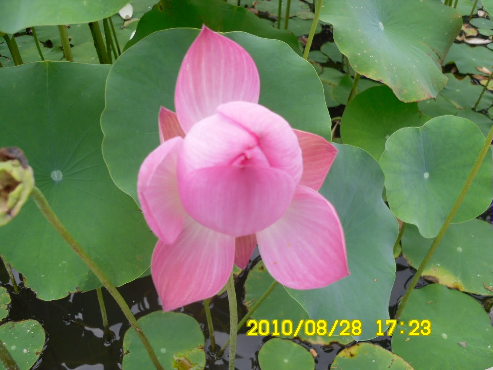 [The lotus flowers at the temple, 寶鏡寺境内のハスの花、보경사 경내의 연꽃]
Tippuri party was rather simple this time. It was cold beer and simple dry sidedishes available from shops. Yet, Bernardo liked cold beer, so did I.
 [A kind of Ganodermataceae?、マンネンタケの一種?영지버섯의 일종? ]
 [Tippuri Party, ティプリ・パーティ、뒤풀이]
 We left the tippuri site at 6:30, therefore, we came back to Daejeon at 10 p.m. I was happy that the rain in Daejeon was stopped when we were back, so I did not need to use my raincoat at all.
2010年8月28日(土)、曇り。
目的地:慶尚北道(경북)・浦項(ポハン포항)の内延山(ネヨンサン내연산)・香爐峰(ヒャンロボン향로봉:930m)
同行者:ベルナルド、アランドロン、チョンジョン、ソヨン、チョンダウン、チョロンペン、ウスミポッタリなどアトサン会員45名、
コース:フェリ2里の村会館[회리2리마을회관]-ハクソン岩[학성바위]-東台山[トンデサン동대산]-内延山(ネヨンサン)-サムジ峰[삼지봉]-チョンハ谷(청하골)[銀滝-延山(ヨンサン)滝-観音滝-双生滝]-宝寶寺(ポギョンサ보경사)-駐車場[6時間]
8月最後の登山。この日、韓国は西側が大雨、東海岸側は比較的穏やかだった。
悪天候にもかかわらず、前の週に続いて参加者は45人で、空席はない。目的地は浦項の「内延山(ネヨンサン)で今にも降り出しそうな空模様が続いたが、結局雨は降らなかった。ラッキー!
行きは1回の休憩だけで目的地へ急いだが、現地に近くなってから道がわからなくなったようで、現地の人に道を聞いたりした。
登山口のハオク里香爐橋(하옥리향로교)に到着したのは11時半だった。今回は三脚を持参したので、よい写真がとれた。
最初の尾根にでるまでの道は、先週同様、かなりきつかったが、30分ほどで尾根に出て、「スズキタイム」にした。山で飲む冷えたマッコリは実にうまい。
 [A mushroom, 途中、目についたキノコ、도중에서 눈에 띈 버섯]
「スズキタイム」では、提供した果物の入れ物を片づけなければならないため、いつも後れを取る。ベルナルドは今回もキノコの写真をよくとっていて、先頭グループについて行った。
昼食は頂上でということで、午後1時半過ぎになってしまった。内延山の尾根はたいへんフラットで最高峰の香炉峰(ヒャンノボン:930m)の周りもまるで平原のようだった。広々としているのでアトサン全員で食事ができた。
ベルナルドは先頭組の最後だったようで、私は中間組の先頭のようだった。弁当は持参したカモ肉が人気。
食後、霧がかかった香炉峰の石標に集まってセルフタイマーで写真を撮った。
 [At the top of the mountain, 内延山・香爐峰(ヒャンロボン)の頂上にて、내연산·향노붕의 정상에서]
香爐峰からの下りはかなり急で、チョロンペンや他の会員が滑ってしりもちをつくほどだった。
一気に下ったところがうっそうとしたくらい渓谷で、ベルナルドとチョロンペンが渓谷の水で顔を洗った。

ここからまたやや緩やかな尾根に上がって、おおきな渓谷に出た。渓谷に出てから宝鏡寺に出るまでのコースは渓谷沿いですばらしい。
特に双生瀑布(쌍생폭포)付近は絶壁と人工の橋との調和がすばらしい。

 [A view from the cliff,崖の上から下を見る、벼랑 위로부터 아래를 본다]
約100mほどありそうのな絶壁に素手で挑戦している若者が数人いた。たいしたものだ。
寶鏡寺には5時過ぎに到着。ハスの花がすばらしかった。ベルナルドは境内でインド人たちとチャッティングしていてこのハスの花を見逃した。
 [The mountain gate of Bogyonsa Temple,宝鏡寺の山門、보경사의 산문]
 [The lotus flowers at the temple, 寶鏡寺境内のハスの花、보경사 경내의 연꽃]
ティップリはビールと焼酎とかわきものでたいへん簡単だった。それでもベルナルドは冷えたビールが気に入ったようだった。[Cheers! at Tippuri, ティプリで乾杯、뒤풀이에서 건배]
現地を出発したのが予定より大幅に遅れ6時半ごろ。大田・南門には10時15分に着いた。大田も昼間はだいぶ雨が降ったようだが、バスがついたときは晴れていて、雨具は最後まで使わないで済んだ。
0 件のコメント:
コメントを投稿