Destination (mountain): Hallasan, Jejudo
Hiking course: [Donnaeko Course – Wuisseoreum – Yongsil Course]
Partner: 50 AhToSan members [Including Chris (USA) and Alex (Bulgaria)
[5 Trails of Hallasan: from Wikipedia]
There are five hiking trails on Hallasan. They are:
1) Gwaneumsa Trail (관음사) - 8.7 km
2) Eorimok Trail (어리목) - 4.7 km
3) Seongpanak Trail (성판악) - 9.6 km
4) Yeongsil Trail (영실) - 3.7 km
5) Donnaeko Trail (돈내코) - 9.1 km

[Five trails for Mt. Halla, 漢拏山の五つの登山路、한라산의 다섯 등산로]
The Donnaeko trail was officially reopened to the public on December 4, 2009, after a fifteen year hiatus. Only the Gwaneumsa and Seongpanak trails lead to the summit. The Donnaeko, Eorimok and Yeongsil courses only go as far as Witse Oreum, as the rest of the trail leading to the peak has been closed off since 1994 in order to restore and protect the vegetation.
--------------
I climbed Hallasan in Feburary 2009. This is the 2nd hike to Mt. Halla.

[AhToSan went to Jeju from Wando in 2009, 2009年は莞島から済州島へ出航した、2009년은 완도에서 제주도에 출항했다.]

[In front of the Choenjiyeon in Feb., 2009, 天地淵の前で2009年2月、천지연 앞에서 2009년2월]

The first time, it was during the winter and we needed climbing irons.

[We began hiking before 6 am in 2009, 2009年2月は城坂岳コースを午前6時に出発、2009년2월은 성판악 코스를 오전 6시에 출발]
The climbing course was Seongpanak Trail (성판악) and descending course was Gwaneumsa Trail (관음사), total walking distance was 18.3 km.

[Near the top of SeongPanAk Course, 城板岳コースの頂上付近(2009年)、성판악 코스의 정상부근(2009년)]
We could climb the top of Hallasan and look down the crater lake “Bengnokdam.”

["Bengnokdam" from SeongPanAk course in Feb, 2009, 火口付近から見下ろす白鹿潭(2009年2月)、분화구부근에서 내려다보는 백록담(2009년 2월)]

[At Gwaneumsa Trail in 2009, 観音寺登山路にて2009年、관음사 등산로에서 2009년]
--------------------------
[All pictures below are taken on June 17, 2012]
This time, we walked Donnaeko Trail (돈내코) for climbing, and we walked more to Wuisseoreum (윗세오름) and came down through Yeongsil Trail (영실), total walking distance was 19.4 km.

[A group picture at the cemetery, 共同墓地にて出発前の集合写真、공동 묘지에서 출발전 단체사진]


[Azalea flowers at the entrance of Donnaeko Trail, トンネコ登山路入口付近のツツジ、돈내코 등산로 입구부근의 철쭉]

It was much easier than before, because of the season (no snow, means, no climbing irons necessary.)

[Wild hydrangeas near the entrance of Donnaeko Trail, トンネコ登山路入口付近の山アジサイ、돈내코 등산로 입구부근의 산수국]

[Flowers of thistle near the entrance of Donnaeko Trail, トンネコ登山路入口付近のアザミの花、돈내코 등산로 입구부근의 엉겅퀴 꽃]
Besides, we could enjoy the nature, not only the shapes of the mountains, but plants and animals as well.
Alex and I enjoyed a comfortable stay by sharing a room (comparing to share a room with 5 persons as other memers.) It required 15,000 won for earch, though, I believe it was a good choice.
This morning, we got up at 5:30, had breakfast at 6 am, then checked up and took the bus at 7 am.

[In front of the hotel before the breakfast, 朝食前にホテルの前で、아침 식사전에 호텔 앞에서]
Every thing went smoothly, but when we lef the bus, suddenly Alex began searching something in his bags. He realized that he forgot to pick up his favorite sweater!
He said he had been wearing that sweater for more than 20 years! I soon asked the president, and she soon called the hotel so that he could pick it up on the way to the harbor after the hike.
We had a Best Member Reward ceremony for Chris. It was a big supprise for him, and he seemed very happy to get the card with his picture.

[Chris became a Best Member, クリスがベストメンバーになった。크리스가 베스트 멤버가 되었다.]
We arrived at the starting point of Donnaeko Trail at 7:50. It was a cemetery for islanders, and it reminded me of 4.3 insident in 1954. Anyhow, we took a group picture there and began hiking.
Some members noticed “gosari” or brackens along the trail and they began picking them up.
Then we entered in the old-growth forest. At this time, I was already the last hiker among all AhToSan members.
This time two stuff members, “Yoro” and “Kkachi” kept walking with me.

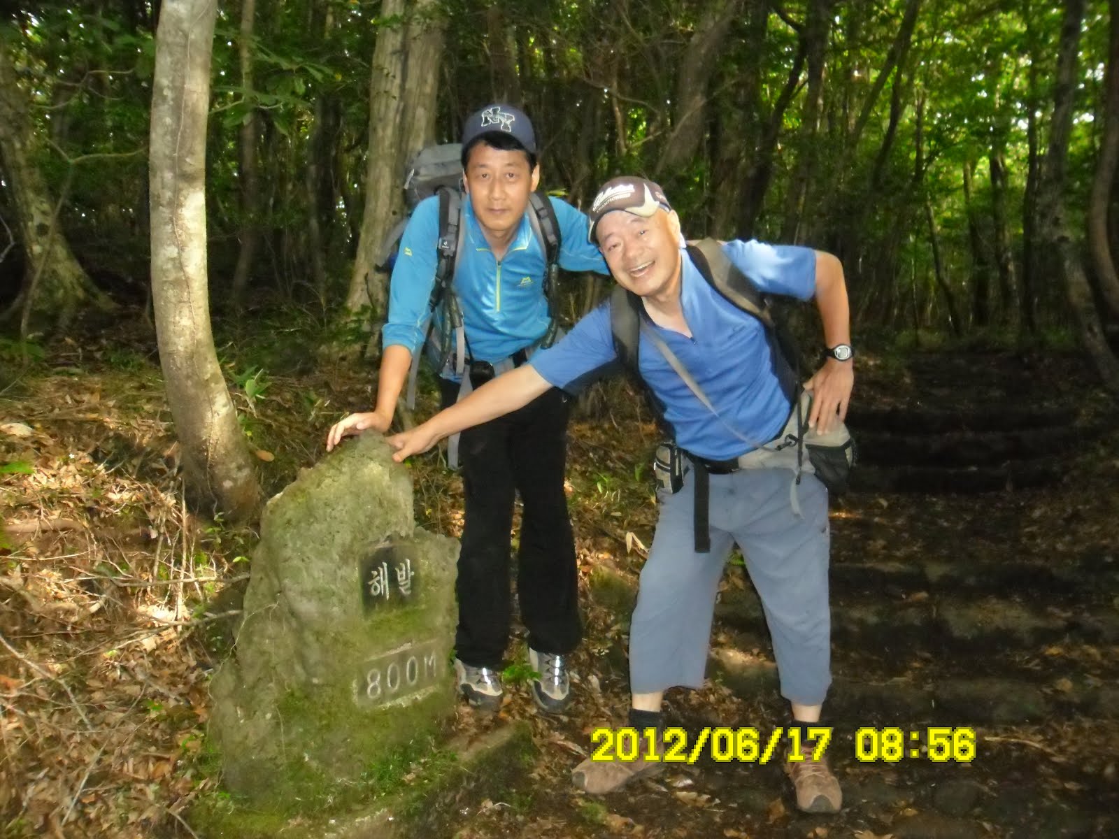
[Yoro and Kkachi at 800 meter altitude point, 海抜800m地点にてヨロ大将とカッチ大将、 해발 800m 지점에서 여로대장님과 까치대장님 ]
We caught up with 4 familier members; Chilgapsan, Jindallae, Daedungsan and Minju at the point of 1000 altitude.


[At the point of 1400 m altitude, 海抜1400m地点にて、해발 1400m 지점에서]

It was fun to walk with many people. When i came to the Pyonggwe Shelter (1450 m altitude), a dozen of people were having “Makgeolli Break” and I joined them. Some members gave me a cup of cold makgeolli and it tasted very good.

[President "Jeongdaun" and General Manager "Minju" at Pyonggwe Shelter, ピョンクェ待避所にてチョンダウン会長とミンジュ総務、평궤 대피소에서 정다운 회장과 민주 총무]

[AhTo Members at Pyonggwe Shelter having "makgeolli" break,ピョンクェ待避所にてマッコリ休憩をとる会員たち、평궤 대피소에서 막걸리 휴식을 하는 회원들]
He offered me dried sardine and garlic stems which went well with makgeolli.

[Flowers near the shelter, 待避所近所に咲いてた花々、대피소 근처에 피어 있는 꽃들]

I was not tired then, so I resumed walking soon, and I felt as if I was not the member of the last group. I also caught up with Chamwe and Salangcho.

[Chamwe and Salancho, 『チャメ』と『サランチョ』、『참외』와 『사랑초』]
When I caught up with them, there were no trees at all, but only bushes and grasses. The change of the plants were very clear, and I could see the great cliff of South Cliff of Mt. Halla very clearly as I approached toward it.
When I came to the view point of South Cliff, “Hangeryong” with a big camera, was waiting for other members to take portraits. Thanks to him, I got a nice photo by his camera.

[In front of the South Cliff, 漢拏山南壁前にて、한라산 남벽앞에서]
I arrived at another view point called “Bang-A-Oreum” at 11:38. There I found not only AhToSan main group, but also the members of “Puruna” as well. They were having lunch, and I joined them there.["Oreum" means parasite volcano in Jeju local language.]

[Looking at Hallarsan (South Cliff) at Pang-A-Oreum Oversatory, パンアオルムから漢拏山・南壁を見上げる、방아오름에서 한라산·남벽을 우러러 본다.]

["Puruma" members having lunch at Bang-A-Oreum, 『パンアオルム』展望台で昼食中の『プルナ』のメンバーたち、방아오름 전망대에서 점심중인 프르나 멤버들]

I ate my lunch quickly and left the observatory before noon. Then I caught up with KS and his friends. They are always making a big fun to take pictures. So I really enjoyed walking with them.

[After lunch, I caught up with KS group, 昼食後KSグループに追いついた。점심후 KS그룹을 따라잡았다.]
I found alpine flowers here and there, and among them I saw edelweiss the most famous alpine flower there.

[Hallasan Edelweiss, ハルラサン・エーデルワイス、한라산 에델바이스]
It was my fortune to walk with Mr. & Mrs KS. They were not only big funs of taking pictures, but also the great providers of various kind of foods.

[Mr. & Mrs. KS near Wuise Oreum, 威勢山(ウィッセオルム)付近のKS夫婦、윗세오름 부근의 KS부부 ]
We arrived at “Wuise Oreum” at 12:42, and the “Wuise Shelter” at 12:48. I used a clean restroom there, and began descending “Yongshil Trail” with Mr. & Mrs KS and their friends.

[At 1700 point of Wuise Oreum, 威勢山(ウィッセオルム)1700m地点にて、윗세오름 1700m 지점에서 ]

[Alpine flowers which I do not know the names, 名前の分からない高山植物、이름을 알 수 없는 고산 식물]

[Wuise Oreum Lodge, 威勢山(ウィッセオルム)休憩所、윗세오름 휴게소]
For a while (about 30 minutes) we enjoyed a well facilitated gentle slope. Then we came to the steep down trail.

[Wooden trail of Yongshil Cource, 霊室コースの木道、영실 코스의 나무길]
We enjoyed seeing the shape of rocks called “Obaekrahan” and well-shaped cliffs while walking.
On the way, Mr. & Mrs. KS provided oliental melons called “Chamwe참외” and cucombers. The melon was very sweet and I liked it the best.

[At Yongsil Course, 霊室コース下山路にて、영실 코스 하산로에서]
The trail rather short and we suddenly came out to the paved area called “Yongsil Parking Lot.” I saw an interesting restaurant named “Obaek-Janggun-gwa-Kkamagwi” wich means “500 generals and crows.”

[ “Obaek-Janggun-gwa-Kkamagwi”Restaurant, 「五百将軍とカラス」食堂、「오백장군과 까마귀」식당]
We had to walk more than 2 kilometers because the buses could not come to the service area (the paved road was too narrow.)
Many members used taxi to go down to the another service area where it was 1000 m altitude. But I felt fine and I dared to walk to the final leg.
It was almost 3 pm and Alex called me when I was almost arrived the bus.
Anyway, the bus left the service area and headed for the harbor, but on the way, it stopped at the gift-shop. Alex got his sweater which he left at the hotel that morning.

[At a gift-shop, みやげ物屋にて、특산물매점에서]
The ferry-boat left at 4:30 pm, and they checked our IDs before boarding. And to my surprise, I got a ticket for a private room!

I do not know why, but I could take a good rest, not dringking or dancing, but just a rest on bed.
The ferry boat arrived at 9:05, and the bus arrived at Daejeon at midnight.
Sansalang drove us (Alex and I) to Shinseongdong, and we came back to my studio apartment at 0:30 am.
It was my 31st hike for this year and 284th AhToSan regular hike.
-------------------------------------------------------------------
分類:ポイント 韓国、済州島(Jejudo)
登山月日:2012年6月17日(日)曇り
登山地:済州島・漢拏山
登山コース:[トンネコ(돈네코)コース]共同墓地(海抜500m)~ピョンクェ(평궤)待避所(海抜1450m)~南壁分岐点(海抜1600m)~威勢山(ウィセオルム윗세오름)待避所(海抜1700m)~[霊室(ヨンシル)コース]~ヨンシル登山路入口(海抜1280m)~駐車場(海抜1000m)
同行者:アトサン会員50名(外国人は私の他、クリス(米)とアレックス(ブルガリア)
2009年2月、アトサンといっしょに初めて漢拏山に登った時は、今回と異なり、莞島から済州島に出航した。また、前日、島内観光をして、有名な天地淵をトレッキングした。

[AhToSan went to Jeju from Wando in 2009, 2009年は莞島から済州島へ出航した、2009년은 완도에서 제주도에 출항했다.]

[In front of the Choenjiyeon in Feb., 2009, 天地淵の前で2009年2月、천지연 앞에서 2009년2월]
さて、これから登山される方のために、漢拏山登山の概要を紹介したい。
[漢拏山登山の概要:Wikipediaより]
2012年10月現在、山体保護の為、東稜の一部を除いて、頂上部への立ち入りは禁止されている。また、西北壁、南壁への立ち入りも禁止されている。従来入山料が徴収されていたが、世界自然遺産登録後無料となった。
整備されている登山路(探訪路とも呼ばれている)は5つあり、観音寺登山路、城板岳登山路の2つは火口脇の東稜頂上まで行くことができ、互いに通じている。残りのオリモク登山路、霊室登山路はこれより短く、トンネコ登山路は西帰浦市側から登れ、互いに通じているが、いずれも西北壁、南壁が通行禁止のため、海抜約1,700m地点までしか登ることができない。 また、夜間登山は禁じられており、日没前に完全下山完了できるように、季節により時間が異なるが、途中の待避所で12時前後になるとそれ以上登れず、東稜頂上で14時前後になると下山が求められる。また、火気の使用も禁じられている。
登山路が整備され、待避所もあるため、軽装で登る観光客も多いが、急な気象変化に備えて、ある程度の装備はする事が望ましい。特に11月から4月は山頂部で氷雪に合うことを念頭に置いておく必要がある。
(1) 城板岳登山路
城板岳(ソンパナク、성판악)登山路は、東から東稜頂上へ向かうコース。距離9.6km、登りコースタイム4時間半。コース途中に往復40分のサラオルム展望台があり、火口湖と済州島の南部が眺望できる。登山口まで路線バスが利用しやすく、傾斜が緩く、板階段などが整備されたコースで、入り口に食堂、途中に売店もあるため、最も多くの登山客が利用する。済州市外バスターミナルから5.16道路線西帰浦市外バスターミナル行きバス(06時から21時の間多数運行)で約30分の城板岳下車すぐが登山口。

[Near the top of SeongPanAk Course, 城板岳コースの頂上付近(2009年)、성판악 코스의 정상부근(2009년)]
(2)観音寺登山路
観音寺(クワンウムサ、관음사)登山路は、北から東稜頂上へ向かうコース。距離8.7km、登りコースタイム5時間。途中まで耽羅渓谷を通った後、傾斜がきつく、急な石段が続く箇所が多いが、北壁の勇壮な景色を眺めながら登ることができる。登山口までのバスは第二・第三土曜日と日曜日にのみ明道岩から東門、市庁などを経由する済州市内バス1号路線が経由して運行される。市内中心部から17kmほどなのでタクシー利用もしやすく、下山客待ちのタクシーもいる。また、1117道路を50分間ほど歩けば、城板岳コースと同じ5.16道路のバス(済州医療院または山川壇バス停)も利用できる。登山口にキャンプ場、コンビニあり。

[Near the top of Gwaneumsa Course, 観音寺コースの頂上付近にて(2009年)、관음사 코스의 정상부근에서(2009년)]

[At Gwaneumsa Trail in 2009, 観音寺登山路にて2009年、관음사 등산로에서 2009년]
(3) オリモク登山路
御里牧(オリモク어리목)登山路は、北西から威勢山(ウィッセオルム윗세오름)待避所(海抜1,700m地点)を経て、南壁分岐点までのコース。南壁は通行禁止のため頂上には行けず、霊室登山路、トンネコ登山路と接続。距離6.8km、登りコースタイム3時間。サジェビ丘まで急な坂を登った後、稜線をたどるコースのため、ハルラ山の眺望は良い。登山口までのバスは、済州市外バスターミナルから1100道路線中文サゴリ行きバス(夏は6時半から16時、冬は8時から15時運行、約1時間に1本。)でオリモクまで約30分。登山口のオリモク広場は、片道30分強で登れ、ハルラ山を眺望できる御乗生岳(オスンセンアク、어승생악。標高1,169m)への登山路(1.3km)入り口にもなっているため、観光バスのツアーで訪れる観光客も多い。
(4) 霊室登山路
霊室(ヨンシル、영실)登山路は、西南からウィッセオルム山小屋を経て、南壁分岐点までのコースで、頂上には行けず、オリモク登山路、トンネコ登山路と接続。距離8.2km、登りコースタイム3時間10分。オリモク登山路と同じ1100道路中文サゴリ行きバスを利用する場合は、霊室入口(ヨンシルイプク、영실입구)バス停から登山事務所までさらに1時間弱かかるが、タクシー等の場合、登山事務所より先の駐車場まで入っていけるので距離5.8km、コースタイム2時間30分に短縮できる。五百羅漢と呼ばれる崖の景観が良い。
(5)トンネコ登山路
トンネコ(돈내코)登山路は、東南から南壁分岐点までのコースで、頂上には行けず、オリモク登山路、霊室登山路と接続。2009年12月まで約15年間閉鎖されていた。距離7.0km、登りコースタイム3時間30分。さらに2.1km、1時間でウィッセオルム山小屋まで行ける。5.16道路線バスを使う場合は、南西橋(ナムソキョ、남서교)または西帰浦産業科学高等学校バス停からさらに1時間ほど余計にかかる。
[これより下の写真はすべて2012年6月17日に撮影したものである。]

[The entrance of Donnaeko Trail, トンネコ登山路入口、돈내코 등산로 입구]
漢拏山登山は2009年2月の雪山登山に続いてこれで2回目。前回は5つの登山路のうち、最も長い城板岳(ソンパナク、성판악9.6km)登山路から登り、頂上から火口湖の白鹿潭(ペンノクタム(백록담)を見下ろし、岩場の多い観音寺(クワンウムサ、관음사8.7km)登山路から下山した。総行程は18.3kmだった。
これに対し、今回はアイゼン不要で、上りが3年前に再開されたトンネコ(돈내코)登山路の9.1kmにウィッセオルムまでの2.1kmを加え、霊室(ヨンシル、영실8.2km)登山路を下ったので、総行程は19.4kmだからほぼ同じだった。雪がない分今回の方が楽だった。
また、上りでは原生林の中を進む登山後、植物帯の変化を楽しむと同時に目前に迫る南壁の迫力を楽しみ、下りでは百羅漢と呼ばれる崖の景観を楽しみながらの下山でとても良かった。
さて、この日、ホテルでは5:30起床、6:00朝食後チェックアウトし、7:00きっかりバスでトンネココース登山路入口へ向けて出発した。

[In front of the hotel before the breakfast, 朝食前にホテルの前で、아침 식사전에 호텔 앞에서]
予定通り進んだが、バスが出てからアレックスがお気に入りのセーターをホテルに忘れたとひどく落胆した。チョンダウン会長に告げ、ホテルに連絡し、下山後、土産物屋に立ち寄った際、忘れ物をピックアップする手はずをとった。
アレックスは非常に嬉しそうだった。きけば20年以上愛用しているセーターということだ。
また、バス内でクリスのベストメンバー認証式があった。クリスは韓国語で「感激しました。ありがとう」とあいさつ。

[Chris became a Best Member, クリスがベストメンバーになった。크리스가 베스트 멤버가 되었다.]
さて、我々は7:50頃、出発地に到着。出発地点は共同墓地で、墓地内で漢拏山を背景に集合写真を撮ってから出発した。

[A group picture at the cemetery, 共同墓地にて出発前の集合写真、공동 묘지에서 출발전 단체사진]
墓地を過ぎて林に入るまで、登山路ぞいの野原にはゼンマイが自生して、めざとい会員が摘みながら進む。


[Wild hydrangeas near the entrance of Donnaeko Trail, トンネコ登山路入口付近の山アジサイ、돈내코 등산로 입구부근의 산수국]

[Flowers of thistle near the entrance of Donnaeko Trail, トンネコ登山路入口付近のアザミの花、돈내코 등산로 입구부근의 엉겅퀴 꽃]
30分ほど進むとうっそうとした原生林に入り、陽射しはほとんど入らない。
登山路は火山独特の凹凸の多い石道で歩きにくいが勾配は緩く、そのぶん息は上がらない。
しかし、野生花の写真を撮っていたこともあり、みんなから遅れ、またしてもヨロ大将の世話になる。途中、カッチ大将も加わり、3人で最後尾を進んだ。
[]With "Yoro" at 800 m altitude point, 海抜800m地点にてヨロ大将と、해발 800m 지점에서 여로대장님과 함께]
海抜1000mでは一人旅だったが、その後、1100m付近で七甲山、チンダルレ、大屯山、ミンジュの4人に追いつき、しばらく7人で進んだ。

[I caught up with 4 AhToSan members, 4人のアトサン会員たちに追いついた、아토 회원 4명에게 따라잡았다.]

[There were many white flowers at this area, この付近では白い花が目につく、이 부근에서는 흰 꽃이 눈에 띄었다]

1450m地点のピョンクェ(평궤)待避所には出発から2時間半ほど経った10:30に到着。ここではチョンダウン会長やヨレジら中間グループがマッコリ休憩をしていて、わたしも冷えたマッコリをごちそうになった。

[AhTo Members at Pyonggwe Shelter having "makgeolli" break,ピョンクェ待避所にてマッコリ休憩をとる会員たち、평궤 대피소에서 막걸리 휴식을 하는 회원들]

マッコリのつまにみなイワシを半分に割いたものやニンニクの茎をそろえて切ったものが準備されていて感心した。

[At Pyonggwe with the president of AhToSan, ピョンクェにてアトサン会長と、평궤에서 아토산 회장님과 함께]
あまり疲れていなかったこともあり、休憩は短めにして先に進んだ。もはや最後尾グループを抜け出したという気分で進むと、チャメとサランチョに追いついた。
この辺から上は高い木はまったくなく、背の低いツツジや熊笹地帯となり、その上はさらに灌木もなくなりお花畑となった。
南壁前の撮影ポイントには寒溪嶺が一人で待機していて、会員の写真を撮っていた。おかげで私も撮ってもらった。

[In front of the South Cliff, 漢拏山南壁前にて、한라산 남벽앞에서]
この時点で11:24。南壁前からさらに20分ほど進んだパンアオルム展望台(방아오름 전망대)にはチョンダウンら中間グループのほか、昨日、フェリー内であったタルマジや雪花らのプルナの会員たちも食事中だった。 [『オルム』とは済州島の方言で『山』という意味らしいが、実際には『寄生火山』のことである。]
ここではアトサンとプルナの両方の会員からマッコリをごちそうになった。また、ホテルで受け取った弁当もここで食べた。

[AhToSan members having lunch at "Pang-A-Oreum",『パンアオルム』展望台にて昼食中のアトサン会員たち、방아오름 전망 대에서 점심중인 아토 회원들]

食事後に出発した時の時刻は12時少し前だった。出発してすぐにKS夫妻一行に追いついた。彼らは写真大好き人間で実に楽しい。お互いに写真を撮り合って進んだ。

[After lunch, I caught up with KS group, 昼食後KSグループに追いついた。점심후 KS그룹을 따라잡았다.]
南壁分岐点近くではかわいいエーデルワイズが多数、目につき、威勢山(ウィセオルム윗세오름)へ向かう谷あいではきれいな高山植物も見つけた。

[Hallasan Edelweiss, ハルラサン・エーデルワイス、한라산 에델바이스]

[Alpine flowers which I do not know the names, 名前の分からない高山植物、이름을 알 수 없는 고산 식물]

この日の最高峰1700mには12:42に到着。威勢山(ウィセオルム)休憩所には12:48に着いた。ここで清潔なトイレを使い、霊室コースの下山に向かった。

[At 1700 point of Wuise Oreum, 威勢山(ウィッセオルム)1700m地点にて、윗세오름 1700m 지점에서 ]


休憩所から先の約30分間ほどはすばらしく整備された広い木道で、歩きやすい。
やがて南壁のような断崖を左に見ながらやや急こう配の下山路を下った。途中、KS夫婦がリュックからチャメ(マクワウリ)とキュウリを出して同行者にふるまった。特にチャメは甘くておいしかった。

[At Yongsil Course, 霊室コース下山路にて、영실 코스 하산로에서]
このコースはトンネココースに劣らず、断崖や奇岩(五百羅漢)がすばらしく目を楽しませてくれる。

[Five Hundred General Rocks, 五百羅漢岩、오백 나한 바위]

急こう配の坂をぐんぐん下ると、まっすぐに伸びた赤松の林にでて、いきなり霊室休憩所に出た。
ここには「五百将軍とカマグィ(カラス)」という看板を掲げた食堂があった。「五百将軍」とはあの「五百羅漢」を意味するのではないかと思う。

[ “Obaek-Janggun-gwa-Kkamagwi”Restaurant, 「五百将軍とカラス」食堂、「오백장군과 까마귀」식당]
ここは海抜1280m地点で中型車以下の駐車場があるが、バスは入れない。そこでさらに2kmほど下った大型バス駐車場(海抜1000m)まで舗装道路を下らなければならない。
多くの会員はタクシーを使って下りたが、私は体調も良かったので歩いた。バスに到着したのは15:00少し前。アレックスが私を心配して電話をかけてきた。
全員そろったところで出発し、港へ行く前に土産店に立ち寄った。アレックスはここでホテルへ忘れたセーターを受け取った。

[At a gift-shop, みやげ物屋にて、특산물매점에서]
多くの会員がここでみやげ物を買ったが私は港についてからチョコレートを買った。港の売店では試食させてくれて43個入りが1万ウォン。さらに15個入りの箱が付くのでこちらの方が買い得だったようだ。
帰りの船の出航は16:30で、16時前に到着したので予定通り。復路の私のチケットはなんと一人用個室のチケットで、おかげでゆっくり休むことができた。
木浦港にはまたしても遅れて到着し、21:05。大田の南門には12:15ごろ戻った。アレックスがと私はサンサランに新城洞まで送ってもらった。今年31回目、アトサン通算284回目の登山は非常に満足できる登山だった。