About pictures/当ブログ内の写真について/당 블로그내의 사진에 대해서

Most of the pictures in this blog are taken by my camera, yet some of them were downloaded from the website of the hiking club. If you click any pictures, they become the original size.

当ブログ内の写真の大部分は筆者のカメラで撮影したものですが、一部、山岳会の共有写真からダウンロードしたものを含みます。すべて、各写真をクリックすれば、元のサイズに拡大します。

당 블로그내 사진의 대부분은 필자의 카메라로 촬영한 것입니다만 일부 산악회 공유 사진으로부터 다운한 것도 포함합니다. 모두 각 사진을 클릭하면, 원래 사이즈에 확대합니다.

2011年2月28日月曜日

110203 Mt. GuBongSan, Daejeon (大田の九峰山)

Date: Feb. 3, 2011 (Thursday/Holiday)

Place: GuBongSan (264m), Seo-gu, Daejeon

Course: “BBaul Yaksuto(빠울 약수타)” (Bbaul Mineral Spring) – the 1st gazebo (GwanPungJeong) – the 2nd gazebo – the 3rd gazebo (GuBongJeong) –> back to “Yakusuto” using the same trail. (5 km, 3 hours)

Partner: Alan (USA), Tracey (Australia)

Alan proposed “Seollal” hiking at Stammtisch on Feb. 2nd. “Seollal” means Lunar New Year’s Day. This year, it happened to be on Feb. 3rd. In Korea three days starting with Lunar New Year's Eve are national holidays.

Alan called me at 10 a.m. So I went to see him in front of his institute (the back gate of KAIST) at 11 a.m.

He drove to E-mart where we picked Tracey up and headed for GuBongSan.

"GuBongSan" means “The Mountain with 9 Peaks.” There are several "GuBongSan" in Korea, but this one must be the lowest, I guess, although Daejeon city office designated the autumn view of this mountain as one of the eight most beautiful landscapes in Daejeon.

[At the entrance of the trail, 九峰山登山路入口にて、구봉산 등산로 입수에서]

I climbed this mountain with Alan before. That time, we entered from the cemetery area. This time, we took a shorter couse from the “Yaksuto” or “Mineral Spring.”

[We prepared for the hike at the entrance of the trail,登山路入口でハイキングの準備をした。등산로 입구에서 하이킹 준비를 했다.]


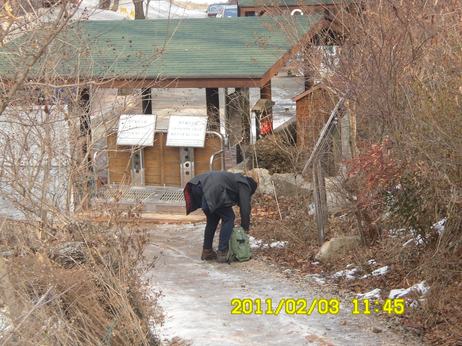
The entrance of the trail was partially frozen. So, Alan and I wore climbing irons. After walking for 10 minutes or so, we came to the wooden stairs. They seemed quite new.

[The guide post showing the "Yaksuto" and "GuBongJeong" 薬水場と九峰亭を示す標識、약수터와 구봉정을 나타내는 표식]

Then we came to the ridge, and there was a nice gazebo with a clock on the wall. There was also a nice frame with 3 chinese letters “GwanPungJeong” the name of this gazebo.

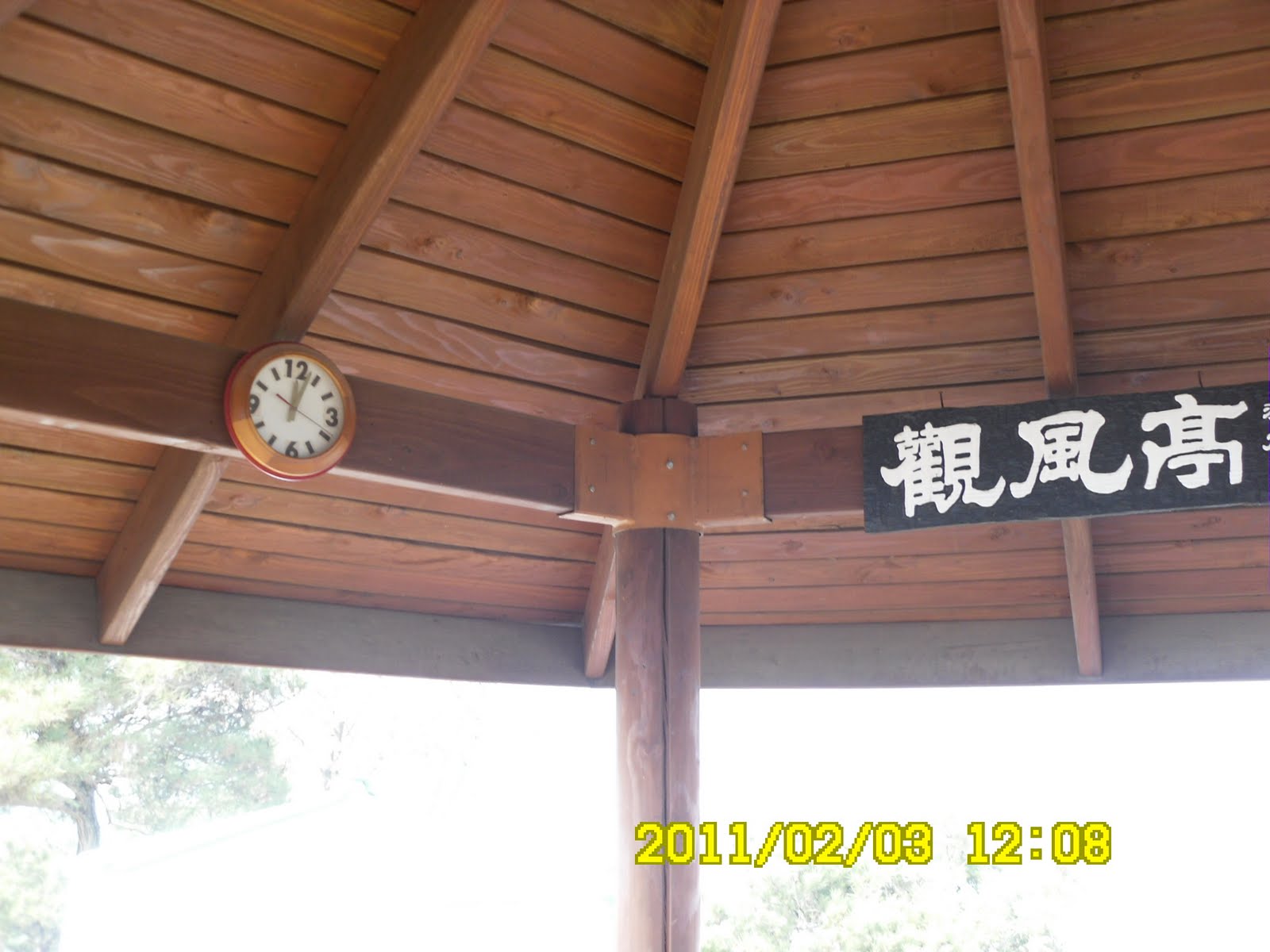
[The gazebo with a clock and the three letters of Kanji, 時計と「観風亭」の入った額、시계와 한자「관풍정」이 들어간 액자] [At the first gazebo, 第1亭子にて、관풍정에서]

“Gwan観” means to see, and “Pung風” means wind, and “Jeong亭” means gazebo. So, you can see wind from this gazebo!

We looked down a part of Deajeon. We could see a lot of high-rising apartments from there.

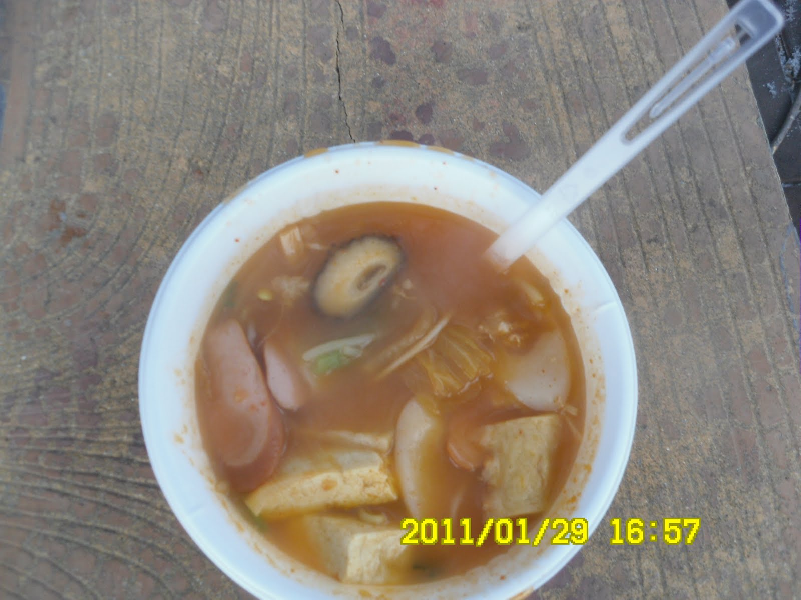
I had lunch while others had snacks there.

Then we enjoyed nice views while walking on the ridge toward GuBongJeong.

There was the 2nd gazebo between the 1st and the 3rd ones.

[The 2nd gazebo, 第2亭子、두번째의 정자]

We arrived at the 3rd gazebo (GuBongJeong) at 1:25 p.m. We could see nice view from there. We could see the Gapchon River making a big curve and the cemetery area as well. There were some visitors at the cemetery, and even on the frozen river!

[At GuBongJeong, 九峰亭にて、구봉정에서]

We returned to the Water Place from GuBongJeong. On our way back, a middle aged trail runner spoke to Trace at the first gazepo.

He spoke to her in Korean language, first, then he called his daughter by his cellphone and handed it to Tracey. His daughter was an English teacher, therefore, she could talk with Tracey in English.

It seemed that he just wanted to let Tracey know his daughter could speak English! What a strange man. But Alan picked up the cellphone and talked with his daughter to join our regular meeting of “foreginers.”

[Alan was talking with a daughter of the trailrunner, トレイルランナーの娘さんとケータイで会話をするアラン、토레일 러너의 따님과 휴대폰으로 대화를 나누는 앨런]

We decended the mountain with this middle aged trail-runner. But we missed the right trail to return to our car.

We had a little trouble to find the right trail. Anyhow, we back to the “Yaksuto” at 3 p.m.

[We came back to "Yaksuto" by 3 p.m.我々は薬水場に3時に戻った。우리는 약수터에 3시에 되돌아왔다.]

It was the first hike for Feburary, and the 9th hike for this year.

登山月日:2011年2月3日(木)[旧正月]

登山場所:九峰山(クボンサン구봉산264m)大田広域市西区

登山コース:パウル薬水場(빠울 약수텨)~第1亭子(観風亭)~第2亭子~第3亭子(九峰亭) [往復](往復約5km、3時間)

同行者:アラン(米国)、トレイシー(豪州)

前日のスタムティッシュでアランが「ソルラル・ハイキング」を提案。大田市内の九峰山に登ることにした。「ソルラル」は旧正月で今年は2月3日。韓国では旧正月を挟む両日も祝日なので3連休になる。

10時にアランから電話があり、11時にKAIST後門で待ち合わせることにした。早速弁当とコーヒーを用意してKAIST後門まで歩いた。

アランは私をピックアップしてからEマートへ向かい、トレイシーをピックアップ。三人で九峰山へ向かった。

九峰山はその名のとおり、9つの峰がある大田市内の山で、私はアランと2回登ったことがある。九峰山の紅葉は大田八景の1つに数えられている。

今回は以前と異なり、墓地へは行かず、高速道路のトンネルのわきの水場(韓国語では薬水場:「ヤクスト」と言う)に駐車して入山した。

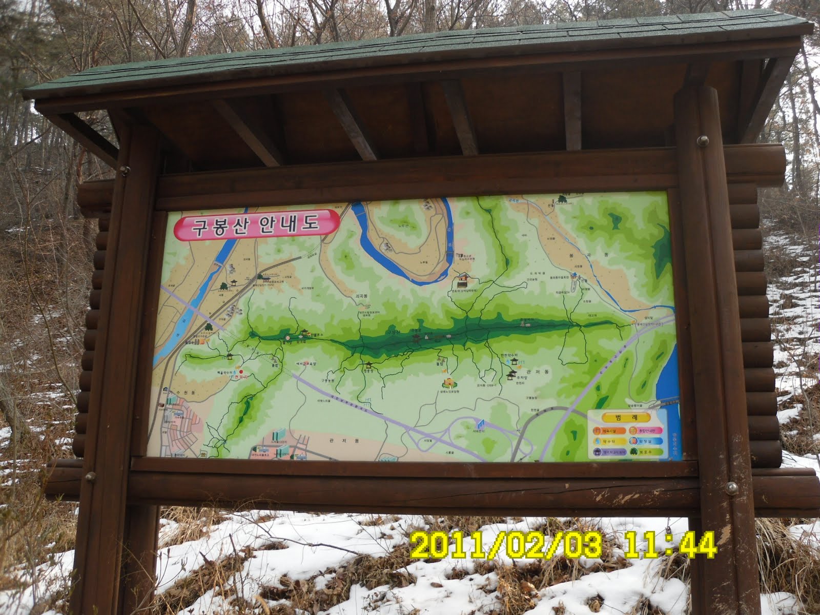
[↑The map of Mt. GuBongSan, and the board on which the healthy effects of the trail were written ↓, 九峰山の地図と、この登山路(黄土道)および「裸足歩き」の効用が書いてある看板구봉산의 지도와, 「황토길」과 「발지압」의 효용이 씌어져 있는 간판.]

この登山路は最近、木の階段で整備されたようで、30分ほどで亭子(チョンジャ)のある最初の峰の頂上に出た。途中、坂道の雪が凍っており、アランと私はアイゼンを装着した。

[Alan on the wooden stairs, 木の階段のアラン、나무 계단 위에 서는 앨런]

歩き始めたのが11時半だったので、この最初の亭子で昼食をとることにした。本格的な弁当を持参したのは私だけで二人は軽いスナックだった。

[At the first gazebo, 第1亭子にて、관풍정에서]

あとは尾根伝いに左右の展望を楽しみながら、1時間ほどのハイキングで九峰亭(クボンジョン)に到着した。

ここは若干風が当たり、涼しかったが、途中は風もなく陽が当たって汗ばむほどだった。

九峰亭からは飛龍浦のように甲川が大きく曲がる部分が見え、甲川は全面凍結していた。

[At GuBongJeong, 九峰亭にて、구봉정에서]

この日は旧正月の連休第1日目だったせいか、墓参りの人々が見えた。また、凍結した甲川の上にいる人々も良く見えた。

[You can see people on the Gapchon River (Please click twice),甲川の上の人々、전면결빙한 갑천 위의 사람들]

九峰亭からUターンして第1亭子へ戻るとちょうど2時だったのでここまで往復2時間。ここで1958年生というトレイルランナーのおじさんに話しかけられた。

トレイシーに向かって韓国語で話しかけ、それが通じないと携帯電話で英語の教師をしているという自分の娘へ電話してトレイシーと話をさせた。

[The first gazebo and 観風亭と山火事監視所, 관풍정과 산불감시초소]

この峰から眼下に見えるヌリウルアパート(누리울Apt)の住民だという。面白い心理だが、娘自慢の表れなのだろうか。それとも西洋の美女トレイシーと話がしたかったのか。

[A view frim the first gazebo, 第一亭子(観風亭)からの眺め、관풍정에서의 조망]

このトレイルランナーと一緒に下山したら、水場へ下りる道を通過してしまい、畑の中を歩く羽目になったが、無事車に戻った時間はちょうど3時だった。

[We saw a "target" for military traing while coming down from the mountain, 下山途中で見た軍の訓練の「標的」、하산 도중, 숲 속에서 본 군훈련의 「표적」]

これは今月初めてで、今年9回目のハイキング。e

2011年2月27日日曜日

110129 Mt. SoBaekSan/BiRoBong (小白山・毘盧峰)

Date: January 29 (Sat) Fine

Course: YulJeon Villege – Eowi Valley – Junction of three ridge trails – Mt. P
BiRoBong – CheonDongRi (12km, 6 hours)

Partners: 44 Koreans

This hike happened just one day after returning to Korea. So I had a couple of rice balls which Kikko made in Japan.

It was an extremely cold day. Yet there was no vacancy in the bus. The man who sat next to me was “OnNuRi” who looked as the same generation of me. (Good cameraman.)

There were several new commers including a young couple. We went through the town of DangYang. We arrived at YulJeon Villege at 10:30.

[A group picture at YulJeong Villege, ユルジョン村で団体写真、율정 마울에서 단체사진]

The trail was completely frozen, so we had to wear climbing irons at the starting point.

[The mountain stream was completely frozen, 渓谷は完全に氷結、계곡 물은 전부 댜 얼었다.]

I offered Japanese sake which I brought from Japan at the first rest time. I kept the sake warm and people liked it very mch. They also liked dried squid along with sake.

[Grape tometoes & "takuwann" ミニトマトと日本から持参したタクワン、방울 토마토와 일본에서 가지고 온 단무지]

It was almost noon when we reached at the redge. The leader suggested to have lunch there, before walking along the ridge, so we followed his advice.

[Lunch time, 昼食の時間、점심식사 시간]

Since it was so cold, people liked hot ramen very much. Chorompem cooked “odeng” before ramen. His odeng was really popular among AhToSan members.

After the lunch, we began ridge-walking against the strong wind. It was so strong that my whole body was almost flew away! I really regret that I did not carry a mask to cover my face.

[On the ridge,稜線にて、능선에서]

In spite of the extremely cold weather, there were many Korean hikers around the stone post on BiRoBong. We had to wait to take a picture with the stone post. I felt frozen to death that time.

[At Mt. SoBaek, BiRoBong, 小白山・毘盧峰にて、소백산小白山·비로봉에서]

We took a short rest at the shelter hut near BiRoBong. Then began decending the mountain.

I noticed that several big trees of “Jumok” or “Spreading Yew/Taxus cuspidata” which I had seen in the previous hiking.

[In front of the "Jumok" tree, イチイの木の前で、주목 앞에서]

Windy place was only ridge area. When we began decending, we did not have strong wind any more.

I arrived at the destination at 4 p.m. I really appreciated the hot “bude” soup.

[After the hike party, ティップリは部隊チゲ、뒤풀이는 부대찌개]


On the way back to Daejeon, we stopped at the famous sightseeing spot called “DodamSambong.” They are a group of rocks in the NamHangang River. But the river was completely frozen, so we could walk to the rocks.

[The NamHanGang River was completely frozen, 南漢江は完全に凍っていた。남한강은 완전히 얼어 있었다.]

We came back to Daejeon at around 8:30 p.m. It was my 8th hike for this year, and 226th hike with AhToSan in total. It was also one of the coldest hike I ever experienced in my life.

登山年月日:2011年1月29日(土)晴れ

登山コース:ユルジョン村(율전마울)-オイ渓谷(어의계곡)-主陵線三叉路(주능선삼거리)-昆盧峰(ビロ峰비로봉)-泉洞里(チョンドンリ천동리)(12キロ、6時間)

同行者:44名(外国人は私だけ)

今年も韓国へ戻った翌日の山行。前日喜久子につくってもらったおにぎりとカップラーメンを持ってアトサンへ。

今回は外国人は私だけ。極度に寒い気候だが、満車になるとはすばらしい。隣は私と同年配にみえるオンヌリニム(온누리님)。

初めて参加した男女も数人いた。見覚えのあるコンクリート工場と嶋潭三峰(トダムサンボン)を経て、出発点のユルジョン村には10時30分に到着。逆光の中、団体写真を撮って出発。


いきなり道がカンカンに凍っていて、アイゼンを装着した。1時間ほど登ったオイ渓谷でスズキタイム。今回はブドウがなく、ミニトマトもあまりよくなかったが、鶴岡のいなかから持参した日本酒の熱燗が評判よかった。また、つまみは剣先するめが好評だった。


オイ渓谷から稜線にでる付近で12時すぎになり、稜線に出てからは強風で食事ができないからと、ここで昼食にした。このような寒い時はラーメンが好評。とくにチョロムペムはおでんから始めてたっぷりラーメンを振る舞い、みな大喜び。また、私が持参したオールドパーも好評だった。

[Lunch time, 昼食の時間、점심식사 시간]

食後いよいよ稜線に出たが、うさわにわがわぬ強風で、70キロのこの体も浮いてしまうほど。また、顔を覆うマスクを忘れたことが悔やまれた。とにかく寒い。

[It was browing strong wind on the ridge,稜線では強風が吹き荒れていた、능선에서는 강풍이 거칠게 불어대고 있었다.]


毘盧峰では30人ほどの団体が写真のポイントを一時占領し、待たされた間が寒かった。

[The stone monument of BiRoBong, 毘盧峰の石標、비로봉 석표]

毘盧峰から少し下ったところに位置する待避所には先頭グループが退避していた。

この後、山を下りはじめると強風も収まり、楽になった。見覚えのある朱木も写真を撮り、泉洞休憩所に出る頃はすっかり風もなく、厳しさも和らいだ。

[Chondong Rest Center, 泉洞休憩所、천동쉼터]

ここから泉洞駐車場までは意外と距離があり、一時同行したウポにも置いて行かれてしまった。見覚えのある泉洞里の登山路入口には3時50分に到着した。

[Chondongli Entrance, 泉洞里登山路入口、천동리 입구]

ティップリはあつあつの部隊チゲ。一人1杯だけだがおいしかった。また、マッコリもうまい。

[The menu of "After-the-hike party" was "Bude" soup and Makgeolli,ティップリのメニューは部隊チゲとマッコリ、뒤풀이는 부대찌개와 막걸리]

帰路の途中、嶋潭三峰(도담삼봉)でバスをとめ、写真撮影をした。南漢江がみごとに凍り、みな子供のようにはしゃいで氷の上を走った。

[At DoDamSamBong,嶋潭三峰にて、도담삼봉에서]

南門には8時半ごろ到着。ワンルームにはちょうど9時に戻った。今年8回目の登山でアトサンの通算は226回目。昨年12/25の徳裕山に続いて、私の人生で最も寒い登山を経験した。

2011年2月24日木曜日

110126 Mt.Tanzawa (Ohyama)丹沢・大山

Date: Jan. 26 (Wed) Fine, then cloudy, snow on the summit of Mt. Ohyama

Course: Hadano – (bus) – Minoge - Yabitsu – Mt. Ohyama – Shimosha Shrine – Otokozaka – Cable Station (About 8 km, 5 hours)

Partner: None

As for the last hike in Japan, I intended to climb Omoteone inTanzawa Mountain alone.

I took 7:25 train to Fujisawa. Change trains there and at Sagamiono, I arrived at Hadano at 8:50 a.m.

Then I remembered that there was only one bus which went Yabitsu Pass during week days. It left at 8:20 and I missed that bus.

I took 9:05 bus which went up to Minoge, not Yabitsu Pass. So, I had to walk from Minoge to Yabitsu. I walked this trail when I was in the middle school, as my first hiking in Tanzawa, about 50 years ago.

Hiking is not very popular in Japan. There were only 4 passengers in the bus. The three hikers took a different trail and it was only I who took the trail to Yabitsu Pass.

After walking for 15 minutes, I noticed several bottles of liquid put in front of a house. The notice says “They are bottles of ‘Pyroligneous acid’ or ‘wood vinegar.’ You may use them for odor eliminating or as antisepsis. Take one if you like, for free.”

[Several bottles of "wood vinegar for free, 無料の木酸液、무료인 목초액]

I feel happy to know that there are people who are generous to share what they have with strangers.

The trail from Minoge to Yabitsu was gentle slope among Japanese cedars. I did not see any hikers at all until Yabitsu Pass.

[At the trail from Minoge to Yabitsu, 蓑毛からヤビツ峠への登山路にて、미노게에서 야비쯔고개에의 등산로에서]


I arrived at Yabitsu Pass at 11 a.m. I thought it was too late to go to Omoteone, so I changed my couse to Mt. Ohyama.

[A guidepost near Yabitsu Pass, ヤビツ峠近くの道標、야비쯔고개 가까이의 도로 표지][Small statues of Ksitigarbha(jizo)、小さな地蔵像、작은 지장보살 상]

I enjoyed the trail from Yabitsu to Mt. Ohyama. I could see the ridges of Omoteone from the trail. I saw several hikers while climbing up to the summit.

[Tanzawa Omoteone,丹沢・表尾根を背景に、단자와·오모태오내를 배경으로]

I arrived at the summit at 12:25. When I began eating “onigiri” or rice balls, it began snowing. The sky was dark, and it was snowing rather heavy. So, I stopped eating my lunch and hurried to go down the mountain.

[At the summit of Mt. Ohyama, 大山山頂にて、정상에서][The view from the 16th stage, 16丁目から見た丹沢山塊、16초메로부터 본 단자와 산괴]

When I came down to the 18th stage, it snowed less than before, so I ate the rest of rice ball at the bench at the 18th stage.

Last time I climbed through Onnazaka (the trail for women), so this time, I walked Otokozaka (the trail for men.)

When I got down to the bus stop, it was not snowing at all.

I went back to Ofuna via Isehara. It was 4 p.m. The total hiking hour was 5 hours. It was my 7th hike for this year.

登山年月日:2011年1月26日(水)晴れのち曇り、山頂では雪

登山コース:秦野→蓑毛~ヤビツ峠~大山山頂~下社~男坂~大山ケーブル駅(約8キロ:5時間、

同行者:なし。

今回の冬休みの日本で最後の登山として丹沢・表尾根を登ろうと考えた。

大船駅7時25分で藤沢および相模大野で乗り換え、秦野には8時50分着。

平日、ヤビツ峠へ行くバスは8:20発だけ。平日に丹沢へ行くなら7時前の電車に乗らなければならないということを思い出した。

蓑毛行き9:05に乗って蓑毛へ9:20着。蓑毛からヤビツ峠へ向かった。このコースは中学の時、初めて丹沢へ登ったコースだ。

バスを降りたのは4人で、他の3人は別のコース。ヤビツへ向かうハイカーは私だけだった。

バス停から15分ほど登った、最後の人家の前にペットボトルに入った「木酢液(もくさくえき)」が置いてあり、「ご自由にお持ちください」とあるのに気が付いた。

[A statue of Ksitigarbha (jizo) near the entrance、登山路入口近くの地蔵像、등산로 입구 가까이의 지장보살 상]

木酢液とは、ウィキペディアによると木材を乾留した際に生じる乾留液の上澄分のことで、農薬的な使用、または入浴、消臭、殺菌などの厚生に利用できる。まったく見ず知らずのハイカーのために無償で提供する人の存在に心温まる。

[A board for bottles of "wood vinegar for free", 「無料の木酸液」の看板、「무료 목초액」의 간판]

さて、この山道は杉の比較的なだらかなつづら折りの坂道でハイカーにはまったく合わなかった。ヤビツ峠に着いたのは11時近い。

[The trail from Minoge to Yabitsu, 蓑毛からヤビツ峠への登山路、미노게에서 야비쯔고개에의 등산로]

これから表尾根はきつい。また、ヤビツ峠には雪があり、大山山頂へ向かうハイカー向けの注意書きにはアイゼンが必要とあった。

[A guidepost near Yabitsu Pass, ヤビツ峠近くの道標、야비쯔고개 가까이의 도로 표지]

そこで、表尾根縦走は断念し、方向を大山に変えた。ヤビツから大山へ向かう道は丹沢山塊を右に見ながらの緩やかな尾根道で、下ってくるハイカーに会った(単独3人、カップル2組)。

[Tanzawa Mountains,丹沢山塊の山々、단자와 산괴의 봉우리들]

[Caution about bears, クマ出没注意、곰 출몰 주의]

大山山頂には12:25に到着。ベンチでおにぎりを食べようとするとにわかに雪が降り出し、それもかなりの量。おにぎりは1個であきらめ、下山を開始した。

[The view of Sagami Bay from the summit of Mt. Oyama, 大山山頂からみた相模湾、정상에서 본 사가미만]

下りはじめると雪が小降りになり、前回同様18丁目の追分のベンチで残りの2個のおにぎりを食べた。(前回は下社から山頂へ上る途中だった。)

18丁目からさらに下るとまた雪がやや重くなったが、下社を過ぎ、男坂を下りると雪はやんだ。

バス停には2時半に到着。バスが待っていて、すぐに出発した。

あとは伊勢原で小田急に乗り相模大野で江ノ島線に乗り換え、藤沢経由で大船にもどると午後4時半。

行き帰りの交通にかかる時間はそれぞれ2時間。ハイキングの時間は5時間。歩数は2.2万歩。2011年7回目のハイキング。