Mountain: Mt. Muhaki(舞鶴山무학산:761m), Masan(馬山마산), GyonNam(慶南경남)
Course: “Mannal Pass” – Mt. Daekok – Gaenari Park – Top of Mt. Muhak – Seomajigi – Mt. 703 – Seohaksa Temple – Gwanhaejeong – Seowonkok (About 8 km, 5 hours)
Partner: 24 AhToSan members
Since the mountain was rather far from Daejeon (Masan, GyongNam Province, the southern tip of Korean Peninsula), we left the parking lot at Daejeon at 6 am.
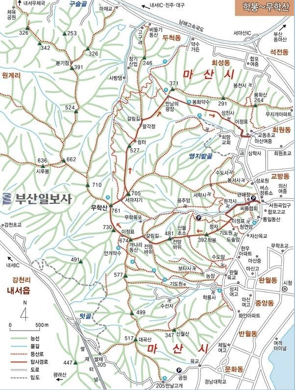
[A map of Muhaksan, 舞鶴山の地図、무학산 지도]
So, I went to the bus-stop by bicycle. It took only 25 minutes.
It was a bit cold early in the morning, but during the day time, it was warm or rather hot.
AhToSan bus arrived at the starting point “Mannal Pass” at 9:40. “Mannal” means “Meeting” and if you come here a certain day of the year, you can find the person you wished to see. (I found the story in the web site, so I will introduce it later.)

[We got off the bus near "Mannal Pass," マンナル峠近くでバスを降りた。만날 고개 근처에서 버스를 내렸다.]
We took a group picture in front of a big Aphananthe aspera tree (푸조나무 in Korean, and “Mukunoki ムクノキ(椋木)” in Japanese.

[A group picture in front of a big tree, ムクノキの大木の前で集合写真、큰 푸조나무 앞에서 단체 사진]

[Aphananthe aspera tree, designated as a protected tree, 保護樹、椋木(ムクノキ)の樹齢は350年、수령 350 년 보호수]
According to the stone plate in front of the tree, it is a 350 year-old protected tree, the circumference of this tree is 3.5 m, the height is 15 m.
It is quite common that a traditional Korean village has such a big tree in the village. But it may have another importance for people who seeks someone to find after long separation. They can meet in front of this tree at a certain day of the year!

[Two staff members on the ridge, 稜線にて私に同行してくれた二人のスタッフ、능선에서 나를 동행해주었든 두 스태프]
Anyhow, I began dropping back since I could not keep up with AhToSan walking speed. About 40 minutes after we be began hiking, the middle group of AhToSan hikers, under the leadership of Alain Delon, stopped and waited for me. It was “Suzuki Time”the first short break to have fruits which I brought for the fellow hikers.

["Suzuki-Time" as short break, 最初の小休止『スズキタイム』、첫 번째 짧은 휴식 "스즈키 타임"]
This time, I brought two boxes of red and blue foreign grapes. They liked them and my bag became lighter.
Jeongjeong and Kadok, two female staff members kept accompany with me and encouraged me. There were a new couple, who came to AhToSan for the first time near us, at least, to the lunch time.
We arrived at Mt. Daeguk (DaeGukSan) at 10:40. From this peak, it was a ridge hike which was quite pleasant, because the trail was not too steep, and we could enjoy nice views of Dadohaehaesang National Park, as well as many spring flowers such as yellow “violets” and “ Potentilla fragarioides” or “kijimusiroキジムシロ雉莚” in Japanese.

[At the top of Daeguksan, 大谷山頂上にて、대곡산 정상에서]
There are many spring flowers. The best of all is “Jindallae진달래.” The Naver Korean-English dictionary says just “azalea” but “azalea” are “Cheoljjuk철쭉” and 철쭉 is “royal azalea” or “rhododendron” in Naver definition.

[Flowers of violet, スミレの花、제비꽃]

[Yellow "violet," 黄色いスミレの花、노란 제비꽃]
It’s a bit confusing. Just recently, I found clear definitions as below.
In Korean language, there are 1)“Jindallae진달래” 2) “Cheoljjuk철쭉” and just 3) “Jindallae-sok진달래속” (They may call the “Cheoljuk” as well.
The counterparts in Japanese are 1) “Karamurasaki-tsutsujiカラムラサキツツジ”、2) “Kurofune-tsutsujiクロフネツツジ”、and 3)”Tsutsuji, includingツツジ/サツキ).
In English, they are:
1) Korean rhododendron、(Binomial name:Rhododendron mucronulatum)
2) Royal azalea, (Binomial name:Rhododendron schlippenbachii)
3) Azallea in general,

["Jindallae" or "Korean rhododendron",「チンダルレ」すなわち「カラムラサキツツジ」、진달래]

"Cheoljjuk" or "Royal azalea," クロフネツツジ、철쭉]
According to Wiki, Azaleas make up two subgenera of Rhododendron. They are distinguished from "true" rhododendrons by having only five anthers per flower.
Well, seeing is believing. I uploaded many of these pictures I took on the mountain, and you can see them. I like Japanese name of “Jindallae”, “Karamurasaki-tsutsujiカラムラサキツツジ.”
“Kara唐” originally from a historical Chinese country (Tang Dinasty 618 AD – 907 AD) name. In Japan, it means “foreign things from China/Korea). “Murasaki” means “purple” the color of the flower, and “tsutsuji” is just a family of azalea.

["J-Nim" on the "Jindallae" trail, 「カラムラサキツツジ」の登山道にて、"진달래" 등산로에서]
However, besides “Jindallae” I like “Gakshibukkot각시붓꽃” or “Iris rossii Baker” very much. In Japan, it is not common to see these flowers in the nature. The areas are limited to Western part of Japan, and some local government designated as “endangered plant” or “protected species.”

[Iris rossii Baker、エヒメアヤメ(古名タレユエソウ誰故草)、각시붓꽃]
I found these flowers often in hiking in Korea.

[A view of Masan from the ridge, 稜線から見た馬山市とカラムラサキツツジ、능선에서 본 마산 시와 진달래]
While enjoying these beautiful flowers, the trail turned to be a wooden tail, and we could see the top of the mountain over the wooden trail.

[Heading for the top of the mountain on wooden trail, 舞鶴山頂上に近づく、무학산 정상에 접근하고있다.
I arrived at the top of Mt. Muhak just at noon. There were many hikers at the stone monument of the mountain then. So, I had to wait for my turn after other hikers. Jeongjeong took my picture at the stone monument.

[At the top of Mt. Muhak, 舞鶴山頂上にて、무학산 정상에서]

[A map of Mt. Muhak on a wooden board, 舞鶴山頂上案内図、무학 산 정상 안내도 ]
Most of other AhToSan hikers had already gone down to the field where many people were having lunch.
Actually there were many Jindallea plants on this side of the mountain, but they were still in buds, not bloomed yet, that I regret most.
I arrived at the bottom of the hill, and joined the main group of AhToSan at 12:18. I spread my sheet for the lunch and offered “Jokpal족발” or “pig's trotters” which I bought previous day. There are different kind of “Jokpal”, some with good quality and some cheap ones. They say front legs are better than hind legs. I bought front legs.

[They were having lunch at Seomajigi Field, ソマジギ草原にて昼食、소마지기 초원에서 점심 식사]

[Pig trotters (out of front legs)、ソンソク(前足)、"앞다리" 족발]
I made “rice balls” for my own lunch. I made four rice balls, and I ate one at service area, and I ate two for lunch and I left the last one to bring back to my apartment, because other hikers shared their food with me, too.

[After lunch at Seomajigi Field, 昼食後、ソマジギ草原にて、점심 식사 후 소마지기 초원에서]
After the lunch, we continued the gentle ridge hike.
The highlight of the afternoon hike was walking through the "tunnel" of "Jindallae" and the rocky place around Mt. 703. We could see the Dadohae Sea and many islands, as well as the city of Masan.
[J-Nim at "Jindallae Tunnel," チンダルレ道のJニム、진달래 길 J 님]

[Looking down the downtown of Masan city from Mt. 703、70峰付近から馬山市街を見下ろす、703봉 부근에서 마산 시내를 내려다보았다.]
After exiting rocky place, we came down to the place called “Dalmaji Pass.” “Dalmaji” means “Viewing the moon” and it was the name of the restaurant the guide of Busan (Daegil) took my 9 guests including my wife and me for dinner after seeing Gyeongju on April 8.

[AtToSan members resting at Dalmaji Pass, タルマジ峠で小休止、달맞이 고개에서 짧은 휴식]

[Royal azalea at Dalmaji Pass, タルマジ峠のクロフネツツジ、달맞이 고개의 철쭉]
From Dalmaji Pass to the last part of the hike was not too long. It was only 30 minutes of down-walk and then we suddenly came to the street of Masan.

[The exit of the trail at Masan, 馬山市街近くの登山路、마산 시내 근처 등산로]
We could not have “party” at the street of Masan, so when all of us arrived at the bus on the street at 14:10, we left Masan to a nearby Service Area.
We stopped at Chilseo(칠서) Service Area and had “Wrap-up Party” there.

[Wrap-up party at Chilseo SA, チルソ・サービスエリアで打ち上げ、칠서 휴게소에서 뒤풀이]

The menu was “Jokpal족발” or “pig's trotters” but hind legs. There were too many bones and less meat on “hind legs” so it is difficult for me to eat, because I have false teeth. They also provided vegetable such as green chili pepper “오이고추” and cucumbers.
There were many flowering quince trees, and the read flowers were in full bloom at Chilseo Service Area.

[Flowering quince at the SA、ボケ(木瓜)の花、산당화(山棠花)/ 명자나무]
We went back to Daejeon at around 5:30 pm. I went back to my apartment by bicycle. I enjoyed cycling through the tunnels of cherry blossoms along the Dandong River(炭洞川) and went home by 6 pm.

[The Rainbow Bridge at Expo Park in Daejeon,大田のエキスポ公園のレインボーブリッジ、대전 엑스포 공원 무지개 다리]

[The cherry blossoms in front of Currency Museum, 貨幣公園前の桜並木、화폐 공원 앞의 벚꽃길]
It was my 16th hike for this year and my 309th AhToSan regular hike.
--------------------------------------------------------------------------------------------------------
分類:登山、韓国、春山(アトサンの定期登山企画411回目)
登山日:2013年4月13日(土)晴れ
登山地:慶南・馬山(마산)の舞鶴山(ムハクサン무학산761m)
登山コース:出会峠(만날고개)~大谷山(대곡산)~レンギョウの園(개나리동산)~舞鶴山頂上(무학산정상)~ソマジギ(서마지기)~703m峰~月見峠(달맞이고개)~西鶴寺(서학사)~クァンヘジョン(관해정)~書院/請願谷서원곡(約8キロ、5時間)
同行者:アトサン会員24名
目的地(慶南・馬山)までの時間が長いのと参加者が少ない(24人)のでバスの中で使うための教材やら保温瓶などを積んで久しぶりに自転車で南門へ向かった。
朝の気温は低く、防水防風のジャケットと軽い手袋ではやや不足と感じるほどだったが、日中は気温が上がり、ぴったりだった。

[We got off the bus near "Mannal Pass," マンナル峠近くでバスを降りた。만날 고개 근처에서 버스를 내렸다.]
出発地点のマンナル峠には9:40に到着。そこは一般道路脇だったので、緩やかな傾斜の広い道路を少し進んだ右側にそびえる樹齢350年の保護樹(푸조나무ムクノキ:椋木)の前で団体写真撮影。

[A group picture in front of a big tree, ムクノキの大木の前で集合写真、큰 푸조나무 앞에서 단체 사진]
さらに車道にしてもおかしくないような広い歩道(クッションが敷き詰めてある)を進み、母子の像と「マンナル峠:出会の峠」の由来の碑がある場所が本格的登山道の出発点。

[The old story curved on the stone, マンナル峠の由来の石碑、만날 고개 유래 비석]
今回も登山開始後すぐに遅れ始めたが、チョンジョンとカドクの二人が私に同行してくれた。

[A staff member who accompanied with me, ビリの私につきあってくれたカトゥクさん、꼴찌인 나를 동행해주었든 사랑가뜩님.]

[With two staff members on the ridge, 稜線にて二人のスタッフと、능선에서 두 명의 스태프와 함께]
歩き始めて40分後の10:20ごろ、尾根に出る前にアランドロン会長らがスズキタイムを期待して待っていてくれたので、青葡萄と赤ブドウの2ボックスを提供。私が到着した時点ですでにマッコリは終わっていたようだった。

["Suzuki-Time" as short break, 最初の小休止『スズキタイム』、첫 번째 짧은 휴식 "스즈키 타임"]
このスズキタイムの後、初めて参加した30代のカップルとチョンジョンとカドクと私が最後尾グループを形成。標高510mの大谷山には10:40に到着した。

[At the top of Daeguksan, 大谷山頂上にて、대곡산 정상에서]
この先の稜線歩きは快適でチンダルレも満開。また右側には常に多島海(タドヘ)海上国立公園の海と島々と馬山の都市部が足元に広がり、撮影スポットも多かった。
足元にはキジムシロや黄色いスミレが多く見られたが、なによりも鮮やかなエヒメアヤメを見つけたのはうれしかった。

[Yellow "violet," 黄色いスミレの花、노란 제비꽃]

[Iris rossii Baker、エヒメアヤメ(古名タレユエソウ誰故草)、각시붓꽃]
エヒメアヤメはこのあと2カ所で見かけたが、最初の花が一番あざやかな紫色だった。
尾根歩きを続けると道は木道になり、舞鶴山頂上が見えてきた。

[Heading for the top of the mountain on wooden trail, 舞鶴山頂上に近づく、무학산 정상에 접근하고있다.
舞鶴山の山頂にはちょうど12時に到着したが、立派な標石のまわりでは多くのハイカーが順番待ちをしていて、長居はできない。チョンジョンとカドクの写真を撮り、私も認証写真をチョンジョンに撮ってもらった。

[At the top of Mt. Muhak, 舞鶴山頂上にて、무학산 정상에서]

[A map of Mt. Muhak on a wooden board, 舞鶴山頂上案内図、무학 산 정상 안내도 ]
最後尾の5人以外は全員、すでに舞鶴山山頂を越えてソマチギと呼ばれる低地へ移動して昼食を摂っていた。

[The trail from the top of the mountain to Seomajigi Field, 頂上からソマチギへ下る階段、정상에서 소마지기에 내리는 계단 길]
この舞鶴山山頂からソマチギへ下る部分がチンダルレの群落地だが、ここのチンダルレがまだつぼみだったのは残念だった。

[The buds of "Jindallae" or "Korean rhododendron"、まだ開花前のカラムラサキツツジ、진달래 꽃 봉오리]
アトサンの中間部隊の昼食時間が終わるころ私が到着し、持参したシートを拡げ、これまた持参したトンソクの前足(アプタリ)を出した。これは好評で肉も多くうまかった。

[They were having lunch at Seomajigi Field, ソマジギ草原にて昼食、소마지기 초원에서 점심 식사]
昼食はチョンジョンとカドクと三人で食べた。朝作ったおにぎりは、途中のサービスエリアで1個食べたが、ここでは残り3個のうち2個食べて、1個は残して持ち帰った。握り飯も正解だった。
昼食後はチンダルレが登山路の両側に咲いているなだらかな尾根を進み、岩場の多い703m峰に出た。ここからも馬山市の市街と多島海が良く見える。

[At "Jindallae Trail"," チンダルレ道にて、진달래 길에서]
 [Jeongjeong near the 703-Bong, 703峰付近にて、703봉 부근에서]
この岩場を過ぎると「タルマジ峠」に出た。「タルマジ」とは「月見」という意味で、ここで休憩しているときに、ある会員が釜山の海雲台の「タルマジ峠」がもっと有名だといった。

[AtToSan members resting at Dalmaji Pass, タルマジ峠で小休止、달맞이 고개에서 짧은 휴식]
そういえば妻を含む日本からの9人の客とともに慶州観光を終えて釜山の海雲台で行った食堂の名前が「タルマジ食堂」だったことを思い出した。
また、この峠では、チンダルレ(진달래)ではなく、チョクチュク(철쭉)の花が咲いていた。

[Royal azalea at Dalmaji Pass, タルマジ峠のクロフネツツジ、달맞이 고개의 철쭉]
チョルチュクの開花は一般的にチンダルレより1ヶ月以上遅れることが多いが、山では高度により両方とも見れることがある。
チンダルレの日本名は「カラムラサキツツジ」であるのに対し、チョルチュクは「クロフネツツジ」と言うようである。
私はどちらも好きだが、特に「クロフネツツジ」の淡いピンクの花が好きだ。
タルマジ峠を過ぎると寺に降りる道と道路に出る道とに分かれていたが、我々は道路に出る道を下り、一気に西鶴寺(ソハクサ)の下の一般道路に出てから右折して大通りに停めてあったアトサンバスのところへ向かった。

[Guidepost at the pass, タルマジ峠の里程標にて、달맞이 고개의 이정표에서]
バスに着いたのは2時10分で、現地は市街地だったため、打ち上げ(ティップリ)は全員バスに乗車してから最初のサービスエリア[漆西(チルソ칠서)]で行った。

[The exit of the trail at Masan, 馬山市街近くの登山路、마산 시내 근처 등산로]
サービスエリアには打ち上げパーティをするにはぴったりの野外のテーブルとイスがあり、まわりには木瓜の生け垣があった。木瓜の赤い花も見事だった。

[Wrap-up party at Chilseo SA, 漆西(チルソ)・サービスエリアで打ち上げ、칠서 휴게소에서 뒤풀이]

[Flowering quince at the SA、ボケ(木瓜)の花、산당화(山棠花)/ 명자나무]
さて、打ち上げのメニューはトンソクとマッコリとキュウリと青コッチュという簡単なもの。ティップリの終了時間は3時15分で、今回の山行大将のコンジャパクが総括した。

[Wrap-up greeting by the hiking planner, 山行リーダーによる締めの挨拶、산행 대장님이 마무리 인사말]
アトサンのハイキングでは珍しく終了予定より1時間以上短い山行時間で、南門に戻ったのは5時半ごろ。

[The Rainbow Bridge at Expo Park in Daejeon,大田のエキスポ公園のレインボーブリッジ、대전 엑스포 공원 무지개 다리]
自転車でエキスポ公園から炭洞川沿いに私のワンルームのある新城洞へ戻ったわけだが、川のほとりは見事な桜並木とレンギョウの生け垣があり、実に美しいツートンカラーである。

[The cherry blossoms in front of Currency Museum, 貨幣公園前の桜並木、화폐 공원 앞의 벚꽃길]
自転車に乗りながら、この美しい風景を撮影して、ワンルームには6時過ぎに戻った。
今回は今年16回目のハイキングでアトサンの定期登山は309回目になる。