Destination (mountain): YongNamAlps (NeungDongSan – CheonHwangSan –JaeYakSan), Miryang, GyongNam Province
Hiking course: Baejae Pass – NeungDongSan – CheonHwangSan – JaeYakSan – Gsari Branch School – CheungCheung Waterfall – HeungNyong Waterfall – PyoChungSa Temple 15.5 km, 7 hours.
Partner: 36 AhToSan members

[A map of YongNam Alps, 嶺南(ヨンナム)アルプスの地図、영남 알프스 지도]
Unlike the previous hike, this time, it was not the full. 36 members applied, and Chim-Han-Salam from Seoul, joined us at the foot of mountain.

[We arrived at PaeNae Pass at 9:35, ペネ峠には9時35分に到着した、배내고개(680m)에는 9시 35 분에 도착했다.]
Among 36 members, there were at least three members were senior than me. It is very unusual. And one of them was 76 years old!

[A group picture before the hike, 出発前の集合写真、출발 전 단체 사진]
Actually they were good hikers. They all arrived at the destination in the top group.
We left South Gate at 6 am and arrived at Baenae Pass at 9:35 am. We began hiking at 9:50 though.
The altitude of PaeNae Pass is 680m. So it was a gentle slope to NeungDongSan. We arrived at the top of NeungDongSan at 10:30.

[At the top of NeungDongSan, 陵洞山(ヌンドンサン987m)の頂上にて、능동산 정상에서]
We had the first short break there, and I offered fruits as usual.
At this moment, one of the hikers had clamp in her leg. So “ChilGapSan” and some staff members were waiting for the troubled hiker there.

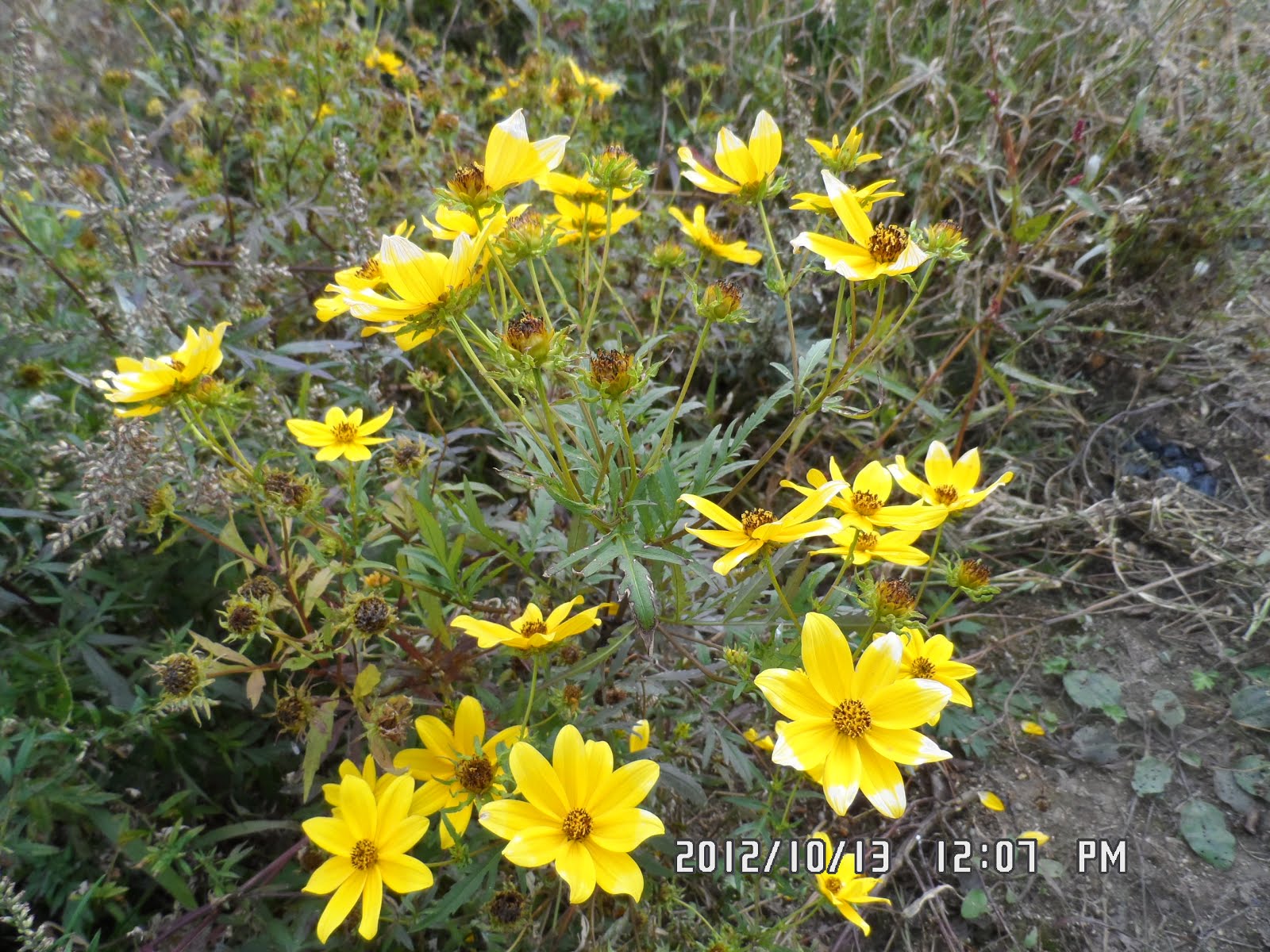
[Flowers of "SanGuk" in Korean, 山菊の花、산국]

[Elsholtzia splendens Nakai, 韓国名「コチャンユ(花香油)」(日本にはない)、꽃향유]

I started walking with some other members, without waiting for them, and we arrived at the 2nd NeungDongSan at 11 am.
We could see a rope-way station ahead of us from the ridge. It seemed far away at first. But actually, we arrived at the rope-way station within one hour.
A part of the trail was “forest road” and I could see many wild flowers both sides of the road.

[Flowers of Siberian chrysanthemum,イワギク(岩菊)の花、구절초]

[At the guidepost toward the rope-way station, ロープウェイ駅へ向かう途上で、케이블카 역으로 향하는 도중에서]

[In front of the rope-way station, ロープウェー駅の前で、케이블카 역 앞에서]
The trails around the rope-way station were well facilitated, and we could see many interesting statutes of animals along the trail.

[Huge "Lizard" ?、巨大な『トカゲ』?、거대한 '도마뱀'?]

["Zebra" in Korea?、韓国に『シマウマ』?한국에 "얼룩말"?、]

[A gorilla in Korea?、韓国に『ゴリラ』?、한국에 "고릴라"?]
The top of the hill behind the rope-way station was called “Orum Haneul Garden” from which people could see good views of YongNam Alps.

[At“Orum Haneul Garden”,「オルムコル・ハヌル庭園」にて、"얼음골 하늘 정원에서" ]

The trail from “Orum Haneul Garden” to CheonHwangSan was a gentle down slope, and there was a tableland between the mountains.
There was a roughly made restaurant called “SaemMul Sanjang”in the middle of the tableland. We had lunch next to the restaurant.

[Flowers near the restaurant in the field, 平原の中の食堂近くに咲いていた花、평원 식당 근처에 피어있는 꽃]
Some of members ordered a bottle of makgeolli, and we spread our sheets for lunch and I offered pig trotters which I bought at nearby market previous day. It was 12:08 when I joined them.

[Lunch next to the restaurant in the field, 平原の中の食堂の隣で昼食、샘물산장 옆에서 점심]
We finished our lunch at 12:40 and began afternoon hike. We were heading CheonHwangSan first, then to JaeYakSan.

[After lunch on the way to CheonHwangSan, 昼食後、天皇山へ行く途中にて、점심 식사 후, 천황산으로 가는 길에서]
The trails to these two mountains were rather easy and gentle slopes. We walked in the field of silver grasses.

[The trail to ChonhwangBong, 天皇山への登山路、천황 산으로 이어지는 등산로]
There were many beautiful flowers among silver grasses. I especially like “Yongdam”in Korean, among them. It is a Kanji word “竜胆”exactly same as Japanese “Rindo.”

[Flowers of gentiana scabra (or Japanese gentian), リンドウ(竜胆)の花、용담 꽃]
According to wikipeida, its scientific English name is Gentiana scabra (or Japanese gentian). It mus be a Korean version of Gentiana scabra.
There was a big stone tower on the top of ChenHwangSan. Next to the tower, there was a big stone mark that three Kanji「天皇山」were carved.
From CheonHwangSan to JaeYakSan, there were many nice looking rocks and sliver grasses.

[On the rock near CheonHwangSan, 天皇山山頂近くにて、천황산 정상 부근에서]

[At the top of CheonHwangSan, 天皇山(チョンワンサン1189m)山頂にて、천황산 정상에서]
Then the trail became a bit steep slope, and it led to a rocky place of top of JaeYakSan.

[The trail leading to JaeYakSan, 載薬山(ジェヤクサン)へ続く登山路、재약산으로 이어지는 등산로,]

[The autumnal color near the top of JaeYakSan,載薬山頂上付近の紅葉、 재약산 정상 부근의 단풍]

When I reached the last peak of this traverce, it was 2:45.

[With AhToSan members at the top of JaeYakSan,載薬山の頂上にて、재약산 정상에서]

There were still more than 6 km left for the whole distance.
I passed across the forest road, and passed over many other hikers, and I caught up one of the members, “Yoreji” and we went down together.

[I caught up with AhToSan members on the downhill trail,下山路でアトサン会員に追いついた、하산 길에서 아토산 회원들을 따라 잡았다.]
When we passed CheungCheung Waterfall, we caught up with other group led by ChilGapSan.

[At Cheungchung Waterfall, 層層(チュンチュン)滝にて、층층 폭포에서]
Then someone called him by walky-talky. It was “Yoyu” the leader taking care of the last hiker.

[The HeungRyong Waterfall, 黒龍滝(フンニョンポクポ)、흑룡폭포]
He said the last hiker, “Haenbok Gaduk” accidentally broke her foot. She could not walk and “Yoyu” tried to call the emergency call “911”but could not be connected.

[A view on the descending trail, 下山路から見た渓谷、하산 길에서 본 계곡]
So ChilGapSan called “911” several times, and fortunately he could reach at Emergency Office.
They dispatched the ambulance but it arried at them one and half hours later.
I went down with these people along the valley and river. We came out to a beautiful teimple named “Pyochungsa” Temple.

[A part of "Pyochungsa Temple, 『表忠寺』の一部、"표충사"의 일부]
I arrived at the parking lot at 5:20. So it was about 7 hour hike!
As for the wrap-up party, I joined the senior members’ table and talked with them. The 78 year old man spoke Japanese a little. They seemed to be surprised that I was Japanese.

[The wrap-up party at the parking lot of Pyochungsa Temple, 表忠寺の駐車場にて打ち上げパーティ、표충사 주차장에서 뒤풀이]
We finished the party at 6 pm when “Yoyu” came after sending the injured member to the hospital.
Later we learned that the husband of “HaengBokGaduk” came all the way from Daejeon to Miryang, and picked her up after the treatment and went home very late.
It was my 51st hike for this year and 291st of AhToSan regular hike.
-------------------------------------------------------------------------------------
登山月日:2012年10月13日(土) 晴れ時々曇り
登山地:嶺南アルプス(영남알프스) [陵洞山(능동산) -天皇山(천황산) – 載薬山(재약산)](ススキ鑑賞)
登山コース:ペネ峠(배내고개680m) – 陵洞山(ヌンドンサン능동산987m) - 天皇山(チョンワンサン천황산1189m) – 載薬山(ジェヤクサン재약산1108m) – 蕨(コサリ고사리)分校 – 層々滝(チュンチュンポクポ층층폭포) – 黒龍滝(フンニョンポクポ흑룡폭포) – 表忠寺(ピョチュンサ표충사) 15.5 km, 7時間
参加者:アトサン36人、現地合流1名(チンハンサラム)
今回も先週に引き続き嶺南アルプスで、登る山々は陵洞山(능동산)、天皇山(천황산)、載薬山(재약산)だ。
今回は満車にはならず、申し込みは36名。座席に余裕があり、私は二人分を使った。また、今回は初めて参加する人が12人もいて少し雰囲気が異なる。
特に私より高齢と思われる人が3人参加した。最年長者は78歳だという。しかし、彼らは全員達者なハイカー達で、私と違ってトップグループでゴールインしたようだった。
出発地点のペネ峠には9時35分に到着したが、トイレがやや離れていて集合写真に手間取り、実際の出発は9時50分だった。

[We arrived at PaeNae Pass at 9:35, ペネ峠には9時35分に到着した、배내고개(680m)에는 9시 35 분에 도착했다.]

[A group picture before the hike (Just practice), 出発前の集合写真(練習)、출발 전 단체 사진]
ペネ峠がすでに高い位置のためか最初の陵洞山(능동산)まではなだらかな尾根道で10時半ごろには到着した。
ここで、恒例のスズキタイムとしてミニトマトとブドウを提供、休憩も兼ねて遅いハイカーを待った。
サランカドクと共に来たヘンボクカドクの足が攣ったという連絡が山行大将のヨユウから入り、七甲山副会長が待機した。

[A short break with Makgeolli and some food, マッコリとつまみで小休止、막걸리와 안주로 잠시 휴식]

私はカウルイルキやルチらと同行し、いったん林道に出てからまた、山道を進み、陵洞2峰(능동2봉)には11時過ぎに到着した。
この辺りの稜線から前方の山の上にはロープウェー(韓国語では「ケーブルカーと」いう)の建物が見えていたが、コースはそのロープウェーの駅を通過するようになっていた。
陵洞2峰からロープウェー駅までの道も林道で、道の両側にはクジョルチョ(구절초和名イワギク)などの花が咲き乱れていた。

[Flowers of gentiana scabra (or Japanese gentian), リンドウ(竜胆)の花、용담 꽃]

[Flowers of Siberian chrysanthemum,イワギク(岩菊)の花、구절초]

[Flowers of wild chrysanthemum, 山菊の花、산국 꽃 ]

[Elsholtzia splendens Nakai, 韓国名「コチャンユ(花香油)」(日本にはない)、꽃향유]
ロープウェー駅に着いたのは11:50で、この付近は一般客も多く、木道がよく整備され、道の両側にはおもしろい動物たちの置物も配置されていた。

[A family of panda in Korea?, 『パンダ』の家族?、"팬더"가족?]

[『七甲山』と大きなオウム、"칠갑산"님과 큰 앵무새]

この裏の頂上は「オルムコル・ハヌル庭園」として整備され一般の人々も嶺南アルプスの峰々が展望できるようになっていた。
ここから「センムル山荘(생물산장)」という平原の中の食堂まではなだらかな下りで、前回の胆月峠を思わせる風景だ。
[Flowers near the restaurant in the field, 平原の中の食堂近くに咲いていた花、평원 식당 근처에 피어있는 꽃]
「センムル山荘」の脇ですでにマッコリを注文して食事をしていた先頭グループに合流したのは12:08だった。
食事の時に、前日購入した「チョッパル」を提供したが、半分ほども食べなかった。これは打ち上げパーティの時に不足した「チョッパル」に追加した。

[Lunch next to the restaurant in the field, 平原の中の食堂の隣で昼食、샘물산장 옆에서 점심]

食事は12:40に切り上げ、ススキの原の中を出発した。前方に独特な形をした山が2つ見たが、それが今回のメインの天皇山(천황산)と載薬山(재약산)だった。
天皇山までの道はススキの原の中で周囲の展望もよく、同行したメンバーも多かったため、写真をたくさん撮った。

[After lunch on the way to CheonHwangSan, 昼食後、天皇山へ行く途中にて、점심 식사 후, 천황산으로 가는 길에서]
天皇山の頂上はなだらかな丘陵のようで、大きなケルンがつんであったが、石標の周りは人だらけで写真撮影は順番待ち。自分のカメラでは写真を撮ることができず、他のメンバーの写真に依存する。
天皇山の反対側すなわち載薬山側は、岩肌がむき出しになっていて、実に面白い風景だ。

[On the rock near CheonHwangSan, 天皇山山頂近くにて、천황산 정상 부근에서]
元気な会員は岩山に登りって万歳をする。また、足元はススキの原で、リンドウが多く見られた。

ここを過ぎてこの日最後の山の載薬山の上りに差し掛かると、後ろから天皇山で写真撮影に時間をかけていた連中が追い越してゆく。

[Near the top of JaeYakSan,載薬山(ジェヤクサン)の頂上付近、재약산 정상 부근]

[The autumnal color near the top of JaeYakSan,載薬山頂上付近の紅葉、 재약산 정상 부근의 단풍]

載薬山の頂上付近は天皇山と違って、険しい岩山だった。この頂上の石標も人気が高く、写真撮影は順番待ちだったが、私も自分のカメラで納めることができた。

[With AhToSan members at the top of JaeYakSan,載薬山(ジェヤクサン1108m)の頂上にて、재약산 정상에서]
載薬山の頂上を過ぎてようやく下山にかかったのは2:45だったが、ここからの下山が容易ではなかった。
かなり急な木の階段を急いで下ったが、多くのハイカーを追い越して林道を横切って、さらに下るとヨレジだけがいた。
「チュンチュン(層々)滝(층층폭포)」を過ぎて林の中をさらに下ると七甲山らに会った。

[At Cheungchung Waterfall, 層層(チュンチュン)滝にて、층층 폭포에서]

[I caught up with AhToSan members on the downhill trail,下山路でアトサン会員に追いついた、하산 길에서 아토산 회원들을 따라 잡았다.]
この時、七甲山にフミ大将のキップンヨユウから無線連絡が入り、朝方足が攣ったヘンボクカドクが下りの階段で転んで足を怪我したという。
彼の電話では119番の緊急救助隊に連絡がつかないため、七甲山及びチョンダウン会長が緊急隊に連絡した。

[The mountain gate of "Pyochungsa" Temple, 『表忠寺』の山門、"표충사"의 산문]
幸い彼らがスマホで連絡すると通話でき、救援隊を派遣してもらうことができた。この時点で3時半だったが、実際に救援隊が到着したのは我々が表忠寺の駐車場に到着した5時過ぎになった。
今回の山行コースは当初10キロメートルで5時間と言っていたが、実際には15.5キロメートルで7時間かかった。
事故は事故として、打ち上げパーティは実施した。私は年長組にはいってチョッパルを食べ、マッコリを飲んだ。

[The wrap-up party at the parking lot of Pyochungsa Temple, 表忠寺の駐車場にて打ち上げパーティ、표충사 주차장에서 뒤풀이]
夕暮れの空にはきれいなウロコ雲が出て、6時ごろ、パーティを切り上げた。
最後にキップンヨユウが戻った時間は6時ごろで、彼はティップリを味わう余裕はなかった。
[後で知ったことだが、「ヘンボクカドク」のご主人が大田から病院のある密陽まで車を運転してきて、病院で治療を終えた彼女を載せて車で大田へ戻ったそうだ。]
事故が無ければ山行距離が長かったことはともかくとして良いハイキングだったが、今後、自分も皆に迷惑をかけないよう自戒するしかない。
南門には9時半ごろ戻り、ワンルームには10時に戻った。
今年51回目、アトサン定期は291回目の登山は起伏に富み、興味深い登山だった。
0 件のコメント:
コメントを投稿