Date: Feb. 5th, 2011 (Sun)
Hiking Course: Odaira – Kurogane Ridge – Tengu Rock – Crosing – Cliff with ladder - Mt. Sobo – Miyahara Ridge – Odaira
Partner: Mr. Matsumoto
Mt. Sobo is located both in Ōita Prefecture and Miyazaki Prefecture. It is the highest mountain in Miyazaki Prefecture. It is one of the best one-hundred mountains in Japan.
We enjoyed the buffet style breakfast at the hotel as well as the spa in the morning.
We left the hotel at around 8 a.m. after taking a picture with the rent-a-car.
 [In front of the hotel before leaving, 出発前にホテルの前で、출발전에 호텔 앞에서]
 We drove along the narrow road for about 90 minutes and arrived at the parking lot of Odaira. (There was an important mine in Odaira from 1617 – 1954.) It was the starting point of the trail. There was a nice flushable public toilet, but no water came out (maybe it was frozen.)
We began walking at 9:30. We walked along the stream in Kawakami Valley.
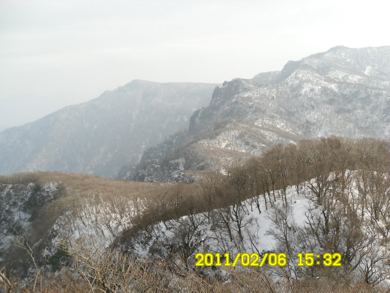
 [The peak of Mt. Sobo from the entrance of the trail, 麓から見た祖母山の峰々、기슭으로부터 본 소보산의 봉우리들]
 [At the entrance of the trail,登山路入口にて、등산로 입구에서]
 Soon we came to the 1st suspension bridge. That was an important bifurcation point of Gurogane Ridge and Miyahara Ridge.
 [At the 600m Point, 標高600m地点にて、표고 600m 지점에서]
 [At the fork near the 1st suspension bridge, 第一つり橋のそばの分岐点にて、제1 조교 옆의 분기점표식에서]
 The explanation board says Gurogane couse is tougher, but better view and Miyahara course is easier for general hikers.
We considered ourselves as strong hikers, and chose Gurogane course, but it was our mistake. (We found out this fact later.)
There were a few guideposts, but there were signs showing the altitude. We began walking at lower than 600 meters, and the top of the mountain is 1756 meters, so the difference is more than 1,000 meters.
 [Kawakami Valley, 川上渓谷、카와카미 계곡]
 [At 800m Point, 標高800m地点、표고 800m 지점]
 [Big mushrooms on a pine tree, 松の木に生えた大きなキノコ、소나무에 자란 큰 버섯]
There was no snow until up to 1,000 meters. Then we had snow, and the snow became deeper and deeper as we climbed the mountain. We both put climbing irons on our booths, but I did not bring spats. (I did not expect so much snow.) Therefore, snow came into my booths, and feet got wet was I walked.
 [1200m point, 1200m地点、1200m지점]


We could not see the trail clearly, yet we could see someone’s steps on the snow. The worst problem was the mountain bamboos covered by deep snow. We have to walk one step by one step, pulling our feet out of snow covered bamboo bush. Oh, it took much time and patience.

 [1400m Point, 1400m 地点、1400m 지점]
We came to the natural shelter called “Tenguno Iwaya.” It was already 1 p.m. We had a lunch break there, but not much appitaite.
 [The natural shelter, "Tenguno Iwaya" 天然のシェルター『天狗の岩屋』천연의 쉼터인「텐꾸의 이와야」]
 After the break, Mr. Matsumoto happened to find an ice ax under the snow. He lost his own when we were in Yatsugatake half a month ago. It was just like that God returned his ax which he lost in Yatsugatake, in Kyushu.
We came to the cross point the trail from Mt. Kosobosan. There we saw a small tent in which someone was inside. He was the only hiker we saw for the entire trail from the beging to the end.
The snow became deeper and deeper and I felt my legs cramped up. Mr. Matsumoto encouraged me, saying “we must reach the top first, otherwise, we cannot go down.”

When we reached at the last cliff where there were steel ladders. It was the most difficult part, because the ladders were buried with snow, and it was a steep cliff. My big gloves were helpful. I could hold snow with them. They were waterproof and comfortable. I pushed Mr. Matsumoto up to the to of the cliff. We were very close to the top.
 [The most dangeous part of the hike,今回の登山でもっとも危険な場所、이번의 등산에서 가장 위험한 장소]
When we arrived at the top of Mt. Sobo, it was 4 p.m. already. It was the time we were supposed to be down, but we began descending from that point.
 [We arrived at the top of Mt. Sobo at 4 p.m., 我々は4時にようやく祖母山頂上に着いた、우리들은 4시에 드디어 소보산 정상에 도착했다.]

Miyahara Ridge was much easier, so we were almost running against the time. When we reached at Kawakami Vallege, it became completely dark.
 [At "Umanose" or "horse-back" point, 『馬の背』地点にて、『말 등』지점에서]
We turned on our flash lights, but when we came to the point where the trail was crossing the stream, we lost our way.
Both of us tried to find the trail, and I was the first one to find the correct way. I called Mr. Matsumoto, and we came to the 2nd suspension bridge.
When we came back to the 1st suspension bridge, we were sure that we could go back to our car.
There was crescent moon and a bright star on our head. It was 7 p.m. when we arrived at the car.
Then something unexpected happened.
When Mr. Matsumoto pushed the start-button, the engine did not work! He tried several times, but failed to start. He tried to call the rent-a-car company, but we were out of the cell-phone signal. Oh, we were so anxcious at that time. But alast, we heard the sound of engine. We could start the car and drive to our hotel.
When we arrived at Seib Resort-In in Beppu, it was 9 p.m. We decided to use the car for one more day, and had a little party at my room. It was a kind of “Busness Hotel” and the cost for a single room with breakfast was 6,200 yen. I think it was quite reasonable. I also liked the spa at the hotel.
九州旅行第2日目 2月6日(日)晴れ
登山地:九州・祖母山(そぼさん1756m)
登山コース:尾平→黒金尾根→天狗岩→交差路→梯子付岩場→祖母山山頂→宮原尾根→尾平
同行者:松本氏
祖母山は、大分県(豊後大野市、竹田市)と宮崎県(西臼杵郡高千穂町)にまたがる、標高1,756mの山であり、宮崎県の最高峰である(大分県の最高峰は標高1,791mの九重山中岳)。日本百名山の一つ。
さて、国民宿舎『久住高原荘』の朝食もハイクォリティの朝食だった。
ホテルの前でレンタカーとともに写真撮影後8時ごろ出発。細い林道のような道路を標高600メートル地点の出発点、尾平鉱山跡へ向かう(尾平には江戸時代に開発され、戦後閉鎖された鉱山があった。今もその跡がある。)
 [In front of the hotel before leaving, 出発前にホテルの前で,출발전에 호텔 앞에서]
 1日に2本しかないというバスは竹田駅を9時発だという。バスの終点の登山口へ9時30分に到着。立派なトイレがあったが、氷結のためか水が流れない。それでも二人でトイレを利用してから出発。
 [The peaks of Mt. Sobo from the entrance of the trail,麓から見た祖母山の峰々,기슭으로부터 본 소보산의 봉우리들]
 [At the entrance of the trail, 登山口にて、등산로 입구에서]
川上渓谷に沿って20分ほど登るとつり橋があり、その手前が黒金尾根コースと宮原尾根コースの分かれ道になっていた。
 [The first suspension bridge、第一つり橋、제1 흔들다리]
ここで、一般コースの宮原コースをとらず、登山路が急峻だが景観がよいという黒金尾根コースと選択したことを後で悔やむことになるとはこの時点では知る由もない。
 [The notice at the fork, 分岐点の注意書き、분기점의 설명서]
道標はあまりなかったが標高が100m上がるごとにその標識があった。標高1000m地点までは雪もなく、順調に登った。
 [A view from an observation, 展望台からの眺め、전망 대로부터의 조망]
 しかし、標高1000m地点で登山路に雪が現れてからアイゼンを着けたが、この後がたいへんだった。積雪がしだいに多くなるのはもちろん、登山路が明確でなく、ただひとつあった靴跡を頼りに登ったが、熊笹を踏み外すと膝の上までの雪。一歩進んでは足を雪から引き抜いて進むと言う按配で非効率極まりない。
 [1000m Point, 1000m地点、1000m지점]
おまけにスパッツを忘れたため、靴に雪が入ってきて靴の中がびしょびしょになった。
 [1300m Point, 1300m地点、1300m지점]
熊笹と雪と格闘しながら天狗の岩屋に着いたのは午後1時すぎ。ここで昼食にしたが、コンビニで買ったビールを飲む気にもならなかった。
 [The natural shelter, "Tenguno Iwaya," 天然のシェルター『天狗の岩屋』천연의 쉘터인「텐꾸의 이와야」]
 岩屋で小休止後、松本氏は雪の中に埋もれたピッケルを見つけた。ピッケルは前回、八ヶ岳で失くしたばかりだったので、ちょうど良いタイミングだった。
午後2時過ぎに古祖母山との交差路に出た。ここで今回の9時間の山行で唯一、他のハイカーと交差した。もっともこのハイカーは一人用テントの中に入って休んでいたようだ。
 [At the cross point, 交差点にて、교차점에서]
この地点からさらに進むとますます雪が深くなり、前進する速度も遅くなった。また、私は両足が攣りそうになった。
 [Mt. Kosobosan, 古祖母山、코소보산]
かなり苦しい状況だったが、最後のピークに差し掛かる前の断崖を登る部分は、簡単なスチール製の階段が雪に埋もれ、特に大変だった。
 [The most dangeours point of this hike, 今回の登山で最も危険な場所、이번의 등산으로 가장 위험한 장소]
松本氏も足が上がらないようで、彼の尻を押した。その上の岩場はつかむところがあるのでさほど大変ではなかった。
二重手袋の外側の部分だけを使ったが、防水でもあり、十分暖かかった。
結局頂上に到達したのは午後の4時。登山開始以来6時間以上もかかったことになる。
 [We arrived at the top of the mountain at 4 p.m., ようやく午後四時に頂上へ到着した。드디어 오후 4시에 소보산 정상에 도착했다.]
ここで松本氏はレンタカーの係員に携帯電話を掛けた。そして急いで下山にかかった。
 [Mt. Matsumoto called the company, 松本氏はレンタカー会社へ連絡、마쓰모토 씨는 렌트카 회사에 연락]
宮尾コースは黒金コースにくらべればずっと楽なコースでしかも下りなので一気に下ることができた。
 [Altitude 1200m poit, 標高1200m地点、표고 1200m 지점]
 [Altitude 1100m point, 標高1100地点、표고 1100m 지점]
 それでも明るいうちに完全下山とは行かす、700m地点までおりたところですっかり暗くなった。
川上渓谷まで下りたところで道が見えなくなり、二人でしばらく渓谷をさまよった。私の方が先に対岸の登山路を見つけ、ライトをつけて彼に知らせた。これは正解だった。
しっかりした登山路をライトで照らしながら下るとつり橋に出て、一安心。
軽乗用車に戻ったのは7時だった。ところが、ここで真っ青になる事態が発生。
それはレンタカーのスタートボタンを押してもエンジンがかならないことだ。しかも携帯電話も谷あいのため通じない。結局5分ほど試しているうちにようやくエンジンがかかった。
うれしい気持ちで車を走らせ、30分ほど下山すると彼の携帯に着信メッセージが入った。ここで車を止め、レンタカー会社の人に電話をかけ、車をもう一日借りることを告げた。
この後、予約してあった別府の西鉄レゾートイン別府に着いたのは午後9時だった。
ホテルのそばのコンビニで食事を購入し、チェックイン後、温泉に入ってから食べたのは午後10時だった。
ここはビジネスホテルなので部屋はシングルを2つとってあり、料金は朝食込みで6200円はリーズナブルだと言えよう。
0 件のコメント:
コメントを投稿