About pictures/当ブログ内の写真について/당 블로그내의 사진에 대해서

Most of the pictures in this blog are taken by my camera, yet some of them were downloaded from the website of the hiking club. If you click any pictures, they become the original size.

当ブログ内の写真の大部分は筆者のカメラで撮影したものですが、一部、山岳会の共有写真からダウンロードしたものを含みます。すべて、各写真をクリックすれば、元のサイズに拡大します。

당 블로그내 사진의 대부분은 필자의 카메라로 촬영한 것입니다만 일부 산악회 공유 사진으로부터 다운한 것도 포함합니다. 모두 각 사진을 클릭하면, 원래 사이즈에 확대합니다.

2013年4月25日木曜日

130301 Mt. Geumsubong (錦繡峰クムスボン금수봉531m) in Sutonggol 8ストンコル수통골), Yuseong-gu(儒城区), Daejeon

Date: March 1st (Fri) Rain, then fine

Hiking Course: Sutonggol Parking Lot – Binggesan (415m) – 3 junction – Geumsubong (531m) – Stonggol Fall – Parking Lot (About 5 km, 3 hours)

Partners: Jim (Australia), Corum Ireland), Eric (China)

March 1st is a national holiday in Korea. It commemorates the day (March 1st, 1919) when Korean people uprised against Japanese imperial rule on the Korean peninsula that day.

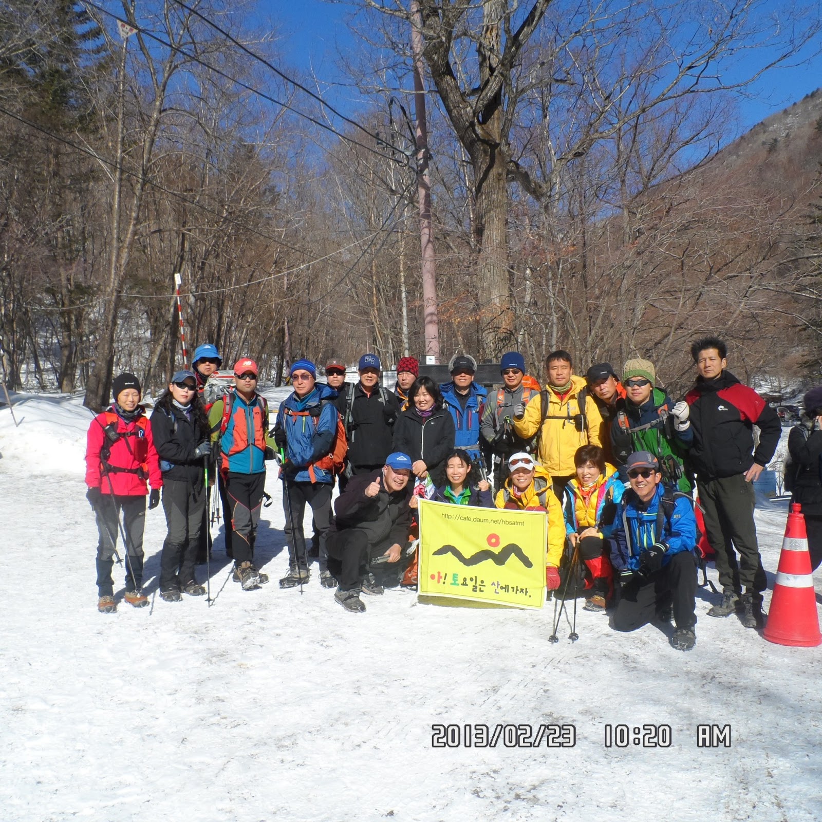
I proposed a hike for Teajonhikers’ community, and 3 people joined me; Jim, Corum and Eric.

Jim had a private class in the morning, so we gathered at KAIST Main Gate Parking Lot at 12:00.


[We got together at KAIST at noon, 昼にKAIST正門に集合、정오에 KAIST 정문에 집합]

Jim came by his wife’s car. So we could all go together by his car. (I originally planned to go by bus.)

Jim parked his car just in front of the entrance of the trail to Binggesan. There was a banner for the traversal competition starting that point.


[A banner at the foot of the mountain, 『トルレ山道縦走大会』の横断幕、"둘레산길 종주 대회 '현수막]

We followed the same trail up to the top of Binggesan.


[We began climbing Binggesan, ビンゲ山登山開始、빈계산 등산 시작]

I walked this trail with Taejonhikers’ member before, but the trail was well facilitated with wooden steps this time.


[We could see Mt. Geumsubong from the ridge, 稜線から錦繡峰が見える、능선에서 금수봉이 보였다.]

Korean people, esp. local governments are improving many trails all over the peninsula. Yuseong-gu office is no exception. They are active in making many trails in Yuseong-gu, just the same as Daejeon City Government. (Since Stonggol is a part of GyeRyongSan National Park, it might be a branch of Korean government to facilitate the park.)


[At the top of Binggesan, ビンゲ山山頂(415m)にて、빈계산 정상에서]

Anyway, it was not too difficult to reach the top of the first mountain, Binggesan. We had light lunch there. I shared my sandwiches using “vegemite” with Jim and Eric. (Corum had his own sandwiches.)

Then Jim proposed to hike to Mt. Geumsubong, the main mountain peak in Songgol. We all agreed and headed for Geumsubong.


[The guidepost of the junction, ビンゲ山三叉路の里程標、빈계산 삼거리 이정표]

When we arrived at the observation deck, it became clear in the sky and we could see the town of Daejeon very well.


[At the observatory deck, 展望台にて、전망대에서]


We could even see Geumgang River in the distance. I also noticed Mt. Deokgyusan beyong the river.

There were much snow remained above the observation deck. We walked carefully, not to slip, and arrived at the gazebo at around 2:30.


[The snow covered trail near Geumsubong, 錦繡峰付近の雪道、금수봉 부근의 눈길]

We took a short break at the gazebo. Then we began descending the mountain.


[At the gazebo on Mt. Geumsubong, 錦繡峰の東屋で、금수봉의 정자에서]


[The guidepost showing the descending trail, 下山路を示す里程標、하산길을 나타내는 이정표]

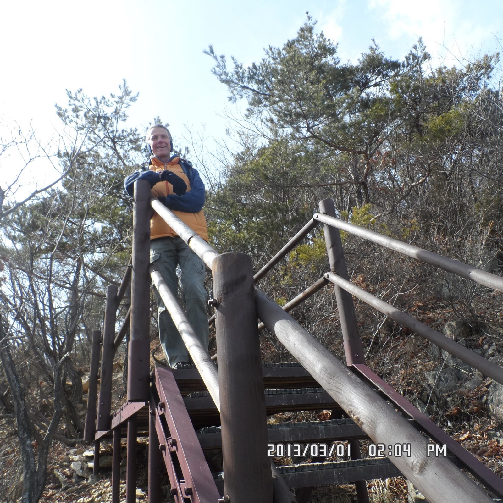
We went down toward the waterfall called Stonggol Fall. It was a bit steep steppes but again well facilitated with wooden stairs.

When we came down to the bottom of the stairs, there was a small river and I used to go into with other members. But I saw a big board warning “No Trans-passing” to protect endangered species such as Korean salamanders.


[We could not go into the river, 渓谷は立ち入り禁止になった、계곡은 출입 금지되었다.]


[We could not go into the river, 渓谷は立ち入り禁止になった、계곡은 출입 금지되었다.]

Well, it cannot be helped and we all have to cooperate such protection movement.


[The Stonggol Fall in the valley, ストンコル滝、수통골 폭포]

We walked along the wooden trail beside the reservoir, then came out to the main gate of Stonggol. It was 3:30 pm.


[A wooden trail along the reservoir, 貯水池の横の木道、저수지 옆의 목도]

It was a bit early for supper, but we dropped in “Stonggol Bongga” Restaurant.


[In front of the restaurant, 『ストンコル本家』の前で、"수통골 본가 '앞에서]

There was no Korean member among us. So, I was in charge of ordering the menu.


[At the restaurant, 『ストンコル本家』にて、"수통골 본가"에서]

We usually order “smoked duck” but this time, I ordered different thing which was on the first on the list. “Yongpuni-Ori-Jumulreok 영풍이 오리 주물럭” was a kind of salad with duck meet with many kind of side-dishes.


[The main-dish "“Ori-jumulreok" メインディッシュの『滋養たっぷりな鴨和え』、메인 요리인 "영풍이 오리 주물럭"]

It was a reasonable price of 33000 won for 4 people (including rice and miso-soup.) We ate all full and satisfied. Jim drove us to KAIST Main Gate at 5:30.

It was the “Samil-Day” hike by Taejeon hikers.

------------------------------------------------------------------------------------

分類:テジョンハイカーズ、ストンコル・ハイキング(錦繡峰クムスボン금수봉531m)

月日:2013年3月1日(金)午後、雨のち晴れ

場所:大田のストンコル(수통골)

コース:KAIST正門→ストンコル駐車場~ビンゲ山(빈계산)~錦繍峰(クムスボン금수봉531m)~ストン滝~ストンコル位置口~ストンコル本家~駐車場 (約5キロ、約3時間)

同行者:ジム(オーストラリア)、コラム(アイルランド)、エリック(中国)

この日は1919年3月1日に日本の植民地支配に抗議して独立運動が起こったことを記念した「三一節」で韓国の公休日だ。今年は金曜日なので一般の人々は三連休である。

テジョンハイカーズの仲間にハイキングを呼びかけたが天気がよくなかったせいもあって、参加者は私を含めて四人だった。

ジムのクラスの都合でテジョンハイカーズの集合時間は12:00になった。まず、アイルランド人の若者、コラムが来て、続いてエリックが来た。12時少し過ぎた頃ジムが車で来た。

出発前にいつものように認証写真を撮ってからジムの(奥さんの)車でストンコルへ向かった。

駐車場に車を停めてからそのまま一番近い登山口であるビンゲ山登山口から山に入った。


[At the entrance of the trail, ビンゲ山登山路入口にて、빈계산 등산로 입구에서]


[The map showing the traversal trails of Daejeon "Dulle" Trail, 大田トルレ山道縦走路を示す標識、대전 둘레산길 종주로를 나타내는 표지]

このコースは林の中を30分ほど登ると稜線に出て、そのまま登り口から2キロほどでビンゲ山頂に出る。所要時間は50分ほどだった。


[On the ridge near Mt. Binggesan, ビンゲ山の稜線にて、빈계산 능선에서]


[We could see the peaks of GyeRyongSan, 稜線から鶏龍山が見えた、능선에서 계룡산이 보였다.]


[At the top of Binggesan, ピンゲ山山頂(415m)にて、빈계산 정상에서]

コラムはサンドをもっていたが、ジムとエリックはなかったので、山頂で私の作った半分サンドを三人でわけてて食べた。

ビンゲ山から錦繡峰まで1.3kmなので行こうとジムが提案し、みなが同意し、三叉路(サムゴリ)まで木の階段を一気に下り、三叉路から錦繡峰までの1キロ弱のよく整備された登山路を登った。


[The wooden trail to Geumsubong, 錦繡峰へ行く木製階段路、금수봉으로 가는 나무 계단 길]


[The mark of "GyeRyongSan Dulegil", 鶏龍山トルレキルの標識、계룡산 둘레길 표지판]

この部分は見晴らしが良く大田の街が良く見える。また、右側奥の方に見える大河の一部は錦江かと思われる。そのかなたは徳裕山(トギュサン)か。


[At the observatory deck, 展望台にて、전망대에서]

木の階段を登り切った尾根には大量の雪が残っていておどろいた。錦繡峰の東屋で認証ショットを撮ったのち、錦繡峰三叉路(クムスボンサゴリ)へ向かって下った。


[The snow covered trail near Geumsubong, 錦繡峰付近の雪道、금수봉 부근의 눈길]


[A warning board on the top of Geumsubong, 錦繡峰頂上の警告板、금수봉 정상 경고판]

この下りは結構急で、コラムがやや遅れたが、ほぼそろって谷川に出た。ストンコルの名前の由来のような川で気持ち良いが、一昨年まで入ることのできた谷川が立ち入り禁止になっていた。生態系の保護のためにはやむを得ないと思う。


[We could not go into the river, 渓谷は立ち入り禁止になった、계곡은 출입 금지되었다.]


[A picture of Koran Crevice Salamander, チョウセンサンショウウオの写真、이끼 도롱뇽의 사진]

ここの小さな滝「ストンコル滝」はいつも気持ち良い。三叉路(サムゴリ)から先は平坦な道ですぐにストンコルの正門に出た。この時点でも4時前で、ほぼ3時間のハイキングだった。


[The Stonggol Fall in the valley, ストンコル滝、수통골 폭포]


[A wooden trail along the reservoir, 貯水池の横の木道、저수지 옆의 목도]

やや早い時間だったが、ストンコル本家で会食にした。今回は外国人ばかりだったので注文を私が担当した。ジムの提案で3万ウォン程度のメニューで十分といいうことになり、メニュー表の一番上のメニュー「양분이 오리 주물럭(滋養たっぷりな鴨和え)」にした。


[The menu on the wall, 壁にかかった料理のメニュー、벽에 걸려있는 요리 메뉴]

これは大正解で、いつものダックの燻製ではなく、鴨肉を野菜たっぷりのプルコギにしたような料理でたしかに量もたっぷりだった。今回はアルコールも注文することなく、追加は1個1000ウォンのライスだけコラムをのぞく3人が注文した。これには味噌汁もついて来る。


[At the restaurant, 『ストンコル本家』にて、"수통골 본가"에서]

支払いは全部で33,000ウォンでカードで払った。一人当たり8,000 Wonだからずいぶんリーズナブルな料金だと思った。

帰りはKAISTまでジムに送ってもらい、5時半ごろ、解散した。その後、サウナであかすりをしてもらい、翌日のアトサン用の果物などを買ってワンルームに戻った。

この日は毎年反日気運が盛り上がる日ではあるが、今年は特に雰囲気が悪く、日本製品不売・不買運動が開始されたというニュースが流れた。私が呼びかけたハイキングに韓国人の参加がなかったことはこのこととは関係ないと信じる。

2013年4月24日水曜日

130223 OhDaeSan (五台山オデサン오대산) Birobong毘盧峰ピロボン비로봉1563m), Pyongchang(平昌ピョンチャン평창), Gangwondo(江原道)

Date: Feb. 23, 2013 (Sat) Fine

Destination: Birobong毘盧峰ピロボン비로봉1563m), OhDaeSan(五台山オデサン오대산), Gangwondo(江原道) Course: Sangwonsa Temple – Jungdaesa Temple – Jeongmyolbogung – Birobong (1563m) – Sangwangbong (1493m) – Bukdaesa – Sangwonsa [10.9 km, 6 hours]

Partner: about 30 AhToSan members

It was a clear and fine day, quite different from the previous day. I was happy riding my bicycle leaving my studio apartment at 5:20 and arrived at South Gate Parking Lot at 9:50 am.

There were many hikers waiting for the bus, but they were not only AhToSan hikers but other hiking club members. Some of them were familier to me, because they were former AhToSan hikers.

One of them “Seolhwa” spoke to me. She used to be a very good AhToSan photographer.

There were only 30 participants for this week hike among AhToSan members. Therefore I could use two seats for myself. I personally like this number of participants.

We arrived at the parking lot of Sanwonsa Temple at 10:10. We walked a paved road for about 20 minutes, then we arrived at the entrance of the trail to Jungdaesa. We took a group picture before climbing the steps.


["Chinhan-saram" joined from Seoul, ソウルから来たチンハンサラム、친한사람이 서울에서 합류]


[A group picture before climbing the mountain, 出発前の集合写真、출발 전 단체 사진]

We needed to wear climbing irons on our boots because the road was completely frozen. The trail to Jundaesa was well facilitated for sightseers. It was a wide steps with unique lighting facilities.


[An unique stone light-stand, ユニークな石の灯篭、독특한 돌 등롱]

Jundaesa Temple was also unique. The buildings were arranged in laminae. It looked like Japanese castles.


[The beautiful temple building of Jundaesa, 美しい中台寺の建物、아름다운 중대사 건물]


[A spring of drinking water, 中台寺の水飲み場、중대사 약수물]


[The reception window of Jundaesa, 中台寺の祈祷受付窓口、중대사 기도 접수 창구]

There was a junction of three trails near Jundaesa. One led to the hill and on the hill, there was Jeongmyolbogung(적멸보궁). The building is said to keep the bones of Gautama Buddha.


[At Jeongmyolbogung, 寂滅宝宮にて、적멸보궁 에서]

After visiting this Jeongmyolbogung(적멸보궁), we came back to the junction of the three trails again, then we headed for the peak of OhDaeSan, Mt. Birobong (비로봉1563m).


[The guidepost to Birobong, 毘盧峰への里程標、비로봉에 대한 이정표]

The trail became narrow and there were no sightseers anymore. There were only hikers heading for the peak. We had “Suzuki-Time” to have fruits for a short-break. One of regular hikers, “J-Nim” offered hot-sake and it tasted good esp. in the winter.


[The short break "Suzuki-Time" 小休止の時間、짧은 휴식 시간]


The snow piled up along the trail was much, maybe deeper than 1 meter. I regretted that I did not bring spats, but the snow on the trail was fixed because many hikers stepped on it.

I saw several Oriental Tits (in Japanese, “Shijukara四十雀” and in Korean “Pakse박새.” They are brave and do not afraid of people. So sometimes, they come close to the hikers.


[An oriental tit at a branch, シジュウカラ、박새]

After the rest, we walked about 50 minutes and arrived at the peak, “Birobong” at 12:20. It was on the ridge and I felt strong wind against my face.


[At Mt. Birobong (1563m), 毘盧峰(1563m)にて、비로봉(1563m)에서]


It was all sudden and I felt freezingly cold. I hurried to wear the jacket, and big gloves, but could not use the pocket-warmers, because it was too cold to take off the gloves and break the plastic bags.

After taking photos with the big stone-mark, I hurried to walk forward, then I joined fast-walkers having lunch under the big trees.


[Lunch under the trees, 木の下で昼食、나무 아래에서 점심 식사]


I made a cup-ramen pouring the hot water, and ate sandwitches with the ramen. It was a quick lunch, and I began after-the-lunch walk at 12:50 with the first group.


[On the way to Sangwanbong, 上王峰へ向かう稜線にて、상왕봉으로 향하는 능선에서]


It blew strong wind while walking on the ridge, but not too strong like around Birobong. But since I used hood, I could not see forward well. I hit my head against branches on the trail several times.


[The president on a tree, アランドロン会長が木に登った。회장님이 나무에 올라갔다..]

The last hit gave me great impact and I was knock down on the snow. After the hard walk of 45 minutes, I arrived at Sanwangbong(상왕봉 1493m) at 13:35.


[At Mt. Sangwanbong(1493m), 上王峰(1493m)にて、상왕봉(1493m)에서]

I was happy to take picture of myself because I was with 1st group hikers.


[On the way to Sangwanbong, 上王峰へ向かう稜線にて、상왕봉으로 향하는 능선에서]

I followed after the 1st group hikers after Sangwangbong and the situation became better when I went down to the woods.


[On the way down, 下山路にて、하산길에서]

I came out to the wider trail covered with snow at 14:10. Now it was much easier because the slope became gentle.


[On the way down, 下山路にて、하산길에서]

I arrived at the parking lot where we started in the morning at 15:20. When the last hiker arrived at the bus, we left the parking lot and went to a small restaurant in Yangpyong in Gyeonggido to have a wrap-up party for this hike.


[Coming back to the bus at 3:20, 3時20分にバスへ戻った、3시 20 분에 버스로 돌아왔다.]

AhToSan paid to the restaurant to use the space and their kitchen. We had the wrap-up party inside the restaurant.


[The entrance of the restaurant for wrap-up party, 打ち上げ会場の食堂入口、뒤풀이 장소인 식당 입구]


[A wrap-up party at the restaurant in Yangpyong, 楊平(ヤンピョン)の食堂で打ち上げ、양평 식당에서 뒤풀이]


["OhDaeSan" a local brand of makgeolli, 地元の『五台山』マッコリ、지역 '오대산'찰옥수수 막걸리]


["Oden" the main dish for the wrap-up party, メインディッシュのオデン、메인 요리인 오뎅]


["Somen" with spicy powder, コッチュカルをかけたソーメン、고춧가루를 둔 소면]


[AhTo members at the party, 打ち上げパーティにて、뒤풀이에서]


The hostess of the restaurant provided us not only the space and kitchen, but also several additional side-dishes such as “takuan” and “kimchi.”

The main dishes were “Oden” and “somen.” We bought local “makgeolli”made from corns.

We enjoyed the party from 4:30 to 5:30 and went back to Daejeon after 8 pm.

The chairman of AhToSan supported the budget, so we could enjoy without additional cost. Thanks to Chairman, Alain Delon!

----------------------------------------------------------------------------------------------

分類:登山、韓国、冬山

登山月日:2013年2月23日(土)快晴

登山地:江原道平昌(평창)の五台山(オデサン오대산)[韓国100名山の1つ]

登山コース:上院寺(상원사)- 中台寺(중대사) - 寂滅宝宮(적멸보궁) - 毘盧峰(ピロボン비로봉1563m頂上) - 上王峰(상왕봉 1493m) - 北台寺(북대사) - 上院寺 [約10.9km、6時間]

同行者:アトサン会員約30名

前日とは打って変わって良い天気に恵まれた。5時20分のEBS日本語放送の開始とともに自転車で出発。南門には10分前に到着した。

いつもより多い人々がバスを待っていたが、そのうちの一人、雪花が私に挨拶に来た。アトサンのほか、プルナも同じ場所に集まっていたようだ。

アトサンの参加者は約30名で座席は余裕があった。江原道平昌の五台山までは4時間かかる。上院寺の駐車場には10時10分に到着した。


[A group picture before climbing the mountain, 出発前の集合写真、발 전 단체 사진]

駐車場から登山道までの道もかんかんに凍っていてあぶない。みんな最初からアイゼンを装着した。


[At the parking lot, 上院寺の駐車場にて、상원사 주차장에서]

上院寺から中腹の中台寺(チュンデサ)、さらのその上の寂滅宝宮(ジョンミョルポグン적멸보궁)までの道は登山者だけでなく一般の参詣者も行けるように登山路は広く整備されていて、積もった雪さえも丁寧に除去されていた。

平坦な道からつづらおりの道へ入る場所には大きな石の玉に金文字で「寂滅宝宮」という漢字4文字が刻まれていた。


[At the entrance of the trail, 寂滅宝宮へ向かう登山路の入り口で、적멸보궁으로 향하는 등산로 입구에서]


[Well-facilitated trail, 良く整備された登山路、잘 정비 된 등산로]


[An unique stone light-stand, ユニークな石の灯篭、독특한 돌 등롱]

つづらおりの道を登り切ったところが「中台寺(チュンデサ)」という寺らしく、坂の途中から城のように階層になった伽藍の丹精が美しい。


[The beautiful temple building of Jundaesa, 美しい中台寺の建物、아름다운 중대사 건물]


[The reception window of Jundaesa, 中台寺の祈祷受付窓口、중대사 기도 접수 창구]

(Note) The shinning plates are those on which "luck-wishers" pay to the temple and write their "wishes" just like Japanese "Ema" you can see when you visit temples/shrines in Japan. 注:手前の銅版は参拝者が祈願を書くもので、日本の『絵馬』に似ている。(주)앞의 동판은 참배객들이 기원을 쓰는 것으로, 일본의 "에마"를 닮아있다. 中台寺の上が「寂滅宝宮」へ行く参道と毘盧峰へ行く登山路の別れ道になっていて、みな参道を登って「寂滅宝宮」を見学してから階段を再び降りて毘盧峰への登山道へ入る。


[The trail to Birobong, 毘盧峰へ向かう登山路、비로봉으로 가는 등산로]

寂滅宝宮はアランたちテジョンハイカーと2005年ころの秋に月精寺から登るコースで訪れたことを思い出した。


[At Jeongmyolbogung, 寂滅宝宮にて、적멸보궁 에서]

当時はこの寺のようにみえる建物が「寂滅宝宮」であることを知らなかった。「寂滅宝宮」とは新羅の高僧慈蔵が感得した仏舎利を奉安している寺院で、五台山の寂滅宝宮は全国で五カ所あるうちの1つである。

当然、この寺院には仏像はなく、仏舎利が奉安してあると言う。この参道の階段を下りた部分から本格的な登山路が始まる。積もった雪は1メートル以上ありそうで、スパッツを忘れたことを後悔したが、登山者が多いため、歩く部分は雪が踏み固められていて、道を外れさえしなければ大丈夫だった。

この雪道に入ってすぐ、中間グループが休憩している所に追いつき、ブドウとミニトマトを提供した。Jニムが熱燗の日本酒を振る舞っていて、私も一杯ごちそうになった。日本酒の熱燗は冬の登山ではありがたい。


[After the short break, 小休止後、毘盧峰へ向かう、짧은 휴식 후 비로봉으로 향했다.]

この時、パクセ(日本語:シジュウガラ)が数羽近づいて来た。彼らは人なれしていてかなり近くまで寄ってくる。


[An oriental tit at a branch, シジュウカラ、박새]

この休憩から約50分ほど進んだ12時20分ごろ、毘盧峰に到着した。毘盧峰の周囲には樹木がなく、強風が吹きすさんでいた。


[At Mt. Birobong (1563m), 毘盧峰(1563m)にて、비로봉(1563m)에서]

それまで上着を脱いでいたのをあわてて着用し、フードも被った。手袋も厚手のものを着用したが、ポケットに用意した一回用カイロはあまりに寒くてセロファンの袋を破ることができなかった。


[On the ridge after Birobong, 毘盧峰を過ぎた稜線にて、비로봉 지나서 능선에서]

写真を撮るために手袋を脱ぐのさえつらい寒さだった。毘盧峰を過ぎて約20分ほど進んだ丘の影の朱木の下で先発隊が昼食をとっていたのに追いついた時はほっとした。

下段は先発隊でその上に中間グループが席をとった。私もその端でカップラーメンとサンドイッチの昼食をとった。昼食は簡単にして、先発隊について行くことにしたので私の休憩時間は15分ほどで12:50には出発した。


[Lunch under the trees, 木の下で昼食、나무 아래에서 점심 식사]


尾根歩きは強風が続いたが、毘盧峰の時ほどの衝撃はない。しかし、フードを被ったため前方の視界が悪く、灌木に頭をぶつけることを繰り返した。


[Mr. Magpie on the ridge, 稜線の『カッチ』大将、능선에서 "까치"대장님]

最後の一発はカウンター気味に当てられた格好になり、ひっくり返ってしまった。出発して45分後の1時35分に上王峰(1493m)に到達した。


[On the way to Sangwanbong, 上王峰へ向かう稜線にて、상왕봉으로 향하는 능선에서]


[At Mt. Sangwanbong(1493m), 上王峰(1493m)にて、상왕봉(1493m)에서]


先発組と認証写真が撮れたのがよかった。この後も先発組の後をついて進んだが強風は林道にでるまでつづいた。


[On the way down, 下山路にて、하산길에서]

2時10分ごろ、雪に覆われた広い林道に出た。あとはやや長い林道の道を上院寺まで下ったが、途中、左足に装着したアイゼンの踵の部分で鎖を結ぶゴムの部分が切れていて、ゴムが踵にきつくかかって足が痛んでしょうがなかった。


[On the way down, 下山路にて、하산길에서]

途中からアイゼンを外して事なきを得た。私がバスに到着したのは3時20分だった。五台山は国立公園のため、飲食を伴う打ち上げ(ティップリ)はできない。全員がそろったところでバスは出発し、1時間ほど山を下った京畿道の楊平(ヤンピョン)の食堂で打ち上げをした。


[The entrance of the restaurant for wrap-up party, 打ち上げ会場の食堂入口、뒤풀이 장소인 식당 입구]


[Inside of the restaurant, 食堂内部、식당 내부]


[A wrap-up party at the restaurant in Yangpyong, 楊平(ヤンピョン)の食堂で打ち上げ、양평 식당에서 뒤풀이]


["OhDaeSan" a local brand of makgeolli, 地元の『五台山』マッコリ、지역 '오대산'찰옥수수 막걸리]


["Oden" the main dish for the wrap-up party, メインディッシュのオデン、메인 요리인 오뎅]

打ち上げ料理担当は『マンチャ』で、メニューはおいしいおでんプラス「ソーメン」だった。タクワンも自家製らしくておいしかった。また、場所を提供してくれた店の女主人の協力もあって、おいしいキムチもふんだんに出て、なによりも楊平産のトウキビマッコリがうまかった。


["Mancha" greeting on the way back to Daejeon, 大田への帰路、『マンチャ』が挨拶をしている。대전으로 향하는 귀로 '만차'가 인사를하고있다.]

打ち上げは4時半から5時半まで1時間続き、大田へ戻ったのは8時過ぎになったが満足のいく山行だった。

参加者は約30名だったので、費用の一部は会長が補填したようで会長アランドロンの太っ腹に感謝。