150816 Namdeokyusan(南徳裕山남덕유산1507m)
Date: Aug. 16, 2015 Cloudy
Destination: Namdeokyusan(南徳裕山남덕유산1507m)
A Course: Yukshipryong (육십령) – Halmibong (할미봉) – Seobong (서봉) – Nam-Deokyusan (南徳裕山 남덕유산) – Wolseongjae (월성재) – ToOkDong Valley(토옥동계곡) – Parking Lot (15km 7 hours)
Partners: About 30 AhToSan Members
I went to the bus stop at Expo South Exit at 6:50. It took my about 15 minutes from Toyoko-inn. I was the first person among the members.
Mr. & Mrs. KS were in charge of meals for “Wrap-up Party.” They arrived soon after me. My old friends such as Jeongjeong, Mogwa and Alain Delon were absent.
Yet other friends such as Jeongdaoun, Sansalang, Ruchi and J-nim joined. It was my pleasure to see Mrs. J who came with J-nim.
The nice couple, Mindollae and Dolkko-nim also joined this hike. They came to Japan to climb Mt. Fuji only two weeks ago.
Dolkko-nim asked me about how to use the pedometer which he bought in Japan. He did not have instruction booklet, so I could not help him.
“Piano Man”took the role of MC on the chartered bus. He introduced “Gongja Park” as the hiking leader that day.
The destination is not too far from Daejeon.I It’s about two hours bus-ride. We arrived at “Yukshipryong” the starting point for A-couse at 9:08 am.
We all got off there and took several group pictures, then B-course members went back to the bus. B course members got off at Yonggaksa temple and began hiking about 30 minutes later.
I walked mostly with Ruchi, the hiking leader for B-course.
I took the group picture of B-course, then began hiking.
There was a wooden stairs there. When we walked up to the stairs, then there were four Korean-style graves and yellow flowers called “Kisuge” in Japanese, around these graves.
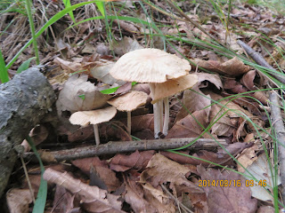
We walked gentle slopes along the ridges in the woods. We walked in the fog. I saw many mushrooms along the trails.
When we came close to Halmae Bong, then the trail became rocky and steep. We needed to grab ropes sometimes.
I caught up with Ruchi at Halmibong, and took pictures of him and he took mine.
When we passed the peak, then we walked in the woods again.
There were many different kinds of flowers. I noticed orange color flowers called Dongjakko(동자꽃) and blue color flowers of small bell shape.
Ruchi used walky-talky and exchange information with “Gongja”. The top group had lunch at Sobong, and we had lunch on the rock away from Sobong about 1.5 km.
My lunch was “red-bean rice” provided by AhToSan as “breakfast.” It was enough for me, but many members liked to share their food. So, I could get variety of side dishes from other members.
After having lunch, we resumed the hike. We arrived at Sobong soon and the views from the peak were good. There were many different wild plants as well.
As we walked to Namdeogyusan, the plants we saw were changed, maybe because of altitude.
From a certain junction of three trails, we had a direct access to the peak of Namdeogyusan and returned to the point about 1.5 km distance. Then we went down through the “closed trail.”
Actually the trail we took was closed, and according to the warning, the fine was 300,000 won!
This course, we had to across the river many times, so the authority worried about hikers accident, I thought.
However, we went to the “closed” trail, and I caught up with Mindullae and Dolkko-nim when J-nim provided “grapes” for the buddies.
When we came out from the woods to the foot of the mountain, it began raining. Just like at Mt. Fuji, Dolkko-him lent me “wind-breaker.”
It was a light rain and soon stopped before we arrived at the parking lot.
The top group members were already enjoying “roundup party” with dishes prepared by Mr. & Mrs. KS.
The main dish was “Odeng” and ramen. They also provided fresh makgeolli.
We finished the party at 5:15 pm and returned to Expo South Gate Bus Stop at 7 pm.
I returned to Toyoko-inn and stayed there. It was a nice hike with nice buddies for me.
--------------------------------------------------------------------------------------------------
分類:登山、韓国、夏山
登山月日:2014年8月16日、曇り
登山地:慶南(경남)・咸陽(함양)・南徳裕山(남덕유산1,507m)
登山コース:Aコース:六十嶺~ハルミ峰~西峰~南徳裕山~渓谷~バス駐車場(15km、7時間)、Bコース:霊覚寺(영각사) - 南徳裕山(남덕유산) - ウォルソンジェ(월성재) -トオクドン渓谷(토옥동계곡) –駐車場(10.5km 5時間)
同行者:アトサン山岳会約30名
東横インから南門バス停まで徒歩約15分。6:50に着いたが、私が一番早い。
KS夫妻が打ち上げの料理担当で、食材を携えてすぐに到着した。チョンジョンやモグァやアランドロンなどが不参加なのは残念。
しかし、チョンダウン、サンサラン、ルチなどが参加したのはうれしい。Jニムがかわいい奥さんを連れてきたのも感激だ。
トルコニムとミンドルレも参加。ほかにはヨハネ、頂上征服、新春などが顔見知りで、新人も数人いた。
連休のためもあってか、全員でも30人以下だった。また、参加費を集めたチョンダウンは私を飛ばしたのは名誉会員として無料にしてくれるという約束を守ったものである。
トルコニムが私を隣に呼んで、日本で買った万歩計の説明を求めたが、説明書がなければ私にもわからない。後日あらためてということになった。
バスの中でのMCはピアノマンで、山行大将(リーダー)は孔子パク。彼はマンチャニムとともにAコースの先頭を終始歩いた。
南徳裕山はテジョンから2時間ほどの距離で、恒例の朝食休憩をとっても、Aコース出発点の六十嶺には9時8分に到着した。
Bコースもいったん下車して全員の集合写真を撮ってから木の階段を登って出発。私はAコースの後尾大将であるルチとほぼ同行した。
階段を上りきるとすぐに4つの墓石がならぶ墓地で、オレンジ色のキスゲがみごとに咲いていた。
なだらかな稜線を進んだが、さまざまな大きさと色のキノコが目に付いた。大体は林の中の道で、霧がたちこめ、幻想的ではある。
ハルメ峰に近くなると急峻な岩場で、ロープをつかんで登った。
ハルメ峰ではルチに追いつき、互いに認証写真を撮った。ハルミ峰を過ぎるとまた木に覆われた稜線の続きで、さまざまな花が咲いているのはうれしいかぎりだ。
特に目に付いたのは童子花やブルーのベルの形をした花などだ。キノコも相変わらず多い。やがて西峰に近づくにつれ展望の良い岩場が現れた。
ルチがウォーキートーキーで孔子パクと情報交換をしたが、先頭グループは西峰で昼食。われわれはその手前1.5kmの岩場で食事をすることにした。
私の昼食は、アトサン車内で配られた朝ごはんの赤飯だ。これと水で十分であるが、一緒に食事した仲間からキムチや卵焼きなど分けてもらった。
今回の昼食仲間には女性はいなかったが、男性メンバーもしっかりおかずを持参している。
昼食後はすぐに西峰に到着した。西峰付近は特に野生花が多くてきれいだった。モンゴルの草原でもよく見かけたタンポポの花を薄紫にしたような花が多かった。また、ピンクの猫の尻尾のような花もきれいだ。岩場のキジムシロの仲間の花も鮮やかである。
西峰を過ぎて南徳裕山に近づくにつれ花の種類も異なってきて、ツリフネソウの花が目に付くようになった。
キリン草のようなオレンジ色の花も多い。また山頂付近では赤トンボが多く飛んでいた。
南徳裕山へのアクセスは約1.5kmがピストンで、三叉路へ戻り、渓谷へ下るコースだ。このコースは立ち入り禁止になっているコースで、違反者には30万ウォンの罰金と書いてある警告を無視して渓谷下りをした。
思うに、このコースはたびたび谷川を横断しなければならない。このコースで足場の悪い谷川に下ると、すぐにBコースの後尾グループに合流した。
このグループの責任者はJニムで、彼がブドウを仲間に提供している場面で合流し、たくさんご馳走してもらった。
このグループにはミンドルレとトルコニムがいてこれから先は楽しく同行した。
またマイダスが小学校3年生の息子と同行していて、この大変な谷川沿いのコースをよくこなしているのを見た。
ホテルから持参したペットボトルの水がちょうどなくなったが、渓谷沿いだからいくらでも補充ができる。合流後は2回補充した。
やがて森林帯を抜けたころ、ちょうどにわか雨が振り出した。雨具はウィンドブレーカーがあったのだが、富士山のときと同様、トルコニムから灰色のウィンドブレーカーを借りた。
彼らは最新の軽いポンチョを取り出した。アトサンのバスが停まっている駐車場に近づくころ、雨はやんだ。
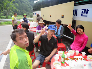
先頭グループが打ち上げパーティをしているところに合流した。メニューはおでんで、飲み物は生マッコリと焼酎だ。
生マッコリはたいへんうまかったし、オデンもうまかった。おでんが終わるころ、袋ラーメンを鍋に入れてこれもうまかった。
打ち上げは5時15分ごろ切り上げ、帰りのバス内では『ピアノマン』がこの日の山行を総括した。
南門には7時ごろ戻った。私は南門から徒歩10分ほどの東横インに戻った。
10キロ強のやや軽い、良い登山であった。
I like hiking very much. I used to go hiking with a Korean hiking club named “AhToSan.” This blog introduces mostly my hiking activities in Korea and Japan, and Sydney in Australia. As of January 2020, I live in Sydney suburb. I go Blue Mountains and bush walk in Sydney area. 私は2003年から2014年まで韓国の大田(テジョン)に住んだ日本人である。11年間、週末は主に「アトサン山岳会」に参加した。14年4月に帰国したが、2020年以降はおもにシドニーで暮らし、時折、日本へ帰国する程度である。したがって最近の記事はSR(Sydney Report)としてブルーマウンテンのトレッキングを中心に書いている。
About pictures/当ブログ内の写真について/당 블로그내의 사진에 대해서
Most of the pictures in this blog are taken by my camera, yet some of them were downloaded from the website of the hiking club. If you click any pictures, they become the original size.
当ブログ内の写真の大部分は筆者のカメラで撮影したものですが、一部、山岳会の共有写真からダウンロードしたものを含みます。すべて、各写真をクリックすれば、元のサイズに拡大します。
당 블로그내 사진의 대부분은 필자의 카메라로 촬영한 것입니다만 일부 산악회 공유 사진으로부터 다운한 것도 포함합니다. 모두 각 사진을 클릭하면, 원래 사이즈에 확대합니다.
当ブログ内の写真の大部分は筆者のカメラで撮影したものですが、一部、山岳会の共有写真からダウンロードしたものを含みます。すべて、各写真をクリックすれば、元のサイズに拡大します。
당 블로그내 사진의 대부분은 필자의 카메라로 촬영한 것입니다만 일부 산악회 공유 사진으로부터 다운한 것도 포함합니다. 모두 각 사진을 클릭하면, 원래 사이즈에 확대합니다.
登録:
コメントの投稿 (Atom)


0 件のコメント:
コメントを投稿