September in Kanto area was hot, just like mid-summer. And the aftermath of Typhoon Faxai remained for long period.
Then in October, another big typhoon hit not only Kanto area, but also Tohoku, or Shinshu, or Koshu areas, and the damage was much bigger than previous typhoon.
Compared in Sydney, we have lots of natural disasters in Japan. Yet, I went climbing mountains as I planned beforehand.
[Hiking at North Yatsugatake 9/25 -26]
I originally planned to go to South Yatsugatake where I could walk through summits from Akadake (赤岳2899m) to Iodake (硫黄岳2760m).
In order to carry out my original plan, I needed to use a night bus, arriving Minotoguchi(美濃戸口) entrance early in the morning, and just like my first day hike of Mt. Hiuchi(燧ヶ岳), more than 10 hour-hike to Mt. Akadake(赤岳).
Unfortunately, there was no night bus to Minotoguchi entrance during the weekday so I had to change my destination from South Yatsugatake to North Yatsugatake
[North Yatsugatake first day: Kita-yokodake (北横岳2480m) 9/25]
I left my house early on Sep. 25, and took the special limited express “Azusa No. 3” leaving Shinjuku at 7:30 a.m.

It was quite comfortable and I arrived at Chino(茅野) at 9:52 a.m. I took a bus from Chino to North Yatsugatake Rope Way Station, leaving at 10:20 and arriving the Rope Way Station at 11:20 a.m.

The rope-way is operated every 20 minutes and it took only 7 minutes to bring people to the summit station (2237m).
I arrived at the summit station before noon that day.

It was a beautiful day. I could see the magnificent views of mountains such as South Yatsugatake, South Alps, Central Alps, Mt. Ontakesan (御岳山3067m) and North Alps mountains.
Nearby the ropeway station, there is an area called “Tsuboniwa.”
“Tsuboniwa” is a nature park of lava plateau at the foot of Mt. North Yokodake.

I reserved a lodge called “Shimagare Sanso (縞枯山荘)” for a night. It is close to Tsuboniwa (坪庭) (only 15 minutes on foot.) I left my bag and climbed Mt. Kita-yokodake (北横岳) without carrying my bag.

It took only an hour from the lodge to the summit of Kita-yokodake. It was an easy hike and I could enjoy better views from the summits.

Just like Hiuchigadake (燧ヶ岳) in Oze there are two summits on Kita-yokodake; one is South Summit and the other is North Summit. Unlike Hiuchigadake, these two summits are closely located, and the ridge trail is short and almost flat.

Anyway, I could return to the lodge at around 3 p.m. The supper was served at 5:40 p.m.
The lodge is 3 story-hut, not so spacious. There were a group of hikers from Nara prefecture(奈良県), 18 people, consisting of 13 ladies and 5 men.
Then an international group from Hong Kong, total 3 consisting of two men and a lady hiker.
Another group was a couple of 60s from Shizuoka prefecture (静岡県). I was only a single hiker among 24 hikers staying at the lodge that night.
Dinner was good at 5:40 p.m. The dining room was packed with people.

After the meal, suggested by Shizuoka hikers, I went out to Tsuboniwa to look up the sky full of stars.
I could see the milky way clearly and even a shooting star across the milky way.
I had a very nice sleep that night.
[North Yatsugatake 2nd day: Mt. Shimagare (縞枯山2503m)9/26]
The name of the lodge is “Shimagare Sanso” and the mountain I climbed on the 2nd day is Mt. Shimagare.
“Shimagare (縞枯れ)” in English is “wage-regeneration.” According to Wikipedia, it is called “Fire wave”
https://en.wikipedia.org/wiki/Fir_wave
It occurs every 100 year’s period. Very interesting.
Anyhow, again by following the suggestion made by the couple from Shizuoka prefecture, I went out to see “sunrise glow” before breakfast.

Breakfast was served at 5:40 a.m. I went out for the early morning hike at 6 a.m. toward Mt. Shimagare.

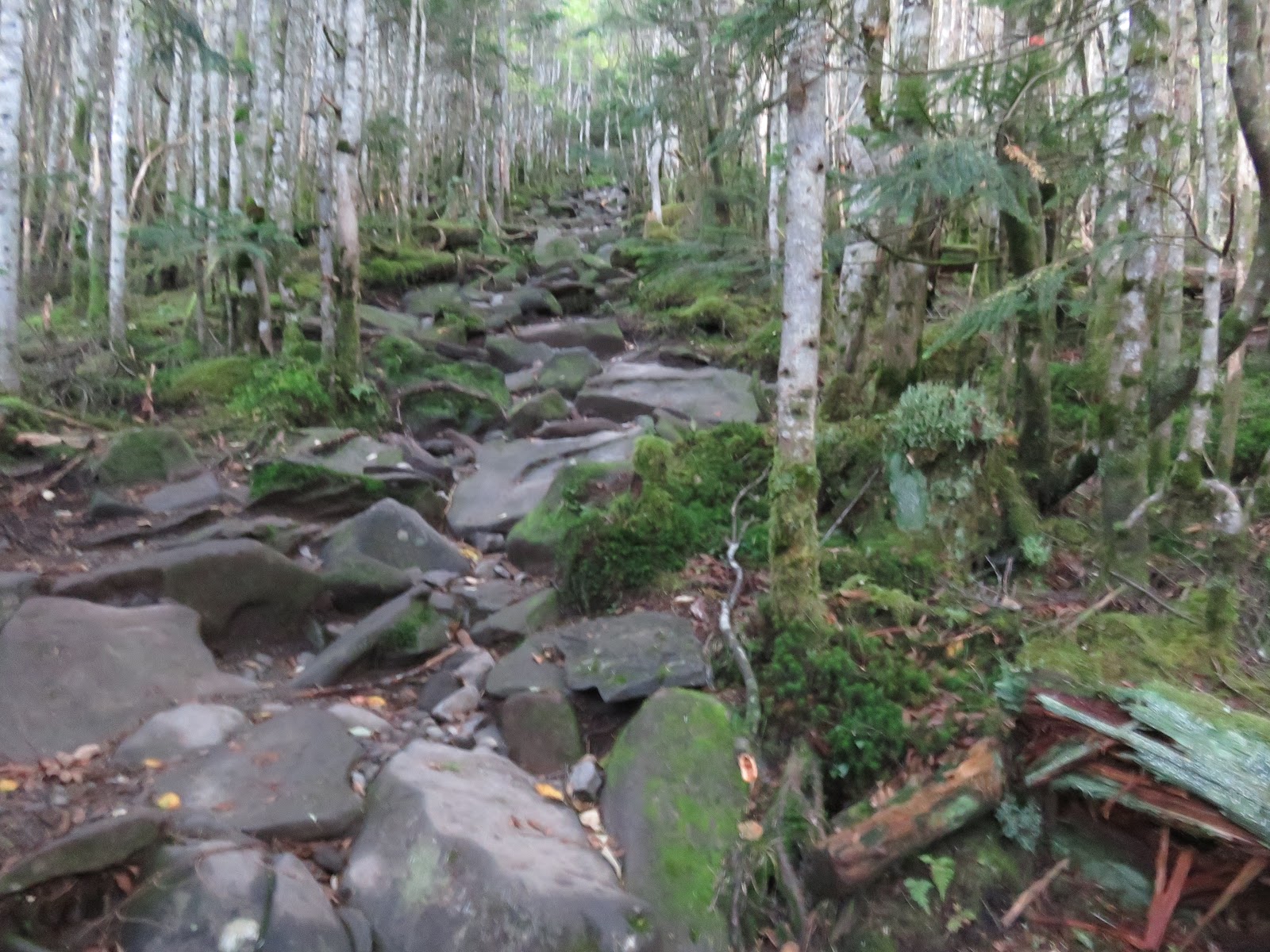
It took less than one hour from the lodge to the summit of the mountain. It was another easy hike.
However the summit was surrounded by trees and no good view at all. I had to walk more to the place called “observatory of Mt. Shimagare” that is only 10 minute walk from the summit.

The observatory however is a rocky place, difficult to walk. It was windy and unstable to stand firm.

The views from the observatory were magnificent like those at Kita-yokodake; Peaks of South Yatsugatake, South Alps, Chuo Alps, Mt. Ontake and North Alps mountains.
After taking pictures, I came down from the observatory. Then I saw the Shizuoka couple coming toward the observatory. It is nice to go hiking together by husband and wife. I was envy of them.
I went down from Mt. Shimagare and walked toward Gotsuji (五辻), then the rope-way statin.
I took 9:40 rope-way to go down to the bus stop. The capacity of the gondola is 100, and I was the only the passenger.

The fee of rope-way is expensive. One way costs 1000 yen. Next time, I should walk down, not using it and save money.
It was my 3rd big hike with one stay at lodge this year, and I could enjoy nice views from the summits of mountains.
I could say it was the best hike among the three hikes, at least - weather wise.
-----------------------------------------------------------------------------------------------------------
KR (Kamakura Report) #4台風19号と「北八ヶ岳登山」
9月の台風15号に続き10月も台風19号が日本列島を襲った。
15号は主に強風に被害が大きく、鎌倉も土砂崩れや倒木による被害が出たが、特に千葉県の送電システムが打撃を受け、停電が長引いた。
これに対し、19号では河川の決壊が広範囲に及び、家屋の流失や人命の被害も多く農地の被害も大きかった。
天災の少ないシドニーに比べ、日本は大変だとつくづく感じた。
私の登山記録は、尾瀬に続いて、北八ヶ岳登山について記す。
[北八ヶ岳登山9/25~26]
当初、八ヶ岳の最高峰である横岳(2899m)がある南八ヶ岳へ、尾瀬同様、夜行バスで登山口(美濃戸口)へ早朝に着き、一気に赤岳登頂を果たし、翌日、八ヶ岳連峰を縦走しようと考えた。
しかし、美濃戸口へ早朝到着する夜行バスが平日は出ていないことがわかり、この計画は断念した。
代わりに特急で茅野へ行き、バスとケーブルを乗り継いで北八ヶ岳へ向かうこととした。
[北八ヶ岳初日:北横岳(2480m)9/25]
北八ヶ岳へのアクセスは夜行バスではなく、大船を朝の6:30出発、新宿(7:30)経由の中央線特急「あずさ3号」を使った。

八ヶ岳の基地とも言える茅野からバス(10:20)で北八ヶ岳ロープウェイ駅へ、そしてロープウェイを使って山頂の「坪庭」へ昼前に到着した。

坪庭は700年から900年前に北横岳が噴火したとき噴出された溶岩が10万坪にわたって露出している地域で、遊歩道が整備されている。

坪庭遊歩コースをめぐってから電話予約した縞枯山荘にリュックを置いて空身で北横岳に登頂した。
山頂からの展望は南八ヶ岳、南アルプス、中央アルプス、御岳山、北アルプスの峰々を一望にでき、登山は天候にそのよしあしを左右されるということを実感した。


縞枯山荘は3層の山小屋で宿泊客は私を含めて24人でほぼ満員だった。奈良県からのグループは18人で女性13人が2Fを占領していた。
3Fは奈良のグループの男性5人、静岡からきた熟年カップル、香港から来たインターナショナル・ハイカーの女性1男性2の3人組、それに私の11人だった。
この山小屋の食事時間は、夕食が午後5時40分、朝食が午前5時40分からと分かりやすく、食事の中身も栄養のバランスがとれたものだった。

夕食後、坪庭まで戻って夜空を見上げると満天の星空で私がわかる星座はカシオペアとさそり座、それに天の川が見事で、月は新月、さらに見事な流れ星を見て、満足した。
[北八ヶ岳:二日目縞枯山(2503m)9/26]
泊まった山荘の名前は縞枯山荘、そして2日目登山する山の名前は縞枯山。これは北八ヶ岳の山々にみられる縞枯れ現象に由来する。
<縞枯れ現象(しまがれげんしょう)は、亜高山帯の針葉樹である、シラビソ、オオシラビソの優占林に限って見られる現象。木々が立ち枯れたり、倒れたりすることにより、遠くから見ると縞状の模様が見られる。
山の自浄作用とも木々の世代交代や天然更新とも考えられている。大規模な縞枯れは蓼科山や縞枯山などで見られる。wave-regenerationと呼ばれる。>(出典Wikipedia)
縞枯山荘に宿泊した翌朝も朝食前に山小屋の前の木道から見た朝焼けの空がきれいだった。

朝食はきっかり5時40分に食堂で提供され、独行の私が最も早く出発の準備ができ、6時前には山小屋を出た。
山小屋の前の木道を坪庭方面とは反対側に進み、縞枯山方面に直登した。
さほど勾配はきつくなく、山小屋を出発したから1時間以内で山頂に到達した。縞枯山頂は低木に囲まれ、展望はまったくない。

山頂から標識に従って左折すると岩だらけの縞枯展望台に出る。

ここからの展望は前日の北横岳からの展望同様で、実に素晴らしい。ただし、巨岩がごろごろで足場が悪く、また、風当たりが強く、それなりの覚悟が必要。
写真撮影を終えて、展望台を降りようとすると、静岡のカップルが登ってきた。夫婦で手を取り合って登る姿は美しい。

縞枯山頂から五辻に下り、ロープウェイ山頂駅に着いたのは9時40分だったので実に軽いハイキングだった。
日本に帰国して3度目の1泊登山だったが、最初から最後まで好天にめぐまれ、感謝。
0 件のコメント:
コメントを投稿