140725 Climbing Mt. Fuji from the Umagaeshi (Yoshidaguchi Route) #1
Date: July 25 (Fri) 2014, Cloudy, then fine
Access: Ofuna – Shinjuku (JR) – Fujisan Station (High Way Bus) – Umagaeshi (Taxi)
Hiking Route: Umagaeshi – 1st Station – 2nd Station -3rd Station -4th Station -5th Station – 6th Station – 7th Station – 8th Station (Taishikan)
Partner: None
I was going to guide some people from Korea to Mt. Fuji this year. So, I felt the necessity to check the route before they come. So, I decided to climb the mountain before I guide them.
I took a train at 7:22 at Ofuna Station to Shinjuku. I went to High Way Bus Terminal of West Exit.
There were many people at the terminal, but I could buy 8:10 bus bound for Lake Yamanaka/Asahigaoka #1. My seat number was 3C, so, there might be a cancel seat.
A young man sat by me, and we began to talk. He was a freshman of a certain university and was to coach tennis for high school students of which he graduated from at Oshino-hakkai.
The bus arrived at Fujisan Station at 10 am. After using a toilet, when I tried to ride a shuttle bus to Umagaeshi, I found out that there was no bus service because of Fujisan Marathon!
The only alternative was to use a taxi. So, I had to hire a taxi from Fujisan Station to Umagaeshi. It cost 3700 yen.
When I arrived at Umagaeshi, there were many “volunteers” for the marathon event. They were providing water, banana, “umeboshi”, etc, to runners.
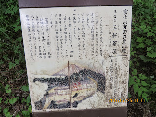
There was a guide plate on which the meaning of Umagaeshi was written. According to the explanation, in the old days, the trail to Mt. Fuji was separated into three.
Kusayama (草山Grass Mountain): From the bottom to Umagaeshi.
Kiyama (木山Tree Mountain): From Umagaeshi to the 5th Station.
Yakeyaa (焼山 The Burned Mountain): From the 5th Station to the summit.
So, I used to climb only the Burned Mountain and I was to climb from “Tree Mountain.”
Along the trail, I saw many people carrying AEDs. They were the students of Kokkushikan University. They were volunteer supporters for the marathon event.
I arrived at the 1st Statin (1520m) at 10:52. It took me about 20 minutes from Umagaeshi.
Then I came to 1.5th Station called “Rekkisu.” There used to be a lodge caleed “Rekkisu” where they sold a beverage named “Rekkisu.” “Rekkisu” was like “Calpis” of nowadays. I happened to see a young Western girl, taking a rest at this point. She is German and came to Mt. Fuji with her friend. She looked like a good hiker.
I came to the 2nd Station at around 11:30. There was a shrine named “Fuji Omuro Sengen Shrine.”
The 3rd station was a service point of the marathon. So there were many volunteers to support the runners. I arrived at the landmark of the 3rd Station (1840m) at 11:52. So, it took me just one hour from Umagaeshi to the 3rd Station.
I arrived at the 4th Station at 12:13. There used to be a lodge named “Daikokuten.”
I arrived at the 5th Station of “Chugu” at 12:30. Actually, I need to walk more until the landmark of the 5th Station (2,350m). There was a “live” lodge named “Satogoya.” So it took me a little more than 2 hours from Umagaeshi to “Satogoya.”
If you take a bus from Shinjuku to the 5th Station of Mt. Fuji, they use “Subaru-Line” and take you to the terminal next to “Omitake Shrine.”
The trail which connects Satogoya and Omitake Shrine used to be called “Omitake-do.” Now this Yoshida Route is connected with Subaru Line Trail above the 6th Station.
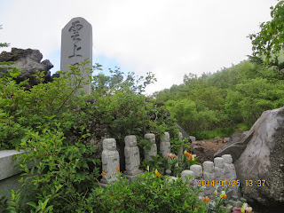
FrI om Umagaeshi, I came to the 5.5 Station called “Kyogatake経ヶ岳.” There was a great Japanese monk called “Nihiren (1222-1282) and he came to this mountain and copied “Hokkekyo法華経” and buried it there. That is way it is called “Kyogatake.”
Anyhow, at the joint of two routes, Umagaeshi Route and Subaru Route, a man sitting under the tent, and asking 1000 yen donation to keep the better condition of Mt. Fuji environment (which started since 2013 after Mt Fuji was designated as World Heritage.)
From this joint to the summit of Mt. Fuji, the route was exactly the same from Subaru Line route.
I arrived at Taishikan which is one of the lowest point of the 8th Station (Hachigome). It was my first time to stay at Taijikan, but I liked it very much because of the larger space between the floor and the ceiling.
Fortunately, there were not too many hikers that day. I shared a section with a young couple and we slept in sleeping bags.
The cost was 7000 yen without any meal.
-------------------------------------------------
分類:登山、日本、富士山
月日:2014年7月25日(金) 曇りのち晴れ。
アクセス:大船~新宿(JR918円)、新宿高速バスターミナル~富士山駅(1750円)~馬返し(タクシー3700円)
登山ルート:吉田口馬返し(1450m10:40)~一合目(1520m11:00)、二合目(1700m11:30)~三合目(1840m11:52)~四合目(大黒屋12:13) ~五合目(佐藤小屋13:08)~六合目スバルライン合流地点(2386m14:00)~八合目「太子館」(3100m17:30)
同行者:なし
にわかに思い立って富士山単独下見登山実施。大I船7:22→新宿8:15 新宿からは中央高速バスで富士山駅へ向かう。
この日は天候も良かったので乗客が多く、河口湖行きは5号車まで臨時便が出た。ということはいついっても切符はとれるということだ。
新宿高速バスターミナルでは窓口で「富士山駅」と言うと8:10発の山中湖/旭丘1号車がすぐに取れた。座席は3Cですぐに満席になったので、キャンセルがあったのかもしれない。
窓際の3Dは忍野八海で中学生のテニス部の合宿にコーチとして参加する大学一年生が座って話をした。彼は第2外国語に中国語を取っているとのことで、英語の実力をつけることの重要性を強調した。
富士山駅には10時ごろ到着。B1のトイレを使ってから馬返しまでのシャトルバスに乗ろうとしたら、この日は富士山マラソンのため運休だという。
しかたなく、タクシーで馬返しへ向かった。料金は3700円で、馬返しには10:30に到着した。馬返しの説明によれば昔は富士山登山道は三区分され、麓から馬返しまでは草山、馬返しから五合目までは木山、そこから頂上までは焼山といわれた。
今回は草山をパスして木山から登山していることになる。木山はその名の通り、樹木がうっそうと茂っている登山道で、これまで利用したバスで五合目まで行くのは単に焼山だけの登山である。
馬返しでは富士山マラソンの関係者が大勢いて、参加者向けのスポーツドリンク、うめぼし、バナナなどをもらった。救護班を含むサポートは国士舘ともう一つの大学生たちで、モバイルAEDを背負った多くの若者をみかけた。
一合目1520mの標識に着いたのは10:52で馬返しからは約20分。
一合目からさらに10分ほど進むと一合五勺で「レッキス」という山小屋跡に到達した。説明によると大正15年(1926年)の開業で、今の「カルピス」のような飲料を提供していたという。
このレッキス跡では一人で休んでいる西洋人の女性に話しかけた。彼女はドイツ人で友人と二人で登山中で、休憩して友人を待っているところだという。私は彼女に頼んで自分の認証写真を撮ってもらった。
二合目付近では富士御室浅間神社を通過した(11:30)。ここには立派な石の鳥居があった。
三合目はマラソンのポイントで、ここでもバナナや梅干し、レモン水などが参加者に提供されていた。三合目の標識(1840m)には11:52に到着したから、馬返しからはちょうど1時間である。
この後、四合目の「大黒天」跡は12:13に通過し、五合目の中宮には約12:30に到着した。
ここから五合目の標識のある佐藤小屋までにはさらに30分ほど歩き、標高2350mに到達したのは13:05だった。馬返しから約2時間強であるから良いペースだった。
この佐藤小屋がある五合目と、スバルラインの終点の五合目とはかなり距離がある。スバルラインの終点には小御岳社があり、ここから小御岳社までの道は小御岳道と呼ばれていた。
スバルラインからの登山道と、吉田口馬返しからの道は六合目の上で合流する。その手前の五合五勺地点は日蓮が法華経を埋納したことから経ヶ岳と呼ばれる。
この日蓮上人の像をまわって、さらに登山道を上ると、スバルラインからの合流地点で、そこには富士山が世界遺産に指定されたことから、昨年から導入された「富士山保全協力金」を徴収する場所があった。
この六合目からこの日の宿泊場所である八合目の「太子館」までのコースは2006年から昨年まで利用した登山道と同じである。
バスで五合目に到着した場合、通常午後1時から歩き始めるので、ほぼ同じペースで登ったといえよう。
八合目の大使館に到着した時間は午後5時30分で、私の足も限界に近かった。
太子館は予約なしで、素泊まり7000円を支払った。部屋は天井が高く空間が他の小屋に比べて広いような気がした。寝る場所は寝袋で、隣は若いカップルだったが、ぎゅうぎゅう詰めではなく、快適だった。
I like hiking very much. I used to go hiking with a Korean hiking club named “AhToSan.” This blog introduces mostly my hiking activities in Korea and Japan, and Sydney in Australia. As of January 2020, I live in Sydney suburb. I go Blue Mountains and bush walk in Sydney area. 私は2003年から2014年まで韓国の大田(テジョン)に住んだ日本人である。11年間、週末は主に「アトサン山岳会」に参加した。14年4月に帰国したが、2020年以降はおもにシドニーで暮らし、時折、日本へ帰国する程度である。したがって最近の記事はSR(Sydney Report)としてブルーマウンテンのトレッキングを中心に書いている。
About pictures/当ブログ内の写真について/당 블로그내의 사진에 대해서
Most of the pictures in this blog are taken by my camera, yet some of them were downloaded from the website of the hiking club. If you click any pictures, they become the original size.
当ブログ内の写真の大部分は筆者のカメラで撮影したものですが、一部、山岳会の共有写真からダウンロードしたものを含みます。すべて、各写真をクリックすれば、元のサイズに拡大します。
당 블로그내 사진의 대부분은 필자의 카메라로 촬영한 것입니다만 일부 산악회 공유 사진으로부터 다운한 것도 포함합니다. 모두 각 사진을 클릭하면, 원래 사이즈에 확대합니다.
当ブログ内の写真の大部分は筆者のカメラで撮影したものですが、一部、山岳会の共有写真からダウンロードしたものを含みます。すべて、各写真をクリックすれば、元のサイズに拡大します。
당 블로그내 사진의 대부분은 필자의 카메라로 촬영한 것입니다만 일부 산악회 공유 사진으로부터 다운한 것도 포함합니다. 모두 각 사진을 클릭하면, 원래 사이즈에 확대합니다.


0 件のコメント:
コメントを投稿