We left Yokohama City Air Terminal (YCAT) at 20:40 by the bus. The round ticket from Yokohama to Kamikochi cost only 6,000 yen. We paid 1000 yen more for the lunch box. The bus went to Ikebukuro via Tokyo and Shinjuku. The bus left Ikebukuro at 23:00 previous day (8/19).
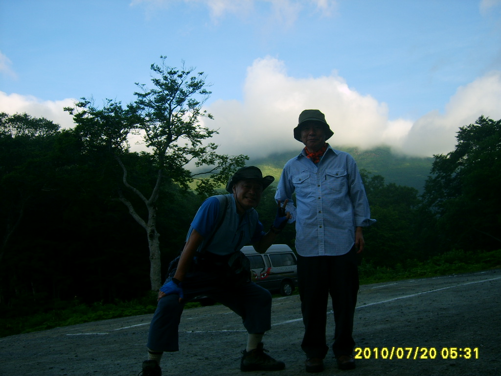
We arrived at Tokura at 4 a.m. We changed to a micro-bus to Hatomachi Pass there. We arrived at Hatomachi Pass at 5:20 a.m.
After having breakfast, we began walking toward Mt. Shibutsu from Hatomachi.
 [Befor starting the hike, 登山出発前に、등산 출발전]
There are huge “Himalayan Cedars” and “Betula ermanii”, or “Erman's Birch” (“Dakekannba” in Japanese) along the trail. We could hear Japanese Bush Warbler (“Uguisu” in Japanese) singing clearly here and there.
Then we came to the place named “Oyamazawa” where there was a small creek and we could drink cold water there.
The trail went to the alpine meadow where there were a lot of alpine plants. We could see Hatomachi Pass as well as Oze Wetland Field. We could also see a part of Mt. Hiuchigadake (2356m), but the peak of the mountain was in the cloud.
 [Oze Wetland from the ridge,稜線からみた尾瀬ヶ原、능선으로부터 본 오재가하가]
The trail became a bit steep from that area. We walked on the wooden trail in the alpine meadow. On the redge, we could see a small dam on the opposite side of Oze Field.


The ridge is called “Oyamasawa Tashiro.” From Oyamasawa Tashiro to Mt. Shoshibutu (2162m), it was a rocky trail with strong wind. The rocks were mostly “serpentinite” which was very slippery and friable so we had to walk carefully.
 [At the top of Mt. Shoshibutsu, 小至仏山山頂にて、소시부쓰산 정상에서]
Since the wind was very strong, the sensible temperature was rather low. We had to wear outer wears.
 [A view from Shoshibutsu, 小至仏山からの展望、소시부쓰산에서의 전망]
The distance from Shoshibutsu to Shibutsu was 1.1 km. Along the trail there were alpine roses, and other beautiful flowers looked like “Hamanasu” or “rugosa roses.”
 [Flowers looked like "Hamanasu" ハマナスのような花、해당화와 같은 꽃]
It took three hours from Hatomachi to the top of Mt. Shibutsu (8:20 a.m.). Originally we planned to go down to Yamanohana, a part of Oze Field. But the trail from Shibutsu to Yamanohana was “climbing only” and “going down” has been prohibited since 2008!
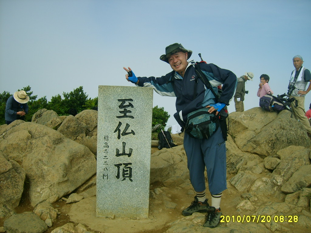 [At the top of Mt. Shibutsu, 至仏山頂にて、시부쓰산 정상에서]
There were more than ten hikers on the top of Mt. Shibutsu. Some of them did not know that the prohibition. The purpose of the prohibition is to protect the trail (and the mountain itself) from the deterioration by steps of hikers. So we gave up the idea of going down to Yamanohana from Shibutsu summit, and we went back to Hatomachi using the same trail.
However, it took only 2 hours to go back to Hatomachi Pass. So we decided to go to Yamanohana from Hatomachi Pass.
From Hatomachi to Yamanohana, it was a gentle down slop mostly on wooden trail. The hiking distance is 3.3 km but we walked for 30 minutes.
The weather became fine when we arrived at Yamanohana. We could take nice pictures of plants in the wetland as well as the wonderful mountains of Shibutsusan and Hiuchigatake.
I expected a lot of beautiful flowers at Oze Wetland. Since it was summer, I exected to see "Nikko Kisuge." I could see them at Oze Field.
 ["Nikko Kisuze at Oze Wetland, 尾瀬ヶ原のニッコウキスゲ、오재습원의 닛코키스게]
Besides this plants, I saw some strange flowers which looked like "white pipe." Later I found this flower called "Ginryuso" or "Monotropastrum humile" as the scientific name. I saw this flower along the trail between Hatomachi and Yamanohana.
 ["Ginryuso", ギンリュウソウ、긴류소]
Anyway, we had lunch at Yamanohana and returned to Hatomachi. We came back to the bus stop by 13:15. The shuttle bas was to leave at 14:30. We took bath at Hatomachi Mountain Lodge.
The bus brought us back to Ikebukuro at 19:45. We went back to Ofuna by Shonan Shinjuku Line, and I said goodbye to Mr. Mano at Ofuna Station.
7月20日(火)登山対象:尾瀬国立公園・至仏山(2228m)、同行者:真野氏
登山前日の19日、YCATを8時40分に尾瀬直行バスに乗車(尾瀬往復6000円+弁当代1000円)。バスは東京、新宿を経由して最終的に池袋を11時に出発した。
大型バスは4時過ぎに戸倉に到着。バス内ではほとんど眠れなかった。戸倉で大清水グループと鳩待峠グループに分かれ、オプションの弁当を受け取った。鳩待峠グループは、マイクロバスに分乗して5時のゲート開門を待って峠へ向かった。
 [From Tokura, we had to go by micro-bus, 戸倉からはマイクロバスに乗り換え、도쿠라(戶倉)에게서는 마이크로버스(microbus)에 갈아타]
峠には5時20分ごろ到着。私は喜久子が1日前に作ってくれた弁当を食べ、真野さんは受け取った弁当を食べた。5時35分に至仏に向かって歩きはじめた。ヒマラヤスギやダケカンバの巨木の林の中を緩やかな勾配の登りが続く。
鶯が多く、すぐそばでおどろくほど大きな声で鳴く。林が切れた見晴らしのよいところにでると雲が切れて遠くの山々が見える。
1時間ほど進んだ地点の小川の水にパイプのあるオヤマ沢に出た。ここから先はお花畑。
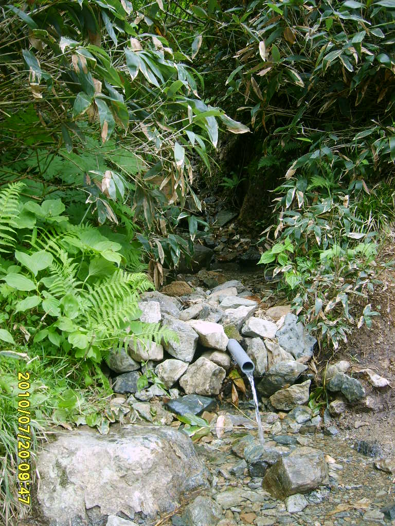 [Oyamazawa Creek, オヤマ沢の水飲み場、오야마 골짜기의 물 마시는 장소]
右下には鳩待峠の小屋が見え、左下には尾瀬ヶ原が見える。ただ、燧岳には雲がかかり、全容は見えない。

このお花畑からはやや急な登りになり、上部には木の階段がかかっている。ここまでは風もなく、曇っていて直射日光はなくても暑い位だったが、木の階段を登りきった部分から、尾瀬特有の蛇紋石が現れ、滑りやすいのと、尾根にでてからは強烈な風が吹き、体感温度が下がって、上着を着ないではいられないほどだった。
 [A lot of Alpine flora, 高山植物の宝庫、고산 식물의 보고]

急な岩場を登りきったところが至仏かと思ったら、「小至仏」の石標があった。小至仏から至仏までは1.1km。この付近から至仏に至る尾根沿いはきれいな石楠花(シャクナゲ)の花が見ごろだった。また、シャクナゲやハイマツにまじって鮮やかなピンクの小型のハマナスのような花も目に着いた。
 [Alpine flora looked like "Hamanasu" ハマナスのような高山植物、해당화와 같은 고산 식물]
ここから尾瀬ケ原の反対方向をみるとダム湖がくっきりと見えた。だが、全体として空は雲が覆っていた。強烈な風のなか、登山開始からちょうど3時間ほどで至仏山頂に着いた。
ここには10人以上のハイカーがいた。みな雲が晴れるのは待っている雰囲気だった。また、至仏から東斜面の下りで山の鼻に至る登山路は登り専用で、下りが禁止されていた。真野さん持参の地図にもこのコースは高山植物保護のため、下りが禁止と書いてあった。
 [Board showing no-going-down for East Side of the mountain, 「東斜面下り禁止」の掲示板、「동사면하행 금지」의 게시판]
止むを得ず鳩待ちまで戻って、山の鼻への木道を往復することにした。上りは3時間かかったが、下りは2時間で下りることができた。また、下るにつれ雲が晴れ、視界もよくなった。
鳩待峠に戻ったのは10時半だった。真野さんはだいぶお疲れのようだったが、ここでは軽い休憩にとどめ、山の鼻へと向かった。
下りの木道は団体さんが非常に多かったが、2本ある木道を追い越し用に使い、コースでは3.3km、1時間のところを半分の30分と飛ばした。
山の鼻では尾瀬ヶ原と燧岳の写真が不十分なのでさらに進んで尾瀬ケ原の中で写真を撮影したのち、山の鼻へ戻って昼食にした。
 [Oze Wetland near Yamanohana, 山の鼻付近の尾瀬ヶ原、야마노하나부근의 오재가하라]
今回のハイキングで期待した植物はニッコウキスゲだが、この花は尾瀬ヶ原でのみ見ることができた。山の鼻と鳩待峠の間で、白いパイプのような不思議な花を見た。これはあとで調べると「ギンリュウソウ(銀龍草)という腐生植物で別名「ユウレイタケ」ともいうそうだ。
 ["Ginryuso", ギンリュウソウ、긴류소]
帰りは1時間20分のコースだが、ここも1時間ほどで歩き、鳩待峠には1時15分に戻った。帰りのバスを待つ間、鳩待山荘で500円の入浴をして、また売店でウィスキーの水割りを飲んでバスを待った。
シャトルバスは予定通り2時半に出発。戸倉で大型バスに乗り換え、帰路に着いた。途中2、3カ所で休憩をとり、池袋には7時45分ごろ到着。8時38分発の湘南新宿ラインで大船へ。大船で真野氏と分かれて家路についた。
0 件のコメント:
コメントを投稿