Destination (mountain): Goryosan(436m), Ganghwado, Inchon
Hiking course: Gukhwa 2 li – Cheongryonsa – Baengnyonsa – Goryosan – Goindul(Dolmen) – Nakjobong – Mikkuji Pass
Partner: 38 AhToSan members
The destination was Mt. Goryosan in Ganghwa Island, in Inchon. It locates close to the border between South and North Koreas. So we left Daejeon one hour earlier (at 6 a.m.)

[At the bus stop in front of Expo South Gate, エキスポ南門前のバス停留所にて、엑스포 남문 버스정류소에서]
It took 5 hours from Daejeon to the destination. Mt. Goryo is close to Seoul and it is famous for Jindallae flowers. Moreover they were having Jindallae Festival. So it was very crowded there.

[We abandoned the bus and began to walk, バスをあきらめて歩き始めた、버스를 포기해서 걷기 시작했다]
Actually we abandoned the bus on the way and walked along the road to the entrance of the trail. We took a group picture at 10:50 a.m.

[A group picture before the hike, 出発前の集合写真、출발전의 단체 사진]
We kept walking on the paved road and arrived at the first temple (Cheongryonsa) at 10:07.
From the first temple, we went into the mountain and arrived at the 2nd temple (Baengnyongsa) at 11:38.
There were huge trees in the grounds of the temples. The cherry blossoms were in full bloom.

[A huge tree in the temple ground, 境内の巨大な保護樹、경내의 거대한 보호수]

After seeing the 2nd temple, we took the first break in the woods on the slope behind the temple.

[The first break with makgeolli, 最初のマッコリ・タイム、첫번째 막걸리·타임]
After having the first break, we came to the ridge from which we could see peaks of Goryosan and ridges covered by Jindallae flowers.

[Jindallae blossoms were in full broom, 満開のチンダルレ、만개한 진달래]


[Jindallae on the "Jindallae Ridge"『チンダルレ稜線』のチンダルレ、『진달래 능선』의 진달래]

[With "Grace" at the observation deck, 展望台にて、전망 대에서]
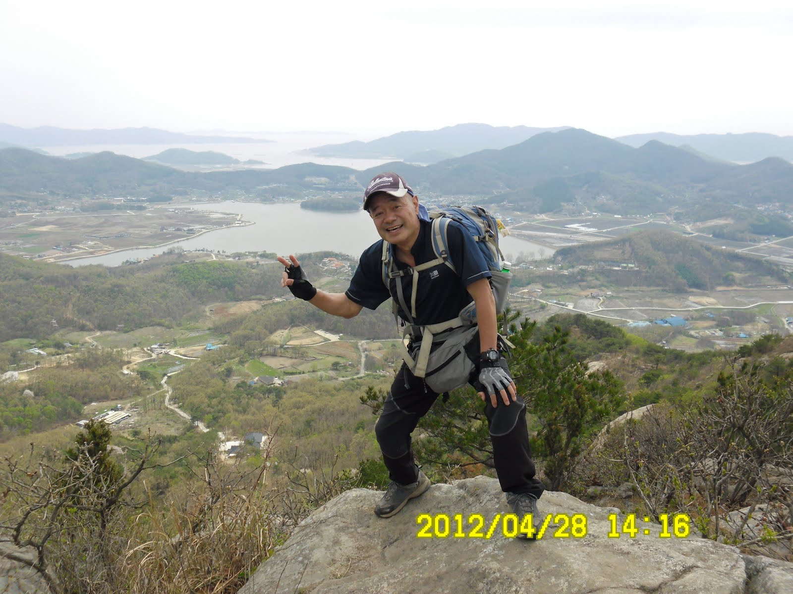
We walked on the paved road to the top of Goryosan where there was a heliport and military facilities.

[A military facility on the top of Mt. Goryo, 高麗山山頂の軍施設、고려산 정상에 있는 군시설]

It is close to the border and important point for defense in case of war. In the past, it was reported that communist agents broke in secretly.

Ganghwa Island: http://en.wikipedia.org/wiki/Ganghwa_Island

[The crowd on the top of Goryosan, 高麗山山頂の人混み、고려산 정상의 인파]
There were many hikers as well as sightseers there. I lost the sight of AhToSan memers, and carelessly followed other hikers to the wrong trail.
After walking for about 15 minutes, I saw a guidepost which said wrong distination. So I realized my mistake. I tried to return to the heliport, but it took another 15 minutes. Totally I lost 30 minutes.
I saw AhToSan members having lunch at the heliport, so I joined them.

[Lunch at the heliport on the top of Goryosan, 高麗山山頂のヘリポートで昼食、고려산 정상의 헬리포트에서 점심]
When we finished our lunch, an MBC helicopter flew about our heads, They were taking video for news. Many hikers waved their hands.

[People waving their hands toward a helicopter, ヘリコプターに向かって手を振る人々、헬리콥터를 향하고 손을 흔드는 사람들]
Then I hurried to the right trail. The ridge trail was called “Jindallae Ridge”and indeed, the jindallae were in full bloom.

[Jindallae on the "Jindallae Ridge"『チンダルレ稜線』のチンダルレ、『진달래 능선』의 진달래]
When I walked for about one hour from the heliport, I saw the AhToSan Flag in the woods of pine trees. It was the main group of AhToSan hikers, having lunch there. So, I joined them.

Ganghwado Dolmen Sites: http://en.wikipedia.org/wiki/Gochang,_Hwasun_and_Ganghwa_Dolmen_Sites

[Dolmen sites of Ganghwado, 江華島の支石墓群、고인돌 유적]

It is said that there are many dolmen sites in Korea and there are 120 sites in Ganghwado alone,

[More jindallae on the trail, さらに多くのチンダルレ、더 많은 진달래]
Then I saw many jindallae flowers in pine woods. The trails were gentle and it was an easy hike.
I also noticed flowers of “Iris rossii Baker” here and there.
The trails in the woods suddenly ended to the paved road. That was the final destination of the day: Mikkuji Pass. It was 3 p.m.

[At the Mikkuji Pass, ミクジ峠にて、미꾸지고개에서]
Our bus came to pick us all within 15 minutes, and we hurried to get out of Ganghwa Island in order not to be trapped by traffic jam.
When we came to the service area in Hwaseong, we stopped there and had a wrap-up party at a gazebo on a small hill in the park.

[The wrap-up party at a gazebo on a hill, 丘の上の亭子で打ち上げパーティ、언덕 위의 정자에서 뒤풀이]
We had plenty of duck meats and makgeolli. We all enjoyed the foods and drinks.
I noticed that there were a tank and other military use vehicle. They might be used during Korean War.

[A tank on display at Hwaseong Service Area, 華城サービス・エリアに展示されていた戦車、화성 휴게소에 전시되고 있었던 탱크]
We finished the party at 6:15 and went back to Daejeon at 8:30.
It was my 23rd hike for this year, and 278th regular hike with AhToSan.
--------------------------------------------------------------------------
登山月日:2012年4月28(土)晴れ。現地は曇り
登山地:仁川・江華島の高麗山(강화 고려산436m)
登山コース:菊花2里(국화2리)-青蓮寺(チョンニョンサ청련사)-白蓮寺(ペクリョンサ백련사)-高麗山(コリョサン고려산)-チンダルレ稜線-支石墓(コインド고인돌)群-落照峰(낙조봉)-ミクジゴゲ(미꾸지고개)約10km5時間
同行者:アトサン会員38名

[The Map of this hiking, 今回のハイキングの地図、고려산 등산 지도]
登山地は仁川・江華島の高麗山で、混雑が予想されるため出発は6時。登山コースは菊花2里を出発して青蓮寺(チョンニョンサ)と白蓮寺(ペクリョンサ)の2つの名刹を見学してから高麗山(コリョサン)に登り、チンダルレ稜線を経由して支石墓(コインドル)群を経由し、最後に落照峰に登ってからミクジゴゲ(サムファ・サービスエリアに出るコースで距離は約10km、ゆったりと5時間。バスは39人だったので、隣の席も確保。実際、片道約5時間かかり、休憩は往路も復路も2回ずつ。

[We abandoned the bus and began to walk, バスをあきらめて歩き始めた、버스를 포기해서 걷기 시작했다]
予想通りの渋滞は、江華島に入ってから特にひどくなり、菊花2里の手前でバスを降りたのは10:38。他の山岳会も渋滞で身動き成らないバスを降り、道路脇を歩いた。
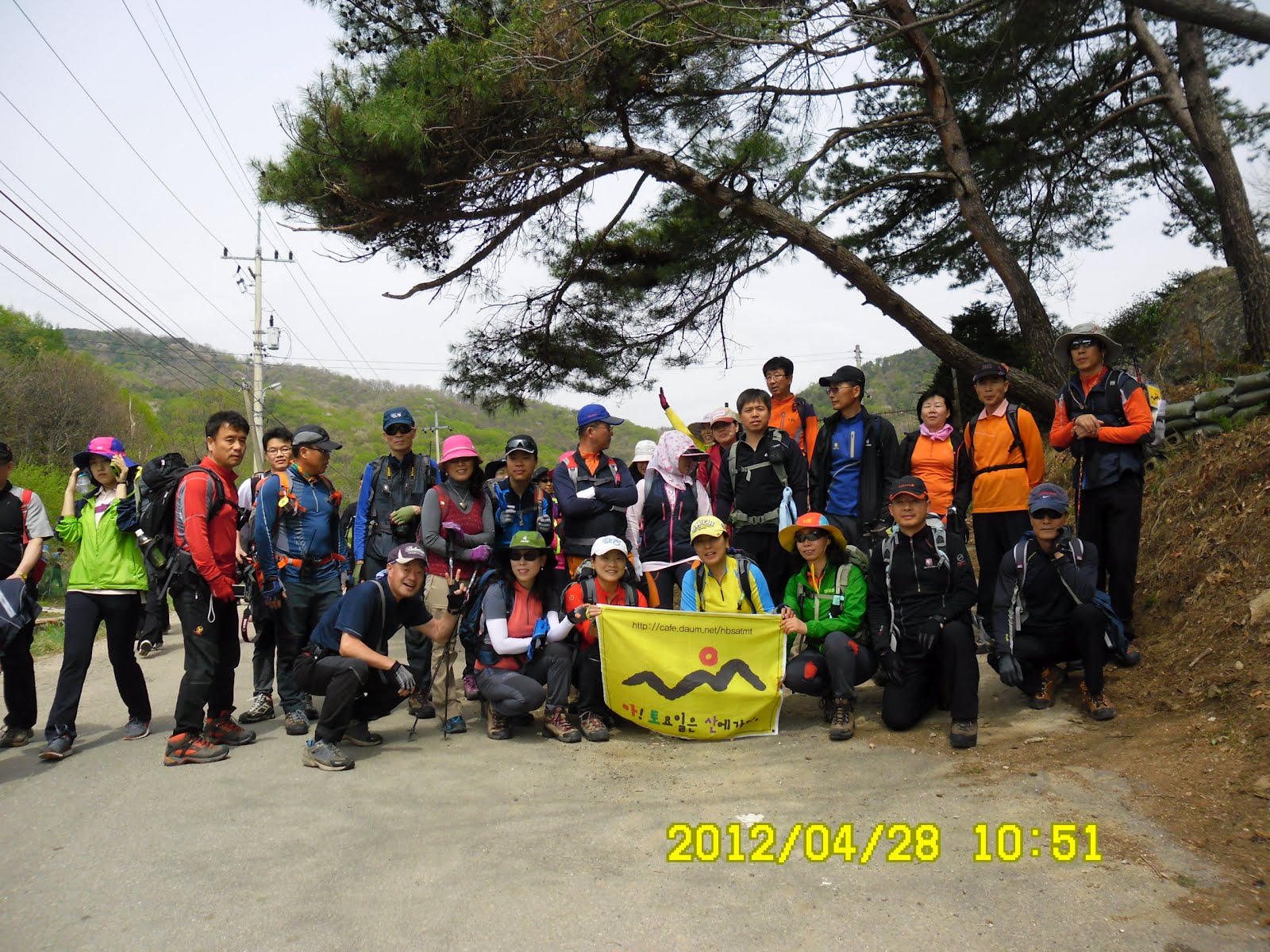
[A group picture before the hike, 出発前の集合写真、출발전의 단체 사진]
登山口の松の下で集合写真を撮ったのは10:50。ゆるやかな舗装道路を進んで11:07にまず青蓮寺に着いた。

[A huge tree in the temple ground, 境内の巨大な保護樹、경내의 거대한 보호수]

白蓮寺に着いたのは11:38だから、バスを降りてから約1時間後。どちらの寺にもみごとな巨木が多かった。寺の境内の桜は今が満開。白蓮寺見学後、寺の左側のゆるやかな坂を上った途中で、マッコリとくだもの休憩。人数が多かったため、1回でトマトもぶどうも終わった。

[The first break with makgeolli, 最初のマッコリ・タイム、첫번째 막걸리·타임]

[Jindallae blossoms were in full broom, 満開のチンダルレ、만개한 진달래]

休憩後、高麗山の稜線に出るとそこはもうチンダルレだらけ。また、それを見に来た人々も非常に多い。チンダルレの覆われた山を背景に写真を撮ってもらおうとしたら、ルチの知人のグレイスが隣でポーズをとった。

[With "Grace" at the observation deck, 展望台にて、전망 대에서]

[A group picture at an observation deck, 展望台にて集合写真 전망 대에서 단체사진]
車の走れる広い道路をゆるやかに登ると軍事施設とヘリポートがある頂上に到達した。
江華島は北朝鮮との境界に近く、特に島の北側は海を隔てて北朝鮮統治地域と至近距離で向き合っている。過去には北の諜報部員が度々侵入したと言う。そのためか、軍事施設の前には撮影禁止の看板が見えた。
さて、頂上は人々でごった返しており、ふと気づくと周りにアトサンのメンバーが見えない。また周囲の人々が軍事施設の右側の木柵を超えて行くのが見えた。 江華島: http://ja.wikipedia.org/wiki/%E6%B1%9F%E8%8F%AF%E5%B3%B6
つい地図も確かめず、その人々の群れに着いて行くとナントカ峠(コビコゲ?)に下る道であることに気付いた。この間15分ほどだろうか、すぐ引き返そうとしたが狭い道で思うように進まず、結局30分ほどの時間の浪費となった。
元のヘリポートに引き返すと、チョムワ・トワ夫婦が食事を終えて、出発するところだった。また、近くにはKSたちが昼食をとっていたので、そこへ合流した。やれやれである。

[AhToSan people having lunch at the heliport, ヘリポートで昼食をとるアトサン会員たち、 헬리포트에서 점심을 먹는 아토산 회원들]
昼食を終える頃、MBCのヘリコプターがニュースの取材のため、飛来した。多くの人々が上に向かって手を振るなか、尾根道の先を急いだ。

[People waving their hands toward a helicopter, ヘリコプターに向かって手を振る人々、헬리콥터를 향하고 손을 흔드는 사람들]
この尾根はチンダルレ稜線と呼ばれるところで、チンダルレがいちばん見事な所。

[Jindallae on the "Jindallae Ridge"『チンダルレ稜線』のチンダルレ、『진달래 능선』의 진달래]
この稜線を過ぎた林の中にアトサンの旗が掲げてあるのが見えた。林の中で会長や副会長、アランドロンなどアトサン本隊が昼食をとっていた。

[The main group of AhtoSan, having lunch in the woods, 林の中で昼食中のアトサン中間グループ、숲 속에서 점심중님 아토산 중간 그룹]
この本隊が食事を終える頃、本隊に先だって先を進んだ。なだらかな稜線の道で、やがて2つのコインドル(支石墓)群を通過した。
はたして古代の人々が儀式などに使ったコインドルなのかどうか私の目にはわからない。しかし、ユネスコの世界遺産に指定されている以上、科学的に調査された結果なのだろう。ちなみに、ウィキペディアの情報によれば韓国はコインドルが世界一多く、江華島には120基存在する。
江華島のコインドル: http://ja.wikipedia.org/wiki/%E9%AB%98%E6%95%9E%E3%80%81%E5%92%8C%E9%A0%86%E3%80%81%E6%B1%9F%E8%8F%AF%E3%81%AE%E6%94%AF%E7%9F%B3%E5%A2%93%E7%BE%A4

[Dolmen sites of Ganghwado, 江華島の支石墓群、고인돌 유적]

コインドルを過ぎた先は、林の中のチンダルレが美しかった。また、奇妙な形をした松や、ユキヤナギなどが目についた。

[At a strange-shaped pine tree on the descending trail, 下山路にて、하산로에서]
[On the rock in the ridge, 稜線の岩の上で、능선의 바위 위에서]
さらにエヒメアヤメの小さな群落もあった。ゆるやかな丘陵の道はいきなり車道に出て、そこがミクジコゲだった。

[A small community of Iris rossii Baker, エヒメアヤメの小さな群落、각시붓꽃의 작은 군락]
この時点で午後3時。他の山岳会もここを終点にしているらしくチャーターバスが止まると次々の乗車して行った。われわれアトサンのバスも約15分後に到着し、全員が乗車して帰路を急いだ。
江華道から金浦へ抜ける道路が非常に混雑し、高速道路に出るまでノンストップで進んだ。高速道路に出てから華城(ファソン)のサービスエリアに入ってその付属施設の公園のような丘の上のチョンジャを利用して打ち上げパーティをした。

[At Hwaseong Service Area, 華城サービス・エリアにて、]


[A tank on display at Hwaseong Service Area, 華城サービス・エリアに展示されていた戦車、화성 휴게소에 전시되고 있었던 탱크]
ここにはお役済みのタンクや大砲が展示してあった。打ち上げパーティのメニューは鴨肉とマッコリでたっぷりいただいた。沈む夕日を見ながらの打ち上げで、終了時間は午後6時15分。大田には8時半ごろ戻り、長い一日を終えた。 今回は今年23回目のハイキングで、アトサン定期登山は278回目だ。
0 件のコメント:
コメントを投稿