Destination (mountain): July 18, 2012 (Wed) Cloudy, occasionally fine.
Hiking course: Nishi-tanzawa Bus Stop – Nishi-Tanzawa Park Bridge – Nishizawadeai – Shimotanazawadeai – Hontanazawadeai – Zenrokunotawa – Azegamaru Ridge (Piston)
Partner: None
It was my first hike in the latter half of 2012. Weatherman decleared the end of the rainy season yesterday. I felt the scorching sunlight and humidity, I got up at 4:30 and my wife made 4 rice-balls for my lunch.
I left 6:15 at home and took 6:30 Tokaido train to Kozu. I changed trains at Kozu to Gotanba line and arrived at Matsuda at 7:22. But I had to wait the bus until 8:25! I should have taken one train earlier so that I could take 7:15 bus. (There were only 2 buses in the morning.)
I bought a round ticket to Nishitanzawa. One way is 1150 yen, but the round ticket was 2070 yen.
There were only 5 or 6 passengers in the bus. Actually there were only three passengers who stayed in the bus until the last stop.
The bus arrived at the terminal at 9:30. There was a nice building named “Nishitanzawa Nature Center” and I filled in the card to report my hiking plan.

[Nishitanzawa Nature Center, 西丹沢自然教室、니시단자와 자연교실]
You can get most up-to-date data at the center. They showed the map of NIshitanzawa area with remarks such as the dangerous routs or the situation of the trails.
There was a big suspension bridge behind the center. The trail was to across the bridge and the along the river.

[A big suspension bridge near the starting pint, 出発点近くの大吊橋、출발점 가까이의 큰 현수교]

[The Nakagawa River under the bridge, 橋の下を流れる中川、다리 아래를 흐르는 나카가와]
It was only 4.8 km from Nishizawa Deai to the top of Azegamaru. From the bridge to Hon-tanazawa-deai (about 2 km), I had to walk along the river.

[The trail along the river and the corduroy bridge, 沢に沿った登山路と川にかけられた丸太橋、계곡물에 따른 등산로와 계곡물에 채워진 통나무다리]

I had to go across the river over the small bridges made of logs. Many bridges were not facilitated properly, because of the flood which happened in the past.

[The sign of Shimotanazawa-deai, 下棚沢出会の標識、"시모다나자와 대아이"의 이정표]

There were many mud-control dams along the river. Hikers have to climb the steps facilitated at the endge of these dams.

[A mud-control dam seen among trees, 林の間から見える砂防ダム、숲속에 보이는 사방댐]

[The steps at the edge of "mud-control dam", 砂防ダムの端に設置された階段、사방댐 가장자리에 설치된 계단]
I arrived at Hontanazawa-deai at 11 am, from which the trail went to the mountain and slopes became steep.

[The trail became steep from Hontanazawa-deai, 本棚沢出会から登山の傾斜が急になった、"본다나사와 대아이"부터 경사가 급한 언덕]
I passed Zenrokunotawa at around noon. Then I found a nice wooden table for lunch.

[A view of mountains from Zenrokunotawa, 善六ノタワから見た景観、 "젠로크노타와"로부터 본 경관]

It was 12:20. So I decided to have lunch there, while listening to NHK educational radio programs (English Conversation and Business English.)

[I had lunch at the table, 木製のテーブルで昼食を摂った。목제 테이블에서 점심식사를 했다.]

I had my lunch while listening to the programs and began descending the mountain after the lunch.

[Moss coated rocks and "Iwatabako" flowers, 苔むした谷川の岩とイワタバコの花、이끼가 낀 바위와 "이와타바코" 꽃]

["Iwatabako" flowers, イワタバコの花、"이와타바코" 꽃]
It took three hours to walk up to the place, but it took two hours to go back to the bus stop.

[The river in the valley and the flower of Tanzawa, "Mountain lily" or "Lilium auratum", 谷川と丹沢の花「ヤマユリ」、골짜기 냇물과 단자와의 꽃 "산나리"]

I returned to the bus stop at 14:40, but the next bus was at 16:25. I had plenty of time, so I went into Nishitanzawa Nature Center.
While watching the exhibitions and displays, a big dragonfly flew into the room.
I happened to see a man who knows plants well. I asked the name of the flowers I saw along the streams. He taught me the name of the flower as “Iwatabako” which literally mean “Rock Tabaco.”

[There were only two passengers, バスの乗客は二人だけ、버스의 승객은 두사람만.]
The leaves of the plant looks like the leaves of Tabaco, that’s why they call it “Iwatabako.”
Anyway the flowers were most beautiful among the flowers I saw that day.
The bus left at 4:25 just on schedule and there were only two passengers including myself. I just worried about the management of the bus company.
When I searched the date as “Azegamaru” I found a wonderful hiking blog as below:
http://homepage1.nifty.com/udagawa_home/mt_azegamaru.html
The writer of this blog is a 38 year-old housewife. The climbed this mountain with 2 daughters (8 and 4 years old.) That is really amazing to me.
It was my 34th hike for this year.
-------------------------------------------------------------------------------------
登山月日:2012年7月18日(水)曇り時々晴れ。
登山地:西丹沢の畦ケ丸(1293m)
登山コース:西丹沢バス停~西丹沢公園橋~西沢出会~下棚沢出会~本棚沢出会~善六ノタワ~畦ケ丸尾根(中間)[往復]
約5時間
同行者:なし
関東地方は昨日梅雨明け宣言。陽射しは強く、蒸し暑い。朝4時半に起床。4時50分に炊飯器のスイッチを入れ、5時40分に朝食。
妻に握り飯4個作ってもらい、6時15分に家を出て6時半の東海道線下りに乗った。
国府津には7時5分到着、御殿場線に乗り換えて、松田には7時22分に到着したが、西丹沢行のバスの始発は7:15発だから次の8時25分まで待つしかない。次回は一本前の大船駅6時4分発の下りに乗ろうと思った。
さて、バスの料金はバス停横の窓口で往復を買った。片道なら1150円だが往復で買えば2070円と230円割安になる。
登山客は私を含めて5,6人。夫婦ものが途中で下車したので、終点で降りたのは私を含めて3人だけ。

[Nishitanzawa Nature Center, 西丹沢自然教室、니시단자와 자연교실]
バスを降りた場所にある「西丹沢自然教室」で提出した入山届には目的地を檜洞丸としたが、実際には沢登りの気分が味わえる「畦ケ丸」登山ルートを歩いた。
登山道は西丹沢自然教室の後ろにある大きな吊橋をわたり、沢に沿って登るルートだ。

[A big suspension bridge near the starting pint, 出発点近くの大吊橋、출발점 가까이의 큰 현수교]


[The Nakagawa River under the bridge, 橋の下を流れる中川、다리 아래를 흐르는 나카가와]
沢は三日前に大雨が降った影響で前日まで増水し、靴を脱がなくてはならないようだったが、ようやく今朝から平常に戻ったようだ。

[Huge fallen trees over the trail, 巨大な倒木が登山路を塞ぐ、거대한 쓰러진 나무가 등산로를 가로막는다]
それでも丸太の架け橋が激流に流されてワイヤーで止めてある側のみまともに岸についていて反対側は流れの中にあるものがかなりあった。

[A corduroy bridge over the river, 川にかけられた丸太橋、계곡물에 채워진 통나무다리]
このコースは西沢出会から畦ケ丸まで4.8kmコースだが、最初の2キロは谷川に沿って登る。
大きな砂防ダムがいくつも掛かり、そのたびにダムの横のコンクリートの階段を登る。また、何カ所か倒木が登山路にかぶさっていた。

[Fallen trees on the trail, 倒れた木が登山路を塞いでいた、넘어진 나무가 등산로를 막고 있었다.]
初めてのルートなので慎重に進んだ。またすべて物珍しく、写真も多く撮ったため、上りにはいつもにもまして時間がかかった。

[A mud-control dam and the steps facilitated at its edge, 砂防ダムとその端に設置された階段、사방댐과 그 가장자리에 설치된 계단]

約2キロ入った本棚沢出会いを過ぎると本格的な山道になり、檜の林の斜面をぐんぐん上がると尾根に出た。
そこから善六ノタワまでは尾根に沿って進み、時々沢に下ってまた上がることを2回ほど繰り返した。「善六ノタワ」とは風変わりな地名だが、漢字では「善六の乢」で、『乢(たわ)』とは尾根のたわんだところの意味で東側の1119m善六山との鞍部のことだそうである(ネットで検索)。

[I saw a wooden table in front of me, 目の前に木製のテーブルが見えてきた、눈앞에 목제 테이블이 보였다.]
善六ノタワ付近で昼になったが、もう少し進んだ開けた尾根の部分に昼食をとるのに適した平たいベンチがあったのでここで昼食をとった。
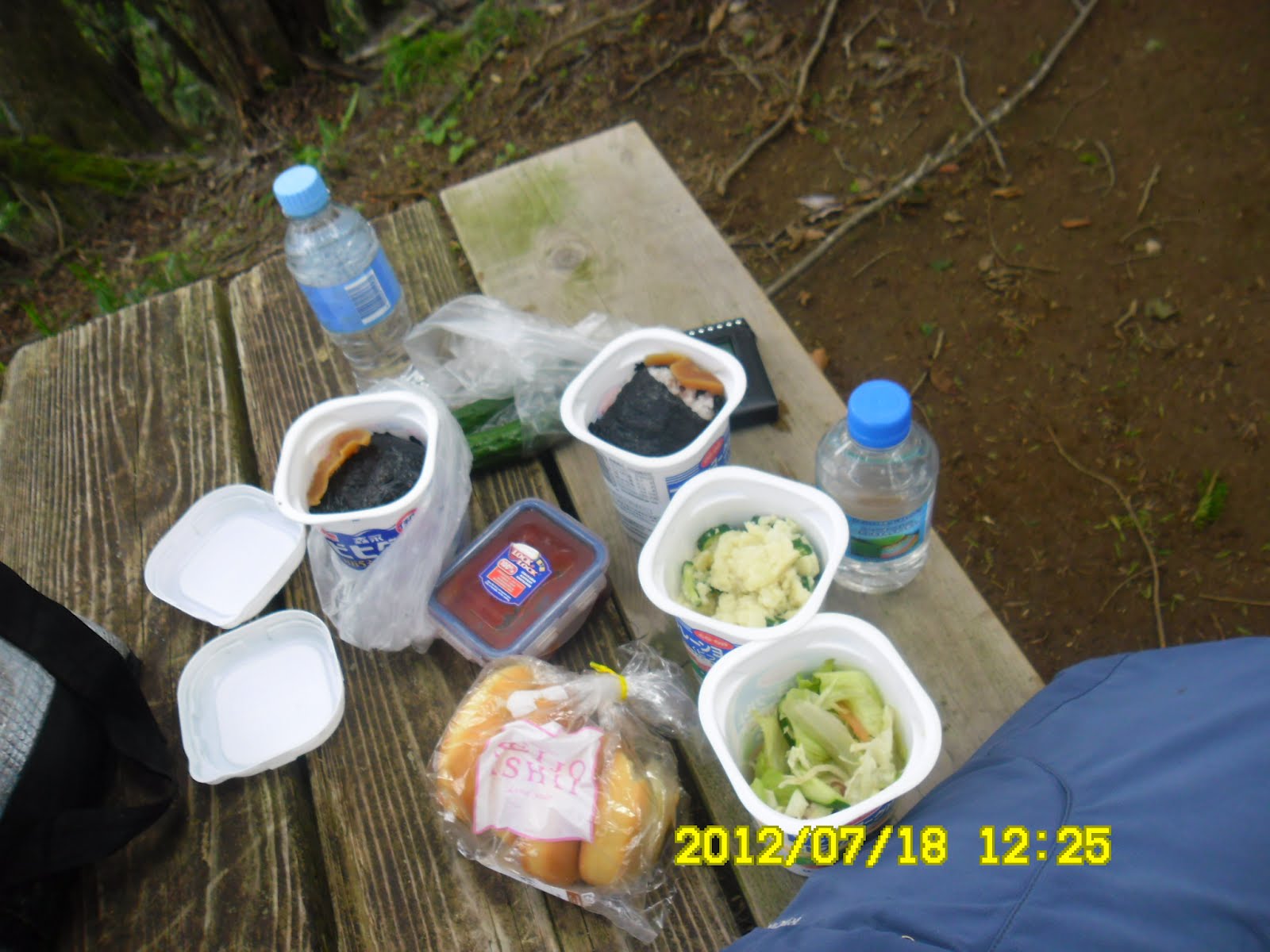
[I had lunch at the table, 木製のテーブルで昼食を摂った。목제 테이블에서 점심식사를 했다.]

この時点で12:20で、12:25からの英会話とビジネス英語を聞きながら昼食にした。放送が終わる頃、さらに進むか引き返すか少し迷ったが、大事をとって引き返すことにした。

[The flower of Tanzawa, "Yamayuri" or "Mountain Lily" or "Lilium auratum", 丹沢の花「ヤマユリ」、단자와의 꽃 "산나리"]
さすがに下りは早く、上りに約3時間かかったのに、下りは2時間ほどで一気に下った。
ちょうど14:40の谷峨駅行きのバスが出る寸前だったが、乗らずに16:25発の新松田まで待ったのは2つの点で正解だった。
1つは切符をすでに購入していたこと、もう1つは自然教室で西丹沢のことをかなり詳しく学ぶことができたからだ。
自然教室内で展示物などを見ていると大きなオニヤンマが一匹入ってきた。また、一人で山に入っていたハイカーと情報を交換し、彼が植物に詳しい指導員だったことから、花の名前を教えてもらった。
沢でみた美しい花は有名な「イワタバコ」であることを知った。

["Iwatabako" flowers, イワタバコの花、"이와타바코" 꽃]
バスはがらがらで乗客は二人だけというい状態が終点の15分前ほどまで続いた。ひどい赤字路線だろうと心配になる。
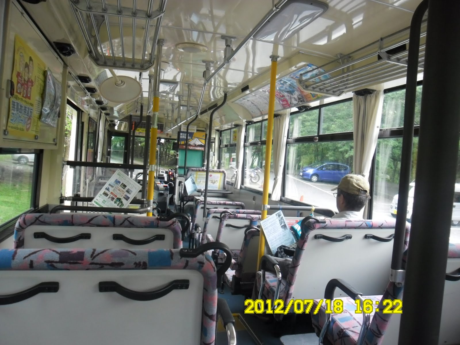
[There were only two passengers, バスの乗客は二人だけ、버스의 승객은 두사람만.]
電車の接続は非常によく、大船駅には6時過ぎに戻ることができた。今年後半初めての登山で、今年34回目
戻ってからネットで探すとすばらしいブログが見つかった。8歳と4歳の子連れでこのコースでこの時間で歩くとは素晴らしい。
次はこのコースで歩いてみようと思った。
「丹沢・畦ケ丸、西丹沢の隠れた名峰」
http://homepage1.nifty.com/udagawa_home/mt_azegamaru.html
0 件のコメント:
コメントを投稿