Destination (mountain): Gyokjabong, Bogildo, Wando-gun, JeonNam
Hiking course: Jeongjari – Seonchangrijae – Pporigijae – Gyokjabong – Suribong - Keungiljae – Parking Lot
Partner: 44 AhToSan members
Since the destination is far from Daejeon, we were supposed to leave the Expro South Gate at 3:40 a.m.
It was raining in the morning, so I took a taxi from Shinseongdong, but the taxi crushed into the street light pole in front of the bus stop.
Fortunately I got no harm, but it was a bad start indeed.
We arrived at harbar in Ttangkket at 8:30 a.m. The ferryboat was to leave the port at 9 a.m. (There were 17 round trips a day. Our ferry was the 4th ferry to the island.)
It was my 4th visit to Ttangkket Village and every time I visit here I found something new. It was a double-deck monorail which connects the foot of the hill and the observation tower on the hill this time.

[At Ttangkket Village, タンクンマウル(地の果て村)にて、땅끝마을에서]

The strong wind was blowring on the sea, yet the boat left exactly at 9 a.m. We arrived at Sanyang Port in Nohwado at 9:40.

[AhToSan members boarding on the ferry boat, フェリーボートに乗船するアトサン会員たち、페리보트를 승선하는 아토산 회원들]

We took the same chartered bus and headed for Bogildo. The two islands were connected by the huge steel bridge.
There were 3 courses for the hiking that day. A course (about 20) was the longest and got off the bus first. I joined A course and took a group picture at 10:20 a.m.

[A group picture of A course members, Aコースメンバーの集合写真、A코스 회원의 단체사진]
B course (16) was a bit shorter than A course, and C course was for mainly sightseeing.

[B course members, Bコースに参加した会員たち、B코스 회원들]
As usual, after taking a group picture, we (A course) began walking in the village.
The trail was not clear at the foot of the mountain, so we had to walk in the bush for about 15 minutes.
Then we found the right trail which was quite rocky and went through the evergreen woods.
We had the first “Mageolli Time”in the evergreen woods, then we walked down for a while.
Cheongjeong, the leader of A group seemed confient, so we all followed her.
At this time, another hikers’ group grom Gyongju caught up with us. They seemed to have the same course and we saw them all the time until the last peak (and even in the ferryboad.)

[A kind of small Orchidaceae,『マメラン』(ランの一種)、『콩난』(난과의 일종)]
The wind was very storong all day and we heard the sound of wind even walking in the evergreen woods.
When we came to the cross-road point in the woods, it became past noon. We decided to have lunch there.
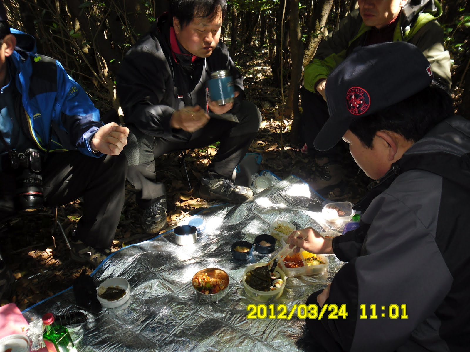
[We had lunch at the cross-road, 椿の林の中で昼食、 동백나무 숲 속에서 점심]
We went through the woods and came to the ridge. Finally we could enjoy good views of mountians and the sea.

[Finally, we came out to the ridge, ようやく展望の良い稜線に出た。 드디어 전망이 좋은 능선에 나왔다.]
When we arrived at the huge rock and began taking pictures, the top group of B group cought up with us.

[The vice-president of AhToSan makes pose on the huge rock, 巨岩の上でポーズする副会長、거대한 바위 위에서 포즈를 찍는 부회장]
Now we enjoyed walking with B group people as well.

[The mark of "Gyongjabong" 格子峰頂上の標識、격자봉정상의 표식]
We arrived at Gyongjabong, the last peak at 14:15.

[At the top of Gyokujabong, 格子峰の頂上にて、격자봉 정상에서]
From the peak of Gyongjabong, it was just the downhill trail. We came to the park with traditional Korean house (Nakseojae) with beautiful garden (Goksudang.)

[AhtoSan members at the Goksudang, 曲水堂にて、곡수당에세]

[The garden of "Goksudan", 曲水堂の庭園、곡수당 정원]
We walked from Nakseojae to the place where our bus was parking. There were several more sightseeing spots, but I quit visiting such places and arrived at bus at 15:30.

[A black goat at Buyong village,芙蓉村の黒ヤギ、부용마을의 흑 염소]
On the way back to the harbor we stopped at the beach with a lot of round stones.

[At the "BoOkRi Beach" with rocks looked like "eggs of dinosaurs." ポオクリ恐竜卵海岸、보옥리 공룡 해변]
We planned to have a wrap-up part at the harbor in Bogildo, but the wind was too strong to have the party, so we gave up the place and returned to the harbor in Nohwado.
By this time, the wind became a little weaker, and we had a wrap-up party at small space between the bus and the wall.

[A wrap-up party at the port, 蘆花島(ノファド)の港で最初の打ち上げパーティ、노화도에서 첫번째 뒤풀이]
The main dish was meat of marinated ray (“kaori” in Korean) and makgeolli and we had plenty of them.

[Our bus in the ferry boat, フェリーボート内のアトサンのバス、페리보트내의 아토산 버스]
We could not finish the makgeolli and marinated ray, so we had the 2nd party in the cabin on the ship.

[The 2nd party in the ship, フェリーの中で2度目の打ち上げ、페리 안에서 2번째 뒤풀이]
The ferry boat left at 17:30 and we arrived at Ttangkket at 18:20. We could see a beautiful sunset from the boat.
We came back to Daejeon at 11 p.m. I could go home before midnight.
It was my 16th hike for this year and 273rd of total AhToSan regular hike.
Note: Time on the pictures were 1 hour earlier then real time.
------------------------------------------------------------------------------------
登山月日:2012年3月24日(土)雨のち晴れ
登山地:全南、莞島(ワンド완도)、甫吉島(ポギルド보길도)、格子峰・赤紫山(격자봉430m)
登山コース:チョンジャ里(정자리) – ソンチャンリジェ(선창리재) – ポリキジェ(뽀리기재) – 格子峰(キョクジャボン(격자봉) – スリ峰(수리봉) – クンキルジェ(큰길재) – イェソン(예송)駐車場 (約8km、5時間)
同行者:アトサン会員44名
エキスポ南門の出発が3時40分と早く、また小雨も降っていたためタクシーを使ったが、そのタクシーが中央分離帯の街路灯に衝突。とんだハプニングだった。
出発時はあまり良い天気とは言えなかったがそれでもほぼ満車。途中で朝食用の海苔巻が2個ずつ渡された。私の隣にはルチが座り、タンクンマウル(「地の果ての村」)の港には8時半に到着した。フェリーの出航は9時。

[The sightseeing map of Bogildo,甫吉島の観光地図、보길도 관광 지도]

[The time table of the ferry boat, フェリーの時間表、페리보트 시간표]
タンクンマウル(땅끝마을)にはウンジョン一家と元夫の運転で観光に来たのが初めてで、アトサンでも2回ほど来たことがある。この観光地は訪れるたびに新しい姿を見せる。今回、港から丘の上を見上げると展望台にはモノレールが新設されていた。

[At Ttangkket Village, タンクンマウル(地の果て村)にて、땅끝마을에서]

船は予定通り9時に出港。海上は強風で、デッキにいたチョムワが帽子を飛ばされた。私は早々とキャビンに入った。

フェリーは9時半に対岸の島[蘆花島(ノファド노화도)]のサンヤン(산양)船着場に到着。ふたたびアトサンのバスに乗車して「甫吉島」へ向かった。蘆花島と甫吉島は大きな橋で連結されている。
車窓からみると半島側と変わらない風景で、島の広さを感じる。Aコースの出発点で私を含む約20人ほど下車し、Aチームのみの集合写真を撮って10時20分ごろ出発した。
BコースはAコースより若干短く、参加人数は16人。残りは主に島の観光で5,6人かと思われる。
さて、我々Aコースは村の中を通過して山に入ったが、登山路が明確でなく、しばらく薮コギをしてから比較的はっきりした登山路に出た。
この登山路は水の流れでできた道のような岩道で30分以上登ってから常緑樹のなかでマッコリタイム。
私の持参したフルーツもよくはけた。また、この休憩中に光州の山岳会のグループが我々に追いついた。
その後、20分ほど下りが続いた。先頭を行くチョンジョンは確信ありげなのでみな半信半疑ながら彼女の後についた。光州の山岳会もチョンジョンに訪ねながら進んだ。
いったん林道に出てからまた常緑樹の林の中を登った。最初の稜線に出た時は大きな岩があり、海岸や山々が見えてよかった。
この日は強風が吹いて、木々を揺らして音を立てた。その後、やや広い登山路の十字路に出て、そこで木洩れ陽の下で弁当を広げ昼食にした。
昼食後は尾根伝いで島の登山の醍醐味を味わった。すばらしい風景を背景に写真も多く撮った。

[Finally, we came out to the ridge, ようやく展望の良い稜線に出た。 드디어 전망이 좋은 능선에 나왔다.]

1時を過ぎたころ、かなり巨大な岩のある展望台に出た。ここで写真を撮っているうち、Bチームが我々に追いついた。
この岩から先はBチームも混じってにぎやかになった。格子峰に着いたのは15:15ごろ。

[A recognition picture at Suri-bong, スリ峰にて認証写真、수리봉에서 인증 사진]
ここでも写真撮影に時間をかけ、Bチームの最後尾グループの到着を待って、下山を開始した。


下山は特に困難はなく、昔の学校のような教育施設(楽書斎)に出た。ここにはカーブ堀の「曲水堂」があり、Bグループメンバーも入って写真を撮った。また、庭の梅が満開でよかった。アトサンのバスが待っている場所へ到着した。

[AhtoSan members at the Goksudang, 曲水堂にて、곡수당에세]
あとは平坦な道路をしばらく進むと、芙蓉村の入り口近くに黒いヤギが繋がれて、のんびり草を食んでいたりした。

[A black goat at Buyong village,芙蓉村の黒ヤギ、부용마을의 흑 염소]
アトサンバスは名所の前に停車していたが、名所を見学する元気は残っていなかった。それでも恐竜の卵のようなつるつるした石がごろごろと転がっている浜「ポオクリ恐竜卵海岸(보옥리 공룡알 해변)」はバスから降りて見学した。
その後、ティップリを予定していた港へ移動したが、あまりの強風でその場所はあきらめ、出航する港まで進んだ。
ただし、甫吉島はアワビの名産地で知られ、アトサンの会員も数人、生アワビをお土産に購入していた。
さて、大橋を渡って蘆花島のサンヤン船着場に着いた時はすでに強風も止んでいて、バスの陰でティップリを約15分ほど強行。おかずは「カオリ」の「ムッチム」で飲み物はマッコリ。どちらもたっぷりで時間も短かったため、かなり大量に残った。

[Marinated ray,「カオリ」の「ムッチム」、「가오리」의 「무침」]
しかし、帰りのフェリーの中で、どちらもおおかた片づけた。第2回目のティップリが終わる頃、ちょうど日没で、すばらしい写真が撮れた。

[The 2nd party in the ship, フェリーの中で2度目の打ち上げ、페리 안에서 2번째 뒤풀이]

タンクンマウル(地の果て村)を6時半ごろ出発。大田ICには11時少し前に到着した。サンサランに新城洞まで送ってもらい、日付が変わらない内に就眠できた。
今回は今年16回目のハイキングで、アトサンの定期登山のトータルでは273回目である。
注:写真の自国は実際の時刻より約1時間以上早い。
0 件のコメント:
コメントを投稿