Mountain: Minbozan(金峯山 킨보우잔458m), Tsuruoka-shi, Yamagata Prefecture
Course: Entrance of Kinbo Shrine – Nakanomiya – Hakkeidai – Kinbo Shrine – return to the entrance (7 km, 3.5 hours)
Susumu, my brother-in-law, drove me to the foot of Kinbozan, after the breakfast.

[Breakfast at the Satoes, 佐藤家の朝食、사토가의 아침 식사]

[At the Satoes' before the start, 出発前、佐藤家にて、출발전 사토가에서]

[Mt. Kinbo in front of us, 前方に金峯山、앞으로 킨보우산]

[Asking the way to a local woman, 地元の人に道を聞いた、현지인에게 길을 물었다]

[At the entrance of the trail, 金峯山登山口にて、킨보우잔 등산로 입구에서]

[The guidepost at the foot of the mountain, 登山口の道標、등산로 입구의 이정표]

[The explanation about Kinbozan, 国指定名勝金峯山の説明、국가 지정 명승 킨보우잔 설명]

[The 1st Torii of Kinbo Shrine, 金峯神社一の鳥居、킨보우 신사 일 도리이]

[The Ryugaike Pond, 龍が池、류우가이케 연못]

[The explanation of New "Okunohosomichi", 『新奥の細道』の説明、"신 오쿠노호소미찌" 설명]

[Memorial Stone of "Shinnoukou" 『神農講』の碑、"신노우코우"의 비]

[The forest road to the shrine, 金峯神社への林道、킨보우신사에 가는 임도]

[The forest road to the shrine, 金峯神社への林道、킨보우신사에 가는 임도]

[Shonai Plain, 庄内平野、쇼나이 평야]

[A big tree along the road, 林道脇の御神木、임도 옆의 신목]

[The parking lot of the shrine, 金峯神社の駐車場、킨보우 신사 주차장]

[Kinbouzan Museum, 金峯山博物館、킨보우산 박물관]

[A small shrine, 小さな神社、작은 신사]

[A cold geyser, 冷水間欠泉、냉수 간헐천]

[A cold geyser, 冷水間欠泉、냉수 간헐천]
[Small shrine near the geyser, 間欠泉のそばの神社、간헐천 근처의 신사]

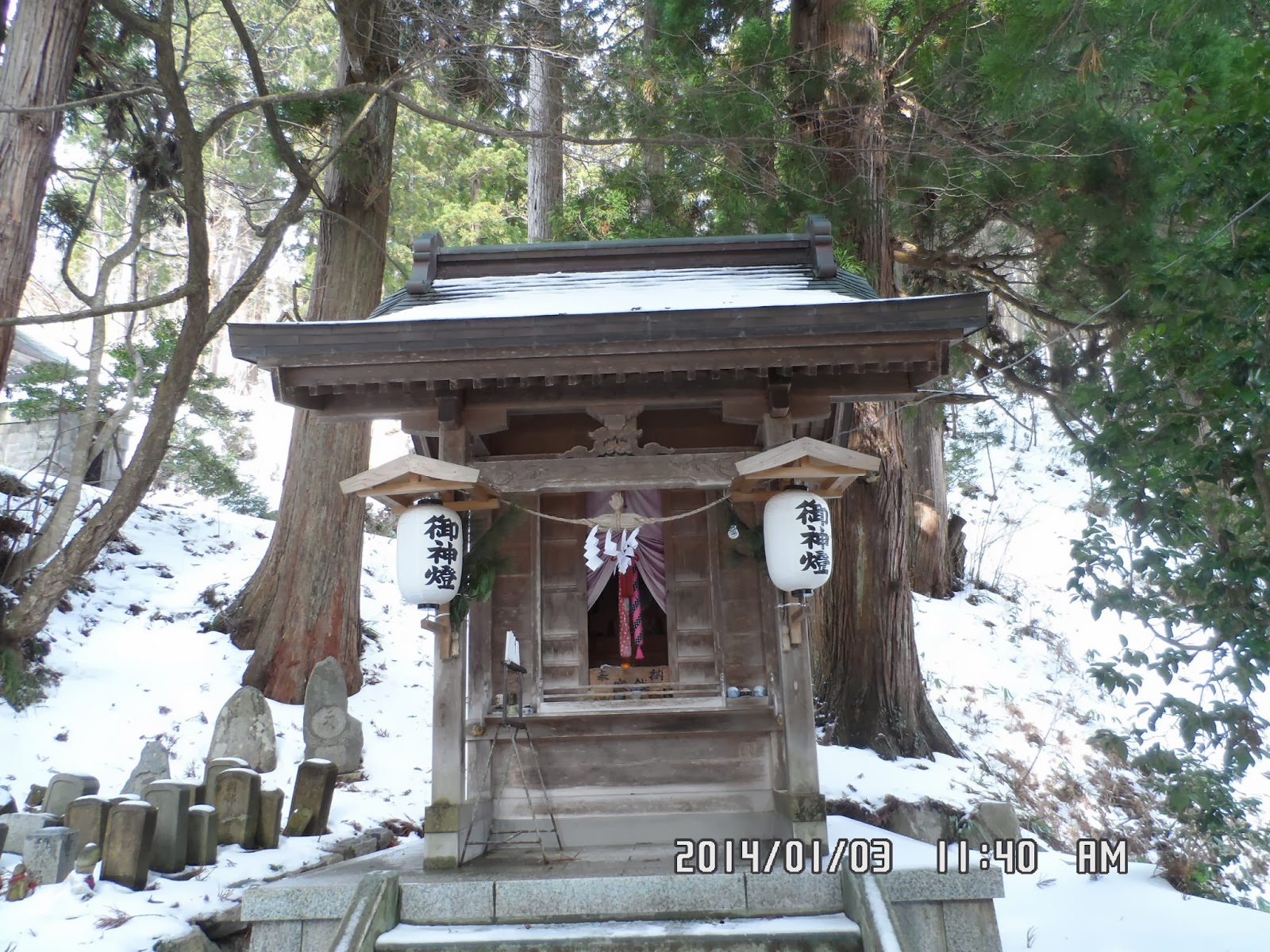
[Kinbo Shrine Nakanomiya, 金峯神社中宮、킨보우 신사 중궁]

[Kinbo Shrine Nakanomiya, 金峯神社中宮、킨보우 신사 중궁]

["Zuishin" in front of the shrine, 神社の前の『随身』像、신사 앞 "즈이신" 상]

[The guide map around Kinbouzan, 金峯山周辺案内図、킨보우산 주변 안내도]

[At the entrance of the trail, 登山路入口、등산로 입구]

[A trail near the entrance, 登山路入口付近の登山路、등산로 입구 부근의 등산로]

[The Outlook guide map, 展望案内図、전망 안내도]

[A view from the ridge, 稜線からの展望、능선에서의 전망]

[A view from the ridge, 稜線からの展望、능선에서의 전망]

[The sign of "Hakkeidai" 八景台の標識、팔경대 표지]

[A view from Hakkeidai, 八景台からの展望、팔경대에서의 전망]

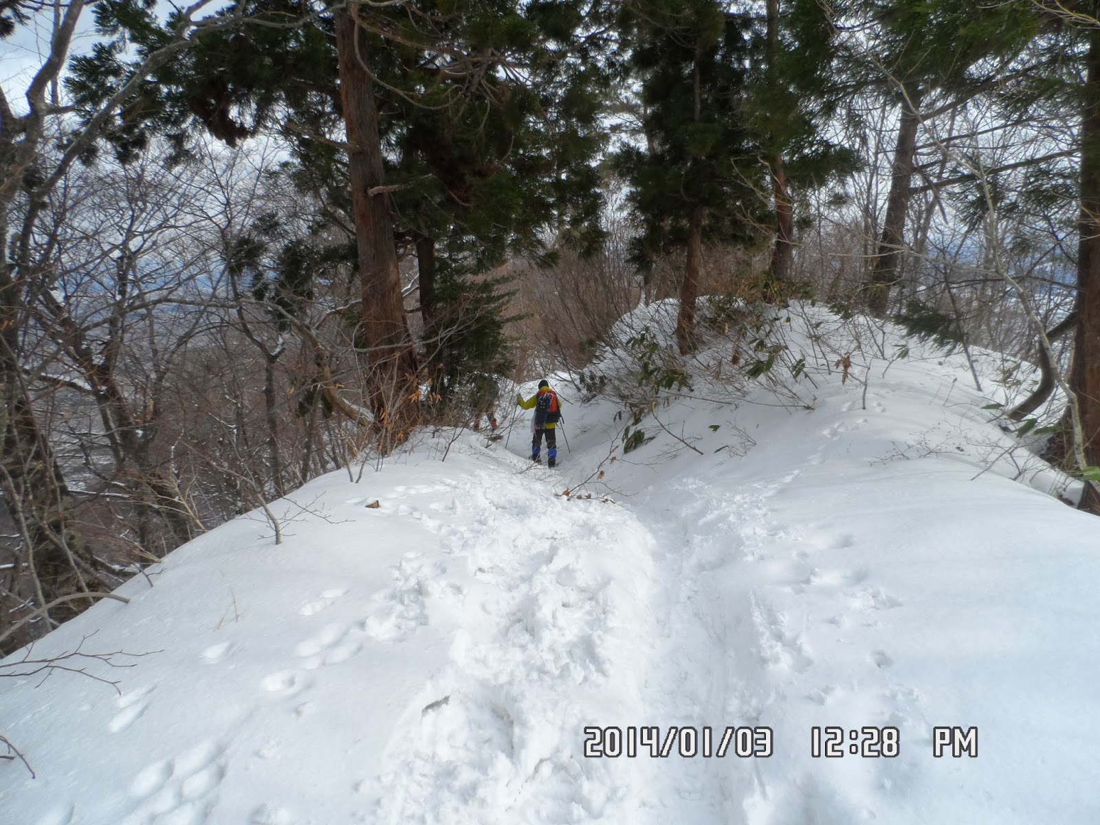
[On the trail, 登山路にて、등산로에서]

[Near the summit, 頂上付近の登山路、정상 부근의 등산로]

[At the summit of Kinbozan, 金峯山頂上にて、킨보우산 정상에서]

[The main building of Kinbo Shrine, 金峯神社本殿、킨보우 신사 본전]

[On the way down, 下山路にて、하산 길에서]

[On the way down, 下山路にて、하산 길에서]
On my way down to the foot of the mountain from the middle shrine, I saw Susumu’s car coming from the foot of the mountain to the middle shrine.

[At the foot of the mountain, 麓の大きな藤の木、산기슭의 큰 참등 나무]
Kikko suggested to visit the middle shrine of Kinbozan, so they came by car.
I waited for their return at the foot of the mountain, and joined them.
We dropped at “Komaginoyu” hotspring, and enjoyed the hotspring for about an hour, then went back to Hodashi Village.

[At the entrance of "Komaginoyu", 『こまぎの湯』入口、"고마키 온천" 입구]

After having supper, we had a nap. And at midnight, we left Hodashi Village to Kasumigaura City in Ibaragi Prefecture, about 450 km south from Tsuruoka-shi, Yamagata Prefecture.
It was my 2nd hiking in the year of 2014.
---------------------------------------------------------------------------------------------------------------------
分類:登山、日本、東北
登山月日:2014年1月3日(金) 曇り時々晴れ。
登山地:山形県鶴岡市、金峯山(458m)
登山コース:金峯山登山口~中宮~八景台~金峯神社本殿(ピストン) 7km (3.5 時間)
朝食後、義弟に金峯山登山口まで送ってもらい金峯山に登った。
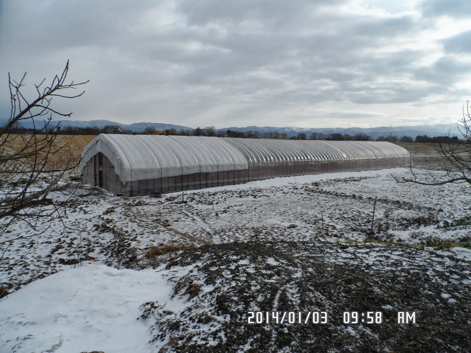
[The greenhouse of the Satoes, 佐藤家のビニールハウス、사토가의 비닐 하우스]

[At the entrance of the trail, 金峯山登山口にて、킨보우잔 등산로 입구에서]

[The 1st Torii of Kinbo Shrine, 金峯神社一の鳥居、킨보우 신사 일 도리이]

[The explanation about Kinbo Shrine, 金峯神社の説明、킨보우 신사의 설명]

[The Ryugaike Pond, 龍が池、류우가이케 연못]

[Rokusho Shrine, 六所神社、로쿠쇼 신사]

[The sign of Kinbo Shrine, 金峯神社案内、킨보우 신사 안내]

[The forest road to the shrine, 金峯神社への林道、킨보우신사에 가는 임도]

[Shonai Plain, 庄内平野、쇼나이 평야]

[Close to the middle shrine, 中宮付近、중궁 부근]

[The spring of Akai, 閼伽井の清水,아카이의 약수]

[Memorial for brushes, 刷毛塚由来碑、"하케즈카" 유래 기념비]

[A cold geyser, 冷水間欠泉、냉수 간헐천]

[Small shrine and a geyser, 小さな神社と間欠泉、작은 신사와 간헐천]

[Kinbo Shrine Nakanomiya, 金峯神社中宮、킨보우 신사 중궁]

[Kinbo Shrine Nakanomiya, 金峯神社中宮、킨보우 신사 중궁]

["Zuishin" in front of the shrine, 神社の前の『随身』像、신사 앞 "즈이신" 상]

[The guide map around Kinbouzan, 金峯山周辺案内図、킨보우산 주변 안내도]
彼らは鎧ガ峯から来たのかもしれない。このあとが本格的な登山路となるが、このあとすれ違った2組はどちらも「がんじき」を履いていた。

[A trail near the entrance, 登山路入口付近の登山路、등산로 입구 부근의 등산로]
[The trail on the ridge, 稜線の登山路、능선의 등산로]
しかし、登山路はほとんどV字の底のため、見通しはきわめて悪い。
唯一、「八景台」というところが尾根で樹木のさまたげもなく、金峯山から鎧ケ峯(566m)そして母狩山(ほかりさん751m)へ続く峰々と庄内平野が見渡せた。

[A view from the ridge, 稜線からの展望、능선에서의 전망]

[A view from Hakkeidai, 八景台からの展望、팔경대에서의 전망]

[On the trail, 登山路にて、등산로에서]

[Near the summit, 頂上付近の登山路、정상 부근의 등산로]

[The map which shows around the summit, 頂上付近を示す地図、정상 부근을 나타내는지도]

[The main building of Kinbo Shrine, 金峯神社本殿、킨보우 신사 본전]

[The guidepost to Mt. Hokari, 母狩山への里程標、호카리산의 이정표]

[On the way down, 下山路にて、하산 길에서]

[Footsteps of wild animals, 野生動物の足跡、야생 동물의 발자국]

[On the way down, 下山路にて、하산 길에서]

[A view of Shonai Plain, 下山路にて庄内平野、하산 길에서 쇼나이 평야]

[The guidepost near the middle shrine, 中宮付近にて、중궁 부근에서]
中宮から麓へ向かってふたたびシャーベット状の雪を踏みながら下ると、中腹よりやや下がったあたりで義弟の車が上がって来るのに会った。

[At the foot of the mountain, 金峯山麓にて、킨보우산 산기슭에서]
麓まで下山して煎餅と燗酒を味わいながら彼らが下って来るのを待って車に乗った。
文下へ戻る途中、こまぎの湯という温泉に入り、さらに主婦の店で買い物をした。

[At the entrance of "Komaginoyu", 『こまぎの湯』入口、"고마키 온천" 입구]

佐藤家では義弟が車を運転することを考慮してアルコール抜きの夕食となった。
夕食後早寝をして夜間ドライブに備え、12時過ぎに文下を出発し、茨城県かすみがうら市を目指した。
今回の登山は今年になって2度目の登山である。
0 件のコメント:
コメントを投稿