Mountains: Dodeokbong (534m) and Geumsubong (531m) in Sutonggol (수통골) Daejeon (대전)
Date: Jan. 31, 2014 (Friday) Fine
Partners: Tina (Canada), Jens (Germany), Pablo (UK), Robby (Indonesia) and 3 Germans (I saw them at Sutonggol for the first time.)
Course: Sutonggol Bus-Stop – The entrance of Sutonggol – Dodeokbong – Geumsubong – Swuigoljae – The Small Sutonggol - The entrance of Sutonggol – Bus Stop (About 10 km, 5 hours and 40 minutes.)
It was the Lunar New Year’s Day. Most of Koreans were busy visiting their relatives.
So, I planned a light hike to Sutonggol for Taejonhikers.
Tina family and Robby replied to my call. We all got together at KAIST at 9 am.
We took #104 bus to Sutonggol.
Since it was the Lunar New Year, the streets were vacant, so was the bus. We were the only passengers.
We arrived at Sutonggol Bus Stop at 9:40. We walked along the river toward the entrance.
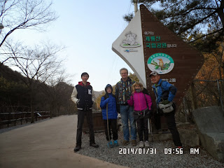
We took some group pictures at the entrance of Sutonggol.
I also took a picture at the big map at the entrance of the trail to Dodeokbong.
We began climbing the mountain at around 10 am.
Soon, three gentlemen came from our behind, and they went ahead of us on the ridge. They were all Germans. When they were taking a short rest at the observation deck, I talked to them. Then I found out their nationality. So, I told them that one of our people came from Germany.
When I introduced Jens to them, they soon began speaking in German.
They were drinking vodka and they encouraged me to sip a shot. It was very strong, but I liked it. I told them that it would be good when it was very cold. One of the three German hikers, maybe Michael or Mario told me that it would be not a good idea to drink a strong alcohol because it might have made a drinker's bodily temperature lower.
Wow, it's a new piece of information! I had been thinking that strong alcohol would always be good for hikers because it would had caused the body temperature high. So, I was wrong!
But I still believe "warm sake" is good during cold weather, as J-nim at AhToSan always provides AhToSan members. I really enjoy his sake very much every time, though it was only a sip.
By the way, one of three Germans, Andreas, was wearing coat. He looked very dandy. I liked his style. It was not a normal hiking style at all.
When I asked their course, they said Dodeokbong and Geumsubong, the same as ours.
So we decided to go all together.
We arrived at Dodeokbong at 11: 30. We took a group picture together.
Then we began ridge hiking toward Geumsubong.
There was an emergency box along the trail. Jens tried to open it, but it was locked. I though that when an emergency situation happened around here, ambulance crews might rush here and opened the box tor the treatment.
Sutonggol is a popular mountain for Daejeon citizens. Even on Lunar New Year’s Day, there were several Korean hikers. When we arrived at the junction near Geumsubong, it was already 1:05 pm.
But it was close to Geumsubong, where there was a nice gazebo. So we continued hiking.
When we finally arrived at the summit of Geumsubong it was 1:30 pm. We had lunch at the gazebo. There were some hikers already there, including an attractive American lady and a nice looking Korean lady.
I spoke to them and found out that they were English teachers in Gongju. I hesitated to speak more because they are beautiful ladies. (Too bad that I could not take their pictures. I needed braver mind.^^)
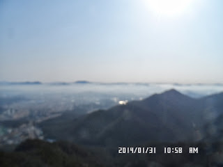
We had nice views from the gazebo that day.
We began descending the mountain after lunch. While going down on the ridge, we could see the Geryonsan Mountains behind the Sutonggol Mountains well.
There were observations decks, same as Dodeokbong route. So, we had another short rest at the observation deck.
Then we came down to the junction called “Swuigoljae.”
Then we went down along the stream, the same trail as we walked on Dec. 25, last year.
This valley is called "Jageun Sutonggol(작은 수통골)" which means "Small Sutonggol". When the two trails meet, you can see the Sutonggol with a waterfall.
I like the both trails, the trail along the Small Sutonggol as well as the trail along the Big Sutonggol. But I like the Big Sutonggol better, because of my dear memories with many Taejonhikers, esp. Alan England who already went home in Tennessee two years ago.
When I walked the wooden trail along the reservoir, all dear memories came back to me, and I felt like a bit nostalgic and a bit sad, because I had to leave Korea soon.
I saw some three banners on top, it said "A Happy New Year!" We, Japanese celebrate New Year Days holiday, starting from Dec. 29 through January 3, every year, but Koreans celebrate their New Year in lunar calendar for three days. This year, Jan. 30 to Feb. 1 (New Year Day was Jan. 31.) So it was actually the hike on Lunar New Year's Day.
It was 3 p.m. when we came to the entrance of Sutonggol.
So it took us about 5 hours for the hike.
We took 5:20 bus from Sutonggol Bus Stop to KAIST.
It was my 7th hike for this year.
----------------------------------------------------------------------------------------------------
分類:登山、韓国、冬山,登山、韓国、Taejonhikers
登山地:大田広域市儒城区のストンコル(道德峰(도덕봉534m)と錦繡峰(금수봉531m)
登山月日:2014年1月31日(金)晴れ
同行者:ティナ(カナダ)、イェンツ(ドイツ)、パブロ[英国)、ロビィ(インドネシア)及びドイツ人3人(現地で新たに知り合った)
登山コース:ストンコルバス停~ストンコル入口~道德峰(도덕봉534m)~錦繡峰(금수봉531m)~スェコルジェ(쇠골재)三叉路~『小さなストンコル(작은 수통골)』~ストンコル入口~ストンコルバス停、距離は約10km、時間は9:40~15:20(5時間40分)
この日は旧正月で、韓国人たちは親戚を訪問して忙しい。そのため、テジョンハイカーズとして自分でストンコルハイキングを計画した。
参加者はティナとイェンツ夫妻及びパブロと私とインドネシアからのKAISTの学生のロビィの5人。
KAIST正門に9時集合。ティナ一家とロビィは時間どおり9時に集まった。
我々はKAIST前の駐車場から104番バスでストンコルへ向かった。
街は旧正月のため車も人通りも少なく、ゴーストタウンのようだ。
9時20分ごろ来たバスも我々以外の乗客はいない。終点のストンコルバス停に到着したのは9時40分だった。
ロビィが水を買いたいと言ったが、ストンコルの売店は休業。公園入口の橋のたもとにとまっていたオデン屋で水も売っていた。
イェンツは500ウォンでインスタントコーヒーを買った。公園の入り口で記念撮影をした時間は9:56だった。
公園入口から4分歩いたところにストンコル部分も含めた鶏龍山国立公園の大きな地図があり、その横から道德峰への登山を開始した。
ストンコルは大田市民が気軽にハイキングを楽しめる山で、登山施設がたいへん充実している。とくに感心するのは要所要所に救急箱が設置されていることだ。
この救急箱の中には緊急手当てに必要な薬や包帯などがそろっている。
最初の緊急箱を過ぎたあたりから稜線に出て、テジョンとくに儒城の街が一望にできる。
駐車場から1km進んだ地点あたりからは特に展望が良く、木製の登山路が整備されている。
最初の尾根に上がる時、後ろからきた外国人の3人組が我々を追い抜いたが、彼らがこの展望台のベンチで休んでいるところに追いついた。
話をしてみると3人ともドイツ人だという。イェンツは元東独出身なので、我々の仲間にもドイツ人がいると言って紹介したら、彼らはさっそくドイツ語で会話を始めた。
3人の名はマリオとマイケルとアンドレアスで、このうちマリオは韓国企業との提携のため長期滞在中である。
他の二人はマリオを訪ねて短期滞在中のようだった。このうち最も背の高いアンドレアスはマントに革靴といういでたちでハイキングの服装ではない。
彼らはウォッカを豪快にやっていて、私も一杯ごちそうになった。
ハイキングのコースを訪ねると道德峰から錦繡峰を経て下山すると言うので彼らと同行することにした。
道徳峰の頂上には登山開始後1時間半の11:30に到着した。
ここからは尾根伝いに錦繡峰へ向かった。
途中にまた立派な救急箱があり、イェンツが箱を開けようとしたが鍵が掛かっている。きっと救急隊員がカギを持っているのだろう。
錦繡峰の手前の三叉路には1時5分に着いたが、錦繡峰まで行けば東屋があるのでそこで昼食にしようと言うことになった。
この三叉路から錦繡峰までの登山路はぬかるみで大変だった。
錦繡峰の東屋には1時30分に到着した。東屋には公州で英語を教えているアメリカ人の若い女性と韓国人の英語の先生の二人連れなど先客がいたが、我々全員がベンチに座ることができ、ここで昼食にした。
ここで約20分ほど昼食休憩をとってから下山にかかった。
なによりも天候に恵まれ、展望がよかった。錦繡峰からピンゲ山へ向かうルートの尾根からはこれまで巡ってきた道徳峰をはじめとするストンコルの峰々と共に、その背後には鶏龍山の山々が良く見えた。
錦繡峰からの下りの途中の展望台も実に良かったのでドイツ人たちも含めて集合写真を撮った。
『スェコルジェ(쇠골재)』三叉路から『小さなストンコル(작은 수통골)』渓谷を経てストンコル駐車場まで至る下山路は前回のビンゲ山の時と同じである。
途中、日影の渓谷では雪や氷が解けずに残っていた。貯水池もまだ凍っていた。
『小さなストンコル』を下ると左手の大きな川と合流する地点からは立派な木製の歩道となる。左手の大きな渓谷の方が本物の『ストンコル』で『将軍滝(장군폭보)』という美しい滝がある。
『ストンコル』は大田市内ということもあり、テジョンハイカーズと一緒に何回も来てさまざまなルートで歩いた。
実は、『ストンコル』という名前がこの渓谷の名前であることは今回道徳峰と錦繡峰の地図をウェブサイトからダウンロードして見て初めて知った。
『ストンコル』の出入口から錦繡峰へ登ったり降りたりするルートは今回の『小さいストンコル』を通るルートの他、今回錦繡峰の前の三叉路から『ストンコル』を通るルートの2通りあることも今回地図ではっきりした。
私はどちらのルートも好きだが、特に本物の『ストンコル』を通る方が一層好きだ。それはテジョンハイカーズと歩いた日々を思い出す中で、特に私の米国人の先輩であるアラン・イングランドと歩いた記憶がよみがえるからである。
アランは2年前に故郷のテネシーへ帰ってしまったし、私もあと1ヶ月ほどで韓国を去らねばならないということを考えると少しセンチメンタルになってしまった。
さて、この日は韓国語で『ソルラル』、すなわち『旧正月』当日である。ストンコルの出口に近づくと3本の横断幕が掲げてあり、その最上段に"새해 복 많이 받으세요!"とある。直訳すると『新しい年に福をたくさん受けますように!』であるが、日本語では『あけましておめでとう』に相当するだろう。
良く整備された貯水池の向かい側の渓谷の水はまだ凍っていた。
さて、今回は3時には公園入口まで下山したから、ハイキングの時間は約5時間だった。
バス停には3時20分に到着。またガラガラの104番バスでKAISTへ戻った。帰路のバスも乗客はわれわれだけだった。
今年7回目の登山は天候に恵まれて快適だった。
I like hiking very much. I used to go hiking with a Korean hiking club named “AhToSan.” This blog introduces mostly my hiking activities in Korea and Japan, and Sydney in Australia. As of January 2020, I live in Sydney suburb. I go Blue Mountains and bush walk in Sydney area. 私は2003年から2014年まで韓国の大田(テジョン)に住んだ日本人である。11年間、週末は主に「アトサン山岳会」に参加した。14年4月に帰国したが、2020年以降はおもにシドニーで暮らし、時折、日本へ帰国する程度である。したがって最近の記事はSR(Sydney Report)としてブルーマウンテンのトレッキングを中心に書いている。
About pictures/当ブログ内の写真について/당 블로그내의 사진에 대해서
Most of the pictures in this blog are taken by my camera, yet some of them were downloaded from the website of the hiking club. If you click any pictures, they become the original size.
当ブログ内の写真の大部分は筆者のカメラで撮影したものですが、一部、山岳会の共有写真からダウンロードしたものを含みます。すべて、各写真をクリックすれば、元のサイズに拡大します。
당 블로그내 사진의 대부분은 필자의 카메라로 촬영한 것입니다만 일부 산악회 공유 사진으로부터 다운한 것도 포함합니다. 모두 각 사진을 클릭하면, 원래 사이즈에 확대합니다.
当ブログ内の写真の大部分は筆者のカメラで撮影したものですが、一部、山岳会の共有写真からダウンロードしたものを含みます。すべて、各写真をクリックすれば、元のサイズに拡大します。
당 블로그내 사진의 대부분은 필자의 카메라로 촬영한 것입니다만 일부 산악회 공유 사진으로부터 다운한 것도 포함합니다. 모두 각 사진을 클릭하면, 원래 사이즈에 확대합니다.
登録:
コメントの投稿 (Atom)


0 件のコメント:
コメントを投稿