Date: Feb. 15 (Sat) fine,
Mountain: Gayasan (伽耶山/가야산 677m) in Yesan (礼山/예산), ChungNam Province (忠南/충남)
Course: Sanggari Parking Lot – Statue of Sanggari Maitreya Buddha – Okyangbong (Ceremony) – Seongmunbong – The junction of three trails – Giljisa Temple – Tomb of Yi Gu – Parking Lot (about 10 km, 5 hours)
The destination was Mt. Gaya in Yesan, ChungNam province. It is relatively close to Daejeon, therefore the departure timeat Expo South Gate was 7 am.
Participants were 42 including 4 none-Koreans (Bernardo from Mexcico, Michael and Mario from Germany and George from Japan.)
I saw Michael and Mario at Sutonggol on January 31, the Lunar New Year hike with Taejonhikers for the first time.
I invited them to AhToSan hike, and Michael expressed his intention to join this hike on Friday.
It was already full, but because of several cancels, they got the last seats.
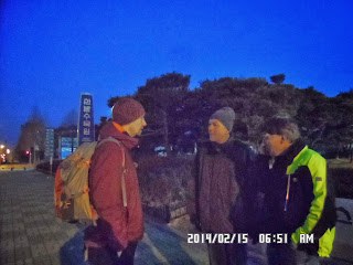
When I arrived at the bus stop at Expo South Gate at 6:30, it was still dark. I saw two big guys walking toward the inliner skatelink, I shouted “Michael and Mario?” They were.
Soon Bernardo joined, and we took the rear seats of the AhToSan bus.
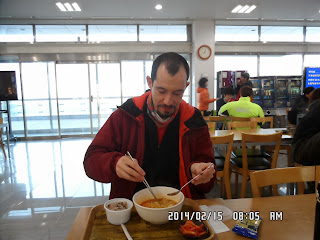
AhToSan had a breakfast break at a service area on the way. I had my breakfast at home, but I joined their table. Bernardo had a good appitite and he orderd ramen and had AhToSan provided a pack of bean rice. The Germans ordered cream coffee for the bean rice.
One of Germans said he had allergy with bread, so he liked Korean style breakfast very much.
There were several new commers, and Jeongjeong, the president of AhToSan introduced them as well as 4 foreigners on the bus.
We arrived at Sanggari Parking Lot at 9:20. Since they were having a ceremony on the summit, they needed to carry a lot of food and drinks (makgeolli). Michael offered this bag to carry “Ttok” or Korean style rice-cake for ceremony.
After taking group pictures at the parking lot, we began hiking toward the mountain.
When we passed a cowshed, there was a fork point of Gaya Temple and Okyangbong. We turned right to Okyangbong.
Then there was a big stone monument, and two big wooden statutes on the right side.
There was a chained female dog and several puppys. They were very friendly.
From the road, we could see Mt. Gaya with antenna facilities on the summit, clearly.
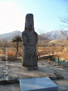
Then we came to the board which said “Sanggari Maitreya Statute Park.”
The stone statute of Maitreya was a bit apart from the trail. I was interested in the historical statute, so I went close to the statute and took a picture.
But while I was away from the trail, all AhToSan hikers went ahead leaving me alone.
Soon there was a fork point of the trails. Both trails lead to Okyangbong, so I took out of the map and turned left which the hiking planner explained on the bus.
Later, I found out that every hiker turned to right, which trail was a little easier than left. And I was the only hiker who took the right course.
I had a bad feeling as I did before when I took the wrong way. Anyway, Jeongjeong, the leader of AhToSan called me while I was walking toward the ridge.
She asked me the place I was, and I answered that I was on my way to Okyangbong. Then she said we would meet at the summit of Okyangbong,
I walked alone for about one hour and half, and when I came close to the summit of Okyangbong, I heard the voice of Ruchi and other AhToSan members.
Good grief! I could join them all right! It was the summit of Okyangbong where they were to have “Shisanjae” ceremony.
I passed over the summit and went to the other side of the mountain. There, Jeongjeong, and Michael and Mario were arriving at the summit.
The fast hikers were already on the summit and preparing for the ceremony. Michael took out the “ttok” from his bag.
They placed the food and makgolli in front of the national flag and AhToSan flag.
Pianoman, a staff member of AhToSan played the role of MC. Then Jeongjeong started the ceremony.
She kneeled down in front of the alter and bowed down and stood up and keeled down and bowed, twice.
Then drank makgeolli and put money under the food.
After Jeongjeong, three former presidents of AhToSan performed the ceremonial bows, then staff members of AhToSan followed suit.
To my surprise, Michael and Mario joined this ceremony. They kneeled down and bowed and drank makgeolli and put money under the food.
I remembered that Cris from USA did this before, and all AhToSan people liked him very much.
Bernardo and I were refrained from the ceremony, since we believe that the creator of the world is the only God in the world.
Anyway, the ceremony ended when Jeongjeong burned the paper on which prayers were written.
Then we had lunch. The food they brought to the mountain were: boiled pork, several different kind of cooked vegitable and “ttok” rice cake with red beans.
Some members cooked ramen, and we shared these food among members.
After the lunch, I took several pictures with the guidepost of Okyangbong. Then we started the ridge hike which I enjoyed very much.
Some part of the ridge trails were facilitated with wooden plates, others were bare rocks.
It was a fine day, and we had nice views of the mountains.
There were nice looking pine trees, and good points for taking pictures.
I walked with Bernard, first, but he was too fast for me. He joined the top group, and I walked with the main group of about twenty people including Michael and Mario.
On the way, Mario joined the other hiking club lunch or drinking place. He was popular wherever he went.
The distance between Okyangbong and Seongmunbong was about 1.4 km. When we passed a 3 meter-high piles of stones, we were close to the 2nd summit; Mt. Seongmunbong.
There was a Korean national flag and a stone monument on the summit of Seongmunbong, therefore many hikers wanted to take pictures with these memorials.
We had to wait for a while until the other hikers finished their turn to take a lot of pictures.
After the summit of Seongmunbong, we continued the ridge hike toward Gayabong, the final summit of the day.
When we came close to Gayabong, we separated ourselves for two groups; one for Gayabong, and the other for going down without going to Gayabong.
Michael and I took joined the latter group, while Mario joined the tougher group.
From this point to the middle of the mountain, the trail was steep and slippery because of snow.
Some members used crampons. I did not used crampons, but I used sticks in stead. Michael also used a stick which he borrowed from another member of AhToSan.
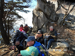
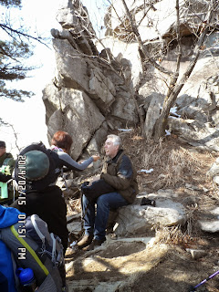
We had a short break at about the middle point. There were about a dozen of members with me.
Michael took out a bottle of coke and some candies from his bag. I was impressed that he prepared well.
He and I walked together until the end of the hike. When we came out from the forest, we saw rice field with a lot of frogs, thousands of frogs calling each other.
[Paddy field at the foot of the mountain, 麓の水田、산기슭의 논]
Wow, it’s spring already, I thought. I could see many of them jumping around and swimming!
After the rice field, there was a strange-looking temple called “Giljisa.” It did not look ordinary temple.
Then the trail joined to the other trail from Gayabong. I saw Gongjapak who planned this hike coming from the bank of the reservoir.
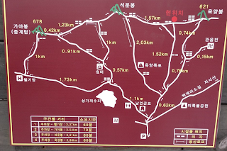
I explained the first part of the trail to Okyanbong when we came to the map. He said I took the right way and they took the way he originally did not plan.
After the map, I saw a little hill on the left side and several AhToSan hikers. So Michael and I climbed up to the hill.
It was the tomb of a price called Namyeonggun (YiGu), the father of Daewongun, who influenced the policy of Lee-dynasty at the end of 19th century.
They say that there used to be a temple named Gayasa at the place. But according to “Feng shui” Philosophy, the place is the best place to make a tomb. So Daewongun burned the temple and made his farther’s tomb there.
Fen shui:http://en.wikipedia.org/wiki/Feng_shui
After the tomb, there was a well facilitated wooden trail, then came to the paved road. Several local women were selling local products to the hikers.
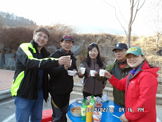
We came back to the parking lot at 3:30 pm. Some fast hikers were already having wrap-up party with makgeolli and shoju.
The main dish was Kimchi jjigae. It’s a bit spicy and hot, but Bernardo likes it very much.
Jeongjeong shouted “A Toyoilun Sanekaja” or “Let’s go mountains on Saturday!” and all others agreed saying “Aja, Aja, Aja!”
I like hiking very much. I used to go hiking with a Korean hiking club named “AhToSan.” This blog introduces mostly my hiking activities in Korea and Japan, and Sydney in Australia. As of January 2020, I live in Sydney suburb. I go Blue Mountains and bush walk in Sydney area. 私は2003年から2014年まで韓国の大田(テジョン)に住んだ日本人である。11年間、週末は主に「アトサン山岳会」に参加した。14年4月に帰国したが、2020年以降はおもにシドニーで暮らし、時折、日本へ帰国する程度である。したがって最近の記事はSR(Sydney Report)としてブルーマウンテンのトレッキングを中心に書いている。
About pictures/当ブログ内の写真について/당 블로그내의 사진에 대해서
Most of the pictures in this blog are taken by my camera, yet some of them were downloaded from the website of the hiking club. If you click any pictures, they become the original size.
当ブログ内の写真の大部分は筆者のカメラで撮影したものですが、一部、山岳会の共有写真からダウンロードしたものを含みます。すべて、各写真をクリックすれば、元のサイズに拡大します。
당 블로그내 사진의 대부분은 필자의 카메라로 촬영한 것입니다만 일부 산악회 공유 사진으로부터 다운한 것도 포함합니다. 모두 각 사진을 클릭하면, 원래 사이즈에 확대합니다.
当ブログ内の写真の大部分は筆者のカメラで撮影したものですが、一部、山岳会の共有写真からダウンロードしたものを含みます。すべて、各写真をクリックすれば、元のサイズに拡大します。
당 블로그내 사진의 대부분은 필자의 카메라로 촬영한 것입니다만 일부 산악회 공유 사진으로부터 다운한 것도 포함합니다. 모두 각 사진을 클릭하면, 원래 사이즈에 확대합니다.
2014年2月20日木曜日
140215 Mt. Gaya (伽耶山/가야산 677m) in Yesan (礼山/예산), ChungNam Province (忠南/충남)
We enjoyed the party until 4:20 and came back to Expo South Gate Parking Lot at 6:25 pm.
It was my 9th hike this year and 341st AhToSan regular hike for me.
--------------------------------------------------------------------------------------------------------------------------------
分類:登山、韓国、冬山
登山日:2014年2月15日(土)晴れ
登山地:忠南・礼山の伽耶山(가야산 677m)
登山コース:上伽里(상가리)駐車場 - 上伽里弥勒仏- 玉陽峰(옥양봉) - 石門峰(석문봉) - 伽倻峰(가야봉) – キルジサ(길지사) - 南延君(남연군)墓地 - 上伽里駐車場(約10km 5時間)
参加者:アトサン会員42名(うち外国人は4名:ベルナルド(メキシコ)、ミカエル(ドイツ)、マリオ(ドイツ)、私
今週のアトサンは忠南・礼山の伽耶山(677m)で始山祭(しさんじぇ)も行った。
テジョンハイカーズの旧正月ストンコルハイキングで会ったドイツ人のミカエルとマリオがアトサンバスが満車になってから申し込んできた。
幸い、キャンセルが出て、二人とも滑り込みセーフで座席を確保できた。
朝はいつものバスの1本前のバスで6時半に南門に到着した。
薄暗い中、大男二人が見えたので声をかけたら彼らだった。すぐにベルナルドも合流して余裕の出発だった。
座席は最後の前でベルナルドによれば一番前の座席との間が広い。この席は車内の見晴らしも良く、快適だ。
ドタキャンが二人いたようで、参加人数は42人だった。
途中のSAで朝食ブレイク。ベルナルドはラーメンを注文してラーメンライス。ミカエルとマリオはクリーム付コーヒーとアトサン配給のお赤飯。
ミカエルはパンのアレルギーがあるとかで、アトサンの朝食が気に入った様子だ。
バス内ではチョンジョン会長が初めて参加した人々の紹介と我々外国人たちの紹介をした。
初参加の人々は会長が若い女性ということで驚いたことだろう。
出発地点の上伽里(상가리)駐車場には9時20分に到着した。
今回は始山祭のため供え物を運ばなければならない。マリオはリュックを持たずに来たが、ミカエルがリュックに余裕があると言ってみずから「トック」を自分のバックに入れた。
その後、駐車場で伽倻山をバックに団体写真をとってから出発した。
牛舎を過ぎると伽倻寺跡と玉陽峰(옥양봉)への登山路の分岐点を玉陽峰の方へ曲がり、5分ほど進むと左手に伽倻亭とかかれた東屋があり、右手には「百済の微笑」と書かれた大きな石標と巨大な木像と案内板があった。
さらに3分ほど進むと左側にフレンドリーな犬の母子がいて、母犬は繋がれているが尻尾が振り切れそうなほど振り、ころころした子犬が二匹、これも尻尾を振りながら犬の好きなベルナルドとミカエルに近づいてくる。
左手遠方にはアンテナが建った伽倻山が見えた。すると左手に「上伽里弥勒仏公園」の案内板があり、「上伽里弥勒仏」が見えてきた。
この高麗時代(AD 918-1392)に造られた弥勒仏の石像はもともとは伽倻寺の方向を向いていたが、李朝末期に大院君が父親である南延君(남연군、ナミョングン)の墓地を風水学上優れた伽倻寺の地に建てるため、伽倻寺を破壊すると、この弥勒物は伽倻寺の反対側を向くようになったという説がある。
私はもともと上りには弱いのだがこの「上伽里弥勒仏」を見学している間に完全に取り残されて一人になってしまった。
弥勒物像のすぐ先には分岐点があり、どちらも玉陽峰に至るのだが、右はおおきな橋を越えて登る道であり、左はさらに渓谷から登る道と稜線から登る道に分かれていた。
私は左折してしまったが、アトサンは全員右の大きな橋を越えて登る道をとったようだ。
稜線コースを登っている途中、チョンジョン会長から私の携帯に電話が入った。
私は自分がとったコースを説明して、玉陽峰に向かっている旨を告げたため、それでは玉陽峰で会おうということになった。
他の山岳会の人々が前後にいるが、アトサン会員はまったくいない状況で約1時間半ほど登り続けると、玉陽峰の頂上付近に近づいた。
すると上からルチやソルヒャンギの声が聞こえた。持参したブドウとミニトマトを食べてもらおうとリュックから出すと、すぐ先の玉陽峰の頂上にアトサン会員が集まって始山式の準備をしているからそちらで食べようと言うことになり、玉陽峰の頂上へ持って行った。
すると反対側からミカエルやモグァ(カリン)、さらにチョンジョン会長らが次々と頂上に到着した。コースは違ったがほぼ同時に玉陽峰頂上に到着したことになる。
始山祭の準備は先に到達したメンバーが始めていた。ミカエルも自分のリュックに入れて運んできたトックを取り出した。
始山祭の司会は総務のピアノマンが務めた。立木の間にアトサンの旗と太極旗(テグクキ태극기)を渡し、その前に餅、豚肉、果物、魚などを供えた。
式次第は新しい1年の登山の安全を山の神に祈願するもので、年末に行う「終山祭」に似ている。
新会長であるチョンジョンが「大きな(礼큰 절)」をしてから手順に従ってマッコリを飲み、お金を供物の下に置くと、次の者に替わる。
会長の次は、以前会長を務めたアランドロン、チョンダウン、サンサランの3人の顧問である。
次は山行大将や総務などのスタッフ、そして一般会員と続く。
今回は外国人のうち、ドイツ人のミカエルとマリオが参加した。彼らが最後に万ウォン札を供物の下に置くとアトサン会員はみな感心した。
最後に会長が山の神に対して書かれた請願文を読み上げてから燃やすと始山祭は終わりで、昼食タイムである。
昼食では供え物の他、各自持参した弁当を食べた。また、ラーメンを煮ている会員もいた。冬場はアツアツのラーメンが人気である。
昼食後は「オクヤンボン」とハングルで書かれた里程標で認証写真を撮ってから稜線歩きを開始した。
稜線はところどころ立派な木製の階段が整備されていて歩きやすい。
雪もさほど積もってなくアイゼンは不要。玉陽峰(옥양봉)と石門峰(석문봉)の間は約1.4kmで、さらにその先の通信施設がある伽倻山をめざして歩いた。
ベルナルドはペースが早く、先頭グループと一緒に先に行き、私はミカエル、マリオと共に中間グループと一緒に進んだ。
某山岳会が建てた3mほどありそうなケアンを過ぎると石門峰である。
石門峰には立派な石標と太極旗があり、人気の写真スポットである。
我々本隊が到着した時は他の山岳会が撮影中でしばらく待たなければならなかった。
石門峰は名前の通り、大きな石が積み重なったような山で、この岩の間の登山路を下った。
この先も見晴らしの良い稜線の登山路で、ところどころ大きな岩がある。
約20人ほどの本隊とともに進み、ときどき休憩した。マリオは他の山岳会の休憩にも混じって話しをしたり、マッコリをもらって飲んだりしていた。
石門峰と伽倻峰の間には数カ所、上伽里駐車場へ下る下山路がある。伽倻峰に近い最後の下山路との分岐点で、伽倻峰へ行くグループと下山するグループに分かれた。
私はミカエルと共に下山するグループに入った。マリオはJニムらと共に伽倻山へ向かうグループに入った。
分岐点から山の中腹まではかなり急こう配で雪も多く、アイゼンを装着する会員も多かったが、私はスティックを使ってアイゼンはつけなかった。
ミカエルも他の会員からスティックを1本借りて慎重に下山した。途中、勾配がかなり緩やかになった場所で休憩した。
ミカエルはこの時点でも自分のリュックからスナックやコーラを出して他の会員と分け合ったから実に準備が良い。
麓へ下りるとそこは水田で、にわかにカエルの大合唱が聞こえた。ミカエルは水田に近づきカエルたちを撮影した。私もビデオで音声と共に撮影した。春の到来を実感した瞬間である。
何千尾ものカエルが合唱している水田を過ぎると伽倻山キルジサという寺があった。この寺の建物はずいぶん変わっていて寺らしくなかった。
キルジサを過ぎると伽倻峰から下る登山路との合流点で、貯水池の土手の方から来た今回の山行企画者であるコンジャパクと会った。
さらに下ると道の反対側に小高い丘が見え、アトサンの会員たちの姿も見えた。
丘に登ってみると墓地であることがわかった。韓国の墓地は一般に南向きで後ろに山があるところが好まれるようだ。
この墓地は南延君(남연군、ナミョングン、1788年 - 1836年)と呼ばれる李朝末期の王族の墓で、有名な大院君(1820年 – 1898年)の父親であり、当時の権力者が、かつてここに会った伽倻寺を焼き払ってその跡地に建てたものという。
この墓地を過ぎると川沿いに整備された木道となり、その先は舗装道路で、道端ではアジュンマたちがハイカーに土地の産物を売っていた。
あとは朝歩いた道に合流し、駐車場に着いた時間は3時半だった。
すでに先頭グループは到着していて、マッコリで一杯始めていた。
今回のメインディッシュはキムチチゲで、飲み物は定番のマッコリと焼酎。先頭グループと共に先に戻ってバスのなかで休んでいたベルナルドも合流してにぎやかは打ち上げコンパである。
私以外の外国人はみな大男で、特に靴のサイズが350mmと半端でない。私の275㎜の靴と比べると私の足が子供のように見える。
楽しいコンパは4時20分までで切り上げ、南門へ戻ったのは6時25分だった。
今年9回目でアトサンの定期山行341目の登山は天候に恵まれ、同行者にも恵まれ楽しい登山であった。
----------------------------------------------------------------------------------------------------------
伽倻山のフォトギャラリー/Photo Gallery of Gayasan/가야산의 포토 갤러리
登録:
コメントの投稿 (Atom)














0 件のコメント:
コメントを投稿