Mountain: Seonjaryong (仙子嶺/선자령1,157m) in Pyongyang (平昌/평양), Gangwondo(江原道/강원도)
Trekking Course: Daegwanryong (832m) – Entrance of Guksaseonghwangdang – Observation Deck of East Sea – Seonjaryong (1,157m) – Spring – Forest – the entrance – Daegwanryong (About 12 km, 5.5 hours)
Participants: 45 AhToSan members
The hiking location was in Pyongchang where the Winter Olympics of 2018 would be held.
Pyongchang is regarded as one of the locations where the heaviest snow fall, and lowest temperature recorded in South Korea.
.jpg)
[A map for the trekking, トレッキング地図、 트레킹 지도]
It takes 4 hours from Daejeon, so we left the South Gate Bus Stop at 6 am.
I went to the bus stop by bycicle. It was quite cold in the morning.
I got a window seat on the 3rd row, and a big male member sat by me.
We stopped at the service area called “Geumwang, about one hour bus ride from Daejeon IC.

[Geumwong Service Area, 金旺(クムワン)サービスエリア、금왕 휴게소]

[At Geumwong Service Area, 金旺サービスエリアにて、금왕 휴게소에서]
We arrived at Daegwanryong Parking Lot at almost 10 am. Daegwanryong is already on the altitude of 832m with a lot of snow.

[The bus has arrived at Daegwanryong, バスは大関嶺に到着、버스는 대관령에 도착]
This area is also known as the strong wind blowing through the year. I saw a big wind mile on the hill near the parking lot.

[A group picture at the parking log, 駐車場で集合写真、주차장에서 단체 사진]
Soon I noticed a Pojangmacha(포장 마차 )like restaurant, and they were hanging a lot of Alaska Pollock.
Alask Pollock is called “Myongdae” in Korean language. They called the same fish by different names according to the states: Raw Myongdae is called “Saengtae”, Frozen Myongdae is called “Dongtae” and Half-dried as “Kodari” and Completely-dried as “Bugo” and “Dried-melt” repeated called “Hwangtae.”

[Drying Alaska pollock, スケソウダラの干し物、명태 건어물(북어 or 노가리)]
The fish I saw might be in the process of being “Hwangtae” or if they were too small, they could be “Nogari.”

["Clear Smile",『澄んだ笑顔』,"맑은미소"]

[The guide map of the trails, 登山路案内図、등산로 안내도]

[A line of hikers, 登山客の列、등산객들]
“Guksaseonghwangdang” is a kind of shrine where “Mountain God” was enshrined.

[At the big monument, 大関嶺国師城隍堂入口にて、국사성황당 입구에서]

["Solhyanggi" at the fork point, 分岐点の『ソルヒャンギ』、분기점에서 "솔향기"]

[The three beauties of AhToSan, アトサン三人娘、아토산 미녀 하이커들]

[Trekking in the snow, 雪中トレッキング、눈속 트레킹]

First, we walked on the gentle ridge to the East Sea Observation Deck, then to Seonjaryong.
So we turned to the right to the ridge course. There was still the paved road until the building with several antennas.
This time, I was not the very end of the whole hikers. I was between the middle group and the last group.
About 50 minutes after starting at the parking lot, I caught up with the middle group at this antenna facilities.

[Suzuki Time with the middle group, 中間グループと『スズキタイム』、중간그룹과 "스즈키 타임"]
It was “Suzuki Time” in my definition.
Then I walked ahead of the last group.
It was a fine day, and I could see gigantic wind mills (each about 100 m high from the bottom to the top of the wind turbine) on the hill well.

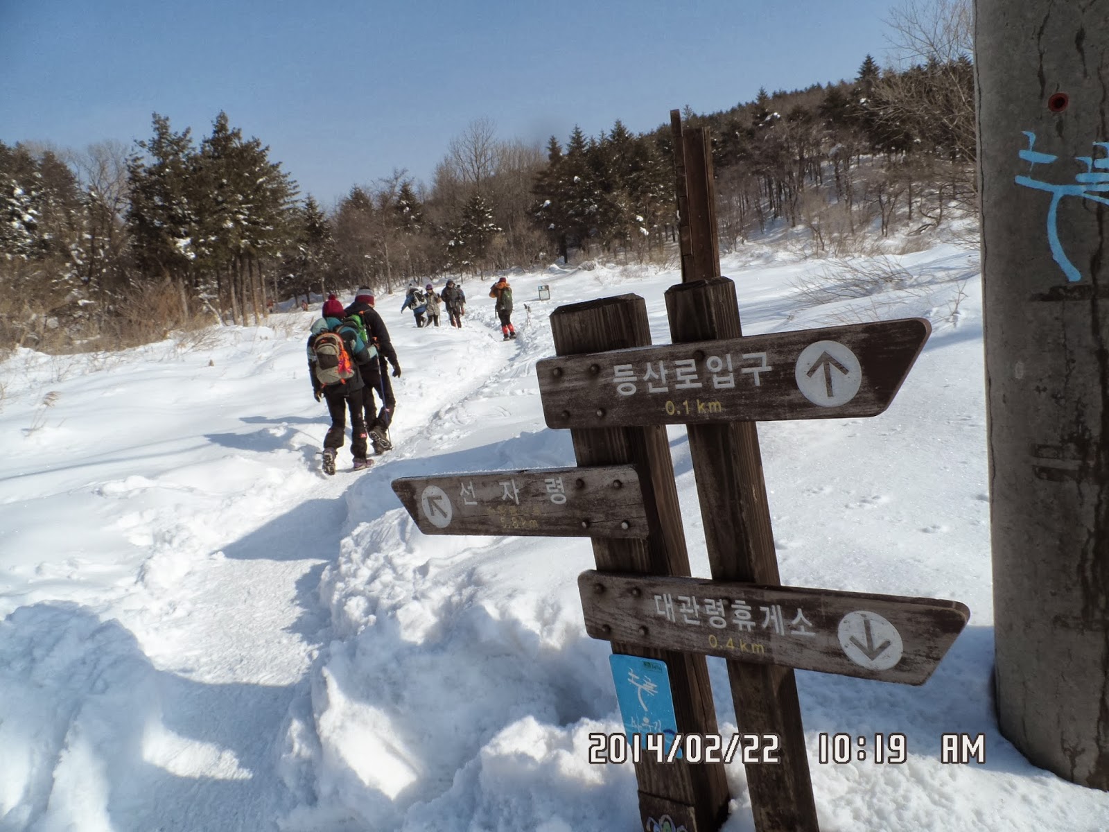
[At a guidepost, 道標にて、이정표에서]

[Wind mills on the hill, 丘の上の風車、언덕 위의 풍차들]
When I left the observation deck, it cleared for a while.
It was almost noon. The middle group hikers were having “Makgeolli” break. The big guy who sat next to me on the bus was offering side dishes for “Makgeolli” called “Jeon” [(also spelled jun or chon), or buchimgae or jijimgae].

["Jeon" for makgeolli, マッコリのつまみ、『ジョン』、막걸리의 안주, "전"]
They are really good for makgeolli.
Then someone said, “Let’s have lunch here.” We all agreed to this proposal.

[Lunch on the hill, 丘の上で昼食、언덕에서 점심]

It was on the snow-covered hill, wide enough to sit down all AhToSan members, here and there.
I joined the hikers such as Ruchi, Grace, Goodman, Jaemi, etc. The mixture of the middle and last group.
What I prepared was a bottle of hot water and a cup ramen. I could utilize the pack of bean rice AhToSan provided in the morning, for lunch. They were enough for my lunch.
Korean hikers are all generous, they share their food. So, I picked up whatever I liked among their food. This is a big difference from Non-Korean hikers.
I brought two cans of Japanese beer; Kirin and Ashahi, but they were not very poplular among hikers.
Rather, they enjoyed home-made wine of diffent kind. This time, I tasted a home-made red wine from grapes.

[Wind mills on the hill, 丘の上の風車、언덕 위의 풍차들]

[Getting close to Seonjaryong, 仙子嶺付近の登山路、선자령 부근의 등산로]

[A pine tree with snow, 雪が積もった松の木、눈이 쌓인 소나무]

[A gigantic windmill, 巨大な風車、거대한 풍차]

[At Seonjaryong, 仙子嶺にて、선자 령에서]

I could hardly take good pictures of the front part of the monument. But I could take the back side of the monument with AhToSan hikers.
After taking the pictures, we went dwon from the summit, then we began “returning to the original place” but the middle group and last group people took the wrong way!

[Tenpi in front of a windmill, 風車の前で『テンピ』풍차 앞에서 "땡삐"]

[We took the wrong way, 道を間違えた。우리는 잘못 들었다.]

[We began descending, 下山開始、하산 시작]

[A guidepost buried by snow, 雪に埋もれた道標、눈묻힌 이정표]

[A short break on a descending trail, 下山路にて、하산 길에서]

When we went to the forest, the heavy fog fell down and it covered the forest.

[On a descending trail in the forest, 下山路にて、하산 길에서]

[On a descending trail in the forest, 下山路にて、하산 길에서]

[Walk along a pasture, 牧場に沿って歩いた。목장을 따라 걸었다.]

[In the forest, 森のなかにて、숲 속에서]

["Clear Smile", 『澄んだ微笑』、"맑은 미소"]

[At the fork point, 分岐点にて、분기점에서]

[With "Flying Column", 遊撃隊と、유격대와 함께.]

["Pojanmacha-like restaurant, 屋台のような食堂、포장 마차 같은 식당]
So, we had “wrap-up party” on the bus. It was very unusual, but we ate dellicous “oden” which Mrs. KS cooked.

[Eating oden in the bus, バスの中でオデンを食べた。버스 안에서 오뎅을 먹었다.]
It was my 10th hike for this year, and my 342nd hike of AhToSan regular hike.
--------------------------------------------------------------------------------------------------------------
分類:登山、韓国、冬山
登山日:2014年2月22日(土)晴れのち曇り
登山地:江原道、平昌(평양)の仙子嶺(선자령1,157m)
コース:大関嶺SA ~ 大関嶺国師城隍堂 (국사성황당) 入口 ~ 東海展望台 (동해 전망대) ~ 仙子嶺(선자령1,157m) ~ 泉(샘터) ~ 防風害植林地 (풍해조림지) ~ 大関嶺国師城隍堂 (국사성황당)入口 ~ 大関嶺S A (約12km, 5.5時間)
参加者:アトサン会員45名
今回の山行は2018年冬季オリンピック開催予定地の江原道の平昌(ピョンチャン)の仙子嶺(ソンジャリョン선자령1,157m)である。
韓国で最も気温の低いところとして言及されることの多い大関嶺(テグァンリョン)から、雪の中のトレッキングコースを東海展望台をへて仙子嶺(ソンジャリョン)まで緩やかに登り、森の中を抜けて再び大関嶺へ戻るコースである。

[A map for the trekking, トレッキング地図、 트레킹 지도]
大田からは約4時間かかることから、出発は午前6時である。
ここしばらく怠け癖が付いてバスを利用することが多かったが、今回は久しぶりに自転車で南門駐車場へ向かった。
朝の大田の気温はマイナス3度で、スキー用の手袋をしていても手が痛い。
座席は前から3番目の窓際で、隣は大きな男性会員。バスは約1時間後に金旺(クムワン/금왕)というこれまで聞いたことのない、比較的小さなサービスエリアで朝食休憩をとった。

[Geumwong Service Area, 金旺(クムワン)サービスエリア、금왕 휴게소]

[At Geumwong Service Area, 金旺サービスエリアにて、금왕 휴게소에서]
目的地の大関嶺の駐車場はすでに標高832mの地点で、嶺東高速道路の大関嶺トンネルを抜けると東海に面した江陵市である。
大関嶺の駐車場には10時前に到着した。バスを降りるとすぐ丘の上に巨大な風車がそびえている。

[The bus has arrived at Daegwanryong, バスは大関嶺に到着、버스는 대관령에 도착]
駐車場であわただしく集合写真を撮ってから、さっそくトレッキングを開始した。

[A group picture at the parking log, 駐車場で集合写真、주차장에서 단체 사진]
日本語では2~3歳未満の未成魚はピンスケ、それより小さいのをマゴスケと言うらしい(ウィキペディア)。
スケソウダラは、韓国語ではミョンテ(明太/명태)と言うが、その状況で呼び名が変わる。
生の状態ではセンテ(生太/생태)、凍らしたものはトンテ(凍太/동태)、半乾燥したものはコダリ(코다리)、からからに乾したものはプゴ(북어)、凍らせたり溶かしたりを繰り返し黄色くなったものをファンテ(黄太/황태)というらしい。
また、稚魚を乾燥したものはノガリ(노가리)という。

[Mogwa and "Bugo" or "Nogari", 『カリン』とスケソウダラの干し物、모과 와 "복어" or "노가리"]
[The guide post at the fork point, 分岐路の道標、분기로의 이정표]

[At the big monument, 大関嶺国師城隍堂入口にて、국사성황당 입구에서]

[The entrance to Seonjaryong, 仙子嶺への登山路入口、선자령에 가는 등산로 입구]

["Ruchi" at the fork point, 分岐点の『ルチ』、분기점에서 "루치"]

[Trekking in the snow, 雪中トレッキング、눈속 트레킹]

[I caught up with the middle group, 中間グループに追いついた。중간 그룹에 따라 잡았다.]

[With the last group, 後尾グループと休憩、후미 그룹과 함께 휴식]

この頃はまだ天気が良く、登山路の脇の木には多くの山岳会のシグナルが結ばれていた。

[A tree with lots of "signals", 多くの山岳会の『シグナル』が結ばれた木、많은 산악회의 "깃발"이 묶인 나무]

[Wind mills on the hill, 丘の上の風車、언덕 위의 풍차들]
この後、また一時雲が晴れ、明るい雪原で12時近くになり、中間グループがマッコリ休憩をしているのに追いついた。

[Lunch on the hill, 丘の上で昼食、언덕에서 점심]
この時点で12時少し前だったが、風もないし、広い雪原で三々五々、場所をとって昼食をとることにした。
私はルチやジェミやグッドマン、グレイスや遊撃隊らといっしょに食べた。

[My lunch, 私の昼食、나의 점심]

[Korean style "Inarizushi", 韓国式稲荷ずし、유부초밥]

["Cake" with a Japanese beer, アサヒビールと『ケーキ』、아사히 맥주와 "케이크"]

[Wind mills on the hill, 丘の上の風車、언덕 위의 풍차들]

[Getting close to Seonjaryong, 仙子嶺付近の登山路、선자령 부근의 등산로]

[A pine tree with snow, 雪が積もった松の木、눈이 쌓인 소나무]

[In front of a windmill, 風車の前で、풍차 앞에서]

[At Seonjaryong, 仙子嶺にて、선자 령에서]

裏側の韓半島と白頭大幹の地図が描かれている方は人が少なく、裏側でチョンダウンといっしょに認証写真を撮った。
仙子嶺を過ぎるとなだらかな下りでやがて広々とした林道に出た。
これを左折してもと来た方向に歩き始めた。テンピやチョンダウンらと歩いたが、かなり進んでから、道を間違えたことに気付いた。

[Tenpi in front of a windmill, 風車の前で『テンピ』풍차 앞에서 "땡삐"]
結局仙子嶺から下ってきた場所の近くまでもどり、右折して細い登山路を下った。

[We began descending, 下山開始、하산 시작]

[A guidepost buried by snow, 雪に埋もれた道標、눈묻힌 이정표]

[A short break on a descending trail, 下山路にて、하산 길에서]

[On a descending trail, 下山路にて、하산 길에서]
後尾グループの到着を待って、彼らにも提供したが半分以上残ってしまった。
この後、霧はますます濃くなって幻想的な雰囲気になった。

["Clear Smile" & "Flying Column", 『澄んだ微笑』と『遊撃隊』、"맑은 미소"와 "유격대"]

[Walk along a pasture, 牧場に沿って歩いた。목장을 따라 걸었다.]

[In the forest, 森のなかにて、숲 속에서]

[George in the forest, 森のなかにて、숲 속에서]

[With "Flying Column", 遊撃隊と、유격대와 함께.]

[Grilling dried Alaska pollack、スケソウダラの干し物、북어 구이]

[Arriving at the parking lot, 大関嶺駐車場へ到着、대관령 주차장에 도착]

[Eating oden in the bus, バスの中でオデンを食べた。버스 안에서 오뎅을 먹었다.]
南門に着いたのは8時で、ワンルームには8時半に着いた。
----------------------------------------------------------------------------------------------------------
仙子嶺(ソンジャリョン)のフォトギャラリー/Photo Gallery of Seonjaryong/선자령의 포토 갤러리


はじめまして。 仙子嶺を検索していて、偶然拝見致しました。 実は、来月二十日にソンジャリョンへ、トレッキング予定です。 そもそも、トレッキングが生まれて初めてなのですが、還暦過ぎの初心者でも大丈夫なのかな~と思っています。 毎週末、トレッキングしているソウルのお友達のお誘いで、思いきって友人と参加することにしました。 軽い気持ちでOKして、ちょっとしたハイキング位のイメージでしたが、検索してみて、ちょっとビビっています。 ダウンジャケットと綿パンに運動靴で、と思っていましたが、甘い考えでしょうか? お手洗いとか、大丈夫でしょうか? どうか、全くの初心者にアドバイスをお願いできましたら、有りがたいです。
返信削除