Destination (mountain): Mt. Ohyama (Kanagawa prefecture)
Hiking course: Ohyama Cable Car Bus Stop – Otokozaka (Male Slope) – Shimosha Shrine – Hus-Wife Cedar (Sugi) – Fujimidai – Top of Mt. Ohyama – Miharashi –Hinata Daishi Bus Stop
Partner: None
When I climbed Mt. Ohyama, I need to change trains at Fujisawa to Odakyu Line. I found out that 7:08 at Ofuna is the best train. I changed to the express train at Fujisawa, and Sagami-ohno and arrived at Isehara at 8:08, it took just one hour.
There is a big “Torii” in front of the bus stop at Isehara. That tori is the first gate of the road which leads to Ohyama Shrine.

The bus left at 8:20 and arrived at Ohyama Cable Station bus stop at 8:45.


You have to walk up about 20 minutes until the cable-car station. But I do not use the cable-car, but walked on the Otokozaka (Man’s Slope).

When I climbed before, I used to walk “Onnazaka” or “Women’s Slope,”but this time, I challenged the harder trail.

“Otokozaka” actually much harder than “Onnazaka” because the stairs are really steep.

[At "Otokozaka, 男坂にて、"남자 언덕길"에서]
I arrived at Shimosha at around 10 a.m.


[The Shimosha Shrine, 大山の下社、오오야마의 「시모샤」]
The entrance of the trail which leads to the top of the mountain is just behind the Shimosha Shrine. There was another “Torii”which is much smaller than the first tori in front of Isehara Station.


Then there is a steep stone steps behind the torii. The sky became clear at that time.
I took my self-portrait in front of “Meoto sugi (夫婦杉).” There are huge Japanese cedars including “Meoto sugi”around there.

[At "Husband and Wife" cedars,夫婦杉にて、"부부삼목"에서]
、

Ohyama is one of the most popular mountains in Kanto area, so there were several hikers on the trail, but not so many like in Korea.
When I arrived at Miharashi-dai or “observation spot”it was 11:15. They say it is the best spot to see Mt. Fuji from Ohyama. Luckily, I could see Mt. Fuji this time.

But while I was taking several pictures of Mt. Fuji, the clouds covered Mt. Fuji.
When I arrived at the top of Mt. Ohyama and the spot called “Mikaerino Fuji” or “If you turn back, you can see Mt. Fuji” spot, I could not see Mt. Fuji any more.
I arrived at the top of the Mt. Ohyama at around noon. It was a sunny day and I could enjoy my bento at the table there.

I noticed that there were two does behind the public restroom. They were eating bamboo leaves there.

They put “grating steps” to keep dear off from the summit area. But it seemed no use. They (deers) came into the summit area through the different paths (avoiding grating steps). They do not afraid people so I could approach close to them.


I began decending the mountain at 12:30. I noticed that the trees were diffent from the shrine side. There were many huge“buna” or beech trees on the other side.
I arrived at Miharashi at 13:40 and arrived at Hinata Taishi Bus Stop at around 15:00.

I took 15:15 bus and came back to Ofuna at 16:30. It was my 3rd hike for the year 2012,

It cost about 2000 yen for the round trip from Ofuna including the bus fee. Total daily step was 28,500 steps (6 hour hike.)
--------------------------------------------------------------------
登山月日:2011年1月17日(火)曇り後晴れ
登山地:神奈川県伊勢原市大山(1252m)
登山コース:大山ケーブル駅~男坂~下社~夫婦杉~~富士見台~大山山頂~見晴台~日向薬師バス停(約10km、6時間) 同行者:なし
大船を7時8分発の下りで藤沢乗り換えると連結が良い。相模大野で乗り換え、伊勢原にはちょうど1時間後の8時8分着。大山ケーブル行きバスは8時20分発で、バス停で降りたのは8時45分。トイレを済ませて登りはじめたのは8時50分だ。

バス停からケーブル駅まではきれいな石畳の道で、両側には土産物屋がならんでいる。特に目を引くのは大山特産の独楽で、敷石には独楽の絵がはめ込んである。

今回は男坂経由で下社へ上った。男坂と女坂が再び合流する地点の約10m手前には、ある新興宗教が建立した「万国忠霊塔」がある。これは世界各国で国のため忠誠を尽くし亡くなった勇士の霊を慰めようと、七曜会の創始者溝上恵照師が建立したものだそうで、昭和33年(1958年)の建立となっている。


ちなみに、この塔のモチーフである金銀の「菊水」の紋は、鎌倉幕府を倒した武将の一人である楠木正成の家紋であるという。
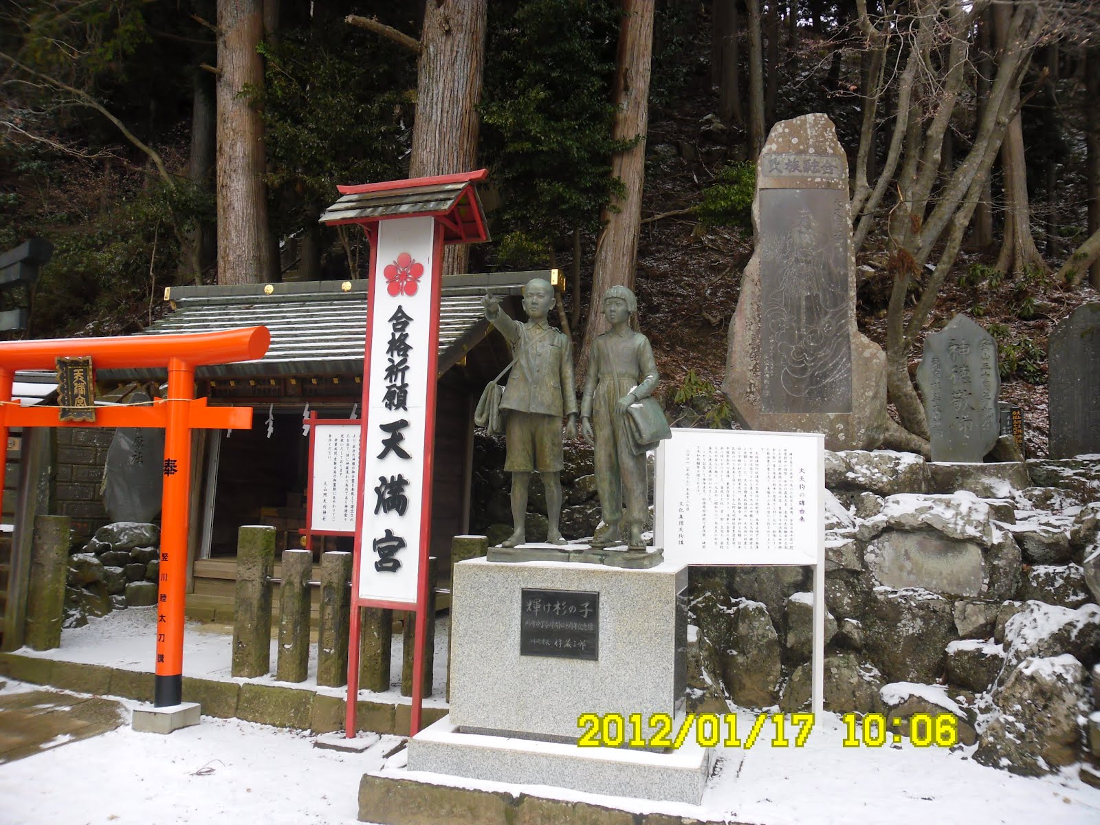
下社の境内にはこのほかにも目につくさまざまな記念像がある。その一つは、大山の頂上に至る登山道の入り口のすぐ横にある「天満宮」と太平洋戦争中の川崎市児童集団疎開記念像「輝け杉の子」の像である。前者は学問の神様、菅原道真を祭る全国に幾多とある天満宮の1つで、後者は太平洋戦争(1941-1945)中に伊勢原市へ疎開した川崎市の児童らの記念像である。
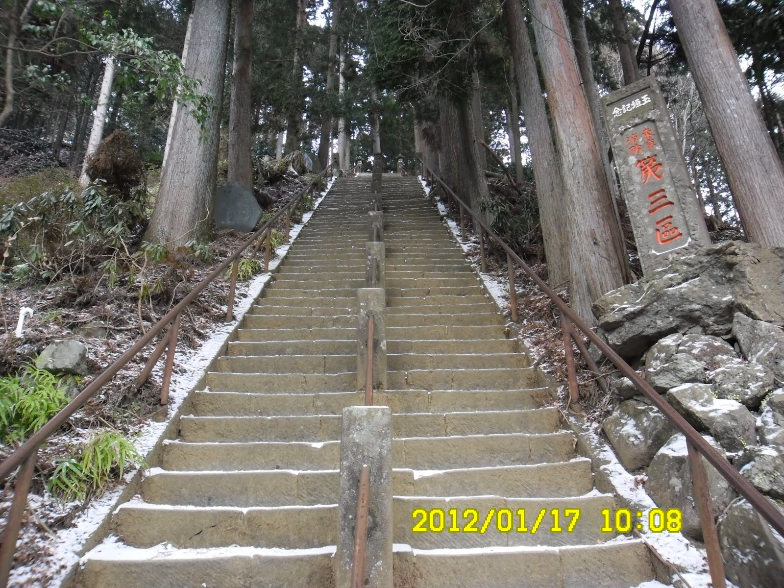
さて、天満宮の横にある片開きの門をくぐって、急な石段を上った。いつものことではあるが、この石段の勾配は実に急で、手すりをつかまりたくなるが、鉄製のてすりは老朽化して握ると危険だと注意書きがある。韓国なら即座に新しいものに更新しているだろうが、日本では「国定公園」でも予算がないのだろう。

急な石段を注意深く上り、さらに10分ほど上ると名物の夫婦杉があり、この付近から雲が切れて、富士見峠ではほぼ快晴となった。

富士山も半分ほど雲がかかっていたが頂上はクリアに見えた。しかし写真撮影をしているうちに富士山に雲の量が増え、後続のハイカーが来た時は見えなくなってしまった。

富士見台であった40代の女性ハイカーと親しく話をした。彼女は頂上まで登ると同じコースをもどるI型登山だった。
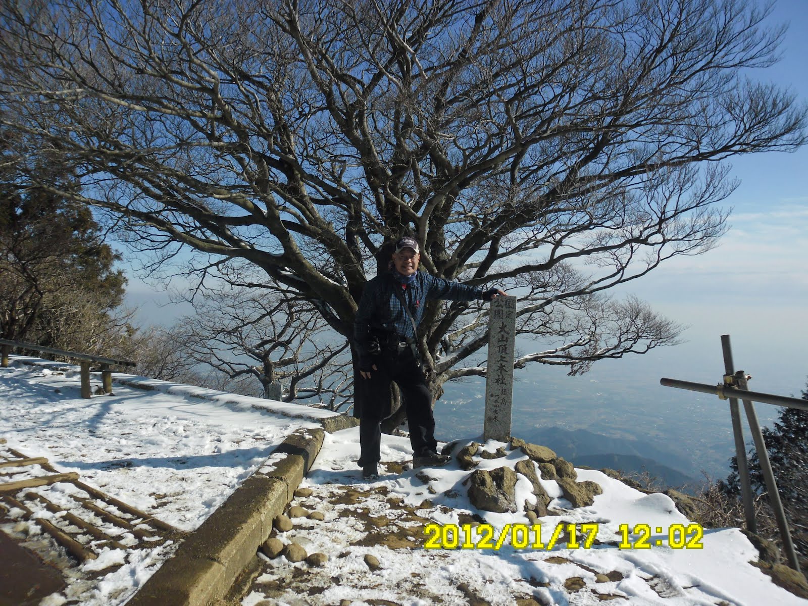
[At the top of Mt. Ohyama, 大山山頂にて、오오야마 정상에서]
頂上には12:10に到着。神社の後方に牝鹿が現れ、トイレの裏からアンテナ塔の方へ、笹を食べながら移動していった。頂上付近に設置された鹿除けのグラデーションは抜け道があるようで効き目がないようだ。

下社から頂上まではずっと雪があったが、アイゼンは不要。見晴らし方面への下りは頂上付近にのみ雪があり、途中からは雪もなかった。

植生が上りと下りではかなりちがうことに気が付いた(上りは杉、下りはブナが中心)。ずっと山ラジオを聴きながら歩き、午後は北原ミレイの歌(「石狩挽歌」、「懺悔の価値もない」)とトークを楽しんだ。

["Jizo" or "Ksitigarbha" on the descending trail, 下山路で見た地蔵菩薩、하산로에서 본 지조보살]

["Shirahige Shrine" near Hinata-Yakusi, 日向薬師付近の『白髭神社』、히나타야쿠시 부근의 『시라히게 신사』]
日向大師はショートカットしてバス停には3時10分前に到着。ちょうど3時15分発のバスに間に合い、伊勢原、相模大野、藤沢の連結も良く、大船には4時半に到着。大相撲の観戦に間に合った。
大船からの交通費:JR大船―藤沢駅で小田急に乗り換えー小田急相模大野乗り換えー伊勢原(660円+バス300円)×2=2000円弱(大山ケーブルは利用しない)
一日の歩数は2万8500歩だった。
0 件のコメント:
コメントを投稿