Hiking Date: July 26 (Thu) Cloudy
Mountain: Mt. Tounotake (1,491m)
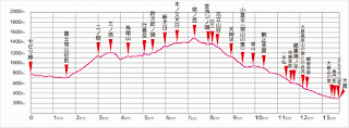
Course (Time) : Yabitsu Pass (9:00) – Fujimibashi (9:21) – Ninoto (10:27) – Sannoto (10:47) – Karasuo (11:14) – Gyosagatake (11:37) – Shindainichi (12:19) – Tounotake (12:33) – Hanatachi (14:11) – Horiyama (14:44) – Komadome (15:00) – Okura Bus Stop (15:57) [14.3 km, 7 hours]
Transportation from Ofuna: JR Ofuna – Fujisawa – Sagami-Ono – Hadano – Yabitsu Pass
(Return): Okura – Shibusawa – Sagami-Ono – Fujisawa – JR Ofuna
The course from Yabitsu Pass to Main Peaks of Tanzawa to Tounotake is very popular among hikers in Kanto area. But the bus service is not fluent, esp. weekdays. There is only one service which leaves Odakyu Hadano Station at 8:18.
Since I arrived at Hadano ST after 8 o’clock, there was no seat available for me. But it took only about 40 minutes, so no problem for me.
If you miss this bus, you have to walk from Minoge to Yabitsu Pass, which may take you more than one hour!
So, paying only 400 yen, you can save more than 1 hour up-hill hiking.
The bus arrived at Yabitsu Pass at 8:58. After using a toilet there, I began walking toward Fujimibashi on Kendo #70 (Hadano-Kiyokawa Line) until Fujimibashi.
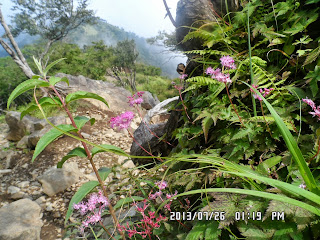
While walking on the paved road, I noticed the strong smell of mountain lilies. It must be an old lily plat because it had about 10 flowers.
[Lilium auratum (山百合 yamayuri; literally "mountain lily") is one of the true lilies. It is native to Japan and is sometimes called the golden rayed lily of Japan or the goldband lily.]
I arrived at Fujimibashi at 9:21. There used to be a lodge on the right side, but it’s gone now. The entrance of the trail is on left side. There is a nice-looking public toilet, and entrance of the trail is about 10 meters ahead of the facility.
From Fujimibashi to the first peak called Ninoto(二ノ塔) the trail was under the shadow of trees. It was a bit wet because of lack of sun-shine, and the slope was a bit steep.
When I came out to the ridge, it was 10:27 and it was “Ninoto.” I saw several hikers there and asked one of them to take my picture.
From Ninoto, the ridge walks started. It’s not too bad with sunshine and having wind.
I arrived at Sannoto(三の塔) at 10:47 and Karasuoyama at 11:34. There is a lodge and wooden tables and benches around the lodge, but because of clouds, I could not see any good views, so I did not stop there.
When I arrived at Gyoshagatake, it was 11:37. “Gyosha” means “ascetic” or “mountain priest.” So this mountain used to be the place for training mountain priests like Gassan in Yamagata prefecture.
There is a chain field like Mt. Myoko in Niigata or Mt. Ishizuchi in Shikoku. But this chain field is shorter than others, and much easier for me.
When I arrived at Shindainichi, it was 12:19. So I had a riceball for my first lunch for this hike.
The trail between Shindainichi to Tounotake was a bright ridge trail. The last access to Tounotake was a bit steep and rocky area.
I arrived at Tounotake at 13:22. On the top of Tounotake, it was a wide space with lots of wooden benches. There was a sundial on the summit. The shade showed 1:30 pm.
I asked a man at the summit to take a picture of me with the guide post of Tounotake. Then had the 2nd riceball and a can of beer for my 2nd lunch.
After taking 20 minute rest, I began descending.
I found a beautiful butterfly “Asagimadara” or The Chestnut Tiger (Parantica sita) near the summit. I was happy to see such a beautiful butterfly at the mountain.
As always these days, I have hard time for climbing mountains, but easier walk for descending. This time again, I passed many hikers on my descending way.
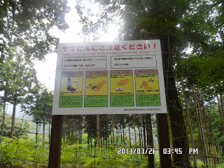
The last part of the course was from Komadome to Okura Bus Stop. It was dark because the trail was in the wood of tall trees. They warned that there might be “mountain leech.”
It can suck blood from human being. According to Wikipedia, if it attaches hiking booths, it can move to the inside of the socks and suck bloods from foot. How awful they were!
Fortunately, I was not attacked by any of them. I came out to the exit of the trail at 15:45.
I saw several places where the farmers put the vegetables for sale. There was no attendants at such shop. If you like any of them, you just put money (usually 100 yen) in a can, and take it with you.
I bought two oriental melons and 10 eggplants for 200 yen. I regretted later that I did not buy several corns for 100 yen.
I arrived at the bus stop at 15:57, but the next bus was at 16:22, so I dropped in a nearby Soba shop.
It was a traditional Japanese soba shop. I bought "Inaka Seiro” a bowl of noodle, and a glass of Ebisu beer. They tasted good and cost 1250 yen.
The bass fee from Okura to Shibusawa was 200 yen. Then I took an Odakyu train from Shibusawa to Fujisawa via Sagami-Ono. I arrived at JR Ofuna at 18:20.
------------------------------------------------------------------------------------------------------------------
分類:登山、日本、関東, 丹沢大山国定公園「丹沢表尾根縦走」
登山日:2013年7月26日(金)曇り、
登山目的地:神奈川県丹沢「塔ノ岳」(1,491m)
コース及びコースタイム:
ヤビツ峠バス停(9:00)~富士見橋(9:21)~二の塔(10:27)~三の塔(10:47)~烏尾山(11:14)~行者が岳(11:37)~新大日(12:19~塔の岳(13:22)~花立小屋(14:11)~堀山の家(14:44)~駒止(15:00)~大倉バス停(15:57)[14.3km、7時間]
-
出典:http://www.kankou-hadano.org/hadano_mountain/mountain_o2js.html-
大船からの交通機関:[往路]JR大船 → 藤沢で小田急乗り換え「新宿行き」 → 相模大野で「小田原行き乗り換え」→秦野下車駅前よりバスヤビツ峠行き乗車→ヤビツ峠下車、[復路]大倉バス停 → 渋沢から小田急 → 相模大野乗り換え→藤沢乗り換え→JR大船
丹沢の表尾根縦走は大変人気のあるコースだが、秦野からバスを利用する場合、その時間に注意しなければいけない。
ヤビツ峠行きのバスが平日は1本、(土曜は3本、日曜は4本)しかないからだ。
秦野発ヤビツ峠行きバス時刻表(出発前に再度確認必要)
平日:8:18
土曜:7:35、8:18、8:55
日曜:7:35、8:18、8:55、9:20
平日は1日1本のバスは満員で、ぎりぎりに到着した私に座席はない。しかし、わずか400円強の料金でミノゲからヤビツ峠までぐんぐん上がってくれるのはありがたい。
ヤビツ峠から登山口に富士見橋までの1.6kmは舗装された車道[県道70号線(秦野清川線)だが、道路わきの防護壁の上にみごとなヤマユリが満開だった。
この香りはかなり強烈で10m以上離れていてもよく匂う。この花はの球根は食用になり、子供の頃、よく近所の山で球根を採ったものである。また、神奈川県の県の花でもあり、私はこの花が大好きである。
富士見橋の登山口から二の塔までの上りはじめじめしたきつい上りの連続で、昔30代のころ、子供二人をつれてきて諦めた場所だ。
二の塔へ出てしまえば、風通しの良い尾根道でそれほど辛い山行ではない。
この日は完全に雲の中で、見通しはゼロに近い。三の塔には10:47に到着し、烏尾山には11:14に到着した。
烏尾山には山荘もベンチもあるが、一面が白い霧で見通しは悪い。したがって休憩もせずに進んだ。
行者ケ岳に着いたのは11:37だ。「行者ケ岳」の名は、修行者がここで修業を行った所からきているものと思われる。その名の通り、ややけわしい鎖場なのだが、石鎚山や妙高に比べればおだやかなものだ。今回、ここの鎖場の鎖は新しいものがついていた。
[A guidepost at Gyoshagatake, 行者ケ岳の里程標、"겨샤가다케"의 이정표]
今回もヤビツ峠から3時間ほど歩いた新大日の手前で12時になり、新大日のベンチで最初の昼食にした。ここの山小屋は「新大日茶屋」という看板がでているが、いつも閉まっている。果たして営業している日はあるのだろうかといつも思う。
新大日を過ぎるとあかるい尾根道で、塔の岳への最後のアプローチがややガレ場ではある。
ちょうど塔の岳に到着したころ、わずかだが雲が切れて、尾根の一部が見えた。
近くで休んでいたアベックの男性に依頼して認証写真を撮ってもらった。
塔の岳で軽い2度目の昼食にして、ビールもロング缶を開けた。
20分ほどの休憩の後、下山開始。
上りの途中で見かけたアサギマダラがここにも1匹、あざやかなピンクの花に止まっていてシャッターチャンスがあったのだが、最初の1枚のみしっかり撮れてあとはピンボケになってしまったのは惜しかった。
下りはいつものことだが、上りに比べてずっと快調で、次々と前を行くハイカーを追い越した。
駒止から大倉までの最後の部分が、杉やヒノキの陰になって薄暗く、ヤマヒルも出そうな雰囲気だった。
舗装道路まで下ると地元の農家が100円野菜を無人で売っている。
マクワウリ2個100円となす10個を100円で買ったが、トウモロコシを買いそびれたのが残念だ。
バス停には3時57分に到着したが、52分のバスが出たばかり。次が4時22分なので、時間つぶしにバス停前の手打ち蕎麦屋にはいって蕎麦とビールを注文した。
なかなか雰囲気の良い蕎麦屋だが値段も立派で2品目1250円だった。
バスは渋沢まで200円で、相模大野では快速特急に乗り、大船には6時20分に戻った。
I like hiking very much. I used to go hiking with a Korean hiking club named “AhToSan.” This blog introduces mostly my hiking activities in Korea and Japan, and Sydney in Australia. As of January 2020, I live in Sydney suburb. I go Blue Mountains and bush walk in Sydney area. 私は2003年から2014年まで韓国の大田(テジョン)に住んだ日本人である。11年間、週末は主に「アトサン山岳会」に参加した。14年4月に帰国したが、2020年以降はおもにシドニーで暮らし、時折、日本へ帰国する程度である。したがって最近の記事はSR(Sydney Report)としてブルーマウンテンのトレッキングを中心に書いている。
About pictures/当ブログ内の写真について/당 블로그내의 사진에 대해서
Most of the pictures in this blog are taken by my camera, yet some of them were downloaded from the website of the hiking club. If you click any pictures, they become the original size.
当ブログ内の写真の大部分は筆者のカメラで撮影したものですが、一部、山岳会の共有写真からダウンロードしたものを含みます。すべて、各写真をクリックすれば、元のサイズに拡大します。
당 블로그내 사진의 대부분은 필자의 카메라로 촬영한 것입니다만 일부 산악회 공유 사진으로부터 다운한 것도 포함합니다. 모두 각 사진을 클릭하면, 원래 사이즈에 확대합니다.
当ブログ内の写真の大部分は筆者のカメラで撮影したものですが、一部、山岳会の共有写真からダウンロードしたものを含みます。すべて、各写真をクリックすれば、元のサイズに拡大します。
당 블로그내 사진의 대부분은 필자의 카메라로 촬영한 것입니다만 일부 산악회 공유 사진으로부터 다운한 것도 포함합니다. 모두 각 사진을 클릭하면, 원래 사이즈에 확대합니다.
登録:
コメントの投稿 (Atom)


0 件のコメント:
コメントを投稿