Destination (mountain): Mt. ShikJangSan (589m)
Hiking course: Left side of SeChon Park – Semetary – Ridge – Yahoo Pass – Junction of Three Trail – SeChon Park
Partner: 3 Americans, 2 French, and 2 Australians and 2 German and Bibi (George Furst’s dog) and myself
It was just the next day when I walked 9 hours on the difficult trails of SeoRakSan, yet I joined Alan’s Taejonhikers hike in the afternoon of following Sunday.
After the service, I hurried back to my studio apartment, picked up some sandwitches, milk and coffee, and went to the main gate of KAIST by 12:30.
There were 10 people including 3 drivers. Alan picked up 2 French men, Michael and Max, and me.
George Furst took his guest, Dr. Manfred Dreiser and his wife, Younghee. Younghee is a Korean who was born in Ichinomiya, near Nagoya in Japan. She came to Korea in 1948, and went to Germany and married Dr. Manfred Dreiser. She is a sister of George Furst’s wife.
 [Before going hike at KAIST、出発前にKAISTにて、출발전에 KAIST에서]
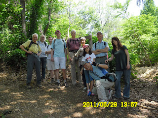
We took some group pictures at KAIST, then at the entrance of the trail near SeChon Park.
 [At the entrance of the trail, 登山路入り口にて、등산로 입구에서]
 [Flowers I found at the cemetery,墓地に咲いていた花、묘지에 피어 있었던 꽃]
 After we began climbing the slop, we happened to come to a traditional Korean semetary. There were some flowers, but the trail was dead end. We went back a little and found the right way. It was a trail I came with AhToSan as irregular hike several years ago.
 [A short rest along the ridge trail, 尾根道で小休止する、산등성이길에서 잠시 휴식함]
 The trail along the ridge was quite comfortable, plenty of shade with gentle slope and fewer hikers.
 [Alan, talking with Ruby, ルビーに話しかけるアラン、루비에 말을 거는 앨런]
 [Dr. Manfred Dreiser walking on the ridge trail, 尾根道を行くドレイザー博士、산등성이길을 가는 Dreiser박사]
 We passed “Yahoo Pass” and stopped at the observatory with bench. That was the highest point of the day. We had snack and I had my lunch there.
 [Alan at Yahoo Pass, ヤホー峠のアラン、야호고개에 도착한 앨런]
 [At the bench on the observatory,展望台のベンチにて、전망대 벤치에서]
 [At the highest peak of the day, 本日の最高地点にて、오늘의 최고지점에서]
 Then we came down to the junction of three trail. It was already 4:45 p.m. So we decided not to go farther. We walked down along the small river.
 [Taejonhikers walking down to the park, 下山路を歩くテジョンハイカーズ、하산로를 걷는 대전하이카즈]
We came to the small dam, and SeChon Park at 5:10. We came back to our cars at 5:25. It was about 3.5 hour hike. I think it was an appropriate hike with senior people and small kid.
This was my 32nd hike for this year.
----------------------------------------------------------------------------
登山月日:2011年5月29日午後快晴
登山地:大田・食蔵山(シクチャンサン589m)
登山コース:細川公園左側道路~墓地~ヤホーコゲ(야호고개)~松原三叉路(솔밭삼거리)~細川公園~原点復帰
同行者:アラン、デボラ(米)、マイケル、マックス[仏]、ジョージ・ファーストとピピ、Manfred Dreiserとその夫人Younghee(独)
5月最後のテジョンハイカーズのハイキング。私は前日、雪嶽山の難コース15kmを9時間で歩いてまだ疲れがとれていなかったが、参加することにした。
午前中の礼拝終了後、すぐにワンルームにもどり、サンドイッチやコーヒー、牛乳などの用意をしてKAIST正門へ向かった。12:30
 [Before going hike at KAIST、出発前にKAISTにて、출발전에 KAIST에서]
今回は車3台。アランの車には私とデボラが乗り、ジムの車にはフランスの青年二人(マイケルとマックス)、そしてジョージ・ファーストの車には彼の客人のドイツ人Manfred Dreiserとその夫人、Youngheeが乗った。
ヨンヒはジョージの奥さんの姉らしい。日本の名古屋近くの「一宮」で生まれ、1948年に韓国へ戻った。その後ドイツへ渡り、ドイツ人と結婚して今に至るようだ。
彼女の職業はクリーン・ナースと言っていた。例によって出発前にKAISTで写真撮影。その後北大田から高速道路でオクチョン近くまで行き、細川公園へ向かった。
以前、同じような時期にアトサンのポンゲで来た時と同じような場所に車を止め、尾根に上がる登山道の入り口で2時少し前に写真撮影した。
 [Flowers I found at the cemetery,墓地に咲いていた花、묘지에 피어 있었던 꽃]
 当初、まちがえて墓地の方へ入ってしまったがすぐ本来の道にもどった。この墓地にはきれいな野生花が多く咲いていた。
 [We walked along the ridge trail, 尾根道を進む、산등성이길을 올라간다]
 本来の登山路に戻ってからは、見覚えのある尾根伝いの登山路をヤホコゲ[야호고개]経由で登った。
 [Alan offered cherry tomatoes、プチトマトを提供するアラン、방울토마토를 제공하는 앨런]
ベンチがあり、大清湖がみえる場所で小休止。その後、展望の良い展望台まで進んでここでやや長い小休止。ここが今回の最高峰だったようだ。
 [At the junction of three trails near the observatory, 展望台近くの三叉路にて、전망대 근처의 삼거리에서]
 [At the highest peak of the day, 本日の最高地点にて、오늘의 최고지점에서]
 ここからは下りになり、松原三叉路(솔밭삼거리)から細川公園へのメインルートに入って、小川沿いに下り、見慣れた小さなダム湖を右に見ながら細川公園へ出た。
 [BiBi enjoyed bathing in the river, 小川で水浴びを楽しむビビ、시냇물에서 목욕을 즐기는 비비]
 [The junction of the tree trails,三叉路の標識、삼거리의 이정표]
 [Bibi and her master, ビビとその主人、비비와 그 주인]
公園入口のすばらしいトイレを使ってから、車道を下り、道路わきに駐車した我々の車に戻ったのは17:23。ここでテジョンハイカーズは解散し、私はアランの車で、KAISTには6時ごろ戻った。
 [We came back to our cars at 5:23, 5:23に道路に停めた車に戻った。5:23에 도로에 주차한 차에 돌아갔다.]
前日の9時間ハイクからの疲労がたまっていたが、Taejonhikersとしてよいハイキングだった。
このハイキングは私にとって今年32回目の登山である。
0 件のコメント:
コメントを投稿