Destination: TaeHwaSan(太華山(태화산1027m), Danyang, Chungbuk(단양丹陽충북忠北/Yongwol, 寧越 Gangwon강원江原道), One of 100 Famous Korean Mountains.
Hiking Course: North Wall – Hwajang-Am – Hweunggyo Fork Point – Summit of TaeHwaSan (1027m) – Remain of Fortress – Goshi Cave – Parking Lot
Participants: 27 AhToSan members
The destination was a bit far in Danynag, so we left 6 am again. There was no bus service at this early time, so I went to the bus stop by bicycle.
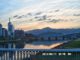
I saw a beautiful red sky at dawn on the rainbow bride in front of the Expo Park.
In spite of the fine weather, the number of participants was only 27. I wondered why.
In Korea, August 15 is an important holiday. It is called Gwangbokjeol, (literally "Restoration of Light Day".)
It commemorates Victory over Japan Day, which liberated Korea from colonial rule.
Since it was Thursday, it was easy to make a five day holidays to take only a day (Friday) off as a paid holiday.
I guess many people took a vacation this way, thus participants for AhToSan hike was rather small number.
But AhToSan chartered the same delax bus with 44 seats again. They also provided a pack of bean rice as breakfast for each member. I just worried about the finance situation of AhToSan.
Anyhow I enjoyed two seats for my own use, and I always like their breakfast(a pack of bean rice), too.
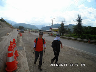
We arrived at the starting point of the trail at 9:45. It was just beside the big road.
We took a group picture on the road, then began walking.
After walking for fifteen minutes, AhToSan members began coming back on the same road. They passed the entrance without noticing it.
The guide post indicating the entrance was buried by summer grasses, so thy did not see it well.
We entered into the trail at 10:07. Then we soon came to a big tree. It must be over 500 years or more.
I walked with the top group up to a little more higher place. So, when we had Suzuki Time at 10:23, I could offer my grapes to the most of members. So all grapes were gone at once.
But after Suzuki Time, I became the last hiker as usual. I followed the last group of “Alain Delon” Ruchi, J-nim, Salangkaduk, etc.
TaeHwaSan is so called “Land Mountain” with many trees. So, we could not have good views of other mountains, but we could enjoy seeing lots of big trees and wild flowers.
I saw huge pine trees and yellow and daylilies here and there, I also noticed orange-color flowers which I never saw in Japan. They are called “Dongjakko동자꽃” in Korean. This plant is endemic species in Korea, so there is no English or Japanese name.
“Dongja” means “Child” and “Kko” means flower, therefore it means a Flower of Kid, or Kid-Flower.
Its scientific name is "Lychnis cognata", a family of carnation.
After Suzuki Time, we had another break. Since it was a hot-humid day, I appreciated for the frozen canned peach provided by Gomdul. I also liked half-frozen “Pocari Sweat” by J-nim.
About 10 people in the last group enjoyed both canned peach and “Pocari Seat.” I really thank them for sharing these nice food and drink with us.
I used sticks even for the uphill hike, because I had sharp pain in my shins, not using sticks for the uphill hike last time. If I use sticks, I can reduce pressures to my shins or legs themselves.
I could join the main group for lunch at around 12:30, not too late, but I was the last hiker to join.
After having lunch, we arrived at the summit of TaeHwaSan at around 13:10. There were two nice stones on which the name of the mountain were carved, both in Hangul, but I found Chinese characters on the side of one of these stones.
There was no good view from the summit, but there was the triangulation station which showed the boundary of Gangwondo and Chungbuk Province.
I was not too late than other people, therefore I could join the group pictures, as well as I cound ask other members to take a single-self picture with stone monuments.
After the summit, we continued easy ridge hike of descending, then we came to the nice spot to view the other mountains and valleys.
We took another break there. Some members offered chopped watermelon. All like it very much and it was gone immediately.
The rest of the trail was also easy, including some steep descending trail, but I could not see river at all until the end of the trail.
After a bit steep stairs, the trail ended in front of Gossi Cave.
According to Wikipedia, the length of the cave is 6.3 km, and there are 4 lakes, 10 waterfalls and 10 large spaces. It is open to the public, but you have to wait for 2 hours before entering the cave.
We just took pictures in front of the cave and hurried to the parking lot which over the bridge in front of the cave.
Most of the hikers were having a wrap-up party and I joined them at 16:22.
The main manu for the party was seasoned squid with vegetable. It was much better than pig trotters.
We finished the wrap-up party at 17:00 and the bus driver stopped his bus at “Dodamsambong도담삼봉”, the famous sightseeing spot.
It’s a set of three small islands in the river. Last time when AhToSan came here, it was in winder. The river was completely frozen and we could walk to the islands.
This time, there were many beautiful flowers on the observation side. We all enjoyed seeing beautiful scenes and taking pictures for a while
We left Dodamsambong at 18:30 and arrived at the Expo South Gate in Daejeon at 21:30.
On the way back to my studio apartment along the river, I noticed a small animal which was jumping ahead in front of my bicycle.
It was a wild hare!!! I remembered that long time ago in the morning, before dawn, I saw a small deer on the other side of the river.
So, there are still many wild animals living in Daejeon. I like this circumstances of environment in deed.
It was my 40th hike this year, and 322nd AhToSan Regular hike for me.
------------------------------------------------------------------------------------------------------------
分類:登山、韓国、夏山,登山、韓国百名山
登山日:2013年8月17日(土) 曇り時々晴れ。
登山目的地:忠北丹陽郡(충북 단양군)及び江原道寧越郡(강원 영월군)の太華山(태화산1027m)
山行コース:北壁(북벽)– ファジャン庵(화장암)- フンギョ分かれ道(흥교갈림길)- 太華山頂上 - 松の木チョンバン台(소나무전방대) - 山城跡(산성터)- 高氏洞窟(고씨동굴)- 駐車場
参加者:27人
今回も先週に引き続き6時出発のため自転車で南門へ向かった。エキスポ公園と南門を結ぶレインボーブリッジの上できれいな夜明け空を見た。この時間にこの朝焼け空をみるのもこれが最後だろう。
さて、バスは今回も豪華な44人乗り。参加者は27人だったが、アトサンの運営は大丈夫なのだろうか心配になる。
今週も先週に引き続き朝食配布。餅は運転手からの差し入れなのだろうか。今回は連休ということもあって参加者が少ないのかもしれない。
山行企画は山を良く知る紳士のコンジャニム、打ち上げ料理担当は植物の名前を良く知っている植物博士のテンピだった。
前会長のチョンダウンは今回は御主人も参加。企画案では太華山12km山行がAで、高氏窟観光がBだったが、B案をとるものは一人もいなかった。
川のほとりの目的地にバスが到着したのは9:45。登山口の集合写真まではよかったが、その後、登山道の入り口を通過してしまい、10分ほど進んでからバックした。
おかげで、最初だけはトップグループで歩き、10:23のスズキタイムではほぼ全員にブドウを味わってもらった。
この先、先頭グループとは完全に離れ、アランドロン会長やサンサラン、Jニム、ルチ、サランカドク、コムドルらの後尾グループについて歩いた。
太華山は完全な陸山で、峰々の展望はほとんどなく、そのかわりに立派な大木があちこちにみえた。
特に松は立派でみごたえがある。また、稜線にでるまでの坂ではキスゲがちらほら見えた。
キスゲで辞書を引くと애기원추리とあった。원추리属の애기원추리ということだろう。
ほかに目立ったのは「동자꽃(トンジャッコ)」と呼ばれる花でこれは韓国固有の花のようで日本語はない。あえて訳せば「童子の花」でその花のようすからつけられたようだ。
昼食前の休憩でありがたかったのはコムドルが提供してくれた冷えたスモモとJニムの凍ったポカリスェットだ。冷えたスモモは意外と量があり、まわりにいた10人ほどが全員楽しめた。
Jニムのポカリも毎回重いのによく持参してくれる。前回の脛の痛みに懲りて、今回は上り坂でもスティックを使って足の負担を軽減した。また、上り坂ではとくに急がないようにした。
昼食は頂上に至る前の林の中で12:30ごろ。一番最後だったが、さほどみんなに遅れずに仲間に入れた。
昼食後は緩やかな稜線を30分ほど進むと太華山の山頂だった。
頂上は見通しはまったくないが、立派な石標があり、江原道と忠北の境界を示す三角点もあった。
ここでも集合写真に間に合った。集合写真の他、他のメンバーに頼んで一人の認証写真も撮ってもらった。
ここからの下りも緩やかな稜線歩きで、約30分ほど進んだ場所は川の流れや対岸の山が見える展望台で、ここで休憩した。
スイカを持参した会員がいてこれは大好評。すぐになくなった。
この後、やや急な下りもあったが、比較的楽なコースだった。
ただし、最後まで渓谷はなく、尾根歩きが最後まで続き、川や駐車場がみえる展望台から鉄製の階段を下るとそこは「高氏窟」の入り口だった。
「高氏窟」は全長6.3kmに及ぶ韓国最大級の鍾乳洞で、4つの湖、10の滝、10の広場があるとされ、入場するには2時間も待たねばならないと言う人気である。
韓国で言う「壬辰倭乱」(文禄・慶長の役)の時に高氏一族がこの洞窟に避難したことからこの名前が付いたもので天然記念物に指定されている。
ここへ下りた時間はちょうど4時で、私の後ろはナドサンだけだった。
駐車場のバスの隣ですでに打ち上げパーティが盛り上がっていて、私が合流したのは4:22。
先週から使い始めた高いテーブルとイスは非常に楽で良い。
また、今回のメニューはオジンゴムッチムでこれはチョッパリよりはるかに食べやすい。
時間的にも余裕があり、駐車場をバスが出発したのは5時だった。
前回に引き続きバスの運転手の計らいで「島潭三峰(도담삼봉)」で30分ほど写真休憩し、ここを6時半に出発し、テジョン・南門には9時半に到着した。
暗い夜道を自転車で新城洞へ帰る途中、エキスポ科学館駐車場から炭洞川沿いの道に入るとクッション張りの歩道を小動物がピョンピョンはねている。
先に行っては止まってこちらを振り向き、私が近づくとまたピョンピョンと跳ねて先に行き、立ち止まって振り返る。まちがいなくウサギだ。ウサギは数回、先に行っては立ち止まり、を繰り返し、東屋の手前で川の反対側の丘の斜面に入っていった。
大田には野生の野兎がまだいるんだと思いほほえましい。また数年前、反対側の川岸を夜明け前に走っていた小型の鹿も思い出した。大田はまだまだ自然が残っている都市だ。
今回は、今年40回目でアトサン定期は322回目である。
I like hiking very much. I used to go hiking with a Korean hiking club named “AhToSan.” This blog introduces mostly my hiking activities in Korea and Japan, and Sydney in Australia. As of January 2020, I live in Sydney suburb. I go Blue Mountains and bush walk in Sydney area. 私は2003年から2014年まで韓国の大田(テジョン)に住んだ日本人である。11年間、週末は主に「アトサン山岳会」に参加した。14年4月に帰国したが、2020年以降はおもにシドニーで暮らし、時折、日本へ帰国する程度である。したがって最近の記事はSR(Sydney Report)としてブルーマウンテンのトレッキングを中心に書いている。
About pictures/当ブログ内の写真について/당 블로그내의 사진에 대해서
Most of the pictures in this blog are taken by my camera, yet some of them were downloaded from the website of the hiking club. If you click any pictures, they become the original size.
当ブログ内の写真の大部分は筆者のカメラで撮影したものですが、一部、山岳会の共有写真からダウンロードしたものを含みます。すべて、各写真をクリックすれば、元のサイズに拡大します。
당 블로그내 사진의 대부분은 필자의 카메라로 촬영한 것입니다만 일부 산악회 공유 사진으로부터 다운한 것도 포함합니다. 모두 각 사진을 클릭하면, 원래 사이즈에 확대합니다.
当ブログ内の写真の大部分は筆者のカメラで撮影したものですが、一部、山岳会の共有写真からダウンロードしたものを含みます。すべて、各写真をクリックすれば、元のサイズに拡大します。
당 블로그내 사진의 대부분은 필자의 카메라로 촬영한 것입니다만 일부 산악회 공유 사진으로부터 다운한 것도 포함합니다. 모두 각 사진을 클릭하면, 원래 사이즈에 확대합니다.
登録:
コメントの投稿 (Atom)


0 件のコメント:
コメントを投稿