Destination: MyoBong (妙峰묘붕879m) Songnisan National Park(俗離山国立公園속리산 국립 공원), Chungbuk Province(忠北報恩충북 보은)/Gyongbuk Province(慶北上州경북 상주)
Hiking Course: Unhweung 1 Village – Sajime Valley – Sajime Pass – TokkiBong(Rabit Peak) – Tomb – “GaeGumong” (Dog Hole Rock) – SangHakBong (862m) – 855 Peak – MyoBong (879m) – Bukkachi – Eunheun 2 Village
(I lost my way and came out to Beopjusa (법주사) which is completely opposite of the AhToSan destination.)
Participants: 44 AhToSan members
“Piano Man” wrote the introduction of the hiking well. Not many hikers visited MyoBong (879 m) in Songnisan National Park. Therefore, the bus was full and no vacancy.

[A map of Songnisan National Park,俗離山国立公園の地図、속리산 국립 공원 지도]

[A map for hiking, 妙峰登山地図、묘봉 등산 지도]

[The man became a Best Member, 新『ベストメンバー』会員、새로운 '베스트 멤버'회원]

[We arrived at the village at 9 am,午前9時に山行地へ到着。오전 9시 산행 목적지에 도착.]

The walls of the village houses were colorfully painted. The village was named as “Dubu (or "tofu" Village.” So they produce “tofu” at this village.

[AhToSan members at Dubu Village, 豆腐村のアトサン会員、두부 마을에서 아토산 회원들]

[A group picture at the village, 豆腐村にて集合写真、두부 마을에서 단체 사진]

[We began hiking. 登山開始、등산 시작]

[I saw the back of last hikers. アトサン最後尾の背中、아토산 마지막 꼬리 회원 등]

[A 3.2 km guidepost, 上鶴峰まであと3.2km地点の里程標、상학봉까지 3.2km 지점의 이정표]

["Leg of pheasant", 『銀の雉の足』(韓国語直訳)、길가의 야생화(은꿩의 다리]

[1.5km from the start point, 出発後1.5km地点、출발 후 1.5km 지점]

[After 1 hour walk, I came out to the ridge, 1時間後稜線へ。출발 1 시간 후 능선에 나섰다.]

[Rocks and pine trees, 岩と松の木、바위와 소나무]
I saw some hikers on the big rock on the top of next mountain. It could be TokkiBong, and they could be AhToSan hikers. I shouted "AhTooo!" but it was too far away.

[Hikers on the rock, 岩の上のハイカーたち、바위 위에 하이커들]

[A view from the ridge, 稜線から見た展望、능선에서 본 전망]

[A view from the ridge, 稜線から見た展望、능선에서 본 전망]

[3.0km from the start point, 出発後3.0km地点、출발 후 3.0km 지점]

[On the ridge, 稜線にて、능선에서]

Unconciously I avoided the TokkiBong, but I did climbed rocky parts and came to the tomb, and then “GaeGumong” or “Dog Hole” Rock.

[The Dog's Hole, ケクモン(犬の穴)、개구멍]

[The guidepost on the ground, 上鶴峰近くにて、상학봉 근처에서]

[Near SangHakBong, 上鶴峰近くにて、상학봉 근처에서]

[At the summit of SangHakBong,上鶴峰頂上にて、상학봉 정상에서]

[Near SangHakBong, 上鶴峰近くにて、상학봉 근처에서]

(A wild flower on the ridge"Ainsliaea acerifolia var.subapoda"(No English name), 稜線の野生花『オクモミジハグマ(奥紅葉白熊)』、능선의 야생화(단풍취)]

[The sign says "Not Trail", 『登山路ではない』標識、"탐방로 아님"표지판]

[On the ridge, 稜線にて、능선에서]

[The sign showing the directions, 妙峰への方向を示す標識、묘봉 방향을 나타내는 표지]
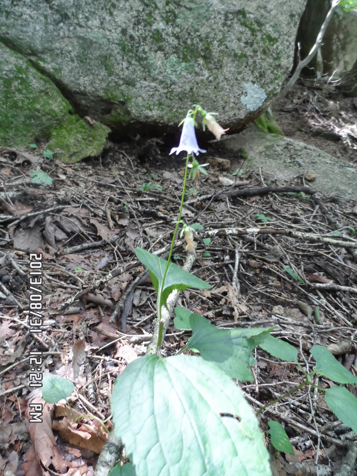
["Adenophora" known as ladybell, ソバナ(岨菜)、모시대,초롱꽃과에 딸린 여러해살이풀.]

[On the ridge, 稜線にて、능선에서]
At that time they were not at MyoBong yet. I should return to SangHakBong, but I did not do that.
Trails were vague around the big rock and I was walking around the rock twice and I got tired of finding the trail.
I began descending the mountain.

[A mushroom on the way down, 下山途中で見たキノコ、하산 길에 본 버섯]

[A tomb on the way down, 下山途中で見た墓地、하산 길에 본 묘지]
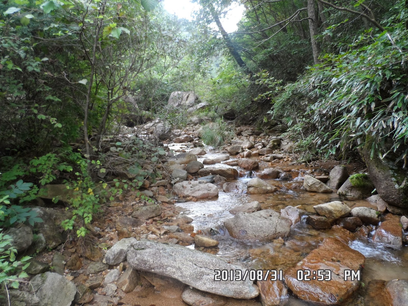
[I happened to come down to a stream, 谷川へ出てしまった、계곡에 나와 버렸다.]

That was one of the worst experience that I fell into the bush and could not move well.
I hurt my legs with bamboo bush, and fell by the river.
Then I walked along the river and came out of the mountain.

[I came out to the road, 道路に出た。임도에 나왔다.]

[Five flavor berry, チョウセンゴミシ(朝鮮五味子), 오미자]
I told him the name of the sign at the exit of the trail. He could not figure out where it was.

[A black goat farm, 黒ヤギ牧場、검은 염소 목장]

Then after a while, SanSalang, another staff member called me and told me that I was completely at the opposite side of the mountain.

[Bulletin board at a village, 村の掲示板、마을 게시판]

[A swallowtail butterfly is on a motherwort flower, アゲハチョウがヤクモソウ(益母草)にとまっている。호랑 나비가 익모초에 앉아있다.]
I walked for about one hour to Beopjusa, and found a taxi. SanSalang talked with the taxi driver and directed the destination.
The taxi ran in full speed for about 30 minutes. Then he let me off at the place where hikers were having “wrap-up party.”
But they were not AhToSan people. Oh, No! I lost again, I thought. Then the taxi came back to pick me up.
He drove for another 5 or 10 minutes to find AhToSan group.
As soon as I joined them, “Hangerong” looked my leg and took care of it by medical care.

[I finally joined the group, ようやくアトサンに合流した。드디어 아토산에 합류했다.]

Mancha, who was in charge of the party, gave me a bowl of warm soup with rice.
Since I did not have lunch, I was hungry and the meal tasted very good.
The main menu for the party was chicken soup. I drank makgeolli and ate the chicken soup.

We left the village at 5 pm and arrived at South Gate Bus Stop at 7:20 pm.
It was my 42nd hike for this year, and my 324th AhToSan regular hike as the total.
But it was the first experience that I lost my way completely, and used taxi to rejoin the group.
The taxi fare was 20,000 won and AhToSan paid the cost for me. Thank you very much.
I really thanked AhToSan staff members, and of course, my God who protected me from the worst situation and brought me back to AhToSan safely (with slight injury in my leg.)
---------------------------------------------------------------------------------------------------------------------
分類:登山、韓国、夏山,
登山日:2013年8月31日(土) 晴れときどき曇り。
登山目的地:俗離山国立公園、妙峰(879m)
山行コース:雲興(운흥)1里会館 ㅡ サジメギ谷(사지매기골) - サジメギ峠(사지매기재) - トッキ峰(토끼봉)- 尖塔岩(첨탑바위) - 墓(무덤)- 犬の穴(개구멍)- 上鹤峰(サンハクボン상학봉862m) - 855峰 - 妙峰(묘붕879m) - プクカチ(북가치)- 妙峰豆腐町分かれ道(묘봉두부마을 갈림길) - ミタサ林道(미타사임도) - 雲興2里村(은흥2리 마을)
(私は最初から他のハイカーから遅れ、ウサギ峰へは行かず、「墓」と「犬の穴」を経由して「サンハク峰」へ到達した。しかしそこからわずか1kmの尾根伝いにあるべき「妙峰」がわからず、おそらく855峰辺りで道に迷い、下山した場所が最終目的地の「雲興2里村」の反対側の古刹「法住寺(법주사)」になってしまった。)
参加者:44人(満席)
今回のハイキングの標題は第431回目の定期登山「俗離山妙峰(879m)」[ 100名山国立公園]で、ピアノマンの書いたハイキングの紹介も魅力的だった。

[A map for hiking, 妙峰登山地図、묘봉 등산 지도]
台風と前線が一体となって、九州では大雨。日本列島はあちこちで大雨になっていたので、韓半島中央部に位置する俗離山の登山も天気が心配だったが、杞憂だった。
近場なので先週に続いて南門7時に出発なので余裕がある。6時15分の606番バスで行くと6時半には到着して早すぎた。
ベンチで横になってEBSの放送を聞いてアトサンのバスを待った。今回は完全に満席で私の隣には今回が10回目の参加という大柄な男性会員が座った。彼は恒例の『ベストメンバー』表彰を受けた。

[The man became a Best Member, 新『ベストメンバー』会員、새로운 '베스트 멤버'회원]

[We arrived at the village at 9 am,午前9時に山行地へ到着。오전 9시 산행 목적지에 도착.]

出発点のウンフン1里会館前にはちょうど9時に到着した。このあたりの食堂には「豆腐村」とあることから、神奈川県の大山のように、良質の豆腐を多く生産しているところらしい。
また、民家の壁には妙峰の絵を含む色彩豊かな絵が多く描かれていた。

[The colorful pictures on the wall, 壁に描かれた妙峰の絵、벽에 그려진 묘 봉의 그림]

[A group picture at the village, 豆腐村にて集合写真、두부 마을에서 단체 사진]

[We began hiking. 登山開始、등산 시작]

[A map of Songnisan National Park,俗離山国立公園の地図、속리산 국립 공원 지도]

[Touch-me-not, ツリフネソウ(吊舟草)、물봉선]

[Commelina communis or the Asiatic dayflower,ツユクサ(露草), 닭의장풀]

[A guidepost with warning, 『危険個所が多いから注意せよ』警告付里程標、 "위험 곳이 많기 때문에 주의하라"경고가 있는 이정표]

[1.1km from the start point, 出発後1.1km地点、출발 후 1.1km 지점]

[A dry river, 水の無い渓谷、물이없는 계곡]

["Leg of pheasant", 『銀の雉の足』(韓国語直訳)、길가의 야생화(은꿩의 다리]

[1.8km from the start point, 出発後1.8km地点、출발 후 1.8km 지점]

[After 1 hour walk, I came out to the ridge, 1時間後稜線へ出た。출발 1 시간 후 능선에 나섰다.]

[2.4km from the start point, 出発後2.4km地点、출발 후 2.4km 지점]

[Hikers on the rock, 岩の上のハイカーたち、바위 위에 하이커들]

[A nice view from the rock, 岩の上からの展望、바위 위에서 본 전망]

[A view from the ridge, 稜線から見た展望、능선에서 본 전망]

[A view from the ridge, 稜線から見た展望、능선에서 본 전망]

[The tomb on the map, 地図にあった墓地、지도에 있던 묘지]

[On the ridge, 稜線にて、능선에서]


[The Dog's Hole, ケクモン(犬の穴)、개구멍]
[At the summit of SangHakBong,上鶴峰頂上にて、상학봉 정상에서]

[Solidago virgaurea (European goldenrod or woundwort),アキノキリンソウ(秋の麒麟草), 미역취]

[On the ridge, 稜線にて、능선에서]

["Adenophora" known as ladybell, ソバナ(岨菜)、모시대,초롱꽃과에 딸린 여러해살이풀.]

[On the ridge, 稜線にて、능선에서]

[The big rock blocking the trail, 登山路を塞ぐ石、 등산로를 막는 돌]
この間、チョンダウンやチョンジョン、ピアノマンらから電話が来たが、妙峰付近にいるとしか答えられず、結局、サンハク峰から来た道を背後にして妙峰らしい岩に向かって地図通り左折する道を下ったが、どうもこの道も正規の道ではなかったようで途中で消えてしまった。
さらに下り始めてまもなく、カメラを落としてしまい、もしやと思って引き返したら、すぐに見つかってありがたかった。

[A pine tree with scar, 幹が傷付けられた松、줄기가 긁힌 소나무]

[I happened to come down to a stream, 谷川へ出てしまった、계곡에 나와 버렸다.]

何とか渓流に出て、渓流にそって下ると砂防ダムがあり、そこを山側にまわって林道に出た。
この時、ピアノマンから電話があり現在位置を言えというのでみると登山口のトイレの場所の名前があったが、その名前は忘れた。

[I came out to the road, 道路に出た。임도에 나왔다.]

かれらは法住寺へ向かって歩いているところだという。この時、チョンジョンから電話があり、そのことがはっきりわかった。

[A friendly dog, 道端の人懐こい犬、길가의 귀여운 강아지]

["Shiitake" mushroom, シイタケ栽培、표고 버섯 재배]

[A swallowtail butterfly is on a motherwort flower, アゲハチョウがヤクモソウ(益母草)にとまっている。호랑 나비가 익모초에 앉아있다.]
結局法住寺の門前街のハズレのバス停に運よく止まっていた1台のタクシーを見つけ、運転手に電話に出てもらい、アトサンに合流することができた。

[I finally joined the group, ようやくアトサンに合流した。드디어 아토산에 합류했다.]
みんなに合流するとすぐに寒渓嶺が私の足に血止め・消毒薬を塗ってくれ、マンチャはおかゆを出してくれた。

[I finally joined the group, ようやくアトサンに合流した。드디어 아토산에 합류했다.]
また、メインは鶏の丸煮でトンドン酒もうまい。
法住寺の門前町に出たのが4時で、合流したのは4時36分だった。
打ち上げの食べ物はたっぷり残っていて5時まで満喫した。
マンチャは私にとキムチをパックにつめたものを用意していてそれを私に渡してくれた。
チョンダウンはスズキタイムの果物があるだろうと言ってカバンから出してみんなに配った。
やはり仲間といてこそ楽しいのだとつくづく思った。
大田ICには7時ごろ戻り、バスで新城洞へ戻ったのは8時前だった。やれやれ、こういう日もある、無事戻れてよかったと神様に感謝した。
0 件のコメント:
コメントを投稿