Place: JangAnSan(長安山、장안산1236.9m), Jangsu, Jeonbuk Province(全北・長寿전북 장수)
Course: Muryong Pass – 977 Peak – JangAnSan (1236.9m) – Jungbong – Hamsujeom – Yonju Village (11.7 km, 4.5 hours)
Participants: 27 (AhToSan members)
The weather was not good, so the number of participants was the same as last week, 27. Yet AhToSan chartered the same big bus with 44 seats.
The mountain is not far from Daejeon, so we left the south gate at 7 am.
It had been raining in Daejeon, but it stopped when I got out from my studio apartment.
But we headed for south, where it was still raining.
We came to this mountain on January 26 when the whole mountain was covered with snow.
It was a fine weather that day, and the contrast of blue sky and white snow was beautiful.
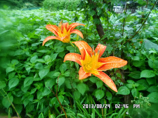
This time, the mountain was covered with green leaves, and wild flowers were beautiful in rain.
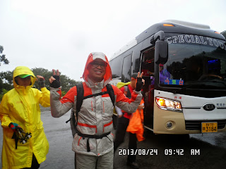
We arrived at Muryong Pass at 9:38, and I took a group picture at 9:45 in rain.
It seemed that Muryong Pass was already in high altitude, so the trail was not too steep. It was a gentle uphill ridge, but many members passed over me.
When “Autumn Diary” passed over me, I thought I became the last hiker. No, I was not. There more about 10 more hikers passed over me!
When they were waiting for me at a guidepost, I proposed to have Suzuki Time, but Yoyu and J-nim suggested to go a little farther until an observation deck.
They were right. I remember this observation deck when I came before. It was wide enough to take a rest, although we had no view of other mountains because of the low clouds.
Anyhow, I offered my fruits and they liked them all. Two packs of grapes and mini-tomatoes were gone within 10 minutes.
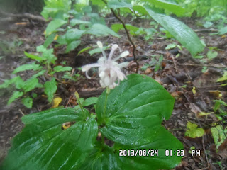
I enjoyed taking pictures of wild flowers in spite of the rain. I could take many kinds of flowers including “Touch-me-not.”
I learned the name of this flower in Korean, first, then I found its Japanese name. It is called “Mul-bongseon 물봉선.” “Bongseon” in Chinese characters are “鳳仙” and we use the same name for the fame family flower.
However the English name for “Bongseon Flowerホウセンカ” is “Rose balsam,” and “Mul-bongseon 물봉선” is “Touch-me-not” and Japanese name is “Tsurifunesoツリフネソウ.” These names are all interesting for me.
Again I was late than other hikers, but this time, not too late. I arrived at the summit of JangAnSan while most of other members were there.
I clearly remember the big stone monument for the mountain. We had lunch in front of this monument.

[Those who are passing here, Korea is relying on you! By 7733 Convoy, as memorial of 100 km marching, 『ここを通り過ぎる者よ、祖国はあなたを信じている』2012年11月14日、7733部隊100km行軍記念]
I ate a rice-ball which I bought at a convenient store in the morning. Since AhToSan gives each member a pack of bean rice for breakfast, I utilize it for my lunch, since I eat breakfast at my room before leaving my apartment.
However, after having lunch, we had group pictures in front of the stone monument.
After having lunch, and when we resumed our ridge hike, it began raining again.
Soon, I became the last hiker following other members.
Billy, a kind young man, from time to time, stopped and waited for me.
Baengnihyang(백리향) and “Autumn Diary” also waited for me at the foot of the last peak at 1:18, I saw then climbing up the peak in the rain, but that was the last chance to see AhToSan members.
I was left behind and when I came down to the paved road, there was no sign of AhToSan bus, or AhToSan members.
So, I checked the map which I was handed to each member before the hike.
According to the map and hiking schedule, the final destination was “Yonju Village.”
I checked the big map beside the road, and headed for “Yonju Vilalge” and I saw no sign of AhToSan bus, neither AhToSan members.
I thought Yonju Village must be farther toward the direction on which I saw on the big map. So, I went farther, but no sign.
I decided to call the president of AhToSan, but he did not answer. The next person I called was the bus driver, but the number was wrong. The number on the map was for the previous driver’s.
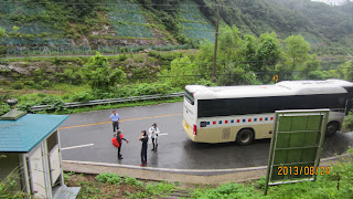
However he told me the new driver’s number. Finally I found out that the bus moved to the opposed direction of Yonju Village.
No wonder I could not find it. I wasted nearly 30 minutes in rain. But I could join the wrap-up party at a gazebo in the village opposite to Yonju Village.
It was still early and we finished the party at 3:15 and went back to Deajeon.
We went back to South Gate Bus Stop at 5:30 pm. It stopped raining and I could see even blue sky.
When I passed by Hanpit Arboretum, I saw many passion flowers.
Passion flowers in Japanese are “Tokeisouトケイソウ” or Flowers of Clock. In Korean “시계꽃” or Flowers of Watch.
However people of Western culture see the same flower as Jesus Christ on the cross.
That is also very interesting for me.
It was my 41st hike for this year, and my 323rd AhToSan regular hike for me.
------------------------------------------------------------------------------------------------------------
分類:登山、韓国、夏山,
登山日:2013年8月24日(土) 雨
登山目的地:全北長寿(전북 장수)の長安山(장안산1236.9m)
山行コース:ムリョン峠(무령고개)-977峰- 長安山 - 中峰 – ハムスジョム(함수점) – ヨンジュ村(연주마을)の約11.6Km(4時間30分/昼食30分を含む) 参加者:27人
テジョンは昨日一日中雨が降り、朝になってようやく止んだ。
自転車で南門へ向かう途中、すこしぱらついた程度でしめしめと思ったが、雨を降らせた前線は北から南へゆっくりと南下。
登山地は大田の南の全羅北道の長安山。この山は今年1月26日に登っているので今年は2回目だ。
前回は最初から最後まで雪に埋もれた山行で、天気も良く青空と白い雪のコントラストが美しかった。
今回は緑の中の雨中山行である。
休憩所ではすでに雨が降っていて、アランドロン会長がわざわざ雨具の用意の無い会員のために雨具購入停車をしたほどだ。
出発点の武霊峠(ムリョンコゲ)には9時38分到着。出発前の集合写真は9:45に撮影。
出発点の武霊峠の標高がかなり高いようで、すぐに尾根歩きになった。
それでもしだいに高度があがる上り坂で、次々と会員たちに抜かされる。
「秋の日記」と言葉を交わした時点ですでに最後尾かと思ったら、さらに10人ぐらいが後から追いぬいて行った。 40分ほど進んだ途中の里程標にはあと頂上まで1.5kmとあったので中間点ほどか。
ここにはキプンヨユウほか5、6人がいてここでスズキタイムにしようかと言ったら、ヨユウやJニムらがもう少し行くと広い展望台があるというのであと10分、上り坂を頑張った。
コムドルがいっしょにつれてきた美人(ニックネーム「般若」)と尾根のカヤ畑でツーショットの写真を要請された。たしかに風情のある風景だ。
展望台は悪天候のためなにも見えないが、「スズキタイム」にするにはちょうどよい広さだ。昨日仕入れたブドウとパングルトマト、どちらも好評で、10分ほどでみな終わった。
この「スズキタイム」の後、すっかり雨に濡れたが、登山路ぞいの野生花は雨に濡れて美しい。
雨の日にもっとも似合う花は「ムルポンソンファ물봉선」だろう。その名は水を好む「ポンソンファ(鳳仙花봉선화)」だが、日本名は「ツリフネソウ(釣舟草)」で英語名は"Touch-me-not"というのは面白い。日本語名の由来はその形からというのはすぐわかる。英語名の由来は触るとすぐ壊れてしまうほど壊れやすいからか。
今回も皆に遅れたが、その差は大きくはない。長安山の山頂には11:15に到着した。
山頂には見覚えのある大きな石標。大部分の会員は石標の前のヘリポートで食事の支度をしていたが、まず頂上の認証写真を撮ってもらった。
ちょうどこのころ雨が止み、食事にはちょうどよかった。食事は3つ4つのグループができたが、Jニムのテーブルとアランドロン会長のテーブルの中間に座った。
私の昼食は朝出発前にセブンイレブンで購入した三角おにぎりと朝バスの中でもらった「お赤飯」だ。「お赤飯」がけっこうボリュームがあり、握り飯の方は1つで十分だった。 昼食休憩は30分以内で、食後は立派な石標の前で全員で集合写真を撮った。
12時前に昼食を終え、尾根伝いに歩き始めると再び強い雨が降り始めた。あとは下山するまで止むことはなく、時々強く降った。
またしても全員の後になったが、ビリーが時々足を止めて私を待ってくれた。
私は一人でも気楽に花の写真を撮りながら歩いた。最後に会員の姿をみたのは13:18で、百里香と秋の日記およびビリーが待っていてくれた時だった。
この後は完全に一人で、尾根歩きをしつつ、最終地点に向かって歩いた。
手渡された地図のルートでは「徳山渓谷」となっていたので、みな渓谷遊びをしているだろうとおもったら、前回同様、最後まで尾根伝いのルートでいきなり車道に出た。 車道に出たところには大きな地図があり、手渡された地図の目的地である「ヨンジュマウル」が近くなのでその方向へ歩いた。
「ヨンジュ」という名のバス停があり、村もあったがバスがない。まずアランドロン会長に電話をしたが、返事がない。
次に地図に書いてあったバスの運転手に電話したら、どうも前回のバスの運転手だったようで、彼に当日のバスの運転手の電話番号を聞いて電話した。
すると「ヨンジュマウル」ではなく反対の方向の隣村で、その東屋でティップリをしているという。およそ20分以上、無駄骨を折ったがなんとか打ち上げに合流したのは2時50分だった。
あとでルチの写真を見ると、アトサンバスは当初、下山口に駐車していたが、アトサンの会員(私を除く)全員が乗車したあと、目的地のマウルとは反対のマウルへ移動したことが分かった。
誰も後続のことを考慮しなかったわけだ。もっとも後続は私だけだったようだ。
打ち上げは3時15分ごろ切り上げ、帰路に着いた。
途中のサービスエリアではまだ雨がかなり降っていたが大田に近づくにつれ天気は好転し、5時に大田ICに着いた時は青空さえ見えた。
南門には5時半に到着し、自転車で新城洞へむかった。途中、ハンパッ樹木院の東園入り口では「トケイソウ」の花が多く咲いていた。
ワンルームには6時過ぎに戻ったがかなり疲れた。
ここちよい疲れだった。今回は今年41回目の登山であり、アトサンの定期山行は323回目の参加である。


0 件のコメント:
コメントを投稿