Date: Dec. 14 (Sat) Fine, occasionally cloudy
Course: Wantongjae – Gamtubong – Daebongsan (or GwaeGwanSan) – Jiso Villege (about 10 km, 5 hours)
Partners: Bernardo, Heesun, Cheomwa, Chorokbaem (Grean Snake)
Participants: 29 AhToSan members

[The map for hiking, 大鳳山登山地図、대봉산 등산 지도]
Applicants were just 30 members including Bernardo from Seoul, but there was one member cancelled.
To my surprise, I found HeeSun among those who took on the bus at the South Gate.
She joined AhToSan hike several times, but mostly island easy hike and it must be the first experience to climb a snow-covered mountain.
We stopped at Deokgyusan Service Area and had breakfast there.

[Deokgyusan Service Area,徳裕山サービスエリア、덕유산 휴게소]

["Ttok" 『トック』、떡]

[The map for hiking, 大鳳山山行地図、대봉산 산행 지도]

["Welcoming to Baekjeon-myon" monument, 『栢田面へ歓迎』の碑、"백전면에 환영"비]

[The bus arrived at the destination, 目的地に到着、목적지에 도착]

[I put on crampons and spats.アイゼンとスパッツを装着、아이젠과 스패츠를 장착]

[The guide map of DaeBongSan, 大鳳山登山路案内図、대봉 산 등산로 안내도]

[A group picture before the hike, 出発前の集合写真、출발 전 단체 사진]

[We began hiking, 登山開始、등산 시작]

[Deep snow on the trail, 登山路には大量の雪、등산로에는 많은 눈]
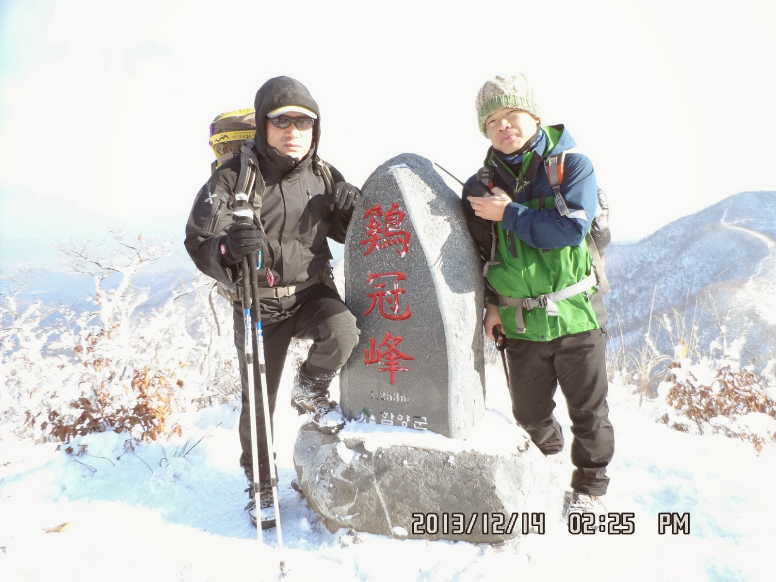
When we arrived at Gamtubong, it was at 10:36. There was a big stone monument, the name of the mountain was curved in Chinese characters.

[At Gamtubong, 甘投峰にて、감투봉에서]

[On the ridge,稜線にて、능선에서]
So, it sould be “Kamtubong” not “Kamtusan” since it is a part of “Daebongsan.”

[Bernardo on the ridge,稜線にてベルナルド、능선에서 베르나르도]
But Alain Delon went fast, and the rest of 5 members walked all together, 4 men supporting HeeSun.
I am grateful esp. to Cheomwa and “Green Snake” since there are experienced strong hikers and I had no worry about losing my way to the destination.
The mountains were beautiful with snow but snow on some part of the trails were too deep. I was glad that I put spats on my legs.
.jpg)
[On the ridge,稜線にて、능선에서]

[On the ridge,稜線にて、능선에서]

[Bernardo on the ridge,稜線にてベルナルド、능선에서 베르나르도]

[HeeSun on the ridge,稜線にてヒソン、능선에서 희선]

[On the ridge,稜線にて、능선에서]

[A view of Baekunsan, 白雲山がみえる、백운산이 보인다]

[At Heliport, ヘリポートにて、헬기장에서]

[Preparation for lunch, ヘリポートにて昼食準備、헬기장에서 점심 준비]

[A lunch set I prepared, 私が準備した昼食、내가 준비한 점심]

[Cooking odeng, おでんを煮ている、오뎅을 끓이고 있다.]

[Cooking ramen, ラーメンを煮ている。라면을 끓이고 있다..]
It was hot and delicious. They added bean sprouts in the ramen. They were hot and tasted very good.
After having ramen, we resumed the hike. We ha d HeeSun walking first, then we followed her.

[On the ridge after lunch, 昼食後稜線にて、점심 식사 후 능선에서]

[On the ridge after lunch, 昼食後稜線にて、점심 식사 후 능선에서]

[On the ridge, 稜線にて、능선에서]

[On the ridge, 稜線にて、능선에서]

[On the ridge, 稜線にて、능선에서]

[The communication facilities, 通信施設、통신 시설]
["Green Snake" and Cheomwa at the summit, 『緑の蛇』と『チョムワ』、"초록뱀" 과 "첨와"]br />

[At the summit of DaeBongSan, 大鳳山山頂にて、대봉산 정상에서]
Since the name of Hamyanggun(咸陽郡) was also curved under the name, Hamyang Local Office should be responsible, but they must not be care too much.
There was a rocky peak which seemed higher than the monument place, and it could be seen as “Cockscomb” so “GyeGwanSan” could be all right.

[A summit behind DaeBongSan, 大鳳山のすぐそばにそびえる岩山、대봉산 바로 옆에 우뚝 솟은 바위산]
Soon after we began descending, I found a huge "Cheolchuk" or "Azalea" tree. There was a stone plate which says "this tree is a protected tree of Azalea aging over 1000 years!

[Over 1000 year-old azalea tree, 樹齢1000余年のツツジの木、수령 1000 여년 철쭉 나무]
There was another peak called “Cheonwangbong (天皇峰) just 900 meters east, and about the middle of the trail, there was a junction of three trails.

[Bernardo put snow on his beard、ひげに雪を塗ったベルナルド、수염에 눈을 바른 베르나르도]

[We took a rest between two peaks, 二つの峰の中間で小休止、두 봉우리의 중간에서 짧은 휴식]

[At the descending trail, 下山路にて、하산 길에서]
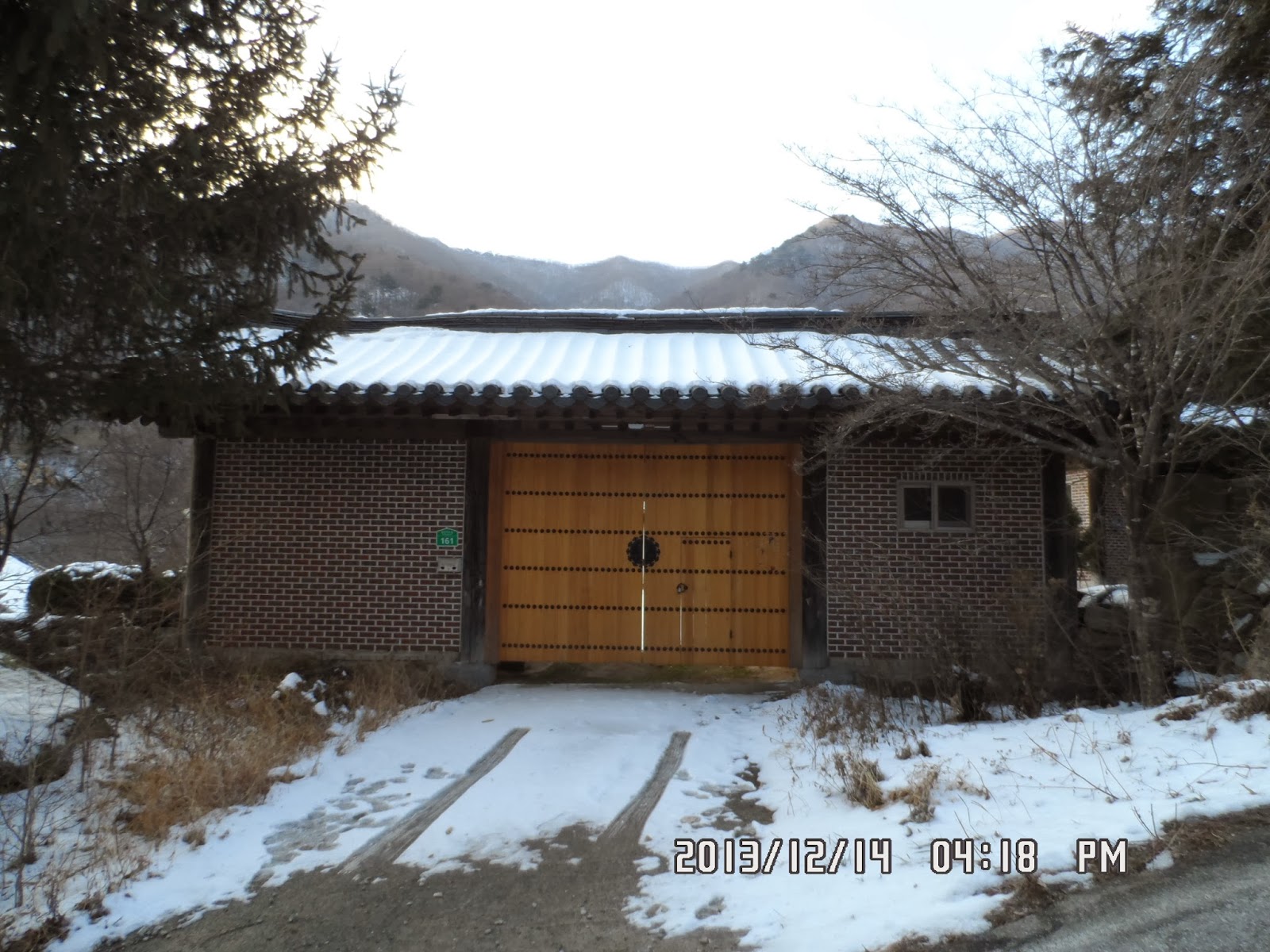
[A big gate of a private house, 民家の立派な門、민가의 훌륭한 문]

[A big persimmon tree with many persimmons, 大きな柿の木、큰 감나무]

[We finally arrived at the bus, ようやくバスに到着、겨우 버스에 도착]

[HeeSun having odeng, ヒソンがおでんを食べている。희선이 오뎅을 먹고있다.]
It was my 61st hike for the year and my participation on AhToSan regular hike was 336th.
--- Photo Gallery by Other Photographers 他の写真家たちによるフォトギャラリー、다른 작가들에 의한 포토 갤러리---


分類:登山、韓国、冬山
登山月日:2013年12月14日(土)晴れ時々曇り
登山地:登山地:慶南・咸陽・大鳳山(대봉산旧名:掛冠山グェグァンサン(괘관산)、1,252m)
登山コース:ワントンジェ(원통재) – 甘投峰(감투봉) -大鳳山(대봉산) or 掛冠山(괘관산) - 天皇峰 – ジソマウル(지소마을) [約10km、 5時間] 同行者:ベルナルド、ヒソン、チョロクペム(초록뱀)、チョムワ(첨와)
登山参加者:アトサン会員29名
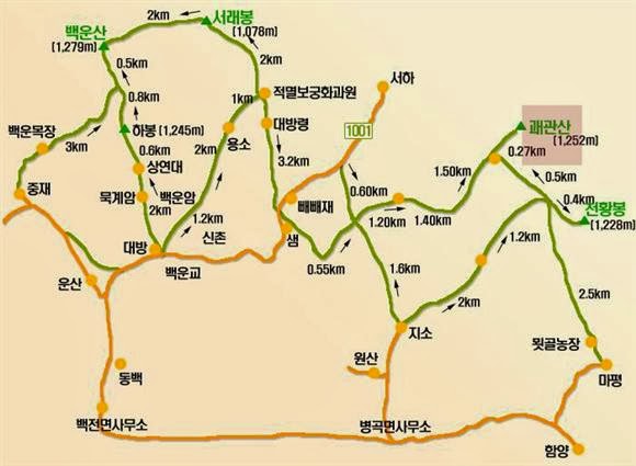
[The map for hiking, 大鳳山登山地図、대봉산 등산 지도]
今回は参加者が少なく29人だった。しかし、ベルナルドがソウルからやってきた。またおどろいたことに、シュガーパイの経営者のヒソンが参加した。
彼女はトレイシーが大田にいたころ、島の軽いハイキングに数回参加した記憶があるが、冬山の本格登山に挑戦するのはおそらく初めてだろう。
すでに周囲の山々が雪化粧した徳裕山SAに8時半ごろ到着。ここで、朝食休憩をとった。

[Deokgyusan Service Area,徳裕山サービスエリア、덕유산 휴게소]

[Mogwa distributing "ttok"モグァがトックを配っている、모과가 떡을 나눠주고있다]

[The bus arrived at Wantongjae, ワントンジェに到着、버스가 완통재에 도착]

[The entrance of the trail to BaekUnSan, 白雲山への登山路入り口、백운산의 등산로 입구]

[The bus arrived at the destination, 目的地に到着、목적지에 도착]

[The guide-map of Hamyang-gun,咸陽郡案内図、함양군 안내도]>

[I put on crampons and spats.アイゼンとスパッツを装着、아이젠과 스패츠를 장착]

[A group picture before the hike, 出発前の集合写真、출발 전 단체 사진]

[We began hiking, 登山開始、등산 시작]

[Suzuki Time on the ridge, 稜線にて『スズキタイム』、능선에서 "스즈키 타임 "]
登山開始後約1時間かかって最初の峰、甘投峰(カムトゥボン감투봉)に到着した。

[At Gamtubong, 甘投峰にて、감투봉에서]

[On the ridge,稜線にて、능선에서]

[On the ridge,稜線にて、능선에서]

[On the ridge,稜線にて、능선에서]

[Bernardo on the ridge,稜線にてベルナルド、능선에서 베르나르도]

[On the ridge,稜線にて、능선에서]

[Bernardo & HeeSun on the ridge,稜線にてベルナルドとヒソン、능선에서 베르나르도와 희선]

[HeeSun on the ridge,稜線にてヒソン、능선에서 희선]

[HeeSun on the ridge,稜線にてヒソン、능선에서 희선]

[Bernardo on the ridge,稜線にてベルナルド、능선에서 베르나르도]

[Short break on the ridge, 稜線にて小休止、능선에서 짧은 휴식]

[At Heliport, ヘリポートにて、헬기장에서]

[Preparation for lunch, ヘリポートにて昼食準備、헬기장에서 점심 준비]

[Preparation for lunch, ヘリポートにて昼食準備、헬기장에서 점심 준비]

[Cooking ramen, ラーメンを煮ている。라면을 끓이고 있다.]

[On the ridge after lunch, 昼食後稜線にて、점심 식사 후 능선에서]

[On the ridge after lunch, 昼食後稜線にて、점심 식사 후 능선에서]

[On the ridge, 稜線にて、능선에서]

[On the ridge, 稜線にて、능선에서]

[HeeSun in front of the facilities, 通信施設の前のヒソン、통신 시설 앞에 희선]

[At the summit of DaeBongSan, 大鳳山山頂にて、대봉산 정상에서]
したがって「鶏冠山(ケグァンサン계관산)」というのは誤記だと思うが、こんな立派な石標と建てるときに確かめなかったのだろうか。
もっともこの山頂のそばにはさらに標高が高そうな岩山がそびえ、それを鶏のトサカに見立てるなら、「鶏冠山」もあながち悪くはない名前のような気がする。

[A summit behind DaeBongSan, 大鳳山のすぐそばにそびえる岩山、대봉산 바로 옆에 우뚝 솟은 바위산]

[We began descending,下山開始、하산 시작]

[Over 1000 year-old azalea tree, 樹齢1000余年のツツジの木、수령 1000 여년 철쭉 나무]

[The guidepost between two peaks, 天皇峰と大鳳山の間の里程標、천황봉과 대봉산 사이의 이정표]

[We took a rest between two peaks, 二つの峰の中間で小休止、두 봉우리의 중간에서 짧은 휴식]
あとは渓谷沿いの下山路だが、ヒソンの足取りは重い。
下山口を過ぎて、みごとな熟れ柿が鈴なりの民家の前を通ったのは4時17分で、バスに着いたのは4時28分だった。

[A big persimmon tree with many persimmons, 大きな柿の木、큰 감나무]

[A big gate of a private house, 民家の立派な門、민가의 훌륭한 문]
打ち上げパーティの料理担当だったと思われるモグァが我々のためのおでんを確保していてくれて、バスの運転手の朴社長とともにわれわれに振る舞ってくれた。

[Alain Delon, Bernardo, Green Snake and Mogwa, アランドロン、ベルナルド、緑の蛇、カリン、알랭 들롱, 베르나르도, 초록뱀, 모과]
この冬2度目の雪山は私にとってもかなりきつかったがベルナルドやチョムワやチョロクペムらのおかげで楽しく安全に登山で来た。
今年61回目のハイキングであり、アトサンの定期山行の参加回数は336回目である。
--- Photo Gallery by Other Photographers 他の写真家たちによるフォトギャラリー、다른 작가들에 의한 포토 갤러리---


0 件のコメント:
コメントを投稿